

After years of talking about it, a family trip was finally organised to Stewart Island – thanks to Adele for organising it, and Neil & Jill for the kind use of a family home. Adele and James were the only ones who’d been before; anticipation was high for all.
 A calm evening ferry ride over, which was just as well as there was still some seasickness.

 We got to the house in the dark, but I couldn’t resist traipsing around the surrounding bush to explore a bit – and see if I could spot a kiwi.
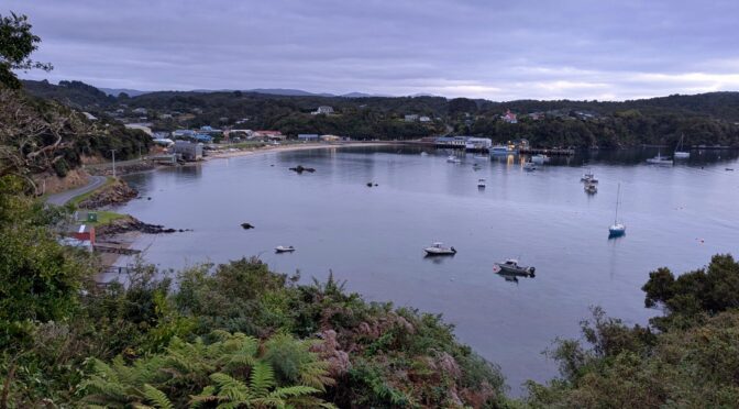
 Waking up overlooking Halfmoon Bay.

Jill had told me of a good running loop from the house, predominantly in native forest and along the coast for large parts. I set out to see what I’d find.
 Promptly distracted from the route by roads and tracks leading in other directions.
 Found myself on Ringaringa Point, looking over Paterson Inlet to Ulva Island.
The trail on the map no longer exists, so I retraced my route to the intended loop. A bit lumpy along the coastal bush section, but I was in no hurry.


Popping back over to Halfmoon Bay and town, it was a short road section back to the house.
 Who should I find but James processing his morning’s catch. It became a daily catch, with rod and speargun; we ate a lot of seafood that week and never tired of it!
 Back to our accommodation nestled in the bush on right.
 Waiting for the water taxi to Ulva Island on Golden Bay.
 Thankfully this boat ride was far more enjoyable and exciting for my nephews!
A predator-free island, Ulva is a sanctuary for many native birds. There’s a couple of hours worth of walking tracks and nice beaches to wander while looking for birds.
 The robins are many, and not at all shy. Far easier to photograph too!
 This was one of the busier beaches on the island.
The following day, the grandparents were given some respite while the rest of us went for an overnight walk and beach camp on the start of the Rakiura Track.
 The northern trailhead is at Lee Bay.
 Coastal forest for the four kilometres that we walked to Maori Beach.
Plenty to amuse us all at the beach, old sawmilling relics, roasting marshmallows and making smores on an open fire, and general camping life. Still no kiwis spotted, although we certainly heard a loud one nearby in the middle of the night.
 Ready to start the return.
 Peters Point.
 Too cute.

 Back to my now favourite cabbage tree.
Sunday brought the first rain of the trip – good going considering Stewart Island’s reputation. But it was bright enough to set off on a walk to Horseshoe Point. Squally showers were pleasant, cooling me a little as I’d overdressed. More beaches and bays to explore as the track wound its way through mostly native forest.


 Eventually arriving at Horseshoe Point, looking towards Horseshoe Bay.
After a final pub dinner (more seafood, yum) our short stay was all but over. Just an early morning rainy bundle into the island’s taxi for James and me to take all the luggage downtown – we got a far choppier ferry ride back to the mainland while the rest went on the wee plane.
 The rain stopped after we’d done all the baggage moving. Lights back at the house as the rest got ready for the plane, while we waited for the ferry.
An excellent family holiday at a leisurely pace in a wonderful little spot of the country – I hope a return visit takes far less time than the first.

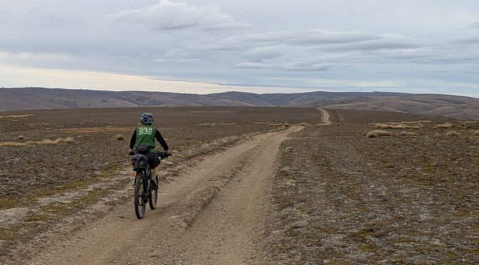
 A leisurely start across the fields, Leaning Rock in the distance.
 (Rachel’s photo)
 Autumnal; out of the gorge and the wind all but gone.
 (Rachel’s photo)
 Extraordinary.
 Finally got to see Mt Cook from up here.
 (Rachel’s photo)
 Quite a drop from the road to the saddle and what looked to be a big push to get on the Old Woman Range.
 Some of it I could ride. (Rachel’s photo)
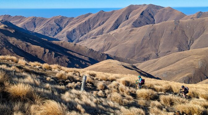
 Well pleased with the clear views back to the ranges around home, and that I can now name them all and some of the peaks.

 (Rachel’s photo)
 (Rachel’s photo)
 Generally a good riding surface; there was the odd bog from 4WDs to avoid.
 Mostly we enjoyed the wide open expanses at such altitude.
 Heading for the little bump on the right horizon.
 Far more prominent from the valley – of which it gave expansive views.
 At least I got a few photos this time – this the climb that needed the most effort that day.
 The transmitter was visible far back, but only got bigger annoyingly slowly.
 Made it and managed not to get clean blown over this time. (Rachel’s photo)
 Still on the ridge, approaching the turn-off right. Track already rougher than the transmitter service road we’d just been on.
 (Rachel’s photo)

 (Rachel’s photo)
 The lower reaches mellowed out through grazed hillside.
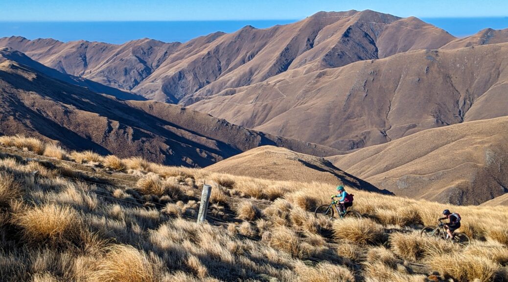
 Riding from
  The new, and excellent,
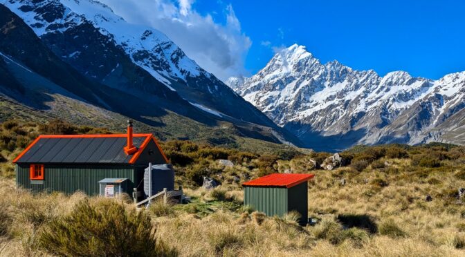
 A typical, but easy (to cater for less-fit me), West Coast hike up to
  And the summit, only posted here because I thought I’d better put some of the rare photos of me in. Thanks to Katie for this one.
 Thanks Orlaith for this pic.


 On a Sunshine Coast walk.
 I did of course manage to borrow bikes and get some short half-day rides in.
 Time on farms was excellent, here having watched a bit of beekeeping, but there were general garden tasks, soap making, and dog walking to get me outside – as well as the riding, general exploring and walking.

 Photo credit to Katie again.
 And again.

 Over to the Remarkables.
 This saddle being the highest we’d get.
 Contemplating the fun down Long Gully.
 Back up the descent from the saddle.
 Some of the switchbacks, and across to Skippers Road.
 A bit of a clamber above the saddle to see if I could see more of our surrounds.
 I could – the downhill to Green Gate Hut, and lunch.
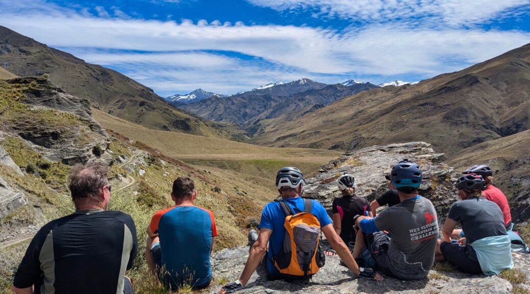
 Off we go… Well, the last three of the sixteen in front.
 Down to lunch.
 With such a large group, stops were, thankfully, plentiful and long – certainly helped get through the day.
 Well above the creek now.
 Thankfully not unpleasantly hot.
 View stop at a spot labelled Easter Island – I missed snapping a photo of the rock that must have inspired the name.
 It seems we somewhat took over the trail. With the part closures, we pretty much had it to ourselves – seeing one other rider all day, and he went past in the opposite direction as we lunched.


 Not a hut to stay in, except in the most dire of circumstances. Something was definitely dead inside.