All posts by bpheasant

Day Seven: Idaho Border to Sandpoint

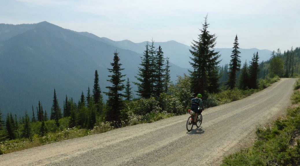
Startled to wake and find the moose still watching us and blocking the road, it was surreptitious that a pick-up idled its way up the hill and our moose sentinels scattered. With an even hotter day forecast, finally managing to start riding earlier was advantageous. Through the trees, we wound our way up noting the smoke was much thicker and breathing not always easy.

Three decent switchbacks further up the climb we came across this large day-shelter. Turns out it was there due to a snowmobile club – I don’t think they would have known if we’d slept there, but as it was a night under the stars with no biting insects was good.

A big fireplace, drying racks, and tables – it was quite a set-up.

Views for metres, scores of metres… Megan had been monitoring wildfire status online and we expected (hoped) we weren’t going to have to turn around.

An hour into the day’s riding we were at the top of the pass – we could see more smoke over the other side. The downhill came as a welcome change, until the road suddenly ended. A route was shown on the GPS, but it was much less obvious on the ground. Having just passed a Idaho fish & game officer, we turned back briefly and asked him if he knew what was ahead. He wasn’t sure, but had maps that showed something promising.

It was worth giving it a go, over turning around. Our progress slowed as it became apparent there had once been a decent road, but it had been ripped up and destroyed. It wasn’t just left to go back to nature, there were big hollows, rises – it was altogether slow riding, when we could ride. Thankfully it was passable and, initially, mostly rideable.

The smoke was still thick and of some concern. But at altitude and the early hour, the day was not too hot yet.

Having dropped off the slopes, and crossed a sizeable stream (I’m glad at least the bridge was still standing well) we were on the valley floor following the water course out. Somewhere the ex-road deteriorated markedly and then disappeared into the undergrowth altogether. There was significant hike-a-bike – particularly when side-creeks came off the mountains and crossed our path.

At times the trail was only a line on our GPSs, definitely not to be seen on the ground.

Sometimes it was pick-a-path through boulder strewn creek beds, which was preferable to what became routine: landslips having taken the route out, we had to scramble down to the main river, pick our way over the rocks and water and then scramble back up.

Definitely adventure “riding”.

Fatigue started to set in for me, but we were in no rush – so plodding on worked.

Ten kilometres and dropping six hundred metres took us two hours – always wonderful to take longer going down a hill than up! We were well pleased to reach an actual road. Until we saw this…

Oh.

Short of water, we snuck past the barrier to top up, eat, drink and rest in some shade. We contemplated trying to sneak through, pleading ignorance if challenged (the fire wasn’t reported as being down to the road, yet) – but the heavy equipment we could hear nearby suggested that was not a good option. We found an alternative route that headed north and then west to the highway – I for one was very relieved we didn’t have to retrace our path up the hike-a-bike!

It worked out well (not knowing what terrain, and crackling fire, we missed) – another six hundred metre climb was manageable in the heat and rather enjoyable. The presence of a quality and proper gravel road certainly helped there.

Heading up the climb, looking back in the general direction from which we’d just come.

Then an absolutely wonder of a thousand metres to drop on the gravel, looking out over the valley, whizzing down, enjoying the wind rushing past.

So. Much. Fun.

Eventually we reached some small signs of inhabitation.

Down at the highway and cooking, we attempted to get to Lake Pend Orielle to cool off. Alas, private property all around.

With sufficient water and food taken on board, it was the highway around the shore towards Sandpoint. We didn’t last long on the highway, preferring a significantly longer route on quieter rural backroads. They were mercifully flat in the heat. Hitting the outskirts of a small conurbation, the first gas station found was raided for cold drinks and ice creams. Sitting in the shade, still melting (not just the ice creams) somewhere with air conditioning was found to escape the inevitable overnight heat.

Five kilometres on a mix of cycle path, quiet roads and then the nasty highway again took us into town. Sandpoint was a nice little town with some tasty eateries (we may have required two large dinners that night) and a nice vibe – I’d have liked to explore more, but was content to walk around a bit in the evening. The first night in town for a week led to mechanised washing of clothes and so on; unfortunately with the increased heat being at lower altitude, better sleep was had the previous night higher up under the stars.

Another fantastic day on this trip – by far the hottest and most challenging yet.

Day Six: Dunn Creek Flats to just-Idaho backcountry

With temperatures set to climb even higher as we headed towards Idaho, we decided to get up and going earlier than we’d achieved up to that point. Best intentions and all that – it was a leisurely start before leaving at nine. A short section on the highway first up, that then crossed the river to leave us on on a deserted road all the way to Libby. As the day warmed, the only other contact we had was people out picking wild chokecherries roadside. I tasted a few – just as well they improve with cooking, they deserved their name.

Following the Kootenai River down, it was strange to see hills with a bit of grass (however brown) on them.

Having heard many trains for days, but seeing few – I finally spied the head of one of the elusive long cargo-carrying beasts as we gently rolled into Libby.

Libby seemed rather down on its heels and was the place I really started to notice yards crammed with junk pick-ups, snowmobiles and other rusting vehicles long past their prime. Getting rather hot, we headed straight for a cavernous diner and proceeded to devour second breakfast. More route planning ensued – after heading down the Kootenai Valley towards Troy would we continue to Sandpoint down low and do a big arc, or strike west through wilderness and over hills?

Three trips to the grocery store, one to the hardware store (back to trusty safety glasses as my sunglasses were slowly crushing the side of my head – well, giving me headaches at any rate), much food and procrastination later we set off into the heat. Already above 35ÂșC, it wasn’t the best time for a little miscommunication and poor navigating on my part. Nonetheless, the quiet road down the right bank of the river didn’t connect and we had to backtrack forty minutes and take the highway west. This required a gas station stop for litres of cold water. Eventually we were on the noisy highway out of town – thankfully the shoulder was mostly generous.

Thanks Smokey. The wildfire smoke seemed to roll in more in the afternoons, at least for a few days.

Mid-afternoon we reached the Kootenai Falls lookout walk; it was time for a break. The small shop and huckleberry ice cream had nothing to do with our need to stop. Monopolising a picnic table in the shade of the busy area for too long, the rest was well deserved. There was some denser shade, so while Megan walked down to the falls I watched the bikes, napped on a bench and soaked my feet in a cold stream. Bliss.

Kootenai Falls

A fraction of the heat gone out of the day, it was not long down the valley before we took the turn and headed up Lake Creek heading for the hills and the more direct route to Sandpoint. Still stinking hot, we filled up water bottles, crossed the creek and tried to find somewhere shady to rest for a while. The woods seemed rather different, but this was by the road – open, with plenty of small trees. Another big rest stop ensued to manage with the heat. Perhaps I was at a disadvantage having come from winter and not having grown up in rural NSW? Rather, I’ve always been susceptible to heat stroke and only very slowly learnt to manage that better.

Leaving Lake Creek behind, the climbing kicked up a bit. The trees got denser, the smoke thicker and the heat slightly dissipated. Seemingly now in the middle of nowhere, we were puzzled by there, for the most part, being a sealed road to ride on. It was rather old, but in good condition on the whole. Not a single vehicle passed us as we climbed and climbed.

It was to be over a thousand metres of climbing to the top and we were wondering if we’d make it by nightfall. Should we camp at the top, or try to drop down? As it happened, we stopped to refill bottles at a creek and found a mama and two young moose with similar thirst quenching ideas. They didn’t notice us for a while, we watched. Eventually they clocked us and ran up the road a bit. Curious, there was no way they were getting off the road. Moose are big and not altogether not-scary; we called it a day at nine o’clock and slowly retreated down the road.

None shall pass. That’s OK, we weren’t really going that way anyway.
Setting up camp beside the deserted (apart from moose) road, there were no food lockers – so a first for both of us, throwing rope up to hang all our food and toiletries up a tree. We weren’t sure if there were bears around (we were close to Bear Mountain), but it seemed reasonable to think there might be and they might like our honey and mustard pretzel pieces. Still warm, it was a glorious night to be fall asleep staring up at a big Montana sky filled with stars. We may not have covered a lot of ground (and some of that was my poor routing), but it was a very hot day – definitely a day of riding I wasn’t really used to; different, but excellent all the same.

Day Five: Whitefish Bike Resort to Dunn Creek Flats

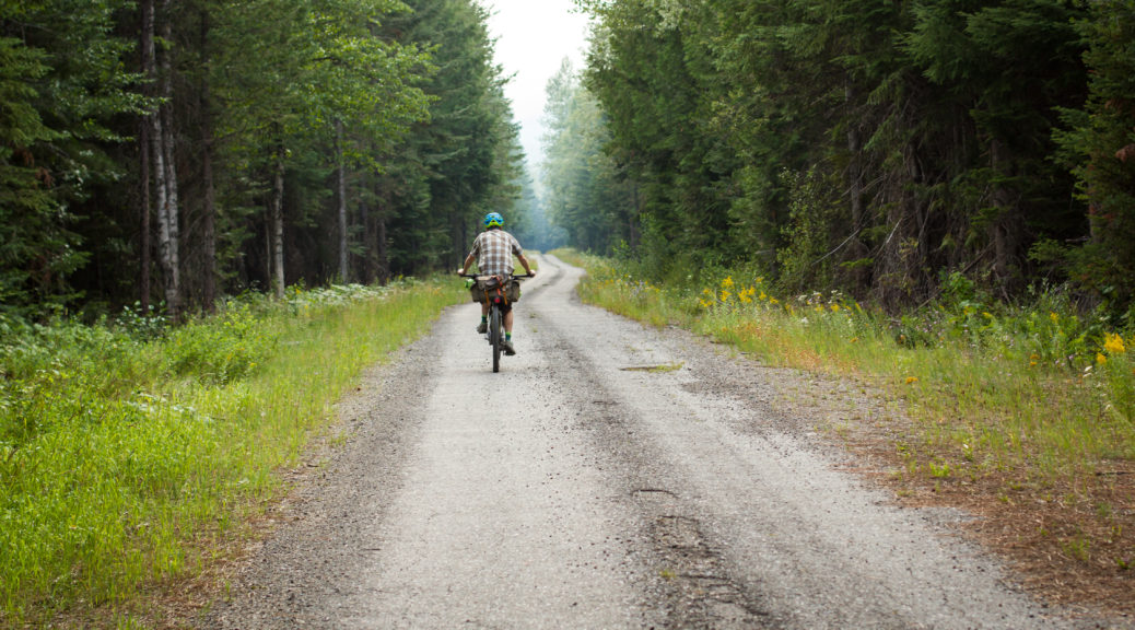
Having eaten at least the mass of my bike, if not myself, for breakfast it was time for all of our group to start packing up. We said our goodbyes and pedaled off down the access road for a short stretch on the highway – it was still nasty, but only lasted quarter of an hour. Enter Megan’s excellent selection of back roads. Mostly on gravel for the rest of the day, traffic was at worst light – but usually non-existent.

Turning off the wonderfully named Farm to Market Road we headed, gradually climbing, towards Tally Lake. With the day warming, and smoke free, a cool lake appealed. Unfortunately the only easy access was through a campground and day access involved a fee.

There may have been trees surrounding the gravel.

Perhaps even more trees.

Away from the lake, the gradient reared a little as we got further into the Flathead National Forest.

Turning onto Star Meadow Road the road was suddenly and unexpectedly smoothly sealed – another deserted road, it existence seeming well out of place, we took it as a fantastic roadies’ road. It was a very nice interlude.

Star Meadow? I’ll assert so. Once again, the hay bales were beginning to congregate.

Leaving the grassland behind, our route kept us heading west with some gentle valley floor gradient before climbing through old burn zones.

Occasionally there were even trees that were not pines. Either way, they were useful for hiding from the beating sun.

The pass was just over 1500 metres high and gave way to a beautiful and sustained descent. Losing all the elevation gained that day, we crossed yet another railroad and found Wolf Creek at the bottom of the valley. Time for a pleasant mid-afternoon rest and water top-up. Also, there were huckleberries! Bushes and bushes of them; even better, there were no bears. Or wolves.

Now into the Kootenai National Forest, we had to choose between a longer, sealed and generally flat route to the campground on the Kootenai River – or a more direct path, that just happened to have a six hundred metre unsealed climb in it. It was warm, but there was plenty of daylight left – we chose the backcountry option. The two hour climb was steeper than earlier in the day, but manageable. In fact, slowly spinning up the hill being shaded by big trees as their shadows lengthened was thoroughly enjoyable.

My new bike may be a bit more of a poser than my previous one.
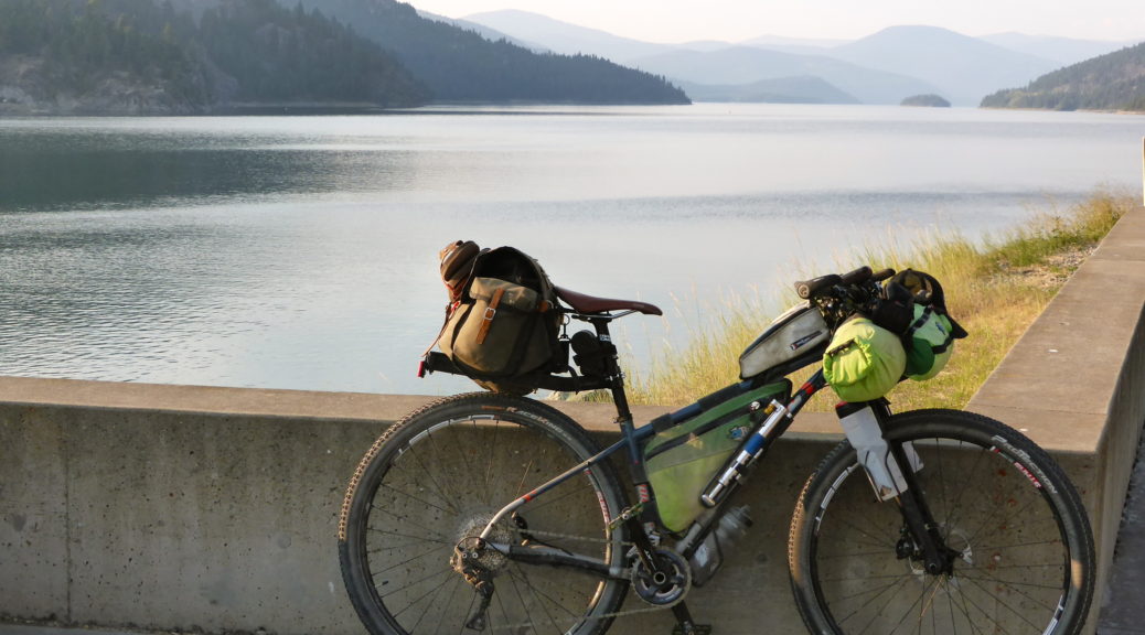
Climbing done for the day, we had ourselves twenty kilometres of downhill gravel bliss to whoop and holler down. All the noise was in part calling to alert any bears in the neighbourhood to the presence of two people have a grand time speeding down hills on loaded bikes. I finally added some sort of substance to my bear call.

A short section on the highway took us alongside Lake Koocanusa and to the top of Libby Dam.

Having dropped from the highway all the way down to the bottom of the dam, a brief trail led downstream to an expansive campground. Choosing a site next to the river, it was time for a dip, to cook dinner and collapse after a most-excellent day through big, deserted country.

Day Three: Red Meadow Lake to Whitefish Bike Retreat (and Day Four: WBR Rest Day)

With a short day on the cards, it was a leisurely start to the day. But perhaps we just slept in and enjoyed taking time in the beautiful setting. A slight climb took us up to 1700 m and from there it was pretty much all downhill to Whitefish – where we planned to rest, eat and resupply before carrying on to the bike retreat. Whizzing down the lush gravel – what great fun; fun which was interrupted by a wasp taking exception and stinging Megan on the ear. Ow.

Within a couple of hours the metal road and easy descent was over and we joined the seal around Whitefish Lake. Also out of the wilderness, we couldn’t actually get down to the lake due all the private property graced with the most ostentatious houses we’d see all trip. Contenting ourselves with views across the lake to the hills behind, and knowing the general direction of the bike retreat, we wondered where along those hills we would be going – I may have also been watching the busy railroad a bit too. Looking at the map now, I see we weren’t too far from the ski resort for which Whitefish is known now – explains the houses a bit, if the lake views weren’t enough.

The road around the lake turned out to be a roadies’ favourite, we were passed by many as slowly the density of buildings increased. A bridge over a large rail yard put us right in town. Amazing crepes were found and devoured, a hardware store provided rope for hanging food out of reach of bears and much food was bought at the grocery store. Eventually we rolled out of town, it was warm, it started raining and we realised neither of us had eaten enough and were actually quite tired. We returned to refuel and rest out of the rain. Salubrious.

Keeping our break to less than an hour, off we went again. Always keen to take back roads, we had a few hills to get over. So nothing was thought as we climbed steeply in the heat up a residential road. Only when a big gate barred us from more big lots and houses did we have to accept that we may have not quite followed the right route. Not wanting to go all the way down, a small cut-through was spotted on the map even further up the hill. Not knowing if it connected, we took a chance and ground our way further up under the beating sun. It connected, just.

Stopping for more food we cruised down a smooth private road, didn’t really find the trail proper crossing the road, ducked around another gate and found the trailhead. I wasn’t keen on pushing through singletrack when we were tired, hot, heavily loaded and didn’t know how technical it was. What an error – the highway was awful and Megan soon found a side road to put us back where we should have been, on singletrack.

Should have gone down here… Now we’ll likely never know what it’s like – but if the rest of the trail is any indication…

The singletrack was so much fun! It was also a big relief to be away from the traffic and in the trees. Both of us were thrilled to be tackling small pinch climbs on smooth trail and flowing down through the lovely curves; generally having a ball on loaded bikes and quality trail.

Honestly, I was having fun! One of the highlights of all the riding. I’ll just say it’s my concentrating face.

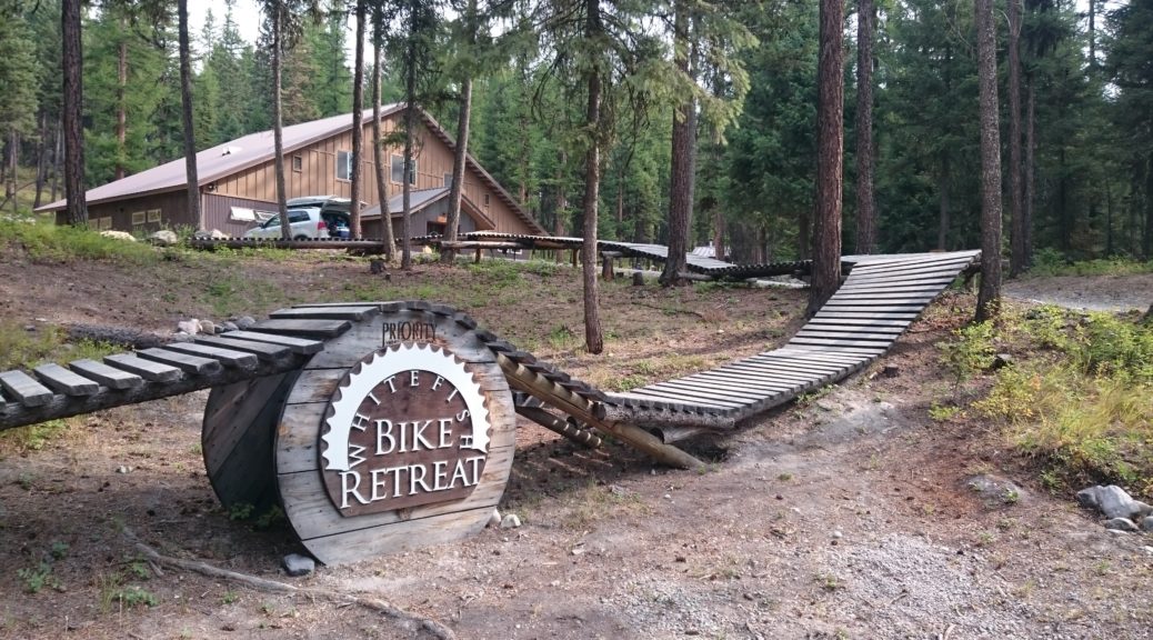
Eventually, we saw this welcome sign – we were close.

Checking-in, it was definitely time for ice cream. We made it to this special little part of the Montana wilderness (admittedly, you can drive there – but we biked in on singletrack, so it felt like backcountry). Set with longer distance trail connecting it, the retreat has a lodge, numerous tent sites, other facilities, its own little network of singletrack, a pump track and a whole lot of bike-themed things.

After the rush of getting to Fernie to start the ride, adapting to life bikepacking again and the heat – a day’s rest was well in order. Much time was spent eating and socialising with friends of Megan’s that had driven down from Alberta & BC. Avoiding wasps every time we ate was also a recurring past-time. Our bikes devoid of luggage there was a bit of fun to be had on the retreat’s trails – but mostly it was eating and resting on Sunday.