All posts by bpheasant

A40BPT5 – Mokihinui to Karamea

Away from the humbler, but excellent, Mokihinui Forks hut – it was a leisurely hour as we had a shorter day planned. Twenty undulating river-side kilometres to finish the Old Ghost Road, and fifty-five on the road up to Karamea for resupply and prep for the next trail.

Soon looking back at the confluence of north and south branches for which the hut is named.

A few kilometres in and we found some more bikers on the trail! Admittedly at a hut, Specimen Point, they were also having a slow start – making the most of the expensive (if you’re biking, the flat price for all huts makes far more sense if hiking) OGR huts. A wee bit of climbing and some exposure above the gorge, this section of the trail is pretty easy going – although less so if you’re at the end of a long day riding the trail all in one go.

Still plenty of small stream crossings, most rideable, some prudent to walk.

Enjoying the reappearance of the rimus – probably my favourite native tree. This section of riding was plain good fun too.

Not quite the picture I was going for, but at least I didn’t get the one I was after and end up riding one-handed into the creek that suddenly appeared while I was distracted.

Out before eleven, that was the singletrack riding done for the day and time to complete the pair of obligatory photos.

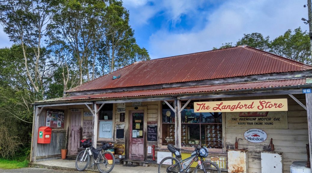
What a great trail, would love to return soon and ride it less-loaded on my mountain bike. Ten minutes on the road to find that we were about an hour early for the small store’s opening hour (noon to one o’clock). A bit of wandering around the adjoining pub and motel units and I found the new owner feeding his chickens – he graciously opened early, and even heated some pies for us. Top service – I was more than prepared to wait until opening time.

Back on the road north (further down the same road we’d left Westport on two days before), it was straight into a four hundred metre climb – strangely warm, but the wind was helpful. That done, there was little climbing for the remaining fifty kilometres of the day. Partly due to the chunky rear tyre (which was a boon on the trail), but mostly because I’m poor on flat tarseal I lagged – ever mindful of the sacrificial drivetrain feeling a bit shonky (but still shifting well). There was the hint of some drizzle near Little Wanganui, but not enough even for me to don my raincoat. The little gravel back road for half of the remaining distance was nice to get away from the wind on the coast, not that it was too much of a bother.

Refreshing to get to our destination well before dark, get organised for the next three days on the Heaphy, wash clothes and eat a lot. Shorter days may not be so interesting, but they’re good for a bit of a reset on tours – and they certainly make for shorter posts here!

A40BPT4 – Lyell to Mokihinui (Old Ghost Road)

The shelter at Lyell provided a surprisingly good sleep, we were on our way shortly after eight.

But first, the obligatory photo.

The old path up from Lyell to long-ago mining settlements further above the Lyell Creek valley was as lovely as ever, and being a long-established trail, in good condition. No shortage of green to look at either. The climb is gradual and the riding mellow for the 800 m gain over fifteen kilometres. Some of the frequent stream crossings require dismounting, but many are rideable.

Taking the time to poke around a long abandoned hut.

The short deviation to Lyell Saddle Hut is under repair – easily the muddiest bit of the whole trail! We should have left our bikes and just taken our morning tea up – a long morning tea chatting with the only hiker we would see on the trail all day (we’d met at the shelter earlier and then passed him on the climb). Studying a map and trail guide in the hut, we’d made good progress (at the fast end of the range given for biking up), but adding the rest of the sections that we planned for the day it was clear we should get moving if we didn’t want too much night riding!

Unfortunately, the climb from Lyell Saddle through the bush (much newer trail) to the ridge-riding was in a right state. It had degraded markedly in the two years since I last rode it. Unlike the older trail below, it just couldn’t handle all the rain in the area (insufficient, and filled, drains that fail to get and keep the water off) – all the fine material had been washed away. This left a very chunky, rocky, loose climb that was far slower and harder going than previously. I was pleased for that replacement tyre I’d borrowed in Westport! Even so, I walked much more than I normally would on such an easy gradient.

Occasional view of the upper Mokihinui Valley.

Hurrah, out of the bush and off the slow surface.

That’s better, more to see too – not quite as clear as previous day, or rides here, alas.

Back west to where we were not twenty-four hours before.

Trying to spot just where we were, cloud not helping.

Ooh, it’s brighter east. Down to the lower Maruia River.

Still climbing, just.

Rocky Tor, which we’d spotted from Denniston Shortcut in clear weather the previous day.

Switching sides of the ridge for the precipitous traverse to Heaven’s Door and the high point.

Still mostly rideable, there are small parts it’s prudent to walk (especially with a loaded bike); also, there are far more fences than when I first rode this section in 2015. Pete’s story of a previous companion falling off the side, breaking a wrist and walking out, was reminder enough not to do so.

The view east from Heaven’s Door.

Now for the drop to Ghost Lake Hut, which soon goes into bush, and a late lunch.

Looking back from the bush to the ridge traverse.

The trail continuing below Ghost Lake Hut.

The drop from the hut to the lake is even more treacherous than previously, so a bit of walking – despite my best attempts.

Such a great place for a hut.

Last time I was here, work was starting on the many tight, heavily rutted switchbacks below the lake so I was wondering if there would be much less walking on a loaded bike this time. Huzzah, an improvement in the trail – barely had to get off my bike, a fair bit of dabbing on each corner though as they’re tight and steep on my bikepacking rig (a dropper post would be useful!).

The snow we could see from Denniston Shortcut now making an appearance.

Out of the switchbacks and looking back to the hut.

Quarter of an hour of climbing to gain Skyline Ridge and open views north to where we were heading.

Down to the Stern Valley, we had six hundred metres to drop in not long. We’d ride along the valley floor, before climbing right through the Boneyard under that mass of rocks that looks ready to let go at any moment and then exiting through the bush at the saddle on left of the centre ridge.

But first we had a ridge to ride along, and then down – more walking here as the track deteriorated again, steep, tight and rutted out.

Bit of a carry down scores of steep steps.

Ooh, trail building – perhaps a way around the Skyline Steps, and ridge (?), has been found…

The descent from the bottom of the steps five hundred metres to Stern Valley Hut was not nearly as fun and flowy as I remembered, but things definitely sped up from here – which was just as well as prevening approached. We didn’t even stop for a cuppa at the hut, just briefly chatting with some hikers and topping up bottles.

Climbing through the Boneyard is far more pleasant without direct sunlight!

Even knowing this time where the trail climbs through here, its exact path is almost as surprising and staggering as the route cut across the exposed ridge of the Lyell Range.

End of the climb through the rocks, back towards Stern Valley from the north end.

The gradient relented for the last little bit of the climb to Solemn Saddle.

Nice to be back in the bush.

Then for the riding highlight of the day, dropping from the saddle to Goat Creek was sublime. Far more flow through beautiful bush, it was quite the reward for all the effort throughout the day. Much fun.

A short detour to spot Goat Creek Hut, but we didn’t fancy fording the creek and getting wet feet just to get closer.

Only eight kilometres to go to Mokihinui Forks Hut, all alongside the south branch of the Mokihinui River. Overall it was flat, but still a few little rises to crest and coast down. Now late in the day, we did the last half of this section in the dark – pleased to get to a sweet little hut. Basic compared to the grand Old Ghost Road ones, it more than met our needs and we reflected on a great day – a bit slower than expected, but can’t go past the spectacular views and the audaciousness of a trail through such country.

A40BPT3 – Westport to Lyell via Denniston

The last time I’d ridden from Westport to the start of the Old Ghost Road, it had been an easy few hours up the highway. But this time we had time, and importantly days beforehand with no rain, to give the Denniston Shortcut a go. It wasn’t a shortcut by any means, but I was well excited to finally explore off the back of the Denniston Plateau – which I’d visited a few times, enjoying the mountain-biking and history up there.

But first things first, ten minutes in it was time to meet Nina in town and have a pie. The wild game (goat in this case) pie from West Coast Pie Company takes the prize for best pie of the trip – it was fabulous. The cinnamon scroll also great, somehow managed to save some for later.

That didn’t last long. Nina’s photo.

Saying farewell to excellent-host Nina, raiding the supermarket for three days’ worth of food and a quick look down the main street we were finally on our way. No rush, a beautiful day of weather and we only had seventy-five kilometres planned and many hours to do it. Out of town on quiet, flat roads to find the coffee cart at Waimangaroa, where we’d leave the main road and start climbing inland, open. Another big pie seemed even too much for me, but Pete fancied another coffee – so more resting in the sun swatting the occasional sandfly. I was surprised to see a small NZ Cycle Trail sign pointing our way; this may make navigation even easier.

Morning smoko done, I was eagerly anticipating the climb to Denniston (from sea level to 600 m) – having only driven up it before. It must be one of the biggest, quiet, sealed climbs around these ways. Thankfully it was pleasantly cool for the most part, only sunny sections down low hot, and a quite reasonable gradient.

The views easily distracted from the task in hand.

An hour of climbing and we were at the top of the Denniston Incline, taking some time to eat while reading fascinating history of coal mining, and living, up here when it was extremely isolated (no road access, just the Incline) – Pete’s great-grandmother having lived up here giving a connection to the desolate place.

Can just spy some of the Incline tracks in the bush.

Off past the few remaining buildings to the back of the plateau, signs of coal still all around. As the road surface degraded from tar seal, to gravel, to rough track we began to wonder which of the two sets of high-voltage lines our pylon road would follow. A small drop to Cedar Creek Road, the scrub was still recovering from mining days as the climb to the highest point of the day began.

Stopped at a corner after a nicely steeper and technical section, I was happy to let a convoy of eight 4WDs drive past in the opposite direction. Assuming they’d come through on our route (which as there was no other, was a reasonable one), the Mackley River can’t have been too high as they weren’t all that well kitted out for deep water. Some encouragement, perhaps; I took it as such.

We must have passed the extent of the mining as the fauna turned more to forest than scrub; just short of the high point.

With the pylon road in surprisingly good condition, it was pleasant riding as we crested the hill and started to get glimpses of afar on such a clear day.

Out to the Brunner Range.

With the forest dropping away briefly, we stopped a few times as the view west kept improving. Fun to see the hills we’d be riding the following day and ponder which range had the distant snowy peaks.

The Glasgow Range on the left, the Lyell right of centre – Old Ghost Road territory, and the distant Richmond Range on the far right. What a clear day!

Rocky Tor, which is so close and prominent while riding the ridge on OGR, clearly visible.

Quickly, we lost almost five hundred metres – steep in places (fifteen percent overall, pleased we weren’t going up!), restraint from having too much fun at borderline speeds was prudent. The surface got a little worse with such grades.

The coal is back.

Stevenson Stream was our first crossing, managed to keep dry feet.

We’d been up at those pylons but minutes before; partway up a grunty little climb to a short plateau.

Before another plunge to Mt William Stream, the section just before was the worst surface of the day. Steep, a bit washed out, but rideable.

Didn’t keep feet completely dry, but the afternoon was warm in the sun and thankfully my newish shoes dry a whole faster than previous ones.

A bit of break as it was Pete’s turn today to deal with a flat tyre. Only a puncture in the tread, it was soon plugged and we climbed again. Another, slighter, climb and more mellow drop over two-plus kilometres deposited us on the right bank of our main obstacle of the day – the Mackley. This was the big unknown, would we be able to safely cross?

A bit wider than I was expecting, it looked deeper too. With damp shoes already, I was happy to let them get soaked as it would make the crossing easier on increasingly cold feet. Bags soon came off the bikes to be carried across, if it didn’t prove too deep. Wading out it was good to see the bottom and no sharp drop-offs as it deepened to cover my legs. This was fine and the current wasn’t too strong. Briefly in the middle it got waist deep, a bit towy for complete comfort. But that didn’t last long and I was soon depositing my bags on the left bank, and returning confident that we’d get our bikes across safely. I think I even managed to keep mine mostly out of the water.

(For those interested in making the crossing, the river level is measured at this point and can be found here, listed as Orikaka Rv at Gorge. When we crossed, the level was reported as 0.92 m – the level having dropped 1.6 m in the preceding two and a half days. For someone my size [171 cm, 58 kg], I wouldn’t want to be crossing alone with it much higher.)

Pete making the third crossing. Limited photos as phone stashed in dry bag, as were a lot of clothes.

Dried off, it was time to get going as still twenty kilometres of who-knows-what to come. Wow, the climb away from the river is a doozy. I see it called Beast of the Mackley somewhere, almost two hundred metres and twenty percent. I was happy to get three-quarters up, with not inconsiderable effort, before my tyre slipped and I was happy to wait, get some water from a stream and walk the rest. Some fitness and climbing legs coming back – it was the only climb I walked all day; pleasing. At the top there were HV lines coming and going every which way; odd to see how it had been unconventionally arranged.

Off the top, it was less steep – but there was still some climbing to be done as the track undulated through more nice bush. Suddenly, an open pit that looked recently worked and abandoned. Shouldn’t have been surprised. Then we were riding through, and on, a lot more coal than earlier in the day, New Creek Mining didn’t look to still be in operation with temporary buildings heavily damaged and littering the road. It was odd and quite a mess with polystyrene insulation spread down a long stretch of the otherwise pleasant road.

Still, the signs kept up – most helpful.

Made it – out to the Buller River on dusk.

Five easy, flattish, kilometres to Lyell and the OGR trailhead. Arriving just after dark, there were pleasantly no sandflies and the shelter had its fly screens intact and made a suitable place to cook, eat and sleep after an excellent and successful day – quite a climby one at that in the middle.

A40BPT2 – Ces Clark hut to Westport (Paparoa)

Woken a little overnight by the wind, it did have the effect of blowing a lot of cloud away – we were both delighted to find the morning a lot less clagged in than on either of our previous trips (mine here). We would see far more this time! Off we went completing the climb of the Croesus Track with a stiff, cool wind buffeting us from the right.

More nice rocky trail, heading towards Croesus Knob – must wander up there one day.

Towards Moonlight Tops. Spot the trail, left to right.

In the cold my phone continued to make a further case for its replacement, dying on me. But no matter, especially as there were soon other things to deal with. Nearing the high point of the day, two hundred metres higher than the hut we’d left, some innocuous-looking rocks conspired to put a two centimetre slash in the sidewall of what was, obviously now, too light a tyre. Frustrating; wouldn’t have been too difficult to consider what tyres were on my bike and the rockiness of these trails at home, and sensibly change it for something stronger and heavier.

Moving a little up the trail to a slightly more sheltered spot, cue over half an hour of giving up on trying to stitch the sidewall (tyre annoyingly too tough for this, but not resistant to the original damage), struggling to get the tyre off the rim, putting a tyre boot and tube in, and eventually getting the tyre reseated. No real drama, a good learning opportunity and for the first time I rode with duck tape and zip ties further protecting the tube – rather hoping it would also somehow stay together at least until we reached the highway, only forty kilometres of such rocky trail…

Pleasant riding along the tops, enjoying the views out west to the Tasman Sea and closer over the topography of the Paparoa Range. By the time we made it to Moonlight Tops Hut, a bit later than expected, it was definitely time to boil the billy and eat – along with putting all my tools back in the correct place and resurrecting my phone.

I do enjoy this view, anticipating getting to the escarpment on the right, and then riding very close to the top and edge of it. Not least for the goblin forest that covers this section.

Predominantly downhill, there is still a bit of climbing to be done – but this is no issue as it’s such a beautiful section of forest to ride through, one barely notices. Getting out of the increasingly strong and cold wind was also a bonus.

The mossy trees don’t have quite the same atmosphere when there’s no mist sneaking its tendrils through; but certainly not complaining about such a clear sky!

Continually distracted studying the old forest.

Popping out of the forest briefly to see the sea.

Ooh, the emergency shelter has been upgraded considerably. Digger garage this end, enclosed shelter other end – another good bivy spot.

We soon dropped off the ridge and began the steep, twisty descent towards Pororari Hut. It was still in reasonable condition considering all the weather it must be exposed to.

With no one else on the trail, I didn’t feel rushed to get off the bridge beneath this waterfall and managed a couple of snaps this time.

One of the more tightly-switchbacked sections through some enormous boulders.

The descent flattened out some, with the odd rise, as we dropped and lost the wind. A beautiful afternoon for riding.

It would be a shame not to stop at this thoughtfully provided seat.

As I was the previous time, I was transfixed by the tight contours of this peak – Lone Hand. The topo map is a mess of packed, twisted lines.

Such a nice, still afternoon there was no need to have afternoon tea inside the last hut.

Dropping to the Pororari River, the riding gets faster and the forest changes to far more ferns – sublime.

The trail crosses the river, and a side stream, before keeping its elevation as the river drops away through a small gorge. This gives a good chance to look back for a last glimpse of the range – only a small part of which we’ve thoroughly enjoyed riding and taking in the views from over the previous day.

The bike track departs from the walking track here and, with one last little sting in the tail, climbs a hundred metres to the next valley. I was astounded to happen across two daywalkers two hundred metres from the end of the trail – such was the solitude we’d had for the rest of the trail, a magnificent way to experience it. A short bit of highway and it was time for an ice cream to celebrate such fun on the Paparoa, and that my rear tyre was still inflated. The duck tape wasn’t much for this world, so off it came before heading north for fifty kilometres of highway.

Calm, clear and mild for a late-afternoon ride – Southern Alps off in the distance.

Heading into Fox River.

There’s still little tourist traffic around, so the highway riding was doubly pleasant. With near seven hundred metres of ascent to Westport, it was as much climbing as we’d done all day along and off the range. I was not fast. Even less so when my tube let go short of Charleston on a steep, twisty descent; that took another twenty-odd minutes of daylight, but it was still a blissful evening of riding into the dark.

Getting towards the northern end of the Paparoas.

Warmly welcomed by Nina, we were spoilt with cups of tea, a large dinner of stew and salad, dessert, much sharing of adventure stories, use of facilities to clean dirty clothes and riders, and most importantly a tyre was found that fit my bike – huzzah! It was much beefier in tread and construction – a far better option for the trails around here, I’d happily take the compromise of being even slower roads. Thanks Nina, and in-absentia Rachel (whose tyre I’d borrowed).

One excellent trail done, forecast still looking good, plans for crossing the Denniston reviewed (I was disproportionately looking forward to this as the only new bit of the route to me) and bike good to go again (sacrificial drivetrain still functioning, just feeling a little off) – our tour was off to a great start and further adventure beckoned.