Category Archives: bikepacking

Geyserland Gravel Grind: Day Two

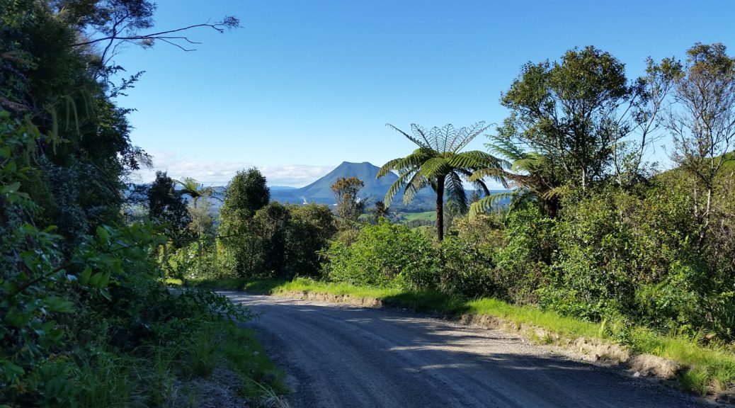
Some people seemed eager to get on the trail, so campsite noise began early. Apparently the wind had really got up in the night, but I’d missed that – so my night maybe wasn’t as sleepless as I’d thought. Breaking camp it was down to the store to find breakfast – hot meat pies are fine for breakfast, right? Retracing our path a little along the highway we were soon climbing up in front of the cliff faces to the valley that Herepuru Road lies in.

Gaining that little bit of elevation quickly confirmed that it was another glorious day in the Bay. That’s White Island puffing away on the horizon – I really should visit one day.

While the more magnificient Tarawera Falls were near to our route, this would be the largest waterfall we saw on our trip.

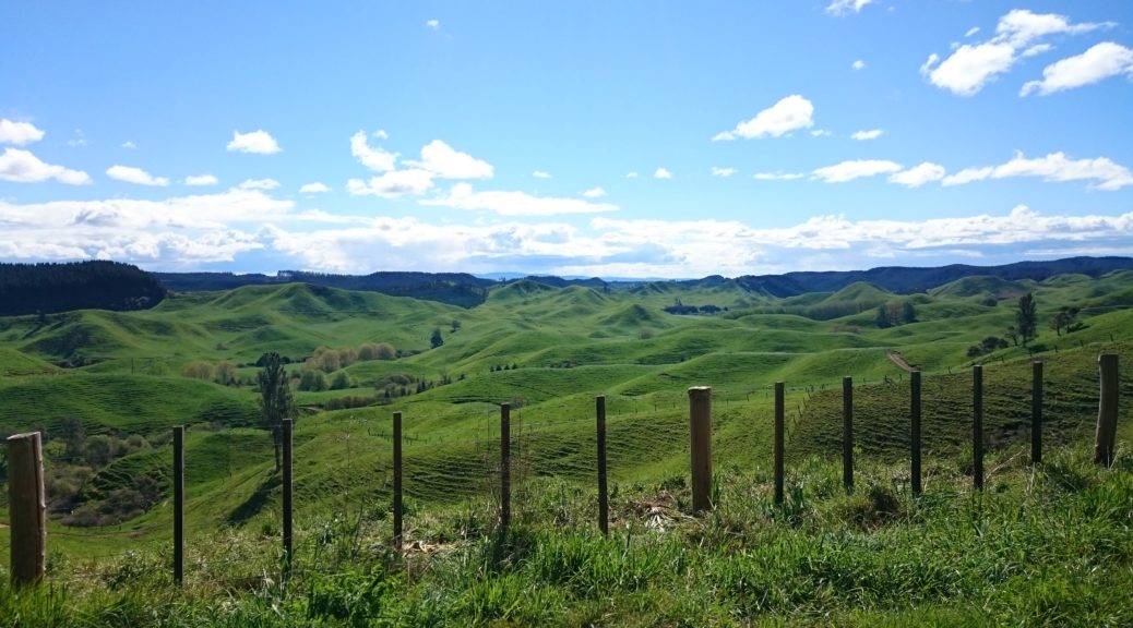
Gaining four hundred metres in altitude was a little bit of a shock first thing in the morning, but it was a lovely climb up through quiet farmland and then onto another stretch of the gravel Manawahe Rd. A fast, loose and thrilling ride ensued on the gravel as we quickly returned to the plains, which were basically at sea level.

Looking toward Kawerau and Mt Edgecumbe partway down the descent back to the plains.

We made good time against a slight wind on the highway before turning south at Te Teko – our last place for getting water and buying supplies for sixty kilometres. Buying more pies, we rolled out under the watchful eye of a local Mob emissary – much speculation was had as to whether he was checking out the patch of the Coastal Crew (a group from Kapiti with their own printed riding gear) or just generally impressed by the large twenty-nine inch wheels.

For the next seventy kilometres we followed quiet backroads through an awful lot of forest, much of it unsealed. I was surprised to see a rail line through here – I’d no idea, apparently it brings logs from Murupara to the mills at Kawerau. It was not unpleasant climbing up to five hundred metres, even if all the pine trees were somewhat similar. We found a trail angel just past the halfway point of the day and gladly accepted oat cookies and were happy to stop and chat for a while. Eventually things flattened out and the hills became undulating; it was time for lunch in the sun on a big grassy patch, and another pie. Stopping briefly in the shade at Rerewhakaaitu School to refill bottles, I looked across the road and saw the hall that we stayed in twenty years ago on aforementioned cycle tours. Those were the days where you could walk or ride up & down Tarawera for the princely sum of two dollars. Always so much fun running down into the crater and then blasting down the 4WD road off the mountain.

Here’s a view of what I consider the back of Mt Tarawera, and what is definitely Steve’s back.

Having skirted around Lake Rerewhakaaitu and passing the roads used to access the northern part of the lake, I recalled numerous days and nights camping beside the lake and finally learning to deep-water start on a single waterski. Gosh, it’s been years since I’ve been waterskiing. There’s a nice bit of new singletrack around the edge of Rainbow Mountain that gets bikes & riders off the highway for a bit. We took that before stocking up for the next day’s breakfast & lunch at Benny Bee cafe – and feeding ourselves for the present as well, naturally.

From there all that was left of the day’s riding was to ride the notorious Waikite Hill – albeit in reverse, we went down the near-twenty percent gradient hill before arriving at the campground. Well, Steve had somehow managed to lose his debit card on the way down – so he got to climb the hill properly; pleasingly, he did manage to find the lost card. The best thing about the campground was that admission to the site also included the adjacent hot pools. Pre- and post-dinner soaks in the pools? Don’t mind if I do. A close second to the pools was the huge plate of beef nachos I devoured. I could get used to bikepacking for the day and finishing at four-thirty – most excellent, especially with hot pools, large dinners & beer.
Geyserland Gravel Grind: Day One

Some months ago, I noticed talk online of a bikepacking event around Rotorua. As the plans developed and a date was set, I was excited for this – and not only because it would be my first bikepacking for the 16/17 summer. Having grown up and spent much time around the area, I was keen to get back and explore it a bit more from the different vantage point of a bike. Also, many of the place names were familiar to me only because Dad used to mention them in passing as places he would visit farms in the course of his work. It was only some time later that I realised the similarities between the route and that taken on my first cycle-touring experiences (two week-long school holiday camps named “Rotorua Lakes Cycle Tour” that I did aged fourteen and fifteen).

Erik had worked diligently to compile what looked a very interesting route, starting in the centre of Rotorua before heading to the coast past many lakes, then returning to the many hills south of Rotorua. A key difference for this event was that the daily distances were set – this meant that we all camped in the same campgrounds. This sounded a good idea in two ways: it would be much more social in the evening compared with wildcamping alone and with the distance set, there was no obligation to try and ride as much as possible. Interest was stronger Erik expected; twenty-six of us assembled Saturday morning, keen to see what the long-weekend would bring. Erik had even gone to the trouble of organising three courses: two, three and four days. Somehow I’d persuaded Steve that stepping up from the brace of two-day trips I’d dragged him on previously (Waikaremoana and a local one) to the full four days was a good idea.

Waiting for the off; once again Steve, as the accomplished & strong triathlete, had the pleasure of carrying our tent. I travelled lighter than in Tour Aotearoa.

With a group photo taken and last minute details explained, we were off into the sun with a brisk southerly chasing us to the shores of Lake Rotorua.

For an event called the Geyserland Gravel Grind, appropriately our first bit of off-road trail was through thermal flats beside the lake. One of my favourite smells, the rotten-eggs of hydrogen sulphide, hung heavy in the air – we must be in Rotovegas!

With over forty kilometres of fun mountain-biking the previous day making their presence known in my legs, I was happy to dawdle at the back as we made our way south through the forest where I’d been riding but twenty hours before. This time the gravel roads and singletrack were there to be enjoyed by taking in the atmosphere, rather than by attacking them. I was surprised to catch up to Steve. It turned out he’d had quite a luggage malfunction resulting in some apparently superficial to the rack he was using. As we attempted to satisfactorily rearrange the constituent parts the situation became all rather hilarious; eventually I managed to stop laughing and a solution was found (those were independent events).

Past Green Lake we were next on the new-to-me highline trail around Blue Lake – that was cool & much better than the road option. Out of the forest and a bit of seal had us whizzing down to and around Lake Okareka.

I stopped to snap a different perspective of Mt Tarawera.

Said perspective, looking across Okareka.

Back onto gravel we soon found the start of the Western Okataina Walkway – which has been opened to bikes since I used to ride regularly around the area. Skirting the western edge of the lake, the seventeen kilometre trail through native bush fair owned us. It was fantastic, even if it took almost two and a half hours. Heavily rutted out in places, there was a fair bit of hike-a-bike and with the rough surface, a few stops were made to readjust Steve’s sleeping bag on the rack. Mercifully it was reasonably dry; the forest was lush and we stopped in a small clearing for a relaxed lunch and doze in the sun. Yet another trail discovered bikepacking that I’ve earmarked for returning to with an unladen (swallow) bike – such fun.

A nice smooth section of trail.

That done, we were on the shore of yet another lake – Rotoiti.

Passing many maraes, we joined a large contingent of GGG riders at the first store in ages – time to stock up on snacks and reapply sunscreen.  Refueled we followed the highway around the shore for a while, before turning off down Manawahe Rd – this road starts off between two more lakes, Rotoehu & Rotoma.  As we passed the top of Pongakawa Valley Rd I was really feeling close to growing up in Te Puke – I used to have classmates that lived up this way.  After having gravel crunching under the wheels for a while longer we were looking for unmarked track off the side of the road.  We managed to take a track fifty metres too early, quickly realising my mistake after a large puddle and a fun, but rough, descent.  Here we were joined by Colin, who I recognised from the Kiwi Brevet last year – I sure hope I’m still bikepacking while drawing a pension, what a guy.

It turns out that the turn was marked, somewhat; although the trail is not immediately apparent.

The two kilometres of overgrown and unmaintained paper road was much more rideable than expected. Soon we were at the top of Pikowai Rd, with three-hundred metres of elevation to lose to get to sea-level and twenty-five kilometres to get to the campsite at Matata. Needless to say, that quick blast downhill was most fun – even spooking a large deer along the way.

The buildings were about the only things watching us up here.

Looking west towards childhood homes – if you squint I’m sure you can see Te Puke there somewhere.

Snaking down to the coast between the cliffs that I was rather familiar with having driven past here many times when younger, we joined State Highway Two for the last ten kilometres of the day. As I had spent so much time on and around this highway growing up, it was weird to be riding along it – especially so as now I regularly ride to and from work on a completely different stretch of the same highway hundreds of kilometres away.

Naturally there was a fair crowd of us stopped outside a store scoffing food and ice creams, so we stopped in before making camp just behind the dunes.

We fair took over three or so sites (this being about half of our tents) – the campsite was busy with the long-weekend and the popularity of the spot.

Back on a Bay of Plenty beach with proper sand & all! There’s even Whale Island over there too.

Plenty of people out enjoying the late-afternoon sun and fishing.
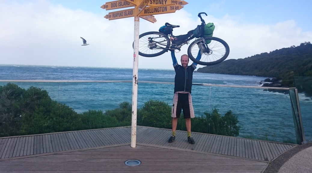
While only a shade over a hundred kilometres, there was a fair bit of riding involved in a fantastic day. It was excellent that all the riders were in the same place at the end of the day sharing stories of the day, beers and copious amounts of fish and chips. But we’re hardly a rowdy bunch – I think most were tucked up in tents by half-eight.

Footnote: It is with some sadness that I know definitely that my uncle will not take this post with him on one of his regular visits to share with Granddad the cycling stories and pictures of his only grandson. Rather than writing stories of my own little rides, I should be preparing what I’m going to say at the funeral of the man whose cycling feats continually inspire and surpass my own. Cycling to Wales of a Friday night to escape the bleakness of London during WWII and then big tours of post-war Europe are some stories I’ll not hear firsthand again. Perhaps I got into this bikepacking/(off-road) cycle touring thing a little late – but hopefully he was able to appreciate and take a bit of pleasure in the fact that I was off seeing many places from the saddle of a bike.

Tour Aotearoa – My Day Seventeen – Mossburn to Bluff, just!

My choice of verandah was almost too good – I woke with a start and realised it was half-past seven and I’d overslept. This was somewhat understandable as the storm had come through and it was still very dark for the time of day, and now also very wet. At least everything I had was dry as I hurriedly packed, scoffed some food and headed out into the rain for the last leg of the journey.

Heading south, it was to be a hundred-odd kilometres to Invercargill on mostly-quiet rural roads. The wind had swung around towards the south from last night’s wonderful nor-west tailwind, so was a bit of a hindrance. I steeled myself to be riding into the heavy rain for the remainder of my Tour. For some reason, the route left the sealed road and turned away from the river it had been following, just to climb a hundred vertical metres steeply and then return to the same river valley it had just left. But in coming down that seemingly-inexplicable hill (I now think it was to put us on the quieter side of the river), a wonderful thing happened – the sky cleared and we were without heavy rain, basking in sunlight.

It was also around this time that another rider, Steve, caught me – we would ride most of the rest of the Tour together. Steve was very pleased to learn that Dad was coming to pick me up and we could probably give him a ride back to Dunedin – definitely better than riding there. We worked out we’d been on the same boat from Pouto Point way back on my Day Three and Steve had just caught up to me. For one last time, I had a farmer in a pick-up pull up beside me as I was riding enquiring as to why there were so many cyclists on his quiet back road. I tried to get across the outline of what we were doing over the noise of the wind. We followed the straight Southland roads down to Winton for the last food stop, always pleased when the wind was more help than hindrance.

For some reason, they don’t seem to bale their hay around here – just make little stacks.

Second to last photo checkpoint – photo with an enthusiastic Southland local. Fascinated as she was by our journey, we also heard a lot of the Wanaka A&P show that was coming up that weekend.

With only seventy kilometres to go, it was a straight run south to Invercargill battling what was now becoming a gale of a sou-wester. Passing through the outskirts of the city, any time we turned east speed was quickly gained with no effort. Unfortunately, the route was still south and on a cycle path on the edge of the estuary – which afforded absolutely no wind protection. It’s a lovely wide trail, smooth and flat for ten miles; well, it normally would be – we struggled to stay on it as we were repeatedly sprayed with water from the estuary and blown into the grass.

How could it be so hard to stay on such an easy trail?

Steve leaning into the wind and fighting his way back onto the path.
The trail looped around a bit and only a few times did we almost get blown into the estuary. Aware of the ridiculousness of this, there wasn’t much to do but laugh at the absurdity of having come so far only to find the flattest part and the last one percent was to be the most difficult.

Finally we reached State Highway One – that which we began our journey on and on which we would ride the last twenty kilometres. This really wasn’t a good thing – for two reasons: one, the road, while flat and straight, was heading straight into the gale for eight kilometres; and two, unlike the far-north this part of SH1 is very busy and largely used by big trucks going to and from the port at Bluff. Sigh. I rode with Steve a little way as our pace dropped to that of walking. We were constantly blown off the hard shoulder, rolling down the grass verge and then fighting back onto the highway only to be almost sucked out into the traffic lane by the pressure drop after each passing behemoth. Once again, my slight frame was no use as I just didn’t have the strength to continually muscle into the wind. Steve gradually pulled away and I was left battling into the wind alone.

On my commute, I ride on a busy highway with even bigger trucks rattling past – but here, for the first time, did I actually start to fear I might get hit by one. After only a mile or so of this madness I decided that it wasn’t worth the effort of riding to just to increase my chance of becoming a hood ornament for a big Kenworth; I got off and walked. After almost three thousand kilometres of riding, I was reduced to walking along a flat, straight highway – it still sounds outrageous. At least I found out the next day that I was trying to ride into an eighty kilometre per hour gale, that was gusting to a hundred and twenty!

I cut a pretty pathetic sight pushing my bike alongside the highway – which in itself was no mean feat and took all the strength and willpower I had to go on and not just give up and lie in the grass. Such a wretched figure I must have looked that three drivers at different times pulled up besides me offering to put my bike on the tray/trailer and drive me the last kilometres. I felt ridiculous having to turn such kind offers down. Then the rain blew in…

Putting a raincoat on in such conditions is remarkably difficult. After taking ninety minutes to mostly-push my bike eight flat kilometres (!), the road finally turned south. Now I only had a big crosswind to deal with – if you don’t know, frame-bags make very good sails. Tentatively I tried to get back on my bike; it was only after a few attempts at riding a few metres that it was actually worth it. But then a skinny, elevated rail bridge with no shoulder had me walking again. Finally, I could ride again; as the road approached Bluff it turned south-east. The struggle was over, I had survived; suddenly I had the wind at my back and was flying through town. With the last twenty kilometres taking over two hours, the toughest part and indeed my whole Tour Aotearoa was over! Such satisfaction.

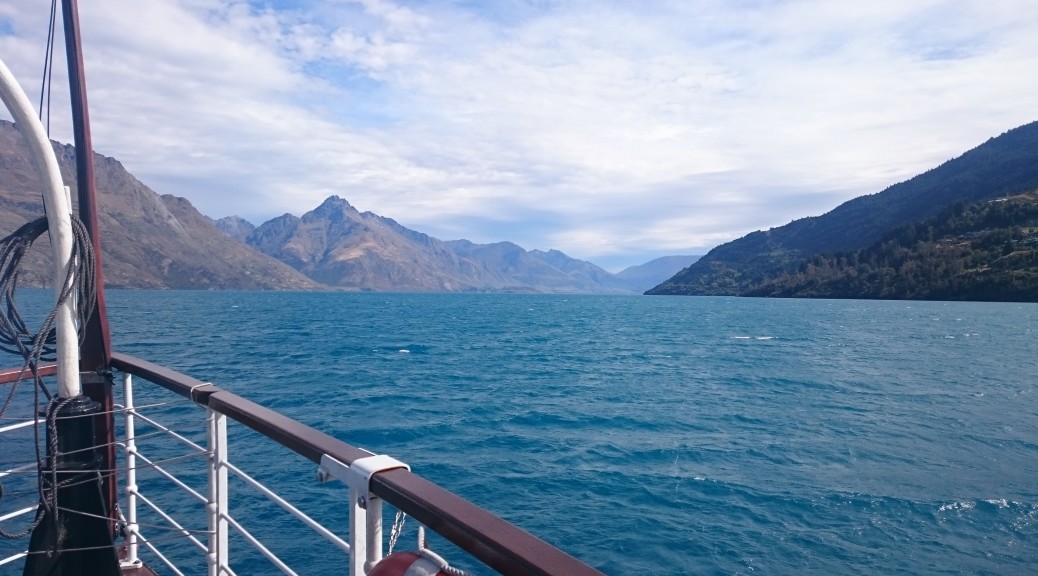
There was no fanfare, or anything external really to mark my finish – just a sign post at the bottom of New Zealand that meant I’d ridden the length of the country. A month later (it sure has taken me a while to write this up) I’m not sure I can convey the wonderfulness of it all – what a great route, what a diverse and beautiful little country, what fantastic people I met along the way, what a lot of tasty food I ate and just generally: how good was that?!

Dad arrived a few minutes after I did after buying tea (due to the wind, I was somewhat later finishing than expected). Photos (above) taken, it was to the adjacent cafe to eat and drink. Somehow I managed to drink a pot of tea, a deserved porter (of the beer variety, not an actual porter) and a water concurrently – I think that was excusable after 3000 km in 16.1 days. That was two days quicker than I’d dared hope – wow, I can actually do these events and I’m pretty sure I could do them better. With two extra days up my sleeve, I had rebooked my flight home so I could rest at Mum & Dad’s before a more relaxed return home.

Tour Aotearoa – My Day Sixteen – Wanaka to Mossburn

There was no real rush to get going on what would be the second-to-last departure – my Tour was drawing to a close. Which was just as well, as the two most challenging stretches were still in store. The roads were relatively benign, the conditions not.

It was a cool, crisp morning as I set off shortly before sunrise. It was chillier than I initially thought as I climbed up out of Wanaka to the bottom of the Cardrona Valley – this wouldn’t have been a problem, but it was over an hour before the sunlight made it over the hills and onto the road. This was more than enough time for me to get very cold – my extremities were the worst. As I tried to put more layers on, my hands were in such pain and so stiff I couldn’t even grip a zipper. There was much rejoicing as the sun finally hit me and the worst pain I had for the whole route disappeared with the shade.

Having driven past it a fair few times, I’d never actually been in the iconic Cardrona Hotel. The kitchen was just opening, so I clunked in with my bike shoes on the old wooden floorboards and got another cooked breakfast and rested awhile to recover from the previous two hours.

The route was heading up the Crown Range Road to the highest point of the Tour – only a shade over a thousand metres above sea level. It was a steady climb and only kicked into a ten percent gradient for the last couple of kilometres. There was plenty of traffic going between Queenstown and Wanaka – but it was no problem as the road got tighter and steeper.

The Cardrona Valley narrows.

From the top – that road was a lot of fun blasting down in the sun.

The other side, being even steeper than most of the climb, was proper fast – there was a big organised group riding up not looking like they were having much fun. I made sure they knew I was having a great time – constantly ringing my bell whenever I passed some of the multitudes. I’m sure that wasn’t really appreciated, but I was having a grand time.

Queenstown off in the distance.

Arrowtown a fair bit closer.

The road flattened for a while and we missed the series of big hairpins by turning off and taking an off-road track that plummeted to Arrowtown. From there I was back on the familiar & excellent cruisy Queenstown cycle trail network. The rider I’d glimpsed leaving Arrowtown as I was also doing so, turned out to be Evan – so it was good to ride with him a bit more into the craziness that is Queenstown.

Cousins David and Mary (more like third-cousins-once-removed, but cousins will do) were waiting for me at the Earnslaw terminal. The weather forecast didn’t look good for the next day, so I booked a ticket in two hours’ time to make the most of the current fine weather. A very enjoyable lunch was spent discussing the Tour and family news, before stocking up for the evening’s ride and lazing on the grass while David looked at new cars. It was time to say goodbye and I was excited to be going on the Earnslaw for the first time.

Another quintessential New Zealand tourist experience I was doing for the first time on this trip, the TSS Earnslaw has been sailing the waters of Lake Wakatipu for over a century. In days gone by it was an important transportation link around the lake – particularly to the remote stations. Nowadays it mostly ferries tourists, and occasionally cyclists, to Walter Peak Station and back.

Nonetheless, it is one of the oldest working steam ships in the world and with all the interesting history and engineering involved, I thoroughly enjoyed the trip over. I was a little concerned when the captain broadcast that we were heading into a sou-westerly as that would mean a headwind for me later on. The voyage was calm enough and having appreciated the scenery on the trip over, it was time to get amongst it as I rode off from the tourist-chaos just after four-thirty. I hoped to get at least to Mavora Lakes and camp before the rain rolled in. Apparently beautiful, this was another part of the country I’d neglected.

Goodbye mad Queenstown.

Original Bourdon instrumentation!

It turned out the wind was really whipping down the lake from the north and following the lay of the land – so the undulating section of gravel road west was into a fair breeze. But turning south away from the lake to up the Von River, I suddenly had a very helpful tailwind. Following the river there was a lot of large roaming stock; when they ran across the road as a herd, it was a little unnerving.

Looking up the northern section of Wakatipu towards Glenorchy.

There was a reasonably steep climb to get out of the valley and onto a large grassy plateau – but I hardly noticed its severity as the wind had really picked up and pushed me up. A storm was brewing as clouds rolled in while I made good time across the flats. It was beautiful riding with the plains and mountains contrasting against the evening sky.

About the only spot of sunlight I saw that evening.

Crossing into Southland, I was over the watershed and the road descended. It descended a lot really – for most of sixty kilometres. I reached the turn off to Mavora Lakes and it was decision time. I really wanted to see them, but I knew a storm was coming and I’d have to camp in it; on the other hand, it wasn’t raining at that time and the wind was kind – I chose to ride on, after a very light dinner.

The wind really picked up as darkness fell and I was getting fair blown along – this was excellent! After some rather chunky gravel roads and a bit of undulation, I missed a turn in the route off the road. Thankfully, I didn’t miss it by much; but finding the correct route was very difficult in the dark. There were no roads to go down – it turned out it was a very new cycle trail all the way to Mossburn, that was very poorly signed (I don’t think it was marked at all).

Quickly reaching the Oreti River, the cycle trail followed it, more or less, all the way to Mossburn. By now the wind was bordering on gale force; the route twisted around various fields and other features. Whenever it turned into the wind I was almost brought to a standstill. However, upon turning south-east again I’d suddenly be up to a great speed without even pedaling. It was mad, but as quite a lot of the trail was past large trees swaying all over the place, it started to get a bit scary!

Eventually I rolled into Mossburn at eleven o’clock and the storm was not letting up. There’s not much of anything in Mossburn and with nothing organised, I would have to sleep outside arriving at that hour. I thought I had the legs to keep going to Winton, but with the storm strengthening I didn’t think it wise. Concerned my tent would not go up easily or stay in one piece once erected, I found a balcony of some rugby clubrooms that was sheltered from the wind and decided to sleep there. It was a good decision; I lay my head knowing I’d only a hundred and forty kilometres to ride the following day to complete this fantastic journey. Little did I know…