Category Archives: MTB

Zion & JEM

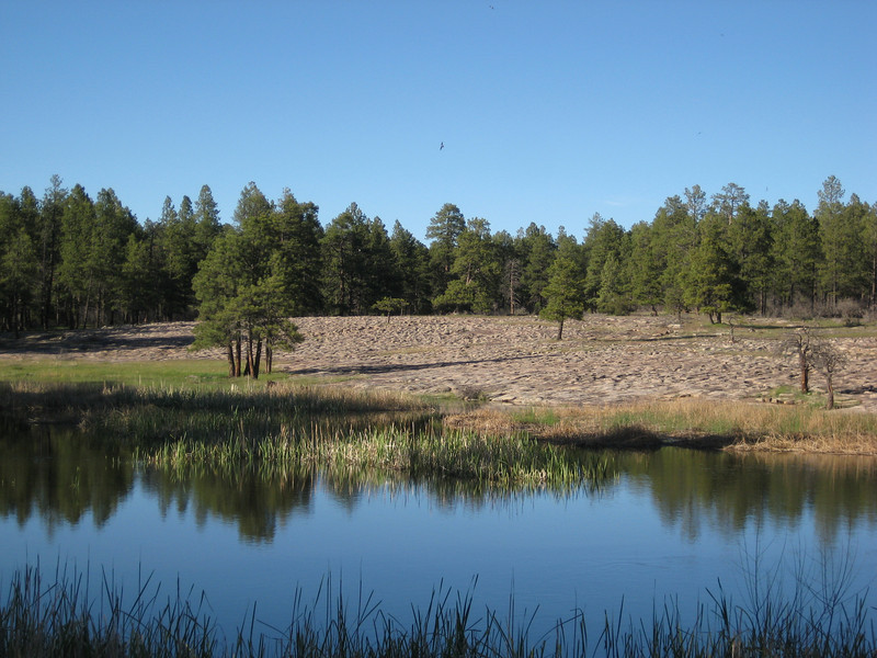
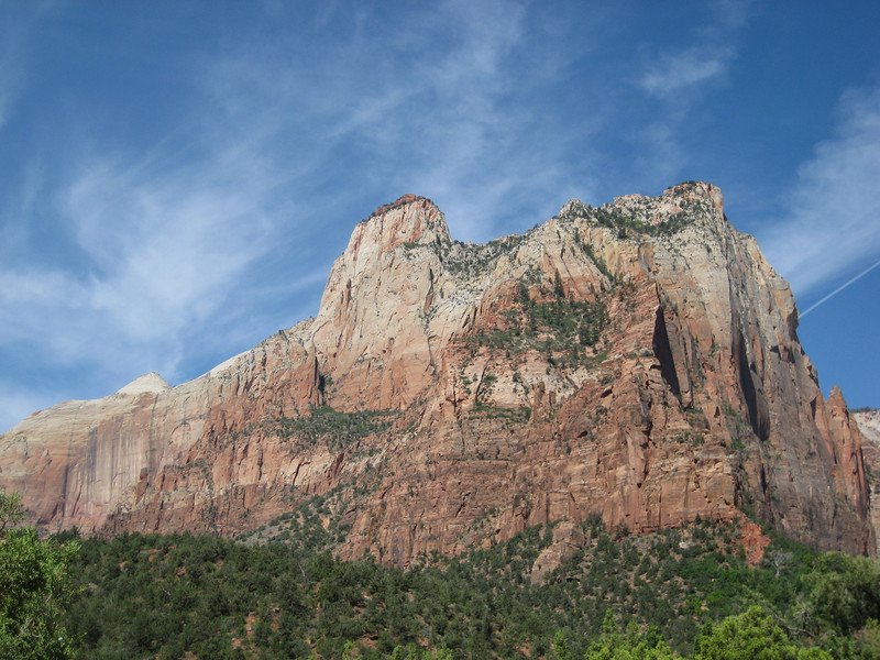
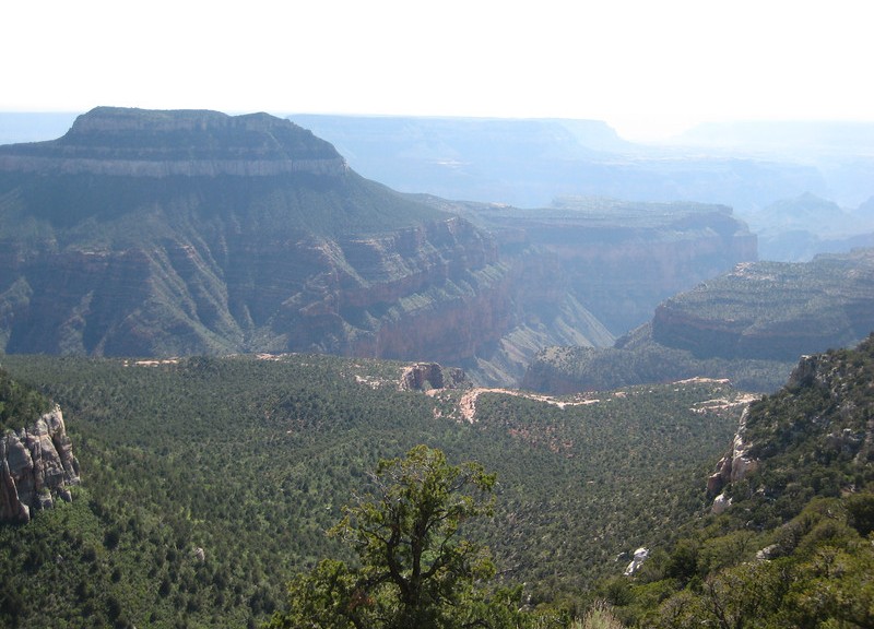
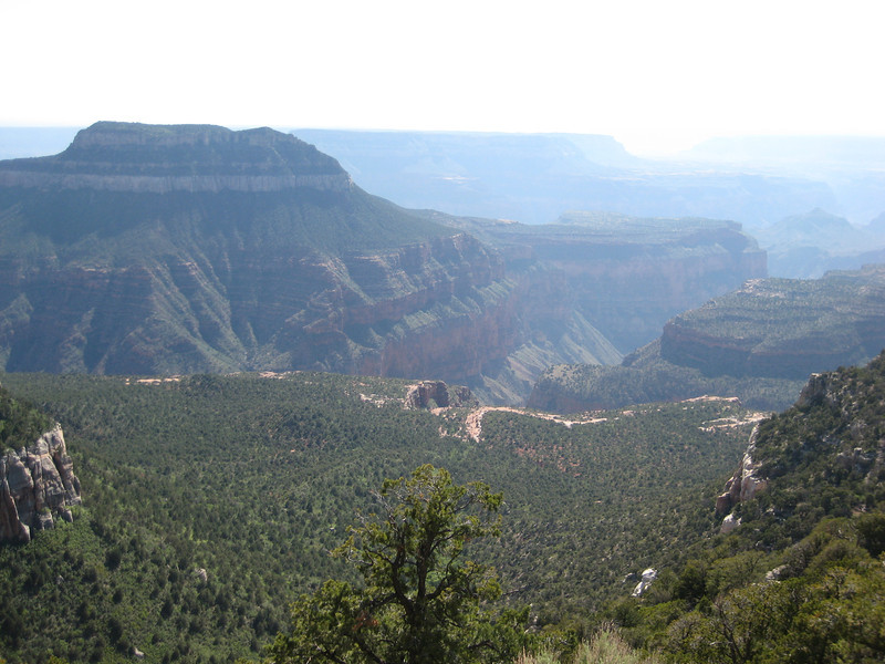
My favourite National Park from my last visit to the States, I just had to go back & show Valerie Zion. Kept awake for most of the wee hours, I was decidedly slow & not really in the mood for walking around in the sun. But after not having been long in Zion, the beauty of the place & then seeing a woman with a stump for a left arm & no right arm at all snapped me out of that. I still love Zion – there’s something about being at the bottom of that canyon with such sheer & red walls. We did pretty much the same things I did on my last visit, with perhaps one extra short walk. For the first time on this trip, I wished I was traveling with someone who would be keen for a big back-country hike (there were a few groups around starting/finishing) – not a lot of Zion is easily accessible, hiking is one of the few ways to get out & see more of the park away from the canyon. I tried to spend more time appreciating the scenery & not taking photos – I think I succeeded in this, but still ended up with a lot of pictures.

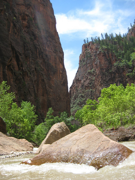
The Virgin River was running quite high – couldn’t walk up to The Needles

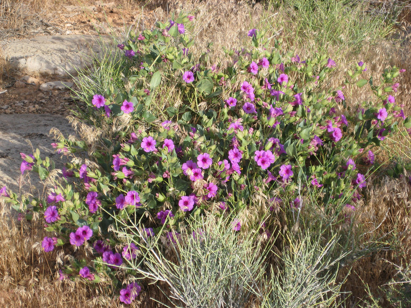
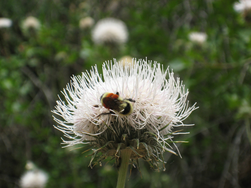
These thistles were bigger than I was – just as well the bees weren’t.

Back in Hurricane in the prevening, I set out to ride the Gould’s Rim/JEM Trail/Hurricane Rim loop again. It was a blast & I whipped out the 33 km in just over two hours of riding (less than 2.5 total) – so quite pleased with that as there was over 600 m of climbing as well (mostly a big hill at the start & then riding around the rim at the end). I also managed to cut out about the extra seven kilometres I did last time when the trail wasn’t marked very well. It started off overcast, but the setting sun dipped below the clouds – with the light breeze it made for very pleasant riding conditions. I shared the trail with a lot of chipmunks & lizards again – also a lot of nice flowers out as I whipped down the JEM trail (that’s always a pleasure, fast flowing singletrack that gets rocky & more technical in an instant).

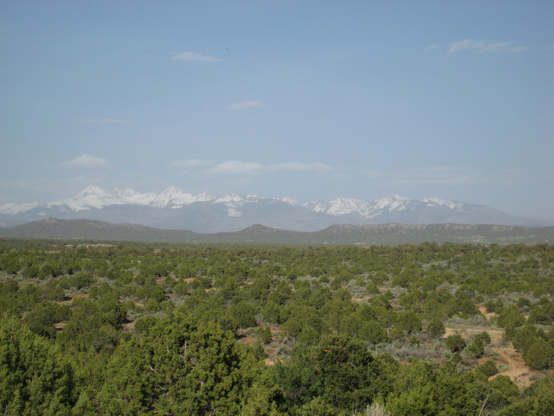
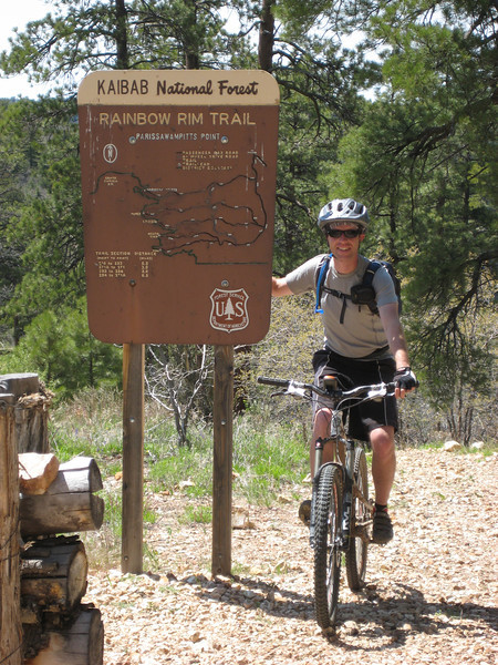
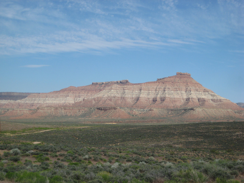
Gooseberry Mesa – would be riding up there two days later


Grand Canyon North Rim & Rainbow Rim Trail

It was with great pleasure that I awoke to a lack of sound from the wind chimes – things were a lot calmer than yesterday.  We left town by 8.30 & headed west back into Utah briefly before dropping south back into Arizona & towards Grand Canyon North Rim.  Once we hit the small town of Fredonia I was back on roads I’d traveled before – the first time since Bragg Creek almost four weeks ago.  After a brief stop at Jacob Lake for me to get a forest road map & Valerie to buy more souvenirs, we were driving through the Kaibab Meadows.  It must have been cold there last night – there was still some fresh snow that hadn’t melted just yet, seems I can’t get away from the stuff.  With the long winter, all the spring growth was not completed & the meadows weren’t quite as pretty as last time I drove through – but they are a still a magnificent sight.

We didn’t stop too long at the rim, maybe an hour, to get a good view of various parts of the canyon.  The sky was wonderfully clear all the way down to the horizon & this enabled us to see some of the mountains a hundred-odd kilometres away – I don’t think I saw these last time.

We drove out of the park & soon after turned onto Forest Development Road 22, continuing on for about 22 miles & 40 minutes to the Parissawampitts (I don’t know how to pronounce it either – I prefer Paris-saw-armpits) trailhead so I could get a ride in.

I was most excited to be riding along the rim of the Grand Canyon on good singletrack.  The trail in its entirety is almost 29 km to the Timp trailhead.  It forms a sawtooth route (roughly) to keep on a reasonably similar level by following all the little side canyons in & out.

This was a great fun trail – I would grade the trail itself as beginner-intermediate level, but at the higher end of that due to the length & elevation (all between 2260 & 2270 m).  The start of it is rocky, but later on it’s mostly dirt.  You do spend a lot of time in the trees, but every so often you get a glimpse of the canyon & then all of a sudden there is a magnificent view that you can be sure not many other people ever see.  I had heard that there’s not much climbing, but there is a bit (apparently I did almost 600 metres all up) – but it’s all pretty easy (middle ring the whole time, & mostly in a small cog).  Despite having been up in the mountains for over a year, I was a just little shorter of breath than normal.  The last eight or so kilometres is great fun as it only has one decent climb in it & you can let it rip on the flatter sections.  I saw quite a few deer, some beautiful birds & flutterbys (the bright yellow ones were the best) & something that may have been a marmot. Only hitch of the ride was losing the seal on my tubeless rear tire – a bit of rest while I had to go back to a tube.  Unfortunately the smog rolled in from California & obscured the view a little in haze.

Telluride & some riding out of Dolores

Not wanting to spend two consecutive days looking at ancient holes in the ground & so on, we went for the suggestion of a nice drive to somewhere “starting with T with a gondola up from town” – at least, that is what Valerie described it as.  I went for Telluride, about a seventy-mile drive north east of Cortez, mostly following the Dolores River – this worked well, as I wanted to ride at Dolores in the afternoon.

The mid-morning drive up the valley was just stunning with the sun really bringing out the contrast between the dark green ponderosa pines & the bright yellow-green of the deciduous trees lining the valley above the fast flowing river.

We climbed up to over 3100m/10000ft to get over Lizard Head Pass & then down to Telluride. I didn’t know too much about the town, except it was once a big mining town & is now a big ski resort/mountain town (sounds vaguely familiar).

Apparently their winter is holding on a bit, with two feet of snow a fortnight ago – but today was a stunner & I was excited to learn there are bike trails at the top of the (free) gondola that runs up to another little town (Mountain Village – possibly the least imaginative name in Colorado, what a shocker) & most of the ski lifts.

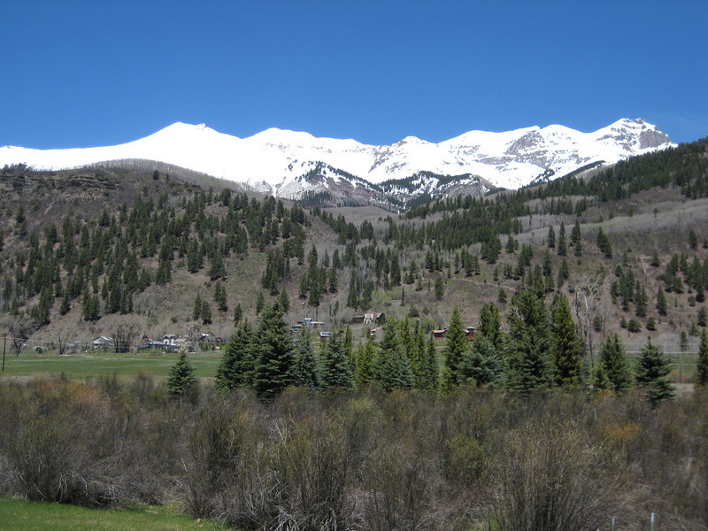
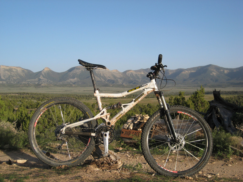
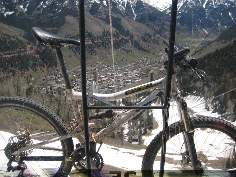
My bike got its first ride on a gondola – been on plenty of chairlifts.  That’s Telluride down there.

Alas, the visitor center was wrong – the bike trails were closed due to too much snow. So we made up for it with a very pleasant ride along the San Miguel River that runs through town. There is a Mountain Film festival on this long weekend, so town had a lot of life to it. We didn’t have long, but I really liked Telluride – looks expensive though, Valerie saw one 5 bedroom, 7 bath house priced at a cool nine million.

The drive back down the valley was just as pretty & I was riding by four o’clock. With four loops to choose from, I went for the longest & hardest option – to make sure I got my money’s (not that I had to pay anything) worth. The riding was mostly at 2300m around a mesa top in more pine forest – it was nice to be riding in trees again. I’m not sure there was anything advanced about this intermediate-advanced level trail & the trail obviously wasn’t as well designed as yesterday’s ride at Phil’s World. Since when is routing the trail down the middle of a creek a valid trailbuilding option? Occasionally there was a little bit of interest, but mostly it was pretty hohum – the surface was often rutted out by bike tires or six-inch deep horse hoof holes. Still, I got a fair bit of climbing in & time on the bike is time on the bike – I may be getting a little fitter as I did the first loop (2-4 hours) in 1.40 then went on to the adjoining beginner loop, hoping for some views of the mountains – but was disappointed. The highlight was the beautiful grassy meadows, different summer flowers, the very loud croaking of frogs & seeing some eagles gliding around – fantastic. After over 100 km of mostly singletrack riding in three days, I might have a day off the bike tomorrow as we go to Four Corners & Monument Valley.

Mesa Verde & Phil’s World

Mesa Verde came recommended by Alex as a completely different national park experience. She wasn’t wrong. Only about ten minutes’ drive east of Cortez, we started a beautiful drive up to the top of Mesa Verde. The Visitor Centre was a good half an hour in to the park, we stopped here to purchase tickets for two ranger guided tours around some of the cliff dwellings. For Mesa Verde was home to a large number of dwellings (some 4700 separate sites have been found so far) since the sixth century. On the top of mesa (which is not actually a proper mesa due to its sloping sides) we were up around 7000ft/2500m – what possessed ancients to come & live up here is beyond me. Still, it must have been sustainable, as they stayed until about 1300 & then packed up & left leaving a lot of houses.

Our first tour was of the Cliff Palaces – not really a palace as they had no king or queen, but about 450 little dwellings perched in an alcove near the top of the cliff. We had to climb down some pretty steep steps (some metal, some set in to the cliff side) & gradually got to walk across the front of the area while listening to the ranger explain it all. I’ve absorbed a lot of history today, so don’t feel like repeating much of it here. There was a lot of grain storage areas, little houses for families, & sunken circular family meeting areas. It was pretty neat seeing the progression of their building skills from the bottom (early) layers to the top (later) layers – there were a lot of square edges & some of the towers went right up to the alcove ceiling.

After lunch was the more difficult drop down to Balcony House on another ranger-guided tour. I have no idea how the original residents got in – maybe they had a massive ladder too.

This area was smaller than the Cliff Palaces, but no less intruiging. There were a lot of balconies (in various states of disrepair) & some of the tiny rooms were still intact.

To get out, we had to crawl twelve feet or so through a skinny little tunnel on our hands & knees & then up another ladder & scramble up a steep rockface – good fun. Above the tunnel on the internal side, there were various staggered platforms for defending the area by throwing things at invaders (cows, ducks & so on I expect – prompting cries of “crawl away, crawl away!”).

We spent another hour or so driving around other sites before heading back to Cortez rather historied-out.

But that didn’t matter as I had another ride planned. A rather nice mountain-bike guide I was chatting to during the walk down from Delicate Arch on Sunday insisted that I ride Phil’s World if I was going to Cortez. I duly obliged – the trail is only four miles east of town. It was fantastic. I did all of the loop options, save one last five mile one at the end as sunset was fast approaching. It’s all purpose built singletrack (unlike most of what I’ve ridden recently) & it’s a super smooth surface, with the odd rock feature thrown in. I managed 24 km in an hour & forty & it was all at a beginner-intermediate level. There was nothing technically challenging in it for an intermediate rider like me – it was just plain fun, flowing trail. It was all easily done in the middle ring – as they didn’t have a lot of altitude gain to play with. I was surprised when I checked that I was over 2000m – but my lungs weren’t screaming, so that was good. Dusk was a great time to ride – I didn’t see another rider on my trail – the light was good & I was joined by a lot of singing birds, lizards & some big jack-rabbits (they have ridiculously large ears – to help cope with the heat). A very pleasant evening ride – if I had this on my doorstep, I’d feel like Postman Pat (a really happy man). I got my trip up to 32 km with a nice big-ring ride into town towards a blustery wind & the setting sun.

Rib Cage was the best section of the loop – many, many steep downs followed by short ups & then little jumps with nice landings at the top. The trail was in fact so smooth & well made that I didn’t notice my rear shock was locked out fully until the end of the ride – oops.