For the first time in over ten years, I phoned in sick to work at the start of the week – so this week has been even quieter than the last few months generally have. But with enforced rest (no riding a bike for a week, absurd), I’ve got time for a rather nostalgic post on this neglected platform.
I was mortified after a not-so-recent bike-commute that I’d worn a hole in my bike shorts. Usually, that wouldn’t be a big deal – but I just didn’t think it was possible with NZO Dobies. Roomy, comfortable and (almost, it turns out) indestructible, Dobies have been my go-to MTBing shorts for over ten years – my first pair was handed down to Adele and still have plenty of life left in them after a decade (maybe I should steal them back). I ordered two new pairs eight years ago before embarking on quite a few years of travel and much mountain-biking.
It is one of those pairs, the (once) black ones, that have finally worn through. I think that’s a pretty fantastic show of longevity as I’ve clocked up well over twenty-five thousand kilometres of mountain-biking in that time in all sorts of conditions. As I was thinking that over, I realised these shorts have been part of an awful lot of my bike adventures and it would be worth doing a quick search through my photos of me on bikes. So now I’ll reminisce for the joy of it; at least, I don’t think I’m mourning a pair of shorts.
 Earliest picture of said Dobies, late 2008; fitting as on a trip with Roger & Mark to Whangamata – I really started to get into riding more once I met those two. Notable also for the NZO socks, gloves, shirt & buff.
 Queen Charlotte Walkway trip early 2009 – that three-day ride remains as a highlight of all riding trips.
 Living the dream – riding in western USA mid-2009; the start of my time away from NZ, the riding was fantastic. This must have been the ride I met Chip, a recurring riding buddy whose bike-over-the-head pose I’m trying for the first time here.
 Black shorts may not have been the best idea on a day that reached 40ºC by nine in the morning – riding the Bootleg Canyon trails, near Boulder City, Nevada. The brewpub was welcome relief at eleven o’clock.
 Having a blast on Just Outstanding somewhere in the Sierra Nevadas. A weekend spent camping with MTB randoms I met on mtbr.com – what could go wrong? Cannell Plunge is one of my all-time favourites – on which I completely cooked my brakes, they were never the same.
 Black Dobies turn up in the teafields of Kenya – some excellent biking & exploring to be done, I was to return despite the dislocated shoulder incident.
 Then a whole summer and fall of biking in the Canadian Rockies. Here Black Dobies are a late ring-in for a Calgarian team competing in the 24 Hours of Adrenaline. Suitable photos worthy of portraying what a fantabulous summer of biking it was are, sadly, lacking.
 Black Dobies were on the excellent three-month west-USA road trip with Valerie; here just out of Grand Junction, Colorado.
 Riding around the north rim of the Grand Canyon.
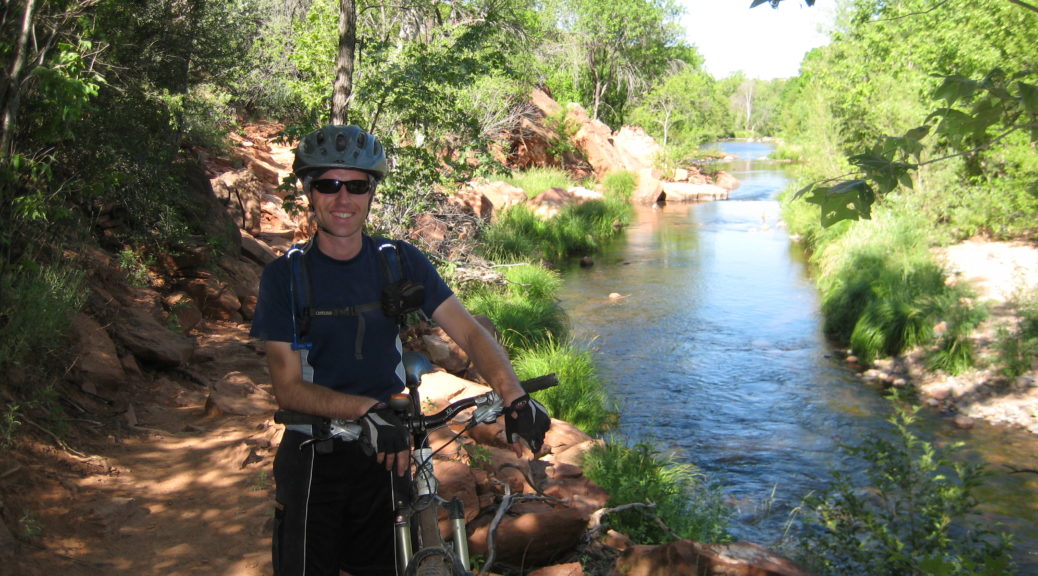
 Wonderful riding just out of Sedona.
 The McKenzie River Trail, Oregon – a ride memorable for cool new friends.
Following all that there was a return to the UK and plenty of riding with great buddies in the south and south-west of England – alas, I seem to have few photos of myself on those pretty countryside rides.
 But the shorts couldn’t be kept away from North America – here, arguably the best MTB holiday I’ve been on, in Moab, Utah. Excellent friends, sublime riding, good food and conditions combined for a memorable & often-remembered week.
Following that trip, it was a cracking summer in the UK during which it didn’t rain for months – I rode plenty in preparation for:
 My first multi-day MTB event – the three-day Rift Valley Odyssey, I didn’t need much persuasion to visit East Africa again.
 Then I was made redundant, so the Black Dobies & I set off biking across Western Europe. A couple of thousand kilometres took me from London to Italy, I was traveling light so the shorts were in constant use.
 On a bridge between Germany & Belgium, it seemed I was constantly crossing borders – the shorts were often confused as to which country they were in.
 Crossing the Alps into Italy.
 Another month of constant Dobies wearing – working on a vineyard in Aosta Valley & hiking in the Alps. The pockets were never the same after I stuffed eighty walnuts in them while out for a siesta-replacing walk.
 Just a little ride around Mt Kilimanjaro; another trip to Tanzania, perche no?
 Then I was back in NZ, for good! Dragging best-sister up steep hills on bikes happened a fair bit that summer.
 My first bikepacking event seemed like a good idea. The Kiwi Brevet was a sublime 1150 km loop around the top half of the South Island – Black Dobies got punished again.

 From the same trip, this seems to be the last momentous photo I have of Black Dobies.
There was another year of riding – some bikepacking, much commuting, a little mountain-biking – before the horrid revelation that I’d actually worn them out, I still can’t quite believe it. Eight years – how is it possible to withstand all that biking and traveling? Never mind, I received a new pair as a Christmas gift. Probably I don’t to need steal my original pair back, that may have been why Adele got me the new pair.
You’ll be pleased to know the days are getting longer & warmer – soon I’ll have more tales of biking, exploring & bikepacking to tell and I’ll not need to resort to writing about shorts.


 We stopped en route at about midnight to sight the church where the service would be in a week’s time. It was already frosty, much colder for winter than I’ve grown accustomed to; naturally we skated around on the lawn.
 We spent the weekend staying at a house that was stuck in the ’70s, it was brilliant inside & out – the views of The Remarkables & Coronet Peak weren’t too shabby either.
 The days were cold and still – we spotted a few hot-air balloons floating around early morning.
 Craig turned up with a wood-fired hot-tub he had made on a trailer – brilliant! We quickly got to work thawing the garden hose, filling the tub and heating it up. The tub got a fair bit of use over the week – they’re incredible,
  We drove most of the way up the Coronet Peak access road, for a reason I could not discern. The view was adequate compensation.
 As the light faded, we headed up the gondola for a bit of luging (little carts on a concrete track, not the Olympic type of luging.)
 Sunday morning’s activity, which ended up being in the afternoon, was skydiving for the stag & a few of us. It was a glorious day for it &, I’m told, the experience was quite amazing.
 A very pleasant drive through Central Otago looking at the recent snow contrasting with the dry pasture soon had me at Mum & Dad’s, where Adele had also arrived from Westport.

 But as this photo has been shared publicly (if you know where to look), I’ll put it here just to show I’m not making this all up – there was in fact a wedding.
 Token new bike picture – I have a fun bike again.
 Chasing horses down the east end of Moki Road – we were heading for the valley in the distance to the right.
 But first a stretch through farmland where Moki Road becomes unformed – but thankfully dry – as the sheep run away. We passed a couple of ruined old houses, still standing – just.
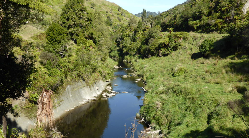
 The valley closes in, as does the native bush.
 There were five wire swing bridges over the bigger chasms – at least these ones had decks. They were considerably easier than the
  At least here, the trail is well defined. With a GPS trail and the orange markers to follow, only a few times did we lose the trail temporarily as it faded into nothing.
 This bridge was intact and rideable!
 Steve trying to work out how much of that slippery approach to another stream crossing is worth attempting to ride as the drop to his right becomes apparent. At least, I assume that’s what he’s thinking as that’s what I thought riding down there.
 There were frequent stops for track maintenance – we cleared numerous branches and trees from the trail, mostly led by Steve, ever the font of energy.
 Finally, we crossed the fifth swing bridge and emerged into the farmland again. Over two hours for less than ten kilometres – that’s
  The view was certainly more expansive out of the trees – Steve taking it in.
 The little tunnel of the ride – the stock were slow to relinquish their positions as Roger approached.
 We crossed to the right side of the Waitara as the farm track improved to was-once-a-gravel-road and things got a bit faster.
 Really nice gravel road riding – and about the highest we got all day at a whopping 350-odd metres above sea level.
 With a steep blast back to the valley floor, we found the start of the Rerekapa Track and a suitable lunch stop – suitable except for the young hunting dog that tried to steal most of our food.
 There was no way we were clearing the trail of this tree, and a fair few others – the muscling of bikes around obstacles became more commonplace.
 Thankfully, Steve had hauled my bike off me and I was standing again before a decent photo was taken. My, that trail looks simple – I assure you that there were more slippery rocks there that I misjudged.
 The trail disappeared into the grass before heading for the trees again.
 Roger emerging from some taller ferns.


 Sunrise wasn’t too bad as I breakfasted.
 The first sun of the day hits Hobbiton – another photo checkpoint.
 I thought that the two Triumphs one of my early primary school teachers owned was excessive, evidently not.

 A sign of things to come – big swing bridges began to appear. This one, I think, was used in the construction of one of the many hydro power stations on the river.
 Steve insisted he get a photo of me – I was bemused to find this in the weekly division news when I returned to work. But, definitely pleased to have a photo of me riding on the event – even if it’s on a road, & off-route!
 Fifteen more kilometres of road, the first half was pretty flat before the climbing that would last for much of the rest of the day began.
 This was easily the worst and most difficult swingbridge of the entire route. It was so skinny, my handlebars would not fit through – and as I couldn’t walk beside my bike and steer it, I definitely could not push it through. The floor was only wire netting, so it was not practical to lift the front of the bike & wheel it through. In the end, I had to walk backwards along the bridge pulling my bike behind me – guiding it through every handlebar barrier; on the way puncturing a dry bag, most annoying. Still, I only had to make one trip along the bridge.
 A photo of me at a checkpoint! Despite the three pies that day, looking a bit thinner than normal. Geographical centre of the North Island, apparently.
 So it happened that I slept next to this relic of a tractor that night.