Category Archives: MTB

Double Heaphy

Every so often it’s good to do something a little nuts just to push one’s limits and see if you can do it. Even before we’d finished our previous, somewhat curtailed by the weather, Heaphy attempt I was starting to consider the feasibility of riding the whole trail there and back over two days. As we’d ridden the western (approximate) half of the trail, I thought it was possible to ride that in about four hours with few stops – and that includes the only big climb when riding west to east.

With that in mind, completing the whole trail in a day should be possible while carrying overnight gear and enough food for two big days of riding. James was also up for this challenge – even if it would mean his two biggest days ever on a bike, all the while lugging quite a load. We just had to wait for two consecutive days which had fine weather forecast – two such days we discovered while away in Christchurch. So dashing back from the east coast on Monday, we had just enough time to buy enough food and organise ourselves before an early start on Tuesday.

The weather was definitely clear when we got up at five o’clock – it was the first frost I’ve seen around Westport, and a heavy one at that. We were at the trailhead just after first light to make the most of the daylight hours (you aren’t allowed to ride the trail at night). The morning gradually warmed, but not by much, as we made good time along the beautiful coastal section to Heaphy Hut. There was little time to take photos, so these from the last trip will have to do.

The section of river crossings to Lewis Hut took but half an hour and then the sustained climb to James McKay Hut, after which I’d pegged as a good time for lunch, was upon us. On our previous trip we’d been told of and seen the resting diggers of trail maintenance crews – we were hoping that they’d improved the trail a lot. The top section had been gravelled and was remarkably better and easier going; alas, the middle section was considerably worse having been churned up by the mini-diggers – there was considerable pushing through thick, gloopy and claggy mud. But we stayed on track and made James McKay for lunch.

This was a different view from the hut compared to last time – a lot less distant cloud and more snow.

We pushed on wondering if we’d be quick enough to get to the end of the trail and then return up the sixteen kilometre, eight hundred metre climb to Perry Saddle Hut for the night. While Brown Hut is at the east trailhead and would have been the best location to stay – other practicalities dictated we would stay at Perry Saddle Hut instead. Brown Hut is an older, smaller hut than Perry Saddle and does not have gas stoves and cooking equipment – things we didn’t really want to carry if we didn’t have to.

The section between James McKay and Perry Saddle was different again – there’s a little climbing, but it’s not too onerous as you mostly stay between six- and eight-hundred metres above sea-level. Through some rather pretty, but soggy, parts early on the trail is board-walked – which provides a nice change from hitting rocks often. Passing across the tussocky Gouland Downs was so much more open than most of the riding – we were glad for a lack of wind. There were a couple of small, swift rivers that we waded through as getting cold and wet feet seemed a lot less hassle and quicker than trying to get across wire swing bridges upstream that were not designed with bikes in mind.

The trail got very slick and quite large sections had standing water that was manageable, but constantly sprayed us with water. On the side of the trail were significant patches of frost and snow. The clay got even more slippery as we climbed up to the saddle (about 900 m) and started attaching itself to our bikes. The last few hundred metres up to the hut was very rough, but just rideable after a long day in the saddle. Getting to the hut just after half-past three, we thought it prudent to call it a day, as while we would have easily got down the last sixteen kilometres to the end – we would not have made it back up by dark. Instead, we opted to start early the next day – this also meant that we would do one of the two big climbs on each day. It made the second day over ninety kilometres, leaving not much time for dilly-dallying or other issues, but seemed a good decision.

Finding another new, well-equipped hut we set about getting the coal range going and drying our bike shoes and clothes. The warden was very friendly and the views from the saddle were much better than I imagined those at Brown Hut at the bottom of the next valley would be. We refueled while watching the sun set on the mountains. Early to bed, satisfied with great day’s ride (James particularly so, the 58 km being his biggest day on a bike – so far) – slept pretty well as the hut was pleasantly warm.

It was not so pleasantly warm when we were out the door and scraping the frost off our bikes at first light the next morning. Unfortunately, I suspect due to a more-limited water supply, this hut did not have a bike wash-down set up – if it had have, we would have bothered to hose the mud off after the first day’s ride. Setting off, we found rear cables frozen – James couldn’t change gear, I had no operational rear brake and my gear shifter was also stuck. It was a gentle climb to start up to the trail’s highest point, Flanagan’s Corner, and left in my easiest gear I was soon spinning out.

That was all sorted out with a drenching of water while we dealt to bigger problems on James’s bike. The Heaphy sure is hard on bikes, particularly chains, with all the mud and grit that flicks up in to drivetrains and brakes. Suddenly, James had no chain – it having come apart. Trying to fix that in the semi-dark with chilled fingers was no fun; once we could see what was going on, the best solution seemed to be installing an eight-speed powerlink on the ten-speed chain. Not ideal, but it worked and it was a lot easier than mucking around with a chain-breaker in the gloom and cold.

We’d hardly got going again when James had that sinking feeling that comes from a puncture – damn. It wasn’t a great start to the day considering the tight schedule we running. That all fixed, we didn’t want to tempt fate and so took it rather easily down to the end of the trail. A nice wide trail, with enough rocks to keep it interesting had us gradually dropping – mercifully, it wasn’t nearly as cold in amongst the trees as I feared. We had occasional glances of the Aorere Valley and the surrounding ranges. For a long time, I’ve not seen a harder frost than the one that greeted us on the valley floor – for that reason, and the extra time we took to descend, we didn’t hang around. Turning at the parking lot, it was straight back into the climb.

The rivers were crystal clear, but on such a chilly morning not at all inviting.

With a nice trail surface and a rather gentle gradient (pretty constant at five percent), we made good time back up to the saddle – only really stopping for a couple of fallen trees and a short snack. As we had to repack our gear (we hadn’t been silly enough to take all our sleeping gear and food to Brown Hut and back) anyway, we had an early lunch while trying to offer V-brake advice to the ranger.

Departing at noon, I thought we would just get through the sixty kilometres by dark as we’d previously averaged just under 10 km/hr riding the same trail in the opposite direction and gaining nine hundred metres of altitude. So with a big net altitude loss, we should be OK without having to push the limits too much. Turns out I was right, we made good time – there was even a bit of time for snapping some photos, chatting to various people: another bikepacker from Yorkshire, our hut companions from Perry Saddle, and the trail builders (although I did embarrassingly get stuck in my clips & fell on a tricky stream crossing right in front of them – getting a little tired).

The wet trail glinting in the early-afternoon sun before the slippery descent onto Gouland Downs.

Looking out over the downs.

As James pointed out, sections of the bush looked a little like giant bonsai trees.

A rather pretty little stream.

Back at sea-level we were on the home stretch – but the Heaphy decided to have one more go at writing James’s drivetrain off – the little chain guides completely ruined. Make sure you’re well covered for spares and mechanical nous on this route – it does at times feel remarkably remote, probably because it is. Also we were back on familiar and faster trails – we almost got back to the car without needing headlamps – donning them only for the last descent from Kohaihai Saddle, as it was very dark under the trees.

I finally bothered to get a photo of one of these signs – the likes of which I’ve never seen on a mountain-bike trail before.
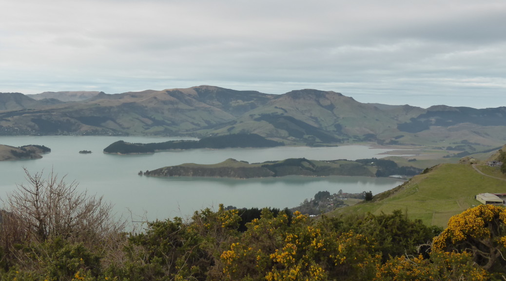
So, it turns out that the Heaphy double is entirely possible over two days – admittedly we had two clear, sunny, almost-windless days – even with a relatively novice bikepacker (having remarkable determination – he says stubbornness – helps). I was pleased to see the whole trail, after missing out ten days prior, and James was excited by conquering the challenge – the second day of ninety-plus kilometres blowing his previous longest day on the bike out of the water.

A great trail through such varied and remote landscape – fully deserving of its “epic” classification in the latest version of the Kennet Brothers’ Classic NZ MTB Rides. Thoroughly recommended; obviously, just going one-way over two days would be more enjoyable and enable more appreciation of the scenery.

South Island Rides All Around

After our thwarted attempt to ride the Heaphy and a few days of inclement weather, James and I were itching to get out riding when the weather was more friendly. It’s just as well James obviously doesn’t mind driving hours for a bit of riding – as that’s what it took to find a bit of sun. Looking back on the last week, there was an awful lot of driving as we rode in three quite distant places in the central South Island in the space of five days.

First up it was close to two hours down the coast to Hokitika, where the locals have built a nice network of trails up on Blue Spur Ridge behind the town. I’d taken to borrowing Adele’s bike (which is considerably lighter and more fun than my touring one) and enjoyed a couple of decent climbs and tried to come to terms with riding wet, slippery and twisty singletrack. We rode for a couple of hours – liking the sun, completing a large circuit of most of the trail network, repeating the trails we particularly enjoyed and only once getting a little off-track. I felt a bit cheated by some of the trail names – See-saw didn’t have a see-saw and Tunnels only had one tunnel.

Looking out over the Hokitika River valley.

There was the odd trail feature built – but I thought it a bit slippery to wisely attempt this.

Yes, the trail disappears through a skinny tunnel. I was pleased not vanish into the ether halfway through.

The following day we headed off to Christchurch as most of James’s family was going to be at his brother’s that weekend – also, the weather forecast was better than in Westport, where Adele would be on-call and not able to go riding. I was lured by the talk of a ride up on the Port Hills (on the southern edge of the city) and exploring trails new to me.

Four McKirdy men (James, his two brothers and their father, Don) and I set off early enough that it was still quite fresh on a clear Christchurch morning – oh, Andrew’s dog Jack also joined us as trail dog. After about five miles of road we were at the west base of the hills – and soon climbing steadily up some well laid trails. That much time has been spent on these trails was obvious, we passed one crew of about five still improving some tight corners and another place where trail tools are kept locked to a fence-post for ready access.

It was disturbing to be suddenly spat out next to a new subdivision – at least we could see the mountains across the Canterbury Plains.

When the singletrack ran out, it was 4WD tracks and grass that took us most of the way to the top.

A herd of Banded Galloways were happened upon.

We paused before our descent to look at more things in the distance.

The McKirdy men looking at things in the distance.

How Jack managed almost thirty kilometres, I’ve no idea. A bit slower on the flat, he was much faster uphill than us and surprisingly quick down singletrack.

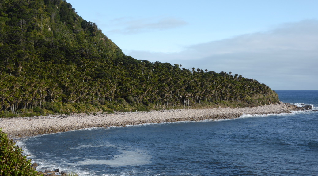
The upper reaches of Lyttelton Harbour – on the other side of the hills to Christchurch.

About to head into the Flying Nun trail – an enormous amount of time has gone in to this one. Lined, almost paved, with plenty of natural rock it flows so well and is just one big bundle of fun!

After an absolute blast on Flying Nun, there was a little bit of climbing on the road up to Victoria Park where we had fun getting slightly lost making our way down the hill on a myriad of trails. There were some quite big jumps that were beyond me, but mostly I was able to ride it. We even found a big (in the size of its vertical drop, not length) see-saw over a fence to make up for the missing one in Hokitika.

We so enjoyed our Saturday ride, that we went up again Sunday – this time Don shuttled the rest of us to the top as we had a family-lunch deadline to meet.  More good fun on Flying Nun before exploring further around the hill in Bowenvale Park.  Near to the end of the Bowenvale Downhill I had one of my worst crashes in a long time.  Negotiating some rocks next to a tall bank dropping off the right side of the trail, I got it all wrong.  The option of flying head-first down a bank didn’t appeal and I somehow managed to put myself down on the trail with my bike weighing heavily and awkwardly on top – I got off rather lightly, with only some slight bruising and no other damage.  I lived to ride home and ride another day.

The next day, in fact.  On the way back to Westport we stopped briefly in Hanmer Springs – a nice little mountain resort town with some quality hot pools.  But we were there to explore the trails in the forest – which we did.  They were a little wet, which is odd as I always think of Hanmer as rather dry and hot.  When it suddenly started dumping snow on us, we turned down the hill to the car – as we still had to get home and prepare for the following day’s adventure.

The snow continued falling as we drove over Lewis Pass – although a bit grey, it was beautiful.  I snapped a few token shots through the car windows.

Half the Heaphy

Adele lured me back to the West Coast for a few weeks with the promise of different biking and a change from the rather fruitless task of finding a job. The biggest part of the carrot was finally being able to ride the Heaphy Track. For most of the time I’ve been a mountain biking, the name Heaphy has been uttered with mild despair by New Zealand mountain-bikers no longer allowed to ride one of the best multi-day rides in the country. But no more, it is now open to bikes during the off-season.

Running between the north of the west coast of the South Island eastwards through rugged hills and valleys, the route dates from mining in the late nineteenth century – after which it was almost forgotten. In the later part of last century, the track came into use again for hiking/tramping and was also open to mountain-bikes as it was in a forest park. But when the North-West Nelson Forest Park became Kahurangi National Park in the mid-nineties, the mountain-bikers were shut out – much to their chagrin. But while I was living overseas, a trial was started allowing bikes on one of New Zealand’s Great Walks in the off-season (May to September) – a lot like how bikes are allowed on the Queen Charlotte Walkway. The trial was obviously successful as it’s now a permanent arrangement. Fantastic!

As Adele has work commitments, unlike James and me, the plan was to drive early Saturday morning to remote Karamea (the west end of the trail) and then catch a light plane with our bikes to the other end of the trail and ride the almost-fifty miles/eighty kilometres back to the car over two days – staying at a hut somewhere in the middle, Saturday night. This was also to be the first time Adele and James had been bikepacking – exciting! Despite the good weather forecast, it was not to be – when we arrived in Karamea it was decidedly wet with very low cloud. The plane couldn’t land – so we adjourned for bacon and eggs while we waited to see what the weather would do. Well fueled by second breakfast, it was now obvious a plane wasn’t coming to get us and we couldn’t be sure one would bring us back Sunday afternoon if we decided to ride the route west to east.

Plans amended consequently, we drove to the trailhead at Kohaihai, sorted our gear out and rode off late-morning into the rain. Immediately crossing the Kohaihai river on the first of many substantial bridges, the route climbed up to Kohaihai Saddle to avoid the cliff-lined coast. That first hill done, it was down to Scott’s Beach as James and Adele got used to riding mountain-bikes while wearing heavy hiking packs. The forest right down to the beach was impressive, but as the drizzle continued to fall we weren’t too interested in sticking around to look at the grey sea. While overall the trail was flat, there were sufficient short ups and downs to keep it interesting.

Quite surprised to bump in to Garry and cohorts riding out the way we had just came, we stopped for a brief chat in the rain. NZ is so small – here unbeknownst to us was a man far from home (as I was too). One of Adele’s previous rural medical teachers and colleagues I’d met him on adventures earlier in the year and then again as he was one of Adele’s teammates on that crazy Godzone adventure race in March. Not quite a bizarre as bumping into your Kiwi third (or fourth, I forget) cousin in a Tuscan village – but odd all the same.

With the tide far enough out, there was a short section on a beach – avoiding the high-tide alternative track.

Plenty of stream and river crossings gave opportunities to emerge from the trees into the rain.

Eventually, it stopped raining – about the time we reached the Heaphy River mouth and our lunch stop at Heaphy Hut.

With tasty, tasty salami and cheese ciabattas fuelling us, we set off inland. The section along the river flats beside the Heaphy was initially through more large groves of nikau palms before winding its way through stands of large native trees – rimu, rata and kahikatea. We eventually crossed the Heaphy on what is apparently the largest swing bridge DOC (Department of Conservation – responsible for much public land in NZ and the associated facilities) has ever built. Almost a hundred and fifty metres long, it is obviously built for when the river is in flood. It looked like most of the bridges have been upgraded recently, possibly for bikes – they are superb and easy to ride across. The one remaining wire-decked swing-bridge looked like hard work for James & his unloaded bike. I couldn’t even get my loaded bike up the ramp, so found it easier just to ride across the stream and risk wet feet.

Adele crossing the Heaphy.

Reaching Lewis Hut the flat coastal riding was done and we began a steady climb to James McKay hut. Generally it’s a very easy climb, taking eleven kilometres to ascend almost seven-hundred metres, but it’s a bit steeper at the start. The track is generally wide and the only really technical parts are some of the frequent, rocky, creek crossings. It was warm work, and some of us were down to short-sleeves before, and even when, the drizzle came back. DOC is working hard to upgrade the surface. If we’d been a week later, I’m told, they’d be finished and we would have missed the in-progress stretches of hundreds of metres of slick mud. This made it tough going at times for our little group, but I found it mostly rideable – even with a rather lightweight rear tyre.

It was with some relief we saw the marker indicating only two kilometres remained until we reached our destination for the night – James Mackay Hut. This was also about the time it started to rain again, albeit lightly. Due to rare wildlife living in the area, kiwi and giant carnivorous land snails (! – I didn’t see one, but saw some of their old shells – disturbingly large), one is not allowed to ride the trail at night – so we had to be at the hut before nightfall.

It’s a pretty damp climate with plenty of interesting flora and fauna.

After one final slog atop the slick and muddy track, we made it to the hut easily before five o’clock – not bad considering the late start. This was where we had intended to stay originally – but approaching from the other end of the track. It’s very weird turning up at such a palatial back-country DOC hut and finding it only contains mountain-bikers. What’s more, in the middle of nowhere it has bike-racks and even a bike wash stand (much needed)! Having cleaned our bikes, we went inside to find the coal range roaring and even such things as basic electric lighting, gas cooking, running water and flush toilets – luxury. Being such a new hut, it is very good and has wonderful facilities – but does lack in character.

It turns out large groups of mountain-bikers have very poor hut etiquette, being generally loud through the night – walking/stomping around, talking loudly, and getting up at four o’clock to shovel coal noisily (who does that?). Thankfully, they were gone by the leisurely hour we got up, had breakfast, packed up, talked bikes and brevets (I even got an unexpected handshake for completing the Kiwi Brevet – I was quietly chuffed) with the other more considerate mountain-bikers. With slightly better weather, we could see all the way down to the Tasman Sea and the mouth of the Heaphy.

Looking all the way back down to where we’d been for lunch the previous day.

Bike racks and wash area – at a hut, wow!

Although it was mid-morning by the time we set-off back down the hill, it was quite chilly and we got a little wet from the spray off the muddy surface. While much easier to ride through the mud assisted by gravity, it still had its tricky moments.

Adele enjoying the downhill – possibly this was before she fell off the side of a bridge, but it’s hard to tell as she’s always got a smile on her face.

While waiting for Adele, James and I tried talking to the friendly locals. This robin was particularly curious, and the many fantails we saw elsewhere were super inquisitive.

The ride out being the same way we rode in is thankfully much shorter to describe, but with much improved weather we saw so much more – and there was an eleven kilometre downhill too! Thankfully, the lack of rain meant I could get my camera out a bit more and I had plenty of time to take photos as well.

Occasionally there were glimpses of the Heaphy River – but annoyingly there were no great lookout spots on the way down.

Looking east up a tributary of the Heaphy – some good limestone cliffs to on the right.

After a rapid pace on the flats back to Heaphy Hut we got strangely hot – a good time for lunch; the nikau palms began to reappear also.

With lunch done, it was only sixteen kilometres back to the trailhead mostly following the coast. It’s a great fun trail and I was expecting to enjoy it more in the dry – it had dried out well since the previous morning. I was not expecting to be so blown away by the scenery – it all seemed so foreign to New Zealand. Apart from the temperature (which was mild), I could have easily believed we were riding alongside tropical rainforest on an island somewhere – perhaps in the Caribbean. The beaches were gorgeous, the surf was wild and the palm groves – wow.

Over the last saddle separating Scott’s Beach from Kohaihai, we enjoyed the final downhill back to the car and the end of our little adventure. I’m pretty sure Adele & James enjoyed their first bikepacking experience – we may not have gone that far, but there was so much to see. Now that all the bikes are cleaned of the grit and mud and all the washing is done, I’m waiting for a two-day window in the weather so I can ride the whole trail. I’m not hopeful, but if the eastern end is anywhere near as scenic as the part we rode it must be quite something.

Old Ghost Road – Lyell Section

While I was overseas I’d started to hear mention of an epic backcountry mountain-bike trail being constructed somewhere on the West Coast. Once back in New Zealand, I’d picked up a bit of excitement for the Old Ghost Road from various places. When completed it will be eighty-five kilometres of trail in remote West Coast hills and valleys – and will be part of the NZ Cycle Trail.

But it’s not complete yet – the trail is the brainchild of a charitable organisation intent on opening such remote backcountry to mountain-bikers using old dray roads from gold-mining in the nineteenth century, and finally putting through trail where the miners dreamed of doing so (before the gold ran out). About thirty kilometres at either end of the route are officially open, leaving about twenty kilometres in the middle (that goes through some of the most rugged terrain) to be completed and opened. It is hoped, with a final push of fundraising and volunteer efforts that the whole trail will be opened later this year.

While in Westport I was keen to make use of the good weather and check it out – James was easily persuaded, although it may have been his idea in the first place. We wanted to do the Lyell end of the trail as this was hillier – as we would be riding the trail as a “there and back”, we’d just take the day as it came and see how far we’d get before turning around. Setting off from the Lyell carpark and camping area, it was immediately over a new bridge and the climbing began through typically damp native forest. The gradient was gentle, but constant, and the trail was wide, well-made and a pretty easy surface to ride on.

Before long we were passing various old mining relics and the occasional ghost town on the old dray road – as this used to connect the towns, I assume this was why the trail was plenty wide almost in its entirety.

After almost thirteen kilometres, we arrived at the Big Slips and rather ominous looking signs telling us to dismount. Two big slips had completely destroyed the dray road decades ago during an earthquake – these were the biggest challenges the track builders faced to that point. I could see why as we pushed our bikes along the narrow stone path, the fall to the right was sudden and there would be no stopping if one were to go over. Not a chance I was stopping to take a photo for you. The slips safely negotiated, the trail crew’s confidence that they could go on and complete the ambitious project grew.

Near the slips the tree canopy at last was broken a little so we could start to see how big the hills were getting – and under the clear blue sky, there was little else to see but hills and trees, and more hills.

For the twenty or so minutes after the slips, the trail flattened off and pretty much followed the contour around to Lyell Saddle. Reaching the saddle after a steady two hours of riding we found the first of the four huts the trust has built on the trail (there are also two DOC huts on the trail). It is consequently quite new, sleeps eleven (there are also two small summer-summer only sleepouts nearby) and has extensive views over the south branch of the Mokihinui and the Glasgow Range. Annoyingly, I seem have not taken any photos there – it was beautiful on such a clear day.

Leaving the hut, it became apparent we were now on brand new trail; as it got steeper, we went through a series of switchbacks. The surface, being new, was quite different with the stones in the gravel seeming much larger. Still, it was all rideable and we were soon out on the ridge making sure not to ride off the edge while looking at the views.

Switching over to the other side of the ridge as we continued north, the trail stretched impressively in front of us – a thin white ribbon seemingly just hanging on the sheer hillside. It became clear that this would be the eight hundred metre section where it was compulsory to walk. I’m pretty sure most of it was rideable, but I’m also sure there was no way I wanted to be put in a body-bag at the bottom. Realising that we would have to turn around soon to get back to the car before dark and home for dinner, we left our bikes and walked to the highest point of the trail – keen to see the view and check out what really is some incredible trail-building.

Looking east towards the Kaikouras.

Turning around and heading for home.

Needless to say, the return downhill was quality. A bit of a pity I got a small puncture that took many little stops to inflate my tyre before the tubeless finally sealed up; and then I slashed my tyre landing a jump on some rocks with a kilometre to go, damn. Nonetheless, it was a fantastic few hours and I’m well looking forward to the whole trail being open and I hope I get to bikepack the whole thing soon.