Category Archives: bikes

Tour Aotearoa – My Day Three – Waipoua Forest to Helensville

As my big illness-induced rest in the middle of the previous day meant there was no question of a big through-the-night ride to the morning ferry, I had all day to ride the 120-odd kilometres to Pouto Point to get the six o’clock boat. So quite a good restraint to make sure I had an easy day and properly got over the nausea. I slept well & comparatively late, on the bike just after seven o’clock. A brief section on the quiet highway had us climbing a bit, before turning off and fanging it down a rather gnarly gravel road. There were many rough parts of the ride where it was great to have proper mountain-bike tyres – this was definitely one of them and there were no complaints from me about the condition of the road.

A smaller climb out of the valley that had put us in, past more large stands of native forest before a gradual descent to farm land on the flats. Thankfully not much time on the highway and just picking the way through various rural roads. I did hear, later, mention of just how much farmland we went through (particularly in the North Island) – but we were traveling the length of NZ and farming is a large and important part of the country; so of course we were going to see a lot of it. I was having a grand old time and thrilled to be out in the sun seeing so much.

Dargaville was the largest town we’d been to yet, and it was definitely time for second breakfast – after returning to the same supermarket I’d been in but three days prior. With only seventy kilometres to ride in eight available hours, I had plenty of time up my sleeve. The cafe down the side street opposite the supermarket was humming with a large group of teachers and a group of retired. I took my time savouring the food and tea.

Cooked breakfasts quickly became a staple wherever and whenever I could get them. And the favourite of those was always what I could get that was as close as possible to a Full English.

Loaded up with plenty of food and water as it was getting rather hot again, I finally rolled out of town just before noon. For thirty kilometres it was flat through more farms – I’m still annoyed I didn’t pause to take a photo of the large Underground roundel sign that marked a cattle underpass. A pair had passed me as I stopped briefly on the outskirts of town – I eventually caught them as the hills started to get bigger, but consistently returned us to sea level.

It was great riding and chatting with Mike and Richard – a father and son (Richard, I think, about my age and Mike retired) from Wanaka. What a great journey to do together. We were clearly heading for forestry – there were a lot of logging trucks. I was glad I’ve gotten used to riding so close to these behemoths on my commute – I imagine it would have been rather disconcerting otherwise. Good old New Zealand and it’s two degrees of separation – we quickly worked out Mike and I knew a few people in common in the deep south. It rather seemed that the hills wouldn’t end, but eventually we made it to Pouto Point with a couple of hours to spare.

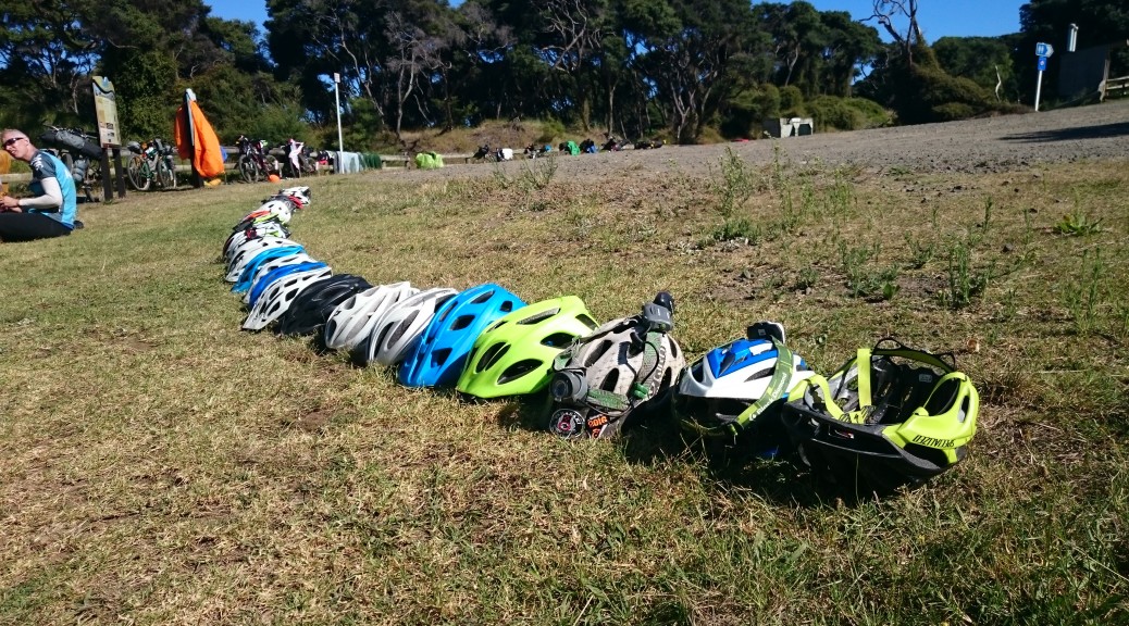
It was said that the boat would only take thirty riders and their bikes, so it was with some relief that I placed my helmet in the queue and found it was twenty-ninth. But I wasn’t too worried as I’d heard rumours that they’d squeezed a few more on earlier sailings. There was ample time to dry out tents, take a swim, sit in the shade, have a beer and wait for the boat to turn up.

A completely normal queuing method, I’m sure.

Looking across the Kaipara towards Auckland. This boat trip is part of the route, one assumes, as otherwise it would be an awful lot of busy and dangerous highway to get into NZ’s biggest city.

Also, it rather adds to the adventure – boarding a boat by walking up & along a long aluminium ladder while wheeling one’s bike along a plank of timber.

The queue stretches – in the end we got about forty-five (reports vary) bikes and riders on. Some of the first of the Wave Three riders just made it on – they’d ridden about 350 km in about twenty-seven hours! Some of them were a bit wrecked, but others were great company.

Looking over to the south head of the entrance to the harbour.
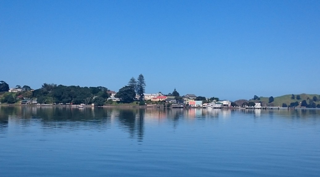
It was a supreme evening for a boat ride across the Kaipara, yet another new NZ experience for me. I was pretty chuffed as Dad had just been telling me that my grandfather use to get a boat across the harbour to Helensville & then get the train into Auckland and boarding school – and here I was doing something very similar just over a hundred years later. Because it was a few hours in a boat across the harbour in the evening, I’d layered up. Unnecessarily as it turned out, it was a warm calm evening and it was also rather cosy aboard – so I was soon removing extra layers.

The service was sublime – cups of tea and large slices of fresh watermelon were brought forth from the cabin. Our orders were taken for dinner from the captain’s favourite fish and chip shop and radioed ashore – brilliant. As the sun set beautifully, we motored up the Kaipara River to Parakai. I’m glad the captain had been sailing these waters for over fifty years – I couldn’t see a lot, but I could see sandbanks seemingly appearing from nowhere.

Safely back on solid ground it was only ten minutes’ ride and we were queuing to get our individual parts of the largest takeaway order I’ve seen in quite some time. The Kaipara Cruising Club had kindly opened their clubrooms (including bar) for us to sleep on the floor for five dollars, so most of us settled there for the night. I was in two minds, but took my (huge) burger (no wonder the captain recommended it) and chips around to eat before deciding whether I would ride into Auckland that night or sleep at the Cruising Club.

As it happened, the burger was so large I could hardly move after finishing it, so had little choice but to try and get some sleep. I was a little disappointed as I was feeling good and absolutely itching to ride (it had been a pretty easy day really), but considering the state I had been in the previous day – a bit of rest would probably be a good idea. It wasn’t a good idea: there were so many people faffing around, it was ages before the lights went off and in the end I slept very little.

Tour Aotearoa – My Day Two – Ahipara to Waipoua Forest

With little sleep behind me, it was up & ready to ride before dawn. My appetite had disappeared again, I only managed to get half a muesli bar down. It was a pretty chatty morning as I left the campground with Kevin, a firefighter from Nelson, and we rode at a similar pace to each other as the route got a whole lot hillier than the previous day – that is not to say it was really hilly, rather the beach was obviously lacking in changes in altitude.

It was a beautifully clear morning, there was little traffic on these backroads of Northland and I was really enjoying the riding as it warmed up and the mist eventually burnt off. Stopping for a quick snack and to de-layer at Broadwood (another little town I had no idea existed), I still couldn’t manage to eat much – but was feeling good. Soon after we turned off the sealed road to a graveled forestry road, once again passing pretty close to the same oversized truck that we’d now seen three times.

A lovely misty morning riding through small, but numerous hills.

This road was a late addition to the route – and a much hillier one. I didn’t know this at the time, but I was not resenting the hills over the flatter more-normal route. It was good riding and a whole lot more interesting than eighty kilometres of beach! Looking at the GPS file, I’m surprised to see that in the sixty-odd kilometres to the Hokianga ferry there was over a thousand metres of climbing.

As the day warmed and we had the big downhill finally to sea level, the lack of appetite and food began to catch up with me as I started to feel rather peaky. I vaguely remember the harbour being glasslike and a tranquil scene; but on the short ferry trip waves of nausea cascaded down – somehow I made it off the ferry & into Rawene. I’ve never been particularly good if I don’t/can’t eat (can’t imagine why), and also somewhat susceptible to heat – so this was hardly surprising. I sat in a cafe for a while, wanting desperately to be able to eat something – but just couldn’t bring myself to. Eventually I gathered the strength and was pleased to find a small pharmacy. The pharmacist was very nice and quite helpful.

Heading into Rawene – the first of the five boat rides on the course.

A bit more of the Hokianga.

I faithfully made up the electrolyte solution in the shade. But this was far too much liquid at once for my stomach to handle; thankfully there was little else in there, but that was also the cause of the problem I suppose.

An amusing diversion from my ills was watching these boys and horses playing in the shallows of the harbour. They were all having a much better time than I was; their laughter was pleasing. Note the boy in the water being towed through the water by the horse on the right.

Not much good for anything else (especially the 180 km I had been debating on trying to ride by tomorrow morning to catch the morning ferry to Helensville from Poutu Point), I went and found a nice patch of grass by the harbour shaded by a big tree. I promptly had a big nap; that, and some doctorly and sisterly messaging had me feeling comparatively great in a couple of hours. All of a sudden I had an appetite again and was craving carbs and salt. Salt and vinegar crisps (which became staple Tour Aotearoa food for me), helped a bit – but I was still hungry. What else does one do after vomiting a couple of hours before, but go to the chippie and order their biggest burger and a scoop of chips? They went down a treat as I chatted to a local nan and her grandkids about our ride to Bluff – like most people along the way, she was really interested and supportive.

That unplanned four hour break over, I was sufficiently better to carry on into the afternoon heat a little slower than normal. Mostly it was sea-level road around to the mouth of the Hokianga, but there were a couple of climbs nudging ten percent gradient – but not that tall – to make it a bit of work. I rested and ate a bit more at Opononi before the hills started in earnest.

The steepest climb so far, or so it felt, was out of Omapere – at least it gave a good view of the Hokianga meeting the Tasman.

For a while we followed the Waimamaku River upstream, stopping in its eponymous village for more wonderful food & flavoured milk (long bike rides really do give an excuse to eat & and drink all sorts of things I wouldn’t otherwise) before climbing out of the valley and heading south. Despite it being early evening, the heat of the day had not dissipated and this slow steady climb was the biggest yet by three hundred metres. Some consolation was the road was quiet and the native forest wonderful to be riding through. Nearing the next photo checkpoint, I caught up to Marilyn – because of my big mid-day break I got to meet a few people I would not have otherwise. Still with a thick Newfoundland accent after decades in NZ, she had her whole North Island accommodation planned out and on track to do the event in approximately hundred-kilometre days. A fantastic effort! I was very pleased when she said she’d booked a cabin at the only campground in ages, just a bit down the road, and there were extra bunks. I really needed a good sleep that I knew my tent wouldn’t provide. I was grateful for such generosity to let me take one of those extra bunks.

We stopped and took our photo of the giant Tane Mahuta. It’s hard to get a sense of scale as it is some way from the viewing platform: the trunk is eighteen metres tall, total height about fifty one metres and trunk girth of nearly fourteen metres.
A wonderfully fast descent through light, cooling drizzle took us down to a river and we had to ride a couple of miles off-course downstream to the campground. It was so good not to have to worry about where I’d sleep – I even got a shower, that was two in two nights – luxury! Despite my four hour break in the middle of the day and the horrible nausea, I’d still managed a respectable day of 120 km and a fair few hills (over 2000 m of climbing) in the heat. Not quite as far along as I had wanted to be, but I wasn’t displeased – in fact I was very happy, I could eat again. There was much rejoicing; actually, there was much sleeping.

Tour Aotearoa – My Day One – Cape Reinga to Ahipara

Waking to a warm, clear and still day in the north, there was plenty of time to do those last minute things and to pop into town to get some lunch. By the time Dad dropped me at the start point, the parking lot was teeming and buzzing with excited/anxious people eager to begin the journey down the length of the country. With so many people and loaded bikes around, it could have got a bit overwhelming so I just quietly got ready and soon enough it was time for the short briefing (which I think was mostly for those that had hired their SPOT trackers & didn’t really know how to use them).

The first photo control point – I really could not bothered wandering all the way down & back up the hill to somewhere I’ve been enough times before.

My support crew (Dad) snapped a picture of me happy and clean before the off; happy didn’t really change, clean definitely did.

Without much fuss, it was two o’clock and we were off into so many unknowns. But the first fourteen kilometres were known – we’d just driven/ridden up that part of State Highway One to Cape Reinga. A fast downhill was followed by a short climb before descending again and turning off the highway (I don’t think we were back on SH1, for more than a few hundred metres, until the very end of the route) and onto a graveled road to the beach. I started near the back and was trying hard not to put much effort in so early on. Eventually the road turned to riding on sand and down a stream bed as we got closer to the beach and some rather large sand dunes.

Rather large sand dunes looming.

They got bigger/I got closer.

There was quite a bit of stream crossing and riding. Very soon I was glad to be riding without external gears; this feeling amplified on the beach with all its sand and salt.

The standing joke of the first day seemed to be: when you get to the beach, make sure you turn left. And that was the end of the navigation for four and a half hours!

It was just over an hour before I reached the beach. Unfortunately, the still day was no more – there was a bit of a breeze that was more than annoying as it did have a headwind component. But we had it much better than Wave One who battled a much worse wind along the beach. A group was just setting off from the beach as I arrived, so I jumped on as I figured it’d be much easier with company.

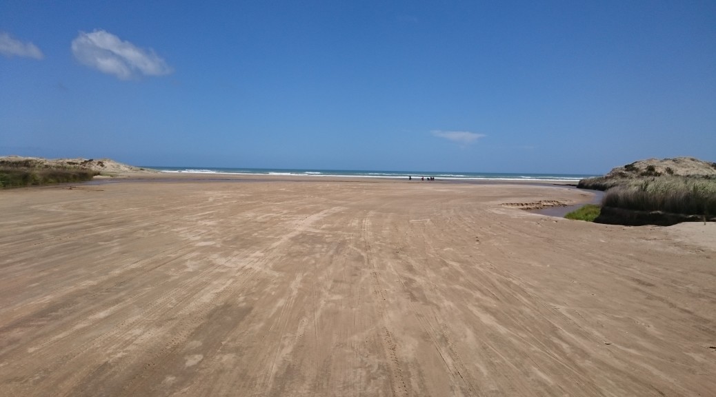
This seems to be the only photo I have from riding along the beach – I guess because it is fairly representative of what I saw for four and a half hours.

The beach was stunningly beautiful – but with eighty kilometres of not making a turn, I had to remind myself of this fact often. Groups morphed over those few hours as some slowed, some sped up and so on. My speed was fairly constant with few stops, just trying to get it over with. I thought I was eating & drinking reasonably well, but I guess the wind and the sun took more out of me than it felt like at the time. It was good to be off the beach and into the campground (the endpoint I decided for the first day, so as not to go out too hard too early) around sunset. However, I started to feel rather nauseous and lost my appetite. A shower and a bit of downtime helped and I was able to keep a large burger and some chips down.

Alas, sleep didn’t come easily as more and more riders kept coming off the beach through the night and setting up camp – something it doesn’t seem possible to do quietly, or without shining lights all around. That ended up being the last time I used my tent for the entire trip – yet I carried it with me the length of the country! There were a few times where I thought I’d have to use it again, but I managed to find other shelter that didn’t require the set-up & pack-down time of the tent.

Despite the nausea, I was thrilled with a great day on the bike and that my Tour was finally underway; not to mention, the eager anticipation I felt for all the riding and sights to come. Bring on Day Two, and the rest.

Bikepacking to Everett’s Campsite via Darkys Spur

After the success of the last bikepacking trip through Waikaremoana to Rotorua, Steve was easily persuaded to join me on a smaller trip closer to home. I’d been studying the topo map of the hills behind work, of which I’d ridden into a little way, and thought I could string a good overnighter together – camping at a DOC campsite on the Mohaka River. A fine sunny weekend was forecast, the only possible problem there being the thirty-plus temperatures.

Saturday morning was spent doing chores and shopping for food. So, it wasn’t until after one o’clock we set off north from Napier. The ride around the coast was as stunning as ever – even though it’s the way I ride to work often, it felt quite different on the weekend with a loaded bike heading off on an adventure.

All smiles at the prospect of exploring somewhere new – Steve has now perfected the riding selfie, no thumbs in this one.

Up Waipunga Road, we were headed for gravel roads that I had at least pedalled over previously. The heat wasn’t unbearable with a bit of motion-induced breeze, but definitely it was hot. Reaching the end of Waipunga Road, we were atop Darkys Spur and ready to zoom down to Waikoau. I insisted we stop a couple of times on the way down to take in the view of the hills and the gravel road winding its way down to the valley floor. Looking at that inviting topo map, I think there are more, smaller, adventures to be had exploring around here.

Passing through the unexpected and decidedly odd ex-Railways village of Waikoau, we were back on sealed road heading down the valley to the Wairoa road. There we knew was the Tutira Store – our last chance to refuel. It was stupidly hot in the store – which went someway to explaining why the woman behind the counter was so grumpy when we asked to fill water bottles, after buying delicious ice creams. I was not surprised to see a For Sale sign up – looking after customers was not a talent on display. We filled our water bottles at the charming little school over the road and headed north-east & inland.

I hadn’t realised there were so many walking tracks and other things to see up this seemingly innocuous country road. Forced to stop at Opouahi Scenic Reserve to wait for a mob of lambs to be herded down the road, we found a nice little lake surrounded by bush and a kiwi (the bird, not the fruit) creche – for which our company seems to be the naming sponsor, who knew?

While we waited we could look back over the valley we’d just ridden down to Darkys Spur – you can just see the cutting for the road heading down and right from the centre of the ridge.

To my surprise, I got closer to the lake than Steve – he didn’t have a swim at all during our ride. (c.f. the three of the last trip)

Just a NZ backcountry traffic jam.

The steady climbing on the well-surfaced gravel road continued as we started to ride through more bush than farmland. Interesting rocky outcrops started to appear on the small bluffs. We avoided being accidentally shot by a farmer out hunting rabbits as dusk settled in.

I didn’t know these signs actually existed – I have a small plastic version that someone (Adele) sent me while I was overseas, I suspect to make me homesick.

There were yet more trailheads to pass – I must come back one day when I’ve run out of places to ride and check out some of the hiking trails. Reaching our highest point for the day, about 800 m above seal level, the views opened up to the north.  In the early evening light I’d really been enjoying the climb and this just topped it off.  We could see a long way north. I checked my GPS’s list of “cities” nearby – we were only forty kilometres from Tuai, a village we rode through on the Waikaremoana trip!  Sometimes I’m surprised by the distance one can cover on a bike with minimal effort – or maybe, it’s just NZ really is quite small.

I’d enjoyed seeing many different uses of the land on this ride so close to the city. Now we were definitely heading into plantation forest.

We reached our northern-most point on the route and turned onto Waitara Road – obviously a haul road for logging trucks, it was the widest gravel road I’ve seen in a long time. We were hauling too down there as we lost a lot of altitude. Unfortunately, after so many hours in the heat there were a few not-insubstantial climbs to surmount before we finally got to the turnoff to the campsite. But the climbing was not over quite yet – eventually, we rolled down the final descent just before eight o’clock.

For an isolated campsite inaccessible to motorhomes, campervans and small cars – it was pretty busy. There was enough daylight left to make camp, head down to the Mohaka to cool and wash off the day’s dust and sunscreen, clean up some severe food leakage in my cooking set and make a well-earned dinner. A warm night with a big moon, it was plenty bright. Steve had no qualms in settling for the bivy bag, while I took my little tent. All slept well as it turned out we’d done more climbing in significantly less distance than the Waikaremoana trip – I wasn’t expecting that.

I think I even made the outrageous claim that I enjoyed that day’s riding more than the Waikaremoana trip – & that was fantastic. Perhaps it was just the living-in-the-moment thing that made it seem so good. But after a couple of days, it still seems that good – maybe because it was a route made up just to go & see what was out there and not one I’d got out of a book. Anyway, I’ll stop trying to rationalise it – it was an excellent afternoon of bikepacking finding new places so close to home.

However, due to leaving it too late in being persuaded in trying to get permission (from a forest owner and a farmer) to access an alternative, more interesting and lower-traffic route home, Sunday was only good without being exceptional. Still, I can’t complain about being out on a bike in the sun – I’ll just have to do the trip again (which I’d be more than happy to do) and organise the land access earlier to make the return to Napier more enjoyable.

Sunday morning continued on gravel with a fair climb up from the river to get us going. Soon we were back on the sealed road and came across the more accessible Glenfalls Campsite – it was very popular, I remember now that it is still school holidays. Our morning got a little more social as first we chatted with a Canadian cycle-tourist (who’d braved the length of the Napier-Taupo, which I’m not keen on doing) and then dropped in to visit someone from work – who just happened to live at the turn-off to the forest I want to ride through next time.

Glenfalls looks a popular place to camp.

From there, it was on the highway for twenty-five kilometres – consisting of one big climb and then a long descent towards the coast. The Sunday morning traffic wasn’t too bad and I pootled up the hill OK. We turned off to take backroads back to the city – we found out we missed a four-car pile-up near this intersection by half an hour, it closed the road. Thankfully the diverted traffic never caught up to us on these smaller roads as we rolled into Napier happy campers (quite literally).

It didn’t take long before my eyes turned back to the local topo maps to start planning more loops in the hills – so much to explore when you live somewhere new!