Category Archives: bikes

Post-Kiwi Brevet 2015

Just a quick post as I sit on the ferry to the North Island to say that I made it and completed the Kiwi Brevet 2015 edition in just over six hours shy of a whole week. Very happy to finish, that was also about twelve hours quicker than I vaguely planned. So that’s nice – but mostly due to a crazed decision to bike through to the finish on the Friday night, rather than being twelve hours faster. That option turned the last day into a nineteen hour day as we finished at 3.40 am Saturday morning.

I had three main reasons for wanting to ride and complete the Kiwi Brevet:

  • To reacquaint myself with NZ countryside & riding after so long away – especially in a part of the country I’ve spent very little time.
  • To meet some like-minded (read: similarly mad) people that would even contemplate doing such a ride.
  • Finally, to challenge myself a little/lot on the bike and put to some use all the riding I’ve been doing since August.

On all three counts the boxes stand firmly ticked.  They were probably checked off after the first day or two. The scenery was stunning for much of the ride, the first five days in particular, and I was happy to stop and take the odd photo. As the ride progressed, naturally the field spread out and I kept seeing and getting to know the same people as we passed each other – that was fantastic.

I did it toughest on the first evening and into the second morning after not drinking enough on a day that was hotter than it seemed – I struggled to even keep water down, let alone my dinner, and was rather nauseated for quite a bit. Once I got that under control, things got a lot better and I could concentrate on simply riding. The all-nighter into Blenheim was also a good challenge and one that I was keen to do mostly just to see if my body could cope with so long on the bike (we had plenty of stops, Oliver & I that is, as we didn’t really plan to ride so long – so were taking it very easy most of the day). Only early in the evening did I feel sleepy for fifteen minutes or so, otherwise the pedals kept going around steadily (mostly slowly) – I was very pleased, & a little surprised, with how well that went.

In some ways we were very lucky with the weather – it was quite unseasonable (January was a particularly hot and dry month) and never really got proper hot, which would have been exhausting. But we did get bouts of very heavy rain and extremely strong winds which were less than ideal (struggling to pedal downhill & only achieving 15 km/hr or pedalling on the flat in an easy gear and only just achieving 8 km/hr for kilometres on end is never fun). Mostly due to the weather, I stayed in hotels/motels for three of the nights and camped the rest. Apart from the last, none of the days were particularly long – three over ten hours, the rest around nine hours (moving time). I managed 1178 kilometres for the week – easily my most intense week of riding ever.

Riding highlights were the top half of the St James Cycleway, riding through McDonald Downs Station in the moist early morning fragrant air, and best of all – the Big River Trail and following long 4WD road out. The Big River Trail, near Reefton, was originally a track to access remote gold mines a hundred-plus years ago. It climbed gradually in very damp and moist conditions – never all that muddy, it was plenty slippery and with a loaded bike it was prudent to dismount at most of the stream crossings or when the rocks and roots got too off-camber. It was one of the few times all week that my big beefy tyres made any sense at all – ten kilometres took me two hours, but I rode the majority and it was so beautiful in there that I never resented the slow progress. By contrast the 4WD road was quite steep (mostly down, but some climbing) and covered with big loose, jagged rocks – I had an absolute blast and arrived in Reefton to find I’d made up a fair bit of time on quite a few, that didn’t happen very often due to there being so much road and my slow tyres/legs.

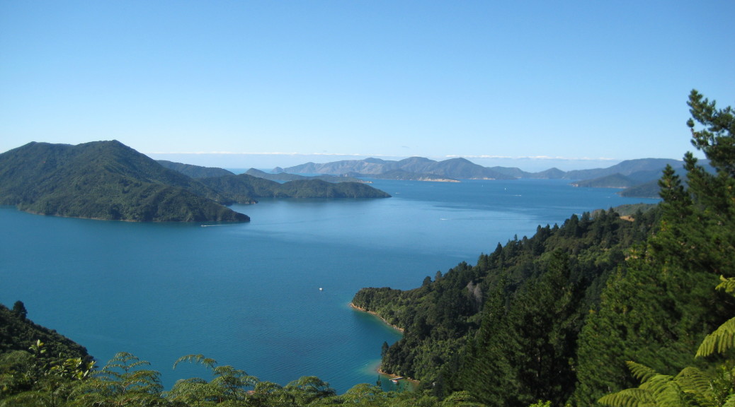
While we got stuck in many herds on country roads during the week – sheep, cows, hot-rods – the best wildlife sighting was ten minutes spent watching a large pod of dolphins extremely close to the shore at the Anakiwa end of Queen Charlotte Sound at dusk. Unfortunately, my camera was packed away due to the recent heavy rain – so that memory will have stay in my memory bank, but believe me it was astounding.

That’s probably enough for now – as I’m prone to do I’ll post later with too many words about each day. Here are some of my favourite photos of the week as a reward for reading/absently scrolling this far down.

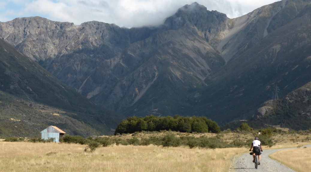
Steadily riding up the Rainbow Valley – Day One.

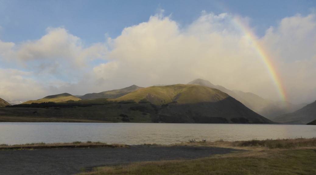
Getting out of my tent at Lake Tennyson – start of Day Two.

Heading down to the St James Cycleway.

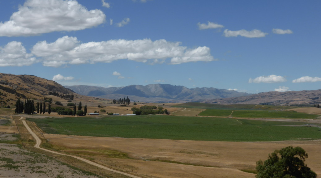
Somewhere after Porters Pass, but before Arthurs – when the wind was still with me.

Would I do it again? While I’m sure I could do it better and faster (carry less, faster tyres and put in longer days), at this stage I have no desire to repeat this route – because now I know what’s there and the sense of discovery of new places would not be there, and that’s a big motivator for me.

Pre-Kiwi Brevet 2015

This year the Kiwi Brevet is a 1150 kilometre clockwise loop (over 700 miles) on a mountain bike (for most) around the top half of the South Island in less than eight days. I’m not sure if I signed up for this because I was riding so much, or I thought it would be good motivation to ride a lot over the NZ summer – or maybe I’d temporarily lost my mind.  Either way, my bike is loaded up  and I’m my way to the start in Blenheim.  At the very least, I’ll get to see a lot of beautiful backcountry in a part of NZ that I’ve spent very little time.

This event draws its inspiration from the legendary and epic Tour Divide race in North America (basically a self-supported race following the Continental Divide from Banff, Alberta, to the USA-Mexico border at Antelope Wells, New Mexico, which is over 4400 km long and has over sixty-thousand metres of climbing!). The Kiwi Brevet is a lot tamer – with nowhere near as much climbing; a distinct lack of bears, mountain lions, aggressive packs of dogs, snakes; shorter distances between supply points; little chance of snow and so on. As such, the odd person uses the Kiwi Brevet as a stepping stone to the Tour Divide – still a vague possibility for me if I don’t completely hate the experience and fail to find a suitable job in the coming months…

By no means a competitive racer and really just along for the experience, I’ve not gone all out in trying to lighten the load on my bike by buying expensive new things (not having a job probably pays a part too). In fact, I don’t think I’ve bought anything new and my set-up is pretty similar in the two following photos taken ten months apart. Of course, it’ll cost me a bit of time and probably a lot of energy, especially the ever-reliable (so far) but large & slow tyres – but so be it.

Taken near Portsmouth March 2014 on my first solo overnight bikepacking trip.

All ready for the Kiwi Brevet; the only small changes I can see are an extra bottle & cage, a better pump, the upgraded (under warranty) k-lite dynamo powered light and no mudguards.

The self-supported part of the event means that you can only use what you carry on your own bike (or person I suppose – I’m not taking a backpack) and that which is available to all competitors. So you can carry camping equipment and camp or stay in hotels, motels, B&Bs (or a mix, of course) – but you can’t arrange to stay with friends, for instance. Similarly with food – you can eat what you carry and you can buy food at shops, restaurants, gas stations etc; but you can’t stop in at a friend’s house for a feed, be followed by a car with people giving you food or use food caches. There are few rules, it is rather low-key event (but with still a lot of organisation done by Scott & Jo) – in fact, I can’t even find the rules any more. I do remember reading that one rule is that you must have at least five hours of rest a night (that is not part of the Tour Divide rules) – I don’t think I’m going to come close to breaking that one. Needing to ride about 150 km per day, sleep had better not be a problem.

Here’s the map of the whole course – I’ve put a small amount of time into thinking where I might eat & sleep each night. Only the first night will be in the wilderness, I hope, as we will be in Molesworth Station after 150 km – which I think will be about my limit each day. The GPS file indicates just over nine thousand metres of climbing for the whole course – I’m somewhat skeptical of this, it doesn’t seem very much. It averages out at less than eight metres of climbing per kilometre – most of my rides recently have been more than this, some up to six times more. So I expect a whole lot more climbing than this (on my Garmin) – considering we’re crossing the Southern Alps and all.

So basically I’m going for a long eight day bike ride and don’t really know what I’m getting myself in for. If so inclined, you should be able to follow my progress (we’re all going to be carrying SPOT trackers) on the Map page of this site, or for the blue-dot-watchers: can follow the whole field here. Here’s hoping I make it around OK in less than the allotted time – after all, I have a Picton to Wellington ferry to catch afterwards so I can spend a week visiting good friends and family in and around Wellington (and maybe I’ll still want to ride my bike too).

Otago Central Rail Trail bikepacking

The Otago Central Rail Trail is the original long distance cycle trail in New Zealand – it’s been around since about the turn of the century, the railway having closed about ten years before that. It’s hardly thrilling mountain-biking, but at a shade over 150 km and passing through spectacular Central Otago landscapes, I was determined to ride it this summer as a training ride.

Initially I thought I’d drive to Ranfurly (a little east of the halfway point) and do two days of out & back rides to cover the whole trail in both directions – not really the pace the trail is intended to be ridden, but good long days on the bike that are necessary two weeks before the Kiwi Brevet. But on my little bikepacking trip just after Christmas I realised I could easily ride to the trailhead from home in just over four hours.

With Linda, of the Grandview ride a few weeks ago, house-sitting near the other end of the trail I planned a six-day bike trip – two days on the rail trail there, the weekend biking around Alexandra & two days riding back the way I came. So Thursday afternoon I set off & rode to the end of Ramrock Road again. It was even more overcast this time & there was a strong wind blowing out of the north. Thankfully, I was generally going west so the wind was manageable the few times I had to go directly into it. A bit fitter and stronger than three weeks prior, I made reasonable time with few stops – & there was much less stock to frighten off the road this time.

Down in the Nenthorn Valley, I remembered to snap a few pictures.

Back up on the ridge again before the gravel road ends for the big descent down into Middlemarch.

I decided it was too early for dinner in Middlemarch, so started on the trail to get dinner at Hyde. The trail didn’t get off to a very interesting start – with its longest straight, 6.5 km, dragging on & on as I started to do battle with the wind that would plague me for days. The straight finished & things got more interesting as the trail curved gently around the foot of the Rock & Pillars; all along the trail there are numerous gangers’ (railway workers of yesteryear) huts that have been spruced up and adorned with information boards. I took to stopping at most of these as the history was interesting and they provided a respite from the wind.

To my dismay, I found in Hyde that the only eating establishment had changed its hours and the kitchen was only open in the evening to pre-booked guests at the adjoining accommodation. A sure trap for novices like me. As I filled my water bottles and tried to decide whether to go much past my intended campsite to Ranfurly for dinner or just to camp where I had planned & have porridge for dinner (neither were appealing options), I spotted the kitchen-hand eating his dinner out front. He & the manager were most gracious and opened up the cafe for me (I assume it is open standard day-time hours) – I felt obliged to order a lot of food, but I hardly need much encouragement.

I hadn’t seen anyone else on the trail at all, being early evening, but as it happened a group of three rode up from the direction I was heading looking for some food too. So I wasn’t the only one whose lack of planning had let them down. They were very chatty and asked all sorts of intelligent questions of my bikepacking set-up and we worked out that they had shortly before swum  in the river next to where I meant to camp – apparently it was beautiful. They were heading back the way they came & I soon caught them up.

There are a couple of tunnels just north of Hyde – I’m told that you can just ride through them with a degree of confidence as the light fades around the bends in the tunnels; I wasn’t so keen on that, so flicked on my bike-light. After more chatting about bikes & adventuring at the rudimentary campsite (there is a toilet and a picnic table – and a river), I let them get on their way as I explored & set up my home for the night.

And very peaceful it was too with the Taieri River slowly flowing past.

The clouds later tried valiantly to break the drought, but not much came of that. But the wind did change in the night to a NWer – with my tent buffeted strongly by that, I didn’t sleep much.

Things seemed a little calmer as I packed up and got back up to the trail – as you can see it’s very well graded and easy riding, or so I thought.

Soon I was out of the shelter of the gorge and very quickly finding out just how strong the NW gale was. The NWer in this part of the world is a very dry &, in summer, hot wind – but this was so strong it had some cooling effect on a clear, sunny day. Away from the hills, there was little shelter out on the plains and for about forty kilometres I battled into the NWer. It was ridiculous – my speed was cut by up to half for the best part of four hours. It was mad that perhaps the easiest, flattest and best-graded trail I’d ever ridden for such distance was one of the hardest rides I’ve done – the hills of the previous day, & even crossing the Alps, were easier! Ranfurly was a good excuse for an early lunch #1 (although at ten-thirty, it may well have been brunch) and a bit of respite.

Understandably, the most popular direction of travel was the opposite one – there were plenty of tourists out on what seems to be the standard hire bike for the Rail Trail, one with two small rear panniers. Finally, I started to catch up to and pass the odd small group heading the same direction I was – always with a brief pause to discuss/slate the headwind. The scenery was beautiful looking out across the plains towards the various ranges that I’m becoming more familiar with – but I wasn’t much in the mood for taking photos, so I have few.

Even after reaching the highest point on the trail & then the most northerly & turning SWW things didn’t get much easier due to battling just to stay on the bike in what was now a fierce crosswind. On more than a few occasions I was suddenly blown almost off the edge of the trail; it was with some relief I could stop and have second-lunch.  Struggling through the next section, I finally thought I should stop and take some pictures of the surrounds – it was very nice after all, I was just a bit preoccupied.

The Poolburn Viaduct is the highest on the trail and the following Poolburn Gorge with its two tunnels make it one of the most interesting parts of the trail.

Finally after eight hours of slog, the trail turned sufficiently south that I had a tailwind for the best part of hour. And there was much rejoicing. Nearing Alexandra, I could glimpse part of the quite-recently expanded network of trails that is making the small town a MTB destination. These will have to wait until I have more time, energy & a more suitable bike.

From there it was only a easy ten kilometres north-west (the wind seemed to have changed) to the end of the trail in Clyde – perfectly timed, I found Linda just starting to ride down the trail to meet me. A beer was in order to celebrate surviving such a hard day. Even at my slow pace on a loaded bike, the whole trail is doable in a day (although, that’s not really the point – there is much to see & explore) – but I do recommend choosing a day with more suitable conditions. That NWer sure sucks the moisture out of you – I drunk so much that day, & only when I stopped did I realise how much I was sweating, such was the rate of evaporation.

The wind had one last cruel trick for me – as we rode home, I found it had changed in that particular area to a southerly. It was a long eight kilometres back to the house – I was exhausted. Strangely, although I was hungry, I didn’t have much of an appetite – can’t really explain that. Despite that, I slept very well that night.

Clutha Gold Trail & Wanaka sojourn

After the exhausting day on the Rail Trail I slept extremely well & reasonably late. More than pleased that I could fix myself porridge as the sun rose on another scorching, but windy, day the morning seemed to be filled with pottering and eating wonderful Central Otago summer fruit that was not in short supply.

Although I wasn’t really feeling like it, I was adamant I should put another decent ride in on successive days – eventually we settled on driving to the Clutha Gold Trail and riding a section out & back. One of the many cycle trail that seem to have sprung from nowhere while I was away for five and a half years as part of the NZ Cycle Trail network, this one runs seventy-three kilometres from Lake Roxburgh to Lawrence – mostly next to or near to the Clutha River. As the name suggests, gold-mining plays an important part in the history around the area – so there is frequent reference to it on the trailside information boards.

As the NWer was still very strong, we drove further south-east so as to start at Miller’s Flat & have the first part of our ride into the wind and have a tail wind on the return leg. Rachel (also house-sitting) was pretty sure she wouldn’t keep up with us, so we separated shortly after leaving Miller’s Flat. Linda pushed a pace that my tired legs and body couldn’t quite keep up with – & that was without all the luggage on my bike, but I fancy my bike was still substantially heavier than a carbon framed 29er. Miserable excuses, I was still tired – but happy to trundle along at my own manageable pace.

A short part of our ride first up was along the quiet road & then beside it on gravel trail until we were down to the riverside – twisting on the wide easy path through the trees.  There were plenty of glimpses of the bright blue-green Clutha making its way to the ocean – it’s NZ’s second biggest river with a very large catchment, so quite a bit of water slowly flowed past.

Amongst the trees, the wind wasn’t so bad & there were plenty of little changes of direction to break it up.  The trail is not as popular as the Rail Trail, but I found it more interesting as there is more greenery around and there is more variety in the trail direction and a few switchbacked climbs – the kind of thing you don’t get when following the path of a former railway.

The second half of the (about) thirty kilometres was more exposed to the strong wind & my speed slowed significantly.  Reaching the trailhead at the Roxburgh Dam (I had no idea that existed) we stopped for a snack and to snap a few pictures before turning and heading for the car – determined to stop at the information boards now that we had a tailwind.

The remains of a dredge that sunk in 1912 – it got over 3300 ounces of gold out of the riverbed between 1902 and 1906.

It was significantly faster returning, even with less effort expended pushing the pedals around – but still about getting a bit late in the afternoon by the time we got back to car to find Rachel patiently waiting and getting a bit cold. Empty bellies called for a good feed of fish ‘n chips in Roxburgh (after the earlier disappointment of Jimmy’s pie shop/bakery being closed on weekends) – the shop seemed to be the local meeting place for a Saturday night with all sorts dropping in. We were strongly encouraged to return the next day and enter a team in the inaugural Cherry Chaos event – which from what I could work out was completing an obstacle course while another team bombarded you with reject cherries, in the spirit of La Tomatina or the orange fight in Ivrea.

With that blasted NW gale sticking around into Sunday, we decided a day off bikes was a good idea; Rachel had organised to visit family in nearby Wanaka, so Linda & I tagged along to spend a few hours at the lakeside town. Somehow, the wind was even stronger there, coming off the lake – we felt sorry for the poor souls competing in a triathlon around the lake-edge. Still, we managed a walk up Mt Iron – where the forecast rain hadn’t quite rolled in & obscured the view – and plenty of delicious gelato and hot chocolates.

Looking west over Lake Wanaka to Mt Aspiring National Park.

South up the Coronet Valley.

East over the lower reaches of the Coronet River – it then flows into the Clutha just after that flows out of Lake Wanaka & is then joined by the Hawea River.

I’m not sure anyone slept all that well Sunday night as the winds reached a whole new level – at one stage the front door blew open, somewhat startling Maddie (the dog). The wind was supposed to change later in the day, but the forecasts were unspecific. I wasn’t keen to battle that again on the Rail Trail and given the choice of riding something new over 220 km that I’d ridden a few days previously – I preferred riding something new. Studying a map, I realised that Lawrence (the other end of the Clutha Gold Trail) is a lot closer to Dunedin than I thought (or not thought – I don’t know if I’d been to Lawrence before). Linda was keen to ride some distance with me, so a plan was hatched: drive back to Miller’s Flat again, ride the Clutha Gold south, stop at Beaumont for lunch, after which Linda would return north to the car & home and I’d carry on the Clutha Gold south to Lawrence & then over the hills hoping to eat & camp near Outram before returning to home the next day…

So that’s basically how it went. Another great thing about the upper reaches of the Clutha Gold is that it’s far from the highway & traffic noise – particularly the Miller’s Flat to Beaumont section. I think the section we did from Miller’s Flat south was my favourite of the whole trail – the only people we saw was a family on holiday in the area when we took a walk down to this restored bridge of a settlement long since gone on Horseshoe Bend (not nearly as impressive as the eponymous section of the Colorado).

The rain started shortly before Beaumont, so the camera stayed squirreled away for the rest of the day.

Escaping the rain we headed for the Beaumont Hotel – a classic NZ rural pub; I first thought that we’d eat in an otherwise empty bar, but they did a quite reasonable trade in the end. I thoroughly enjoyed my first Kiwi whitebait fritter in years, but I still had a long way to go to get to Outram (as well as having no idea just how big the hills were after Lawrence) – so bidding farewell to the pub and then Linda was necessary as the rain continued to fall. My suspicions that there was once a rail line along this valley (based on straight embankments and old bridge piles) were confirmed as signboards became a little more frequent & told me so and I climbed to the longest tunnel (about 400 m) I’d been through during the previous days – being straight, it was by no means the darkest.

The southerly change had come through (bringing the rain) and I worked against that to the end of the trail – thankfully, it wasn’t too strong. This part of the trail was not quite as enjoyable – partly due to the rain, but mostly due to the close proximity of the highway noise for much of it. The easy part of the day was completed at Lawrence and I marked the occasion with a disappointing pie at The Wild Walnut – more a strange triangular pocket of pastry with little meat in it than a proper pie. The rain had stopped as I headed north-east into the hills, hoping I’d make it to Outram by eight o’clock (it was just before four).

Quite soon I was heading up proper steep hills for the first time in days; surrounded by plantation forest, the only traffic was forestry workers heading home for the day in the opposite direction. The rain started again. Soon I was into open farming country, watching tussock slide by and passing the Bungtown Bog Scientific Reserve – what a great name! Previously I’d no idea these hills were even here, they were starkly beautiful in the early evening gloom as the storm rolled in. I continued, frequently dropping steeply & then having to climb again between about 400 and 500 metres above sea level. About the time Lake Mahinerangi (long & skinny – another hydro lake) came into view, the hail started, the temperature dropped and the thunder & lightning started. Although really chilly, I was pretty happy in the rain and quite sure I’d make it to the highway and civilisation again before hypothermia set in.

With another slow steep climb done, I was on the highway (pretty much deserted at that hour on a Monday night) and it almost stopped raining – but not quite. One more longish climb, a screaming downhill and some flat riding later I was in Outram to find the pub kitchen was closed. Damn. I was forced to ride to Mosgiel for dinner – then being so close to Dunedin and all the talk of the storm rolling this far east for the night, camping in a town sounded no fun at all & made little sense; Dad kindly came & picked me up to finish a long, challenging but enjoyable day exploring beautiful places new-to-me.