Category Archives: family

Farewell South Island

With the gradual erosion of my bank account balances, a suitable opportunity to rejoin the workforce was most welcome. As such, since I got the phone call offering me a job on the last day of the June sojourn to the West Coast, July was rather quiet as I sorted details and prepared for the move north. There definitely was not much biking as a rather frigid few weeks set in and I couldn’t get motivated to re-ride gravel roads that were no longer new to me. But there was plenty more to do and think about.

Having been back in NZ for eight months, it was bigger trips away that got more coverage here. Understandably too, as there were a fair few highlights there – mostly notable surviving the 2015 Kiwi Brevet (1150 km around the top of the South Island was a great re-introduction to NZ); the big training rides for the brevet; a couple of trips to the North Island with short bike tours, a fantastic wedding, and visiting family & friends; a quick trip to Sydney to see family; and two trips to Westport to see Adele in her new home (the Heaphy Trail was the highlight of the riding). But the time, between those trips, with Mum & Dad in their new home was just as good – plenty to do and many places to explore.

The local beach, a short distance from home, was always good for a walk in the, frequent, sun.

Waikouaiti Beach

Further around the beach towards to estuary mouth

Out on my twenty kilometre loop – looking out across Waikouaiti and Hawkesbury Lagoon and over the Pacific.

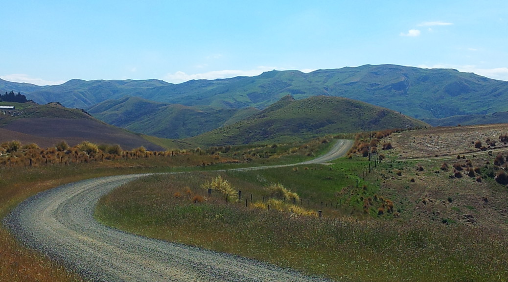
As I trained a little bit for the Brevet, my eyes turned to the myriad of gravel roads slightly inland. I was surprised by the quality of the gravel road riding out there – wonderful scenery and pretty much deserted too.

Out riding in the hills of coastal East Otago.

At the end of one of my favourite gravel roads to ride, a station – remove a letter and you can anagram my name.

Looking over Karitane village to Waikouaiti Beach.

There was even the odd local event to go along to, sit in the sun and drink wine at.

A day at the local races.

My twenty kilometre loop came over that saddle and was a great rush down that hill.

The facilities are looking a little long in the tooth.

Another recurring route on the bike was north to Palmerston, avoiding the highway, and then on past Trotters Gorge to Moeraki.

On one of the few trips to the fishing village of Moeraki – where there is a uncanningly fantastic restaurant, with plenty of seafood, naturally.

The decor is somewhat eclectic – this historic hand-drier reminding me of Polimeri (my workplace in the UK actually still had these!).

Now that Mum & Dad have a much bigger section there was always plenty to do around home – particularly outside. I went a little way towards earning my keep by washing the exterior of the house, repeatedly mowing the lawns, replacing paving stones, picking apples & pears, carting & stacking dry firewood, and finally by wielding a chainsaw an awful lot cutting trees down & into burnable pieces. The weather often played fair and it was always nice to be outside – even on those crisp days close to freezing.

It looks a little different now that winter has arrived and many of the trees have been dealt to by a chainsaw to let some more light in.

So a great few months at home spending time with Mum & Dad. Nice to have that time before I dive into seeing if I can get used to a life that will be more settled &, dare I say it, normal than the preceding six years. We’ll see.

Lake Christabel turnaround

I’m unsure who was more excited – Adele to take two novices for an overnight hike (tramp in the local parlance) or Fiona to go on said hike. It assuredly was not me – but I was more than happy to go along for a walk, at the very least there would be a whole lot less cleaning afterwards than after a West Coast winter mountain-bike ride. We set off early Saturday morning east through the Buller Gorge and carried on past Reefton as dawn marched on.

Adele had chosen a route that would take us from the Lewis Pass highway (just short of Maruia Springs), up besides Rough Creek and on to the tops before descending to the overnight hut at Lake Christabel Hut (which is actually a mile short of the lake), before walking out to Palmer Rd. As such, we had to leave a car at the end of our planned walk – we discovered it really was quite cold out, as all the short wooden bridges on this rural road were iced over.


View Larger Topographic Map

Nonetheless, car shuffle done we set off alongside Rough Creek. Quickly, it became obvious that the creek was not the only rough feature around – the trail was mostly unformed and soon started steeply climbing the hill over a lot of tree roots and moss.

The sun made a brief appearance in the sky – some of its light even filtered through the canopy.

The route flattened out a bit as we walked beside and through/over the river for a while.

While we were still well below the tree line, we started to come across patches of snow – a somewhat worrying sign for walking over the tops.

We made good time to the tree line and started tracking our way through a good half-foot of snow to get a view of where the snow-poles would lead us. Visibility had decreased, but we could make out a few poles in front of us – as it wasn’t windy or miserable we decided to push on. The snow deepened – generally about knee high, occasionally I post-holed to my waist when I was making tracks. We were glad to have a hiking pole each – just as well someone thought to bring those .

There’s a pole! Go over there. About half-way up Adele took the lead through the steeper terrain, I had it easy at the back for a while.

Reaching the saddle (we’d climbed about 900 metres in four kilometres – a bit more than I’m used to), we turned to see cloud filling the valley we’d walked up.

Venturing just over the saddle, Adele suddenly found it very icy and compacted. We were unprepared for such conditions, with no crampons or ice-axes (and Fiona & I have no real experience in using such things). The ice patch was likely not that large, but it wasn’t a risk worth taking – so we turned and headed back down the hill. I’m sure I’ve said before, I loathe prolonged walking downhill – especially with a large pack – it just hurts and there’s no challenge or enjoyment in it. Thankfully we made it back to the car safely – which is no mean feat considering the number of small falls Fiona and I had on the slippery route/roots back down.

So for the second time this year, due to adverse conditions I found myself staying at the rather bizarre Alpine Motor Inn & Cafe at Springs Junction – a place I didn’t even know existed last year. I think I even had the same burger – it was just as large and somewhat weird (probably due to the hash-brown). Grateful for a roof overhead (it was cheaper than huts on the Heaphy) – it was just as well we had our sleeping bags as the only heater in the room shone like a small star, so had to be turned off at night. The provided linen would have been OK, perhaps, in summer. A memorable and perversely fun place to stay, if only for odd reasons – including the mountain stream that the stone-walled building was built into, it reminded me of being in European mountain villages.

Sunday was a much more leisurely day – mostly because we didn’t take loaded overnight packs on a day walk and the terrain and trail was much friendlier. Also, hot pools! Just past Lewis Pass is the northern trailhead of the St James Walkway – a sixty-six, five day hike. We walked the first hour or so until we got a decent view of Cannibal Gorge (a literal name, unfortunately) and then stopped for a snack before returning to the shelter at the start of the trail – where (royal) we cooked and feasted on Pad Thai (meant to be the previous night’s hut-dinner), yum.

A pretty little walk, I don’t think it even rained and considering the snow and ice around – not too cold for wearing shorts either. With all this extra time, we went and soaked in the Maruia Hot Springs. I’ve driven past here a few times in the last few months – considering it’s in the middle of nowhere, it rather odd it is so Japanese-spa themed. Nice all the same.

West Coast Weeks

Now that June is over, my weeks based in Westport are also coming to an end – it’s been a nice change of scenery. While somewhat wet, it has definitely been a lot less cold than if I’d spent the month further south at Mum & Dad’s house. Adele’s also been pleased to have various visitors, besides me, as we all realise just how isolated Westport is. With people new to the area, there is always added incentive to go out and show them new places.

Craig, Kelly and their young daughter, Elsie, visiting for a weekend meant a trip out to Charming Creek – I finally got to ride the whole thing (it’s only ten kilometres each way) after being stopped by a large trail-covering waterfall last time. We didn’t even get rained on! But there was plenty of water standing on the trail to soak us. The river not being in a raging, flooded torrent was not quite as impressive – but it did mean I got to see the most-noteworthy waterfall as we followed the fallen-into-disrepair railway up the valley.

As with a lot of the coast, there were mining relics to explore. These at the top trailhead – where we turned around for a quick, fun and wet return to the cars.

The girls having been for a Sunday mountain-bike ride up at Denniston while we (mostly Craig, admittedly) watched over Elsie – the late afternoon was time for Craig to take James and me on an adventure quite different to those I normally write about (no bikes!). Half an hour south, a bit past Charleston, we turned off the highway and followed a narrow gravel track inland and up into the hills. Craig declared we had found the right place as we parked the car – what he’d seen I had no idea, one patch of native bush looks much like any other. With a bit of advice I managed to get into my harness – as climbing things generally bores me, it’s been many years since I’ve had to put one on.

Someone saw a slight parting in the foliage and we set off down a narrow path, hiding the car keys in a small hovel trailside as the steps got steeper and more slippery. Surprisingly, there was an official sign warning of a tomo – which as far as I could work out was a really big hole in the ground. The surprise being the sign in such an isolated place; the large cavity in the earth being rather the point and not at all suprising. I stood around in the increasingly heavy rain getting rather wet, wondering why I wasn’t somewhere warm reading a book by a fire, as Craig and James set-up various ropes and slings that would, all going well, prevent me falling forty-odd metres and making little impression, but a big mess, on the rocks below.

With little time to do more than accept the fact that I’d be lowering myself a long way down a cliff with only a slight theoretical, and no practical, understanding of the hows and whys – I found myself doing just that. With a wet, doubled-rope threading through my belay device, it turns out being rather small and featherweight [disturbingly – if I was a boxer, I would be a featherweight; also, I’d probably be the worst boxer ever] does slow things down if you’ve not got the technique sorted. Still, in such circumstances I much prefer slow and steady over fast, uncontrolled and dead. The waterfall beside me cascading into the giant hole with much greater certainty and confidence was doing a fine job of making everything very slippery and more difficult. Eventually my technique improved and I descended a bit faster; one strand of rope ran out (a sixty metre rope can’t be doubled all the way down a forty metre cliff) and I bounced a little as I passed that by.

Somewhat relieved to be standing on solid ground, rather than bouncing off the side of it, James made his down and soon we were caving! Some photos of all this would be useful, but it was so muddy and wet down there I left my camera safely at home. For a couple of hours we proceeded through quite a network of tunnels downhill. We followed the stream part of the way, marveling at the large stalagmites and stalactites (some were a good eight inches in diameter) and appreciating the rather dainty ones forming that were no thicker than drinking straws.

It was a lot warmer underground than we expected – the others shed a layer or two, while I gave up trying to keep my feet dry and just walked in the stream when it became too much like hard work to stay out of it. Hauling ourselves up small rockfaces, clambering over things and gingerly jumping off rocks into semi-darkness was, as Craig said a few times, a full-body workout. I felt my shoulders twinge a couple of times from exerting force at weird angles – a warning that I shouldn’t pursue caving more, I’d hate to be stuck underground with a dislocated shoulder.

Craig reckoned he’d been down here four or five times before and seemed to know where he was going as I blindly followed, every so often hearing words along the lines of “this is the right way”. Every so often we’d emerge from a narrow passage into a larger chamber. It was one such chamber that we started to return to repeatedly after Craig started to utter the words “this doesn’t feel right” a little too often. This started to become mildly alarming after what seemed like half an hour. I was not keen on having to get myself back up that slick tomo in the dark. Eventually we had success as one previously overlooked passage sent us on the right track; we crawled and hauled ourselves on our bellies down another shrinking tunnel.

With Craig convinced we were back on the route that would get us back above ground, we elected to take a small side-route. This first involved a ten-metre shuffle head-first under an extremely low ceiling. I’ve not found too many instance where lacking in upper-body strength is useful, and this wasn’t one – but it was a good time to be very skinny. The ceiling was so low that I had to turn my boots parallel to the floor – as if I had my Size 8’s perpendicular, they would quickly wedge between ceiling and floor. Emerging from that, we were in a deep, but narrow cleft, in the rock. Soon this narrow chasm had a stream running swiftly down it, showing just what had carved such a deep slit in the layer rock. The layers were pronounced, but smooth as we shuffled past. Hardly having wide hips, even I had to twist my body sideways to be able to walk forward.

That rather unusual journey over we reached the objective – sizeable whale bones fossilised in the rock many metres below ground, but now somewhat exposed by the rock having been worn away. Amazed, we studied these for some time before deciding we really should get going and returned through the narrow passageway to the main route. With more shuffling down a muddy creek bed, we were finally able to stand up again and clambered up a lot of rock. Suddenly, Craig spotted ferns in the dark ahead – we were outside again and it was much later than we thought. With no real path, we headed up the left bank of the Nile (not that one) before Craig spotted some small reflectors off to our right. Following these had us bush-bashing through dense bush back to the gravel road, ending our fantastic little adventure with a half-hour walk up the road in the rain to the car and retrieving the rope from the start.

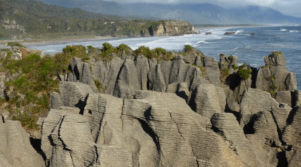
Later the following week, after a flying trip Napier (where I tested out Sounds Air’s new nine-seater service, Westport to Wellington), Fiona, a family friend of ours from growing up in Te Puke, arrived for a few days at the end of her med. school holidays. Around Westport, we went for walks to Cape Foulwind to see the seals, explored small local bike trails and waited for fine spots between the frequent showers of rain. Further south, we visited the Pancake Rocks at Punakaiki. Finding that the gravel road we intended to follow inland was closed due to slips, we explored another short walk nearby.

The Truman Track starts on the side of the highway and follows an easy path through a wide variety of native trees, before the bush finally thins and you find yourself above a rather charming little bay. I enjoyed exploring the bay, and the next one too (avoiding being stranded by the incoming tide), looking at the various wear patterns in the mudstone – while James, the geologist he is, looked more closely at rocks on the beach and Fiona tried to escape sandfly attacks.

A most excellent stay visiting the coast – the highlight was definitely the Heaphy, both trips – there’s a lot to do and more left unexplored for next time. Thanks Adele & James!

Half the Heaphy

Adele lured me back to the West Coast for a few weeks with the promise of different biking and a change from the rather fruitless task of finding a job. The biggest part of the carrot was finally being able to ride the Heaphy Track. For most of the time I’ve been a mountain biking, the name Heaphy has been uttered with mild despair by New Zealand mountain-bikers no longer allowed to ride one of the best multi-day rides in the country. But no more, it is now open to bikes during the off-season.

Running between the north of the west coast of the South Island eastwards through rugged hills and valleys, the route dates from mining in the late nineteenth century – after which it was almost forgotten. In the later part of last century, the track came into use again for hiking/tramping and was also open to mountain-bikes as it was in a forest park. But when the North-West Nelson Forest Park became Kahurangi National Park in the mid-nineties, the mountain-bikers were shut out – much to their chagrin. But while I was living overseas, a trial was started allowing bikes on one of New Zealand’s Great Walks in the off-season (May to September) – a lot like how bikes are allowed on the Queen Charlotte Walkway. The trial was obviously successful as it’s now a permanent arrangement. Fantastic!

As Adele has work commitments, unlike James and me, the plan was to drive early Saturday morning to remote Karamea (the west end of the trail) and then catch a light plane with our bikes to the other end of the trail and ride the almost-fifty miles/eighty kilometres back to the car over two days – staying at a hut somewhere in the middle, Saturday night. This was also to be the first time Adele and James had been bikepacking – exciting! Despite the good weather forecast, it was not to be – when we arrived in Karamea it was decidedly wet with very low cloud. The plane couldn’t land – so we adjourned for bacon and eggs while we waited to see what the weather would do. Well fueled by second breakfast, it was now obvious a plane wasn’t coming to get us and we couldn’t be sure one would bring us back Sunday afternoon if we decided to ride the route west to east.

Plans amended consequently, we drove to the trailhead at Kohaihai, sorted our gear out and rode off late-morning into the rain. Immediately crossing the Kohaihai river on the first of many substantial bridges, the route climbed up to Kohaihai Saddle to avoid the cliff-lined coast. That first hill done, it was down to Scott’s Beach as James and Adele got used to riding mountain-bikes while wearing heavy hiking packs. The forest right down to the beach was impressive, but as the drizzle continued to fall we weren’t too interested in sticking around to look at the grey sea. While overall the trail was flat, there were sufficient short ups and downs to keep it interesting.

Quite surprised to bump in to Garry and cohorts riding out the way we had just came, we stopped for a brief chat in the rain. NZ is so small – here unbeknownst to us was a man far from home (as I was too). One of Adele’s previous rural medical teachers and colleagues I’d met him on adventures earlier in the year and then again as he was one of Adele’s teammates on that crazy Godzone adventure race in March. Not quite a bizarre as bumping into your Kiwi third (or fourth, I forget) cousin in a Tuscan village – but odd all the same.

With the tide far enough out, there was a short section on a beach – avoiding the high-tide alternative track.

Plenty of stream and river crossings gave opportunities to emerge from the trees into the rain.

Eventually, it stopped raining – about the time we reached the Heaphy River mouth and our lunch stop at Heaphy Hut.

With tasty, tasty salami and cheese ciabattas fuelling us, we set off inland. The section along the river flats beside the Heaphy was initially through more large groves of nikau palms before winding its way through stands of large native trees – rimu, rata and kahikatea. We eventually crossed the Heaphy on what is apparently the largest swing bridge DOC (Department of Conservation – responsible for much public land in NZ and the associated facilities) has ever built. Almost a hundred and fifty metres long, it is obviously built for when the river is in flood. It looked like most of the bridges have been upgraded recently, possibly for bikes – they are superb and easy to ride across. The one remaining wire-decked swing-bridge looked like hard work for James & his unloaded bike. I couldn’t even get my loaded bike up the ramp, so found it easier just to ride across the stream and risk wet feet.

Adele crossing the Heaphy.

Reaching Lewis Hut the flat coastal riding was done and we began a steady climb to James McKay hut. Generally it’s a very easy climb, taking eleven kilometres to ascend almost seven-hundred metres, but it’s a bit steeper at the start. The track is generally wide and the only really technical parts are some of the frequent, rocky, creek crossings. It was warm work, and some of us were down to short-sleeves before, and even when, the drizzle came back. DOC is working hard to upgrade the surface. If we’d been a week later, I’m told, they’d be finished and we would have missed the in-progress stretches of hundreds of metres of slick mud. This made it tough going at times for our little group, but I found it mostly rideable – even with a rather lightweight rear tyre.

It was with some relief we saw the marker indicating only two kilometres remained until we reached our destination for the night – James Mackay Hut. This was also about the time it started to rain again, albeit lightly. Due to rare wildlife living in the area, kiwi and giant carnivorous land snails (! – I didn’t see one, but saw some of their old shells – disturbingly large), one is not allowed to ride the trail at night – so we had to be at the hut before nightfall.

It’s a pretty damp climate with plenty of interesting flora and fauna.

After one final slog atop the slick and muddy track, we made it to the hut easily before five o’clock – not bad considering the late start. This was where we had intended to stay originally – but approaching from the other end of the track. It’s very weird turning up at such a palatial back-country DOC hut and finding it only contains mountain-bikers. What’s more, in the middle of nowhere it has bike-racks and even a bike wash stand (much needed)! Having cleaned our bikes, we went inside to find the coal range roaring and even such things as basic electric lighting, gas cooking, running water and flush toilets – luxury. Being such a new hut, it is very good and has wonderful facilities – but does lack in character.

It turns out large groups of mountain-bikers have very poor hut etiquette, being generally loud through the night – walking/stomping around, talking loudly, and getting up at four o’clock to shovel coal noisily (who does that?). Thankfully, they were gone by the leisurely hour we got up, had breakfast, packed up, talked bikes and brevets (I even got an unexpected handshake for completing the Kiwi Brevet – I was quietly chuffed) with the other more considerate mountain-bikers. With slightly better weather, we could see all the way down to the Tasman Sea and the mouth of the Heaphy.

Looking all the way back down to where we’d been for lunch the previous day.

Bike racks and wash area – at a hut, wow!

Although it was mid-morning by the time we set-off back down the hill, it was quite chilly and we got a little wet from the spray off the muddy surface. While much easier to ride through the mud assisted by gravity, it still had its tricky moments.

Adele enjoying the downhill – possibly this was before she fell off the side of a bridge, but it’s hard to tell as she’s always got a smile on her face.

While waiting for Adele, James and I tried talking to the friendly locals. This robin was particularly curious, and the many fantails we saw elsewhere were super inquisitive.

The ride out being the same way we rode in is thankfully much shorter to describe, but with much improved weather we saw so much more – and there was an eleven kilometre downhill too! Thankfully, the lack of rain meant I could get my camera out a bit more and I had plenty of time to take photos as well.

Occasionally there were glimpses of the Heaphy River – but annoyingly there were no great lookout spots on the way down.

Looking east up a tributary of the Heaphy – some good limestone cliffs to on the right.

After a rapid pace on the flats back to Heaphy Hut we got strangely hot – a good time for lunch; the nikau palms began to reappear also.

With lunch done, it was only sixteen kilometres back to the trailhead mostly following the coast. It’s a great fun trail and I was expecting to enjoy it more in the dry – it had dried out well since the previous morning. I was not expecting to be so blown away by the scenery – it all seemed so foreign to New Zealand. Apart from the temperature (which was mild), I could have easily believed we were riding alongside tropical rainforest on an island somewhere – perhaps in the Caribbean. The beaches were gorgeous, the surf was wild and the palm groves – wow.

Over the last saddle separating Scott’s Beach from Kohaihai, we enjoyed the final downhill back to the car and the end of our little adventure. I’m pretty sure Adele & James enjoyed their first bikepacking experience – we may not have gone that far, but there was so much to see. Now that all the bikes are cleaned of the grit and mud and all the washing is done, I’m waiting for a two-day window in the weather so I can ride the whole trail. I’m not hopeful, but if the eastern end is anywhere near as scenic as the part we rode it must be quite something.