The rest of my plan to visit family on the outskirts of Wellington involved leaving Martinborough after an early breakfast and riding to Waikanae over the Rimutakas and then the Akatarawas. From Martinborough it was flat roads for over twenty-five kilometres with a helpful wind at my back.
My route over the hills involved getting back on the Rimutaka Cycle Trail – a long established rail trail, I knew this wasn’t going to be too steep. However, the eastern side is much steeper than most railways – there was some fascinating rail history to read about trailside as the hills were not conducive to ordinary steam engines. Instead, up the steep Rimutaka Incline, Fell Engines had to be used as the gradient for three miles was one in fifteen. The Fell system was the first to use a third rail for braking or traction – wheels were pressed horizontally on either side of the centre rail when required. This steepness of the trail made it slightly harder work than a normal rail trail – but nothing compared to what I’d been riding recently, so it was nice to not be only very gradually climbing.
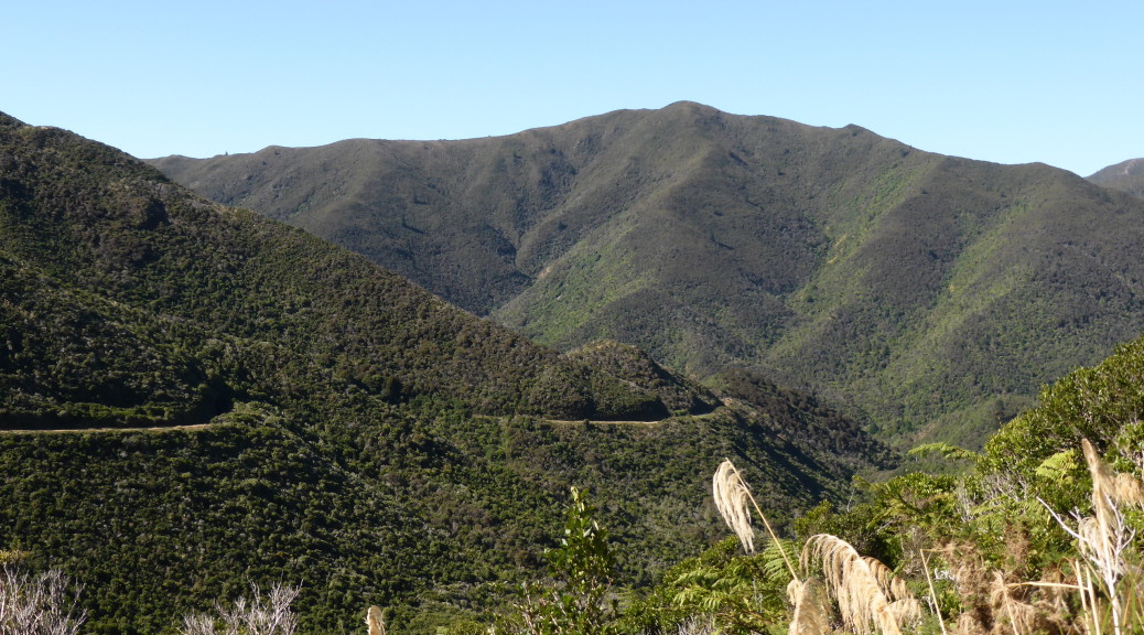
I wound my way up, stopping to read the interesting information panels and look out across the rugged hills lined with native bush. The day warmed and was quite humid, but the going was hardly tough. A few tunnels on the trail provided relief from the humidity and bright day – I was glad I had my light for the almost-six hundred metre long Summit Tunnel. From there it was, of course, a long gentle downhill (the Fell system wasn’t used on the western side of the Rimutakas as the gradient was easier) and as I approached the highway I began to come across a few day-trippers on foot or bikes.


After a brief spell on the highway, I was happy to see the only shop of the day & stopped for a pie and some crisps and wondered how long it would take me to get over the Akatarawas. Home of the longest running mountain-bike event in the Southern Hemisphere, the Karapoti Challenge, (which I’ve done a couple of times, before I went overseas), I knew these hills were big and demanding. But this time I was just riding the road to get to the Kapiti Coast – a skinny, twisty road that plenty of people warned me would be no fun on a bike with the traffic to deal with. As it turned out, it was a very pleasant ride – none too steep, consistently climbing, very little traffic in the middle of a sunny day and more native forest to look at and hide in the shade of.
 The view from the summit wasn’t quite as spectacular as I’d been hoping.
Defying all Google predictions, I was in Waikanae within six hours of leaving Martinborough without really working that hard at all. It was fun to catch up with my aunt Trish and see her new place – she’s recently made a big move south and is now much closer to her daughters and their grandchildren. It was a little odd seeing my cousin Anna after about fifteen years, but well worth it & enjoyable. Thinking two sub-hundred kilometre bikepacking days in a row was a little poor, I rode up State Highway One and back again (not a particularly enjoyable experience – I never felt in danger, but the traffic is just so loud & unpleasant) to visit school-friend Kelly and meet her daughter – things have changed a fair bit for Josh & Kelly since I saw them in London last.
The following day, not wanting to ride noisy highway all the way back to Wellington, I caught the train back. I was surprised to be impressed by a NZ rail service – but it was new, clean, prompt & with plenty of room for bikes. Before long I was back in Karori watching the few days of clear weather disappear (I timed my little visiting cycle tour well) as the clouds, wind & rain rolled in.


 I had to wait a while for the end of the morning rush to pass – the ferry approaches the berth.
 Crossing the harbour, the swells were a lot kinder than my Cook Strait crossing three days beforehand.
 From the wharf at Days Bay.

 That hill directly above the stake in the ground was about the only climbing for the first half of the day – the going was pretty easy and very beautiful.
 Looking back to the city from that little hill.
 Suddenly, I was on a sealed road for a brief interlude to the bottom of the peninsula – even that looked good.

 It was feeling rather remote, rugged and windswept around here.
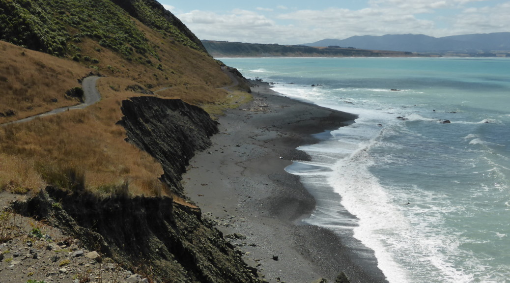
 Occasionally, the trail climbed to skirt some hills – often with signs of the side of the trail having crumbled into the sea. The trail was living up to its name – Wild Coast Trail.
 Dozers, really? Who uses ancient dozers to launch boats?
 And I’ve seldom seen such large tyres on boat cradles or such a long drawbar.
 A few baches – the word is thought to originate from bachelor, as in bachelor pad. At least, that’s how I remember it.
 We started with a short boat trip out of the Otago Harbour into the Pacific to see the wildlife around Taiaroa Head.
 Strangely, this little blue penguin was not that shy – we watched it swim around in front of the boat for quite some time.
 There were plenty of fur seals lounging on the rocks in the sun – once hunted almost to extinction for their skins, they’re doing much better now having been a protected species for over a hundred years.
 Taiaroa Head is famous for having the only mainland breeding colony of royal albatross. At this time of the year, the breeding pairs are taking it in three to four day turns to incubate the large egg while the other is out at sea fishing. We saw many birds sitting on nests and this one spread its huge wings (on average they have a three metre wingspan) and soar off into the wind. Majestic.
 After starting off on the Southern Scenic Route following the coast for a while, we stopped overnight in Balclutha.
 The south of the South Island has been rather treacherous for shipping over the years – so we did see quite a few lighthouses. This one at Nugget Point.
 More fur seals here; you can see how the coast could be problematic for any wayward ships.
 At Surat Bay we could get pretty close to the world’s rarest sea lion – but not too close as weighing up to five hundred kilograms, they can get aggressive.
 At Jack’s Bay, down another long gravelled road, we stopped to look at a large blowhole two hundred metres inland from the sea.
 While it was an awful big hole in ground with the sea rushing in – I don’t think the tide was quite right to create the proper blowhole effect. Still, it was a nice coastal walk.
 More gravel back-roads, and a short walk later we were at Purakaunui Falls – apparently some of the most photographed waterfalls in the world. Not particularly large, they are multi-tiered and quite pretty.
 The McLean Falls were more impressive, at twenty-two metres high.

 At Curio Bay we unsuccessfully tried to spot Hector’s dolphins playing in the surf. I stayed here with my family
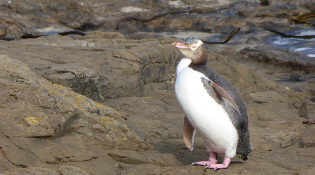
  But around the corner at the petrified forest, we did see a few yellow-eyed penguins – including this one coming out of the sea and heading to its nest at the end of the day.

 Late in the day, we popped down to the southern most point of the South Island and tried our best not to fall off the cliff into a certain abyss.
 Somehow, we found somewhere to stay in the tiny settlement of Tokanui.
 After eventually finding some fuel in Invercargill (while I expected difficulty in finding a gas station in rural Southland, the dearth of gas stations in southern Invercargill was ridiculous) we headed out to Bluff and the end of State Highway 1 (it runs the length of the country).
 Beautiful pohutakawa blossom.
 West of Invercargill we headed out to Oreti Beach to have a very pleasant picnic lunch in the sun. You’re still able to drive down the beach – the scene of some of Burt Monro’s motorcycle exploits that gained more recognition in the film The World’s Fastest Indian.
 On a wonderful summer’s day I was quite impressed with Invercargill – people that have lived there tell me it doesn’t deserve its reputation. But it is awfully flat there and a long way from anywhere & I’m not sure I could handle that.
 At Gemstone Bay, the stunning beaches just kept coming – but the sea had taken any gemstones away.
 Further around the coast, it started to get a bit more wild.
 Another, once-typical, South Island crib (a holiday house, not particularly salubrious).
 Tuatapere was a lot bigger than I remember from twenty years ago – we struck it in the middle of haymaking season with countless tractors and hay-wagons trundling past.
 This is a what a thousand-year tree looks like apparently – always difficult to capture the grandeur of such in a closely packed forest.
 After even more gravel road driving, we were in NZ’s largest National Park (Fiordland) looking across NZ’s deepest lake – Lake Hauroko, 462 metres deep. Suddenly, after the plains and small hills of Southland, there were mountains and the wilderness was starting to look inviting. While home to some of NZ’s Great Walks, unfortunately I don’t think there is much biking in the that particular wilderness.
 We stopped to look at the Clifden Suspension Bridge – once it was NZ’s longest bridge; now that many years have passed and the Manapouri hydro power station has taken a lot of the Waiau River’s flow – it really does seem a big bridge in the middle of nowhere.

 Now, there’s a house I could probably afford.
 Last stop on our little tourist trail was some exploring in the Clifden limestone caves; we then hightailed it for home, scooting across Southland and Otago.
 Looking back towards home.
 Hills and clouds.

 The views opened up, naturally, as we climbed – the reservoir in the centre.


