Getting back to northern Hawke’s Bay for one last weekend of bikepacking seemed a fitting farewell to this region I’ve been fortunate to call home for six years. It also gave the opportunity to add a couple of long dead-end roads that I’ve long been curious about, but never quite got to explore, to an already hilly 175 km loop of previously seen roads. This time there was all weekend available, across two days there was a bit more slack in the plan for any interesting diversions. Also fittingly, the only person I could convince that this potentially-mad route was worth setting out on was Pete – who’s made the most appearances in my more ambitious rides around the central North Island (notably both HBATs, HBOP, his excellent Cape to Cape (half of my double North Island traverse), and his Megas).
Catching up while watching the clear lunar eclipse, our bikes were ready for the leisurely start the next morning – straight to the bakery. Out of town on quiet highway, we were soon on Cricklewood Road. A favourite of mine, it seems to be a bit more infamous with others who have struck it at the end of a long, hot day of hills. From the top, it’s easy to see the sea thirty-odd kilometres distant and 500 metres below and think it’s all downhill – it’s really not! This was my first time climbing it and in the cool of a spring morning, it was very pleasant – almost as good as the other direction. The views soon opened up and already I was enjoying being back here and picking out various ranges in the distance, even Cape Kidnappers, and recalling other rides.
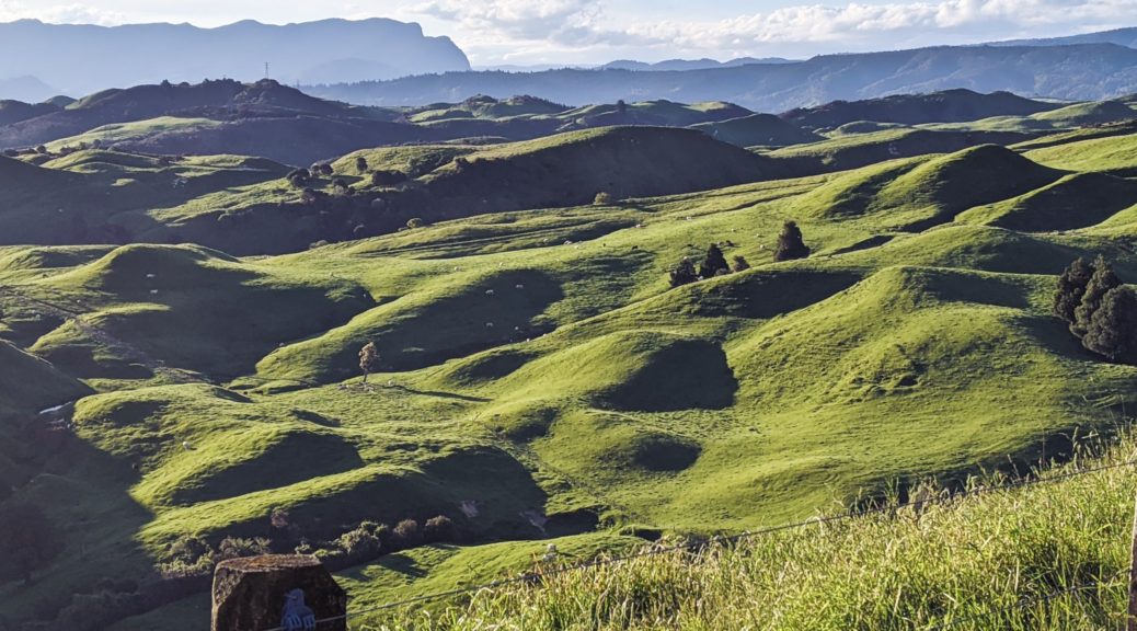
 Remarkably green for this time of year.
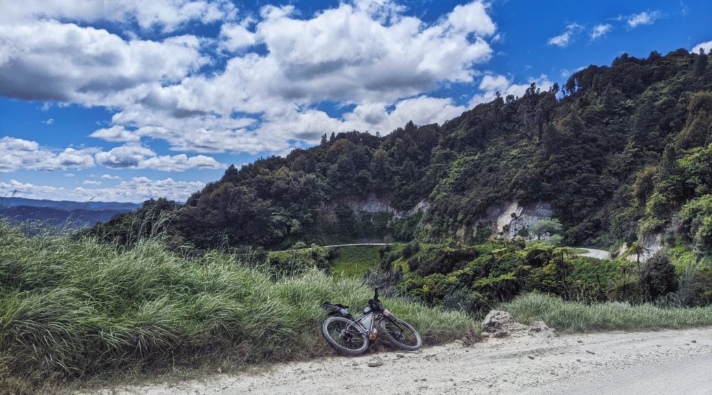
 Snaking up the ridge.
Mid-morning now, the first climb done; following a snack we hit Putere Road and descended towards the Waiau.
 Catches my eye every time I pass.
Instead of continuing all the way down to the river, we set off on the first dead-end. Getting to the end of Putere Road would provided two significant climbs and a descent before finally dropping to the river further upstream – before turning around and doing it all in reverse. What we’d find along the way would soon be revealed.
 First, a well-kept country school – water, shade, bathrooms and a very tempting pool.
 Partway up the first climb, Pukakaramea keeps an eye on Rotongaio.
Many of the hillsides had been logged since I’d last looked upon the area from afar – this really opened up the views.
 Logging still ongoing – I’ve never seen a tidier skid site!
Grovelling back up to crest before the long drop to the river, we could just hear forestry machinery making even slower progress toward us. We paused in the shade to see what it was and let it pass.
 Good thing too, that claw was big – it swung a bit closer than I would have liked as it turned off along the ridge.
 Panekiri Range on the right, I enjoyed seeing it again – this time from yet another angle. Off towards Huiarau Range in the distance, out Whirinaki Forest Park way. The road drops towards that pasture centre-frame.
A long, winding, gentle, freewheeling descent ensued. I was briefly fascinated watching logging operations in progress. Six years working for a forest products company and this was the most I’d ever seen of such things.
 Spot the log moving up the hill.
 End of the road, with this mostly amusing, slightly threatening sign.
Turning for the long climb back up, I dunked my hat in a stream as it was getting hot – I’d repeat this twice more at culverts on this stretch alone. A steady climb, it was not too bad; the second one steeper, it required a rest or two in the shade. Only seventy kilometres in, we’d already managed a couple of thousand metres of climbing – this did not bode well as the mercury climbed.
 Rotongaio again, before dropping to the shade and water of the school once more.
The steep and big drop down Stairway to Heaven soon had us over the Waiau and inspecting the domain and hall for future reference. Neither of us had taken the Ruapapa-Otoi Rd option to where it connects to Waireka Rd. We found it much steeper and less pleasant going – there was much walking as it was well hot now. It wouldn’t have taken too much persuasion to get me to carry on down Ruapapa Rd – but that’s far less interesting (i.e. less hilly). An exercise in putting one foot in front of the other…
 More hills and a different aspect of Panekiri.
Some pleasant ridge riding before dropping again as we got close to the range and then turned east to edge away from it. More walking and finding streams to cool off, the shack we bivied in early-2020 appeared far sooner than I expected – this was a good sign, as it was starting to look to me that this would be a very long day. The sealed climb to Ohuka being about the same again as the biggest we’d already done, it was very much in my mind. Resting in the shade at shearers’ quarters, we were really getting through our food – at least there were plenty of places to get water. The deep gravel, hills and heat were still taking it out of us.
Lake Rd, the main thoroughfare in the area, is not much better, some horrendous corrugations – but they didn’t last long. At least the road up and over to Ohuka is sealed – but that’s because it is so very steep. Still we rested in the shade, craving salt we finished the big bag of chips I’d somehow managed to squeeze/squash/crush into my feed bag and started the early-evening walk. I think we both had music blaring from our phones to get up that hill – a sign extra motivation was needed.
 Panekiri Bluff now into view.
 Spot the winding road going up the other side – at least that could be left to the following morning and fresh legs.
At last, the long descent to the school and the hunt for the key. I was relieved to find it – a kitchen was most welcome, as was the sick-bay bed; I’d lugged a sleeping bag and mattress all day for nothing, oh well – better to have it and not need it…
 Nice surrounds for a school.
Another cracker day dawned, we eventually departed the excellent overnight facilities before seven and went straight into the biggest climb of the day. This gravel was kinder, the morning still cool and with rested legs the hour to the top was most pleasant.
 Easy Sunday morning by this stage.
Before long we’d dropped a few hundred metres to cross the Ruakituri River at Erepeti; I was surprised at just how much of a river it is – where was all this water coming from? Apparently the largest catchment in the Ureweras, who knew? Our next dead-end would take us up the valley twenty kilometres to see a bit of that.
 Back down to where we crossed the Ruakituri.
This quickly became the highlight of the weekend – what a valley! Climbing through a reserve as the valley narrowed into a gorge, the outlook across the river was spectacular before the road dropped through farmland to the valley floor. With the river rushing (renowned trout fishing we were told) through, fine examples of layering on a lot of continental uplift were readily apparent. Plenty of cliff features to catch our attention. The gravel was kinder again – graders and new metal don’t make it up here often.


At the entrance to Papuni Station we found a few graves dating from the NZ Wars – a skirmish between the constabulary and Te Kooti, this being not far as the crow flies from where he landed after escaping from the Chathams. Papuni looked very prosperous, we stopped for a yarn with a few of the workers, maybe a manager – I don’t think they see many cyclists. It was great to hear a bit more about the area and some of the tracks around – pity I’m moving away, there are definitely more opportunities to be investigated.
Behind the houses, a nice climb up to the woolshed, a boulder field and a lot of horses before dropping to the river. The headwind while descending was noticeable, but one could not complain – soon we would turn with it at our backs.
 The gravel stopped at the base of the hill in the background.
Resting at the road-end, what food still remaining was depleted further as we speculated where one could get to from there. A DOC map board was much neglected and unreadable, shame. Back up the hill we went, eventually pushed up the last of the hill as the wind swirled around the valley.
 Back down the valley past the Papuni buildings.
Enjoying the ride out of the valley, the hills were far easier than Saturday’s and, once we’d reclaimed our seat packs stashed in some willows, we hit the seal for the fifty clicks back to town. A wee bit of climbing, and one big hill after joining the Tiniroto Rd it was for the most part heading down to the coast with a helpful wind. Warm though, an ice cream at the store in Frasertown was the first priority – thankfully I got there right on closing. From there, a short sprint back to Wairoa to finish a fine weekend, and indeed, some years of exploring Hawke’s Bay back roads and hills.
The second day easily being the reward for a tough Saturday – all worth it, upper Ruakituri Valley was a cracker and I wonder when I’ll be able to get back and explore some more. Might have to be sooner than I previously thought.


 Heading away from the highway again, this time inland.
 A shed – because we’d seen so many on this route, ranging from rustic to tumbledown. I’m sure plenty were slept in…
 Whanganui National Park, again, in the background.
 We did at least make better progress from the stream than some.
 Now, this is fun!
 Made it!

 A little pleasant climbing to start.
 Leaving the river, to cross Okara Stream and begin the climb out.
 Now you tell us.
 Finally I got to the Bridge to Somewhere! The same as the one to Nowhere, it is slightly more accessible – there is one road to it.
 The dirty Kuri joining the “clean” Whangamomona on its way to its Whanganui confluence.
 But don’t stray – there was a proliferation of similar signs all the way down the sweet Mangaehu descent.
 Looking towards where we’d, in a roundabout way, come from and wondering if there was another afternoon thunderstorm unleashing.
 The cap of clouds dissipated as the sun sunk.
 The last of the sunlight, it was a nice evening to peel off an easy forty kilometres – characterised by mostly flat dairy land interspersed with dropping into drainages and grovelling up the other side.
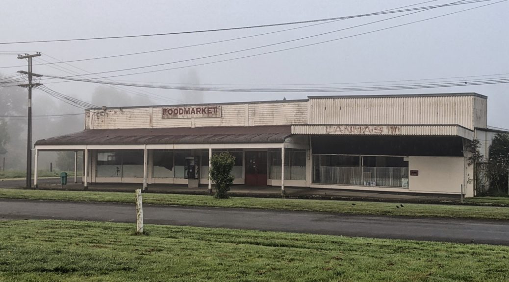
 A misty morning to drag the bikes outside.
 Long since shut, but there is a pay phone…


 Most were more courteous than others.
 The steady, bush clad climb up to the first of the day’s three tunnels is most pleasant.
 Always nice to find a tunnel near the top of a climb, knowing the last bit of ascent is not required.
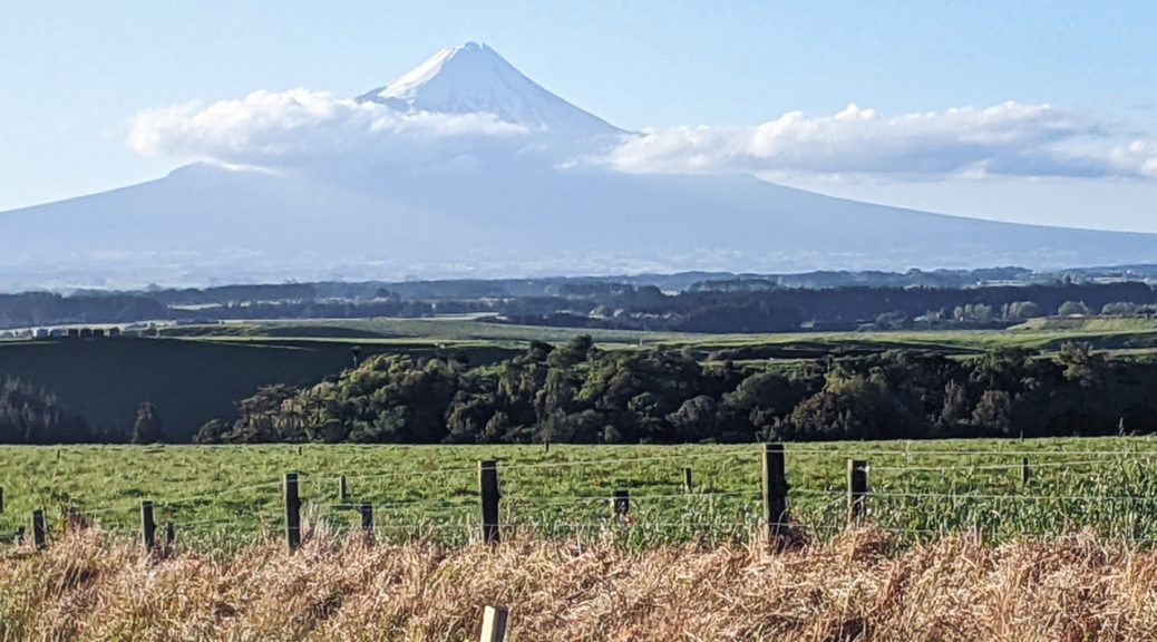
 It did reward us with our first view of the mountain, Taranaki that is.
 Bit slow with this photo.
 Clouds haven’t quite covered it yet.
 The sign seemed more about the geography than the tarmac.
 Apparently the bridge is submerged about ten times each year by the flooding river, I was pleased the river was low and the farm dry.
 Back up the river.
 Probably getting used to seeing bikepackers by now.

