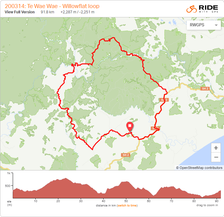
An offer of riding through a farm and potentially cutting a significantly nasty part of highway out of HBAT could not be ignored for long. With the forecast looking only a little rainy, phone calls were made and a plan hatched. Marek signed up at the last minute, possibly I hadn’t fully explained what he was getting into, I finally broke twenty minutes at Park Run this year and we were off driving north.
Ten o’clock was a leisurely time to start what could be a very tough day ride; familiar sealed road and favourite views helped to warm us on a mild morning. Thankfully my legs weren’t hurting too much. Turning onto Pohokura Rd, I was looking forward to the long gravelled climb through farmland and native bush.
 There was actually some rain overnight, odd to see a wet road – it kept the dust away and only slowed us slightly.
 This feels like it should be the top, but it’s not.
 Looking forward even more so to finding what’s at the end of the road – rather than turning onto Waitara Rd as on previous trips.
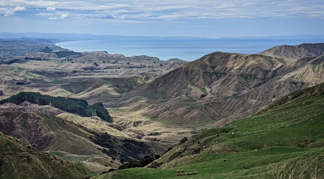
Quickly losing five hundred metres of elevation was only slowed by constantly stopping to take in the changing view of all the hills in their various uses.

 There I go, looking even smaller than is usual.
 A brief level section for the final plunge to the Mohaka.
 Heading into the valley which would take us an hour to traverse from left to right and climb out of. The Mohaka running across the shot from left to centre, the Te Hoe joining it from the background. We were due to climb that grassy face in the middle-distance, far right of shot.
 It really was looking a steep climb away from the Te Hoe.
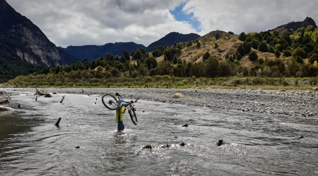
 Crossing the Mohaka, looking west and upstream.
I guessed at which track to take off the side of the road, and guessed correctly. It quickly closed in with gorse and blackberry encroaching ever further.
 Down on the river flats, the track was gone.
Giving up on the track, we turned towards the river for the shortest possible push through the dense thicket of willow saplings. No derailleurs were harmed, thankfully.
 Beyond the foliage, we could easily spy the dozer track that we were to take up the face.
Having been told that the best place to cross was five hundred metres up from the confluence, I was pleased the flats were rideable. Hearing a yell from Ian, but not seeing him, we rode upstream.

Finally I spied a quad bike and two people over the river. With much yelling and little comprehension we found a good place to cross the swift, but thankfully low (droughts are good for something it seems), river.

Safely on the left bank, it was great to meet Ian and his friend Brian. Still very sprightly at over eighty, the yelling continued due to some deafness. Introductions aside, we discussed the best way to get out of the valley – we opted for the shorter, steep dozer track. Next time, it’d be good if it could be the longer route – different views and all that.
 Ian led us across a bog and towards the steepness.
Averaging over fifteen percent, it was at times much steeper. I managed to ride the first third, but was constantly stopping to take in the expanding panorama. I’m glad it was dry, or else the whole ascent would have been a slippery push.
 Te Kooti’s Lookout just right of centre.
 West up the Mohaka.
As well as having people guiding us through and opening and closing gates for us, I thoroughly enjoyed the enthusiastic telling of stories of the land. From the struggles of the early settlers (the land broke them), to Te Kooti’s lookout and stronghold during the Land Wars and eventually the development of a sustainable farm. Now six hundred acres of the property is covenanted native bush and I’d love to get back, explore some more and see some of the huge native trees Ian spoke of.
Generously we were welcomed in for a hearty meal of mince on toast (thanks Carolyn), all the while being regaled further with stories of the farm, the area, the other farms (up near where I’d met son Ian a fortnight previous) and the large family. Bikepacking stories were offered up, but didn’t seem quite as interesting to me. Bellies full, we did eventually go on our way.
By no means was our climbing done, as the near landscape soon turned to forestry – although often affording glimpses of ranges further away.
 My game of “how far away is Panekiri?” continued – a bit further away this time.
This certainly was a decent climb, but it did plateau before another fast descent again to the Mohaka. The gravel ended for the day. Nearing the river, unusually a helicopter started buzzing around – Marek pointed out it was the rescue chopper, not a good sign.
 Pausing at the Willowflat bridge, the river was low and we marvelled at the size of some of the boulders deposited in the flow.
Willowflat was larger than I expected – that is, there were a few houses and actually people around. But my, the climb up to Kotemaori keeps on giving – steep and steady, it just keeps going. Thankfully, our very pleasant riding conditions held and it wasn’t too hot. Worryingly, a lit police pick-up passed us. I’d plenty of time to wait at the first false summit, so proceeded to devour handfuls of ripe blackberries while wondering about the Mohaka Rafting vehicle parked up – ostensibly for cell coverage. Ridge riding commenced (up and down) and seventy kilometres and two thousand metres of climbing in, my waits grew longer – but that just left more time to savour the scenery, blackberries and a staggeringly spectacular day of riding.
 Looking over towards the early part of the route.
Back on the highway, cruising down that section to Waikare Gorge is so much better and safer than the grovel up in the opposite direction. With a final few hundred metres to climb, I pushed on – rather enjoying how the hills around here are becoming more familiar and fitting together in my mind more and more. Back to the car, I had plenty of time for a cuppa with its guardians for the day – more tales of local farming history, and bike trips. Bliss; once again, I’m already scheming on bigger rides to further explore another area of the region that in a few short hours proved utterly captivating.
Unfortunately, Graham confirmed that there had been a drowning on the river, which explained all the unusual activity – sad news indeed, but also helps to appreciate wonderful days of being alive and outside.
 Also, must get back to Ridgemount…
Thanks to Marek for nine of the photos above and being such a sport on a tough day’s riding; also thanks to Ian and Carolyn for being so welcoming to their special part of Hawke’s Bay.

 Starting to look like the season is changing on Waipunga Rd, looking west to the Maungaharuru Range and the saddle we rode over the previous weekend.
 Down Darky’s Spur; twenty kilometres of gravel about to end, no vehicles to be seen on those.
 The northern reaches of the bay, around to Mahia Peninsula. Pleased to have such clear views.
 Across to Napier and around to Cape Kidnappers, not quite as clear.
 East, to South America somewhere out there.
 Across the Waikare and Mohaka River mouths north.
 As good a place as any to turn and head to ride the same hills in the reverse direction, and more resupply at Tutira.
 Part-way up the only more-concerted climb to get back to the highway.
 More signs of autumn across the Esk Valley; funnily enough, the dry conditions haven’t been in the news as much recently.
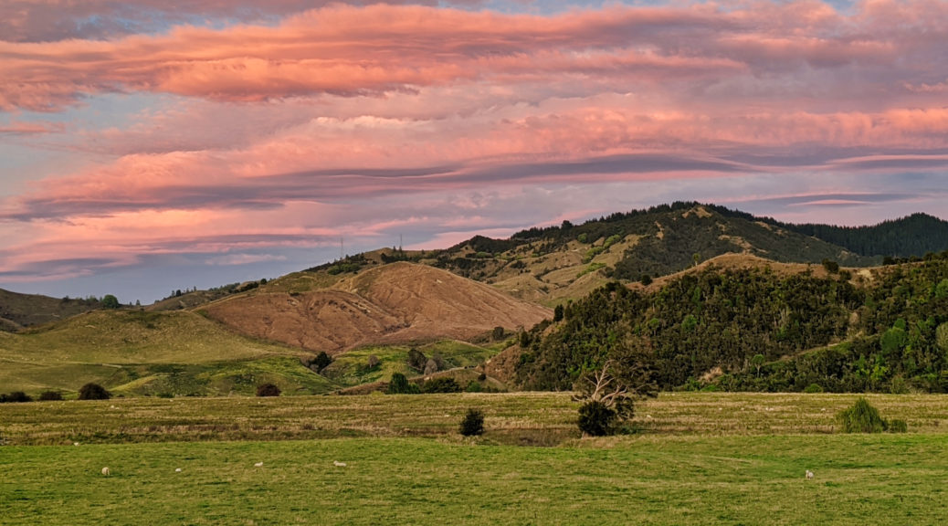
 Bonus sunset to top the day off.

 There was actually some rain overnight, odd to see a wet road – it kept the dust away and only slowed us slightly.
 This feels like it should be the top, but it’s not.
 Looking forward even more so to finding what’s at the end of the road – rather than turning onto Waitara Rd as on
 There I go, looking even smaller than is usual.
 A brief level section for the final plunge to the Mohaka.
 Heading into the valley which would take us an hour to traverse from left to right and climb out of. The Mohaka running across the shot from left to centre, the Te Hoe joining it from the background. We were due to climb that grassy face in the middle-distance, far right of shot.
 It really was looking a steep climb away from the Te Hoe.
 Crossing the Mohaka, looking west and upstream.
 Down on the river flats, the track was gone.
 Beyond the foliage, we could easily spy the dozer track that we were to take up the face.

 Ian led us across a bog and towards the steepness.
 Te Kooti’s Lookout just right of centre.
 West up the Mohaka.
  My game of “how far away is Panekiri?” continued – a bit further away this time.
 Pausing at the Willowflat bridge, the river was low and we marvelled at the size of some of the boulders deposited in the flow.
 Looking over towards the early part of the route.
 Also, must get back to Ridgemount…

 Easy, flattish seal to start.
 The Mangapoike, just before it flows into the Wairoa.
 Nearing the turn-off, I’d be into those hills soon – new roads for me!

 My obsession with seeing Panekiri Bluff from differing angles and distances continued. It’s so close here!
 I stopped most of the way down and chatted to a farmer moving some of his 35,000 sheep.
 It’s quite a gateway to the hall – from the old bridge over the Waiau. Coincidentally, the grandparents of my host for the weekend used to live in that house.
 Finally, I snapped a photo of this cute little house I’ve notice many times before.
 Towards where I’d spent the previous few hours.
 No sheep this time –
  I mean, look at it…
 Over northern Hawke Bay to Mahia Peninsula.

 Grass up the middle and very skinny road – only sealed as just around the corner were a lot of tight switchbacks dropping to the Hangaroa River.


 Celebrations started in style with the best meal of the week (copious numbers of mushrooms in there) – East End Cafe in Wairoa is exceptional. What a find (thanks Keiko) for breakfast, and so close to home.
 And views across to the cliffs towards the Waikare mouth.
 And across the lower reaches of the Mohaka, towards hills that get more and more familiar.
  Home, just over there! With a bit of over-zoom.
 Pretending that the commute-route is new to me.