Category Archives: GPS

Day Six: Dunn Creek Flats to just-Idaho backcountry

With temperatures set to climb even higher as we headed towards Idaho, we decided to get up and going earlier than we’d achieved up to that point. Best intentions and all that – it was a leisurely start before leaving at nine. A short section on the highway first up, that then crossed the river to leave us on on a deserted road all the way to Libby. As the day warmed, the only other contact we had was people out picking wild chokecherries roadside. I tasted a few – just as well they improve with cooking, they deserved their name.

Following the Kootenai River down, it was strange to see hills with a bit of grass (however brown) on them.

Having heard many trains for days, but seeing few – I finally spied the head of one of the elusive long cargo-carrying beasts as we gently rolled into Libby.

Libby seemed rather down on its heels and was the place I really started to notice yards crammed with junk pick-ups, snowmobiles and other rusting vehicles long past their prime. Getting rather hot, we headed straight for a cavernous diner and proceeded to devour second breakfast. More route planning ensued – after heading down the Kootenai Valley towards Troy would we continue to Sandpoint down low and do a big arc, or strike west through wilderness and over hills?

Three trips to the grocery store, one to the hardware store (back to trusty safety glasses as my sunglasses were slowly crushing the side of my head – well, giving me headaches at any rate), much food and procrastination later we set off into the heat. Already above 35ÂșC, it wasn’t the best time for a little miscommunication and poor navigating on my part. Nonetheless, the quiet road down the right bank of the river didn’t connect and we had to backtrack forty minutes and take the highway west. This required a gas station stop for litres of cold water. Eventually we were on the noisy highway out of town – thankfully the shoulder was mostly generous.

Thanks Smokey. The wildfire smoke seemed to roll in more in the afternoons, at least for a few days.

Mid-afternoon we reached the Kootenai Falls lookout walk; it was time for a break. The small shop and huckleberry ice cream had nothing to do with our need to stop. Monopolising a picnic table in the shade of the busy area for too long, the rest was well deserved. There was some denser shade, so while Megan walked down to the falls I watched the bikes, napped on a bench and soaked my feet in a cold stream. Bliss.

Kootenai Falls

A fraction of the heat gone out of the day, it was not long down the valley before we took the turn and headed up Lake Creek heading for the hills and the more direct route to Sandpoint. Still stinking hot, we filled up water bottles, crossed the creek and tried to find somewhere shady to rest for a while. The woods seemed rather different, but this was by the road – open, with plenty of small trees. Another big rest stop ensued to manage with the heat. Perhaps I was at a disadvantage having come from winter and not having grown up in rural NSW? Rather, I’ve always been susceptible to heat stroke and only very slowly learnt to manage that better.

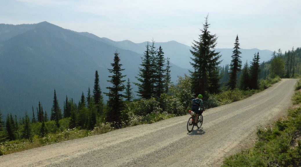
Leaving Lake Creek behind, the climbing kicked up a bit. The trees got denser, the smoke thicker and the heat slightly dissipated. Seemingly now in the middle of nowhere, we were puzzled by there, for the most part, being a sealed road to ride on. It was rather old, but in good condition on the whole. Not a single vehicle passed us as we climbed and climbed.

It was to be over a thousand metres of climbing to the top and we were wondering if we’d make it by nightfall. Should we camp at the top, or try to drop down? As it happened, we stopped to refill bottles at a creek and found a mama and two young moose with similar thirst quenching ideas. They didn’t notice us for a while, we watched. Eventually they clocked us and ran up the road a bit. Curious, there was no way they were getting off the road. Moose are big and not altogether not-scary; we called it a day at nine o’clock and slowly retreated down the road.

None shall pass. That’s OK, we weren’t really going that way anyway.
Setting up camp beside the deserted (apart from moose) road, there were no food lockers – so a first for both of us, throwing rope up to hang all our food and toiletries up a tree. We weren’t sure if there were bears around (we were close to Bear Mountain), but it seemed reasonable to think there might be and they might like our honey and mustard pretzel pieces. Still warm, it was a glorious night to be fall asleep staring up at a big Montana sky filled with stars. We may not have covered a lot of ground (and some of that was my poor routing), but it was a very hot day – definitely a day of riding I wasn’t really used to; different, but excellent all the same.

Day Five: Whitefish Bike Resort to Dunn Creek Flats

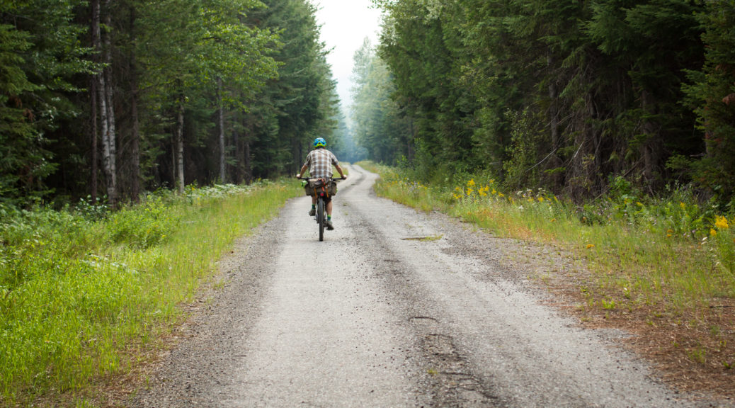
Having eaten at least the mass of my bike, if not myself, for breakfast it was time for all of our group to start packing up. We said our goodbyes and pedaled off down the access road for a short stretch on the highway – it was still nasty, but only lasted quarter of an hour. Enter Megan’s excellent selection of back roads. Mostly on gravel for the rest of the day, traffic was at worst light – but usually non-existent.

Turning off the wonderfully named Farm to Market Road we headed, gradually climbing, towards Tally Lake. With the day warming, and smoke free, a cool lake appealed. Unfortunately the only easy access was through a campground and day access involved a fee.

There may have been trees surrounding the gravel.

Perhaps even more trees.

Away from the lake, the gradient reared a little as we got further into the Flathead National Forest.

Turning onto Star Meadow Road the road was suddenly and unexpectedly smoothly sealed – another deserted road, it existence seeming well out of place, we took it as a fantastic roadies’ road. It was a very nice interlude.

Star Meadow? I’ll assert so. Once again, the hay bales were beginning to congregate.

Leaving the grassland behind, our route kept us heading west with some gentle valley floor gradient before climbing through old burn zones.

Occasionally there were even trees that were not pines. Either way, they were useful for hiding from the beating sun.

The pass was just over 1500 metres high and gave way to a beautiful and sustained descent. Losing all the elevation gained that day, we crossed yet another railroad and found Wolf Creek at the bottom of the valley. Time for a pleasant mid-afternoon rest and water top-up. Also, there were huckleberries! Bushes and bushes of them; even better, there were no bears. Or wolves.

Now into the Kootenai National Forest, we had to choose between a longer, sealed and generally flat route to the campground on the Kootenai River – or a more direct path, that just happened to have a six hundred metre unsealed climb in it. It was warm, but there was plenty of daylight left – we chose the backcountry option. The two hour climb was steeper than earlier in the day, but manageable. In fact, slowly spinning up the hill being shaded by big trees as their shadows lengthened was thoroughly enjoyable.

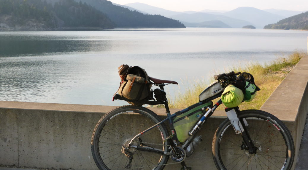
My new bike may be a bit more of a poser than my previous one.
Climbing done for the day, we had ourselves twenty kilometres of downhill gravel bliss to whoop and holler down. All the noise was in part calling to alert any bears in the neighbourhood to the presence of two people have a grand time speeding down hills on loaded bikes. I finally added some sort of substance to my bear call.

A short section on the highway took us alongside Lake Koocanusa and to the top of Libby Dam.

Having dropped from the highway all the way down to the bottom of the dam, a brief trail led downstream to an expansive campground. Choosing a site next to the river, it was time for a dip, to cook dinner and collapse after a most-excellent day through big, deserted country.

Day Three: Red Meadow Lake to Whitefish Bike Retreat (and Day Four: WBR Rest Day)

With a short day on the cards, it was a leisurely start to the day. But perhaps we just slept in and enjoyed taking time in the beautiful setting. A slight climb took us up to 1700 m and from there it was pretty much all downhill to Whitefish – where we planned to rest, eat and resupply before carrying on to the bike retreat. Whizzing down the lush gravel – what great fun; fun which was interrupted by a wasp taking exception and stinging Megan on the ear. Ow.

Within a couple of hours the metal road and easy descent was over and we joined the seal around Whitefish Lake. Also out of the wilderness, we couldn’t actually get down to the lake due all the private property graced with the most ostentatious houses we’d see all trip. Contenting ourselves with views across the lake to the hills behind, and knowing the general direction of the bike retreat, we wondered where along those hills we would be going – I may have also been watching the busy railroad a bit too. Looking at the map now, I see we weren’t too far from the ski resort for which Whitefish is known now – explains the houses a bit, if the lake views weren’t enough.

The road around the lake turned out to be a roadies’ favourite, we were passed by many as slowly the density of buildings increased. A bridge over a large rail yard put us right in town. Amazing crepes were found and devoured, a hardware store provided rope for hanging food out of reach of bears and much food was bought at the grocery store. Eventually we rolled out of town, it was warm, it started raining and we realised neither of us had eaten enough and were actually quite tired. We returned to refuel and rest out of the rain. Salubrious.

Keeping our break to less than an hour, off we went again. Always keen to take back roads, we had a few hills to get over. So nothing was thought as we climbed steeply in the heat up a residential road. Only when a big gate barred us from more big lots and houses did we have to accept that we may have not quite followed the right route. Not wanting to go all the way down, a small cut-through was spotted on the map even further up the hill. Not knowing if it connected, we took a chance and ground our way further up under the beating sun. It connected, just.

Stopping for more food we cruised down a smooth private road, didn’t really find the trail proper crossing the road, ducked around another gate and found the trailhead. I wasn’t keen on pushing through singletrack when we were tired, hot, heavily loaded and didn’t know how technical it was. What an error – the highway was awful and Megan soon found a side road to put us back where we should have been, on singletrack.

Should have gone down here… Now we’ll likely never know what it’s like – but if the rest of the trail is any indication…

The singletrack was so much fun! It was also a big relief to be away from the traffic and in the trees. Both of us were thrilled to be tackling small pinch climbs on smooth trail and flowing down through the lovely curves; generally having a ball on loaded bikes and quality trail.

Honestly, I was having fun! One of the highlights of all the riding. I’ll just say it’s my concentrating face.

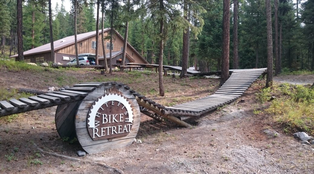
Eventually, we saw this welcome sign – we were close.

Checking-in, it was definitely time for ice cream. We made it to this special little part of the Montana wilderness (admittedly, you can drive there – but we biked in on singletrack, so it felt like backcountry). Set with longer distance trail connecting it, the retreat has a lodge, numerous tent sites, other facilities, its own little network of singletrack, a pump track and a whole lot of bike-themed things.

After the rush of getting to Fernie to start the ride, adapting to life bikepacking again and the heat – a day’s rest was well in order. Much time was spent eating and socialising with friends of Megan’s that had driven down from Alberta & BC. Avoiding wasps every time we ate was also a recurring past-time. Our bikes devoid of luggage there was a bit of fun to be had on the retreat’s trails – but mostly it was eating and resting on Sunday.

Day Two: American Flathead to Red Meadow Lake

Excited to be heading into the wilderness, after a large breakfast we stocked up on food for the next two days and hit gravel soon out of Eureka. Steadily heading up the Tobacco River valley, shortly after crossing the river we were on highway briefly and then off it again heading for the hills. As the climbing began in earnest and farms were left behind for national forest, it was expected that we’d be rolling on gravel. Strangely, the sealed road just got smoother as our elevation climbed.

Traveling far lighter than other cycle tourists (they generally had far larger routes planned), they were hauled in at our steady pace. It turned out that there were so many other cyclists, we couldn’t possible remember all their names – over about two days we met about twenty-five others. Some we chatted with for quite some time, some briefly and others just exchanged greetings. Plenty of interesting folk out riding bikes.

Shortly after meeting some Alaskans, the seal ended and the gravel began – that, I think, was entirely coincidental. A pleasantly warm day, it was nice to be in clearer air than the smoke-stained skies of British Columbia. At least, it meant we could actually see the view in the distance.

There may have been a lot of trees.

The surface was fantastic and the gradient mild. Things opened up a bit where avalanches had long since cleared the slopes.

A feature of the trip was the many different varieties of wild flowers roadside.

You know, a few more trees. Who me? No, I don’t work for a forest products company, not at all.

Eight hundred metres of climbing done, it only seemed fair to stop at the top of the pass and eat. Also, it would be rude not to chat to more passing cyclists. The downhill was long and also mellow – all the better for looking at the views.

The west side of the spectacular Glacier National Park came in to view. It was easy to pick the patches of forest that had long since, or recently in some case, been ravaged by wildfires.

Being in the mountains so much, we were never short of water sources – water treatment drops were used, probably mostly unnecessary but how can one know?

One of the woman from the top of the pass, Sarah, passed us as we stopped to fill bottles. A novice, she was hauling an extraordinary load – worryingly all carried on the rear of the bike. Shortly after, we were confused to come around the corner, see another cyclist standing on the side of the road and some other guy (no vehicle in sight) who must have apparated there . Eventually we recognised Sarah – that was difficult initially as she was covered in an unhealthy amount of blood. She convinced us she wasn’t concussed and the other guy’s family had driven off to fetch her friend – turned out he wasn’t a wizard, disappointing. We couldn’t do any more than had already been done, so carried on – bike helmets really are quite useful.

The road flattened out as we headed for the Flathead Valley.

It became apparent we were out of the national forest as Private Property and Posted – No Trespassing signs started and we noticed increasing numbers of cabins in woods. Riding south along the Flathead, I’m told it was a lot less remote than the Canadian Flathead.

We never quite sure how many of the cabins and houses were holiday homes, permanent homes or properties of survivalists/preppers. Thankfully the road was still quiet and most traffic, except the FedEx pick-up, courteously slowed for us.

Mid-afternoon we turned away from the Flathead River and started towards Red Meadow Lake – the highest and end point for the day. Stopping again for snacks near a small pond, it may have been the first time we partook of one of the most common delicacies of the trip – frozen burritos. Bought frozen at the start of the day, usually from a gas station, these are much mentioned by GDMBR riders – they gradually thaw and then warm over a hot day, ready to eat heated mid-afternoon (depending on how hot the day is). Another one of those things that taste OK, but it pays not to read the list of ingredients.

A mostly gentle climb up more pristine gravel with even less traffic, it kicked a little for the final section before we rolled ever so slightly down to the lake.

What a pristine spot for a campground nestled between lakes and mountains.

We shared a campsite with Johnny, a young Swiss guy riding the GDMBR – well, a large part of it in the time he had. Understandably, he was tiring of all the beautiful mountains – not really traveling to see places just like home, he longed for flat, open lands. He was quite taken with how little we were carrying and determined to shed some of the many kilograms he was carrying.
The dust of the day washed off in the lake, local fisherman met, exuberant young dog pouncing avoided and sick of mosquitoes – it was time to call an end to a fantastic day on bikes in beautiful big country. It was much quieter and cooler than the previous night, far better for sleeping.

Thanks to Megan for the photos of me riding.