Category Archives: GPS

Short Easter rides

Three out of the four days off work for the Easter break were surprisingly fine and sunny – which, after the wet winter we’ve had, is more than one hopes for. So in amongst sorting out details of what promises to be a very busy May, I managed to get out for two very good rides.

Good Friday served up what was the most fun ride I’ve done in ages. Nothing spectacular, especially compared to rides this time last year, but the riding around Winchester was remarkably dry (two weeks ago we got proper soaked on the South Downs Way) and I even came back with dust on my bike – & as an added bonus, it didn’t need a hose down. Out with Dan & Chris, we took whatever bridleways took our fancy, found some really enjoyable singletrack, and sessioned that. Of course, there was a good lunch & a satisfying pint at a pub somewhere along the way – Otterbourne, I think. I do enjoy a nice ride around Winchester – it’s very pretty, if not particularly hilly.

Since the last time I visited Andy, he’s gone & shifted out of Bristol – this time conveniently right on the edge of the Mendip Hills. The Mendips, when the limestone is dried out & not gloopy, provide much quality riding. On that last trip I stopped en route & explored a bit by myself. Somehow Andy & Jo have managed to buy a brand new house pretty much in the middle of Winscombe – with plenty of space & nice views I was suitably impressed. Well-fed, there was plenty of time now that sunset is late, to explore the village a bit to walk off dinner.

It was another very enjoyable ride out in the sun – starting off on the Strawberry Line (yet another victim of the Beeching Cuts repurposed as a shared cycling-walking path) before turning sharply up Crook’s Peak – Andy was keen to ride up here for the first time. It was worth it with some nice views, although Wales was a bit obscured by the haze, and good fast descending. Back on the flat, it was in to the outskirts of Cheddar before climbing up on to the hills a bit. We missed a turn so found another route near the quarry – probably a bit steeper than we bargained for, but not too bad. It was an OK detour as it turned out most of the route we rode I had done on my last visit – albeit in reverse.

With a more-planned excursion into the forest to sample a bit of the many small sections of singletrack done, it was a gradual climb along the top to the highest point on the Mendips – Beacon Batch.  A gradual whiz downhill had us closer to Cheddar again, near the top of the gorge. There was about a hundred metres of elevation to gain up a rooty hike-a-bike before we could ride to the edge overlooking the gorge. Unfortunately, there were many people out enjoying the sun & views so the blast down in to town was a little tempered by scrubbing of speed so as not to frighten anyone too much. Back home on the Strawberry Line to a kitchen filled with wonderful baking aromas.

The Shipwrights Way

With the January & February weather being so dire, my motivation to go bikepacking was low – lest I float away in the middle of the night. March has been, in comparison, very dry so far & the floods have receded in many places – so it was time to load up the bike and head out for a long ride, camping overnight. A couple of weeks ago I stumbled (online) across a new long-distance path (at fifty miles, it’s not that long) close to home in east Hampshire – The Shipwrights Way. Starting in the Alice Holt Forest, near Farnham – the trail uses bridleways, rail-trails and quiet country lanes mostly to follow an imaginary path that ancient oak trees would have taken to Portsmouth to be used in the building of medieval naval vessels.

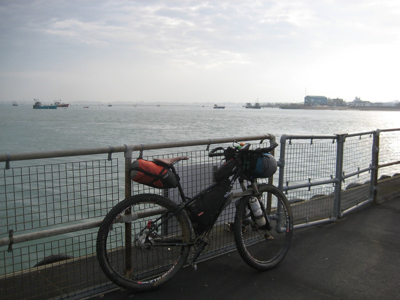
It seemed an easily doable out & back overnight trip – I decided to start at the end (Portsmouth) instead of the beginning as it was quicker to drive there (I couldn’t be bothered being restricted by train times) & meant I was more likely to be wild-camping in the countryside rather than the city. It was easy enough to find free street parking near the seaside in Southsea at eight o’clock on a Saturday morning, I was soon riding along the seafront in the unforecast sun. This first section (for me, actually Section 12) of the ride was soon over as I was waiting for the small ferry to take me to Hayling Island.

Waiting for the Hayling ferry

Most of this part of the route (Section 11) follows a rail-trail, Hayling Billy, so it was easy & pleasant riding – with views back over the harbour. Crossing onto the mainland I was soon riding through the town of Havant – hoping I’d be in the countryside soon. Sure enough, it was country lanes & then a bridleway (an ancient drovers’ road) into the village of Rowlands Castle – the castle is ruins now. The next section (8) paralleled the main London Waterloo-Portsmouth railway line (a lot of the route didn’t stray too far from this, & I crossed it numerous times) north surrounded by fields. Plonked in the middle of one of those fields, on a slight rise & seemingly quite isolated was St Hubert’s Church – built in 1053. For a couple of hundred metres north of Finchdean the whole width of the road was completely underwater – a slow pace was best for not getting soaked; sandbags were still to be seen, as were pipes carrying pumped water to drain from numerous properties – it hasn’t rained for two weeks, it must’ve been very wet.
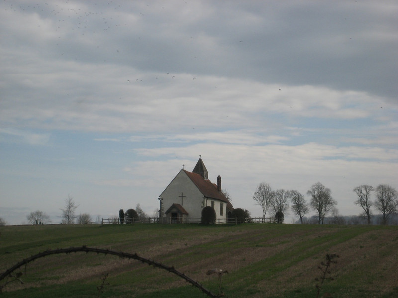
St Hubert’s church

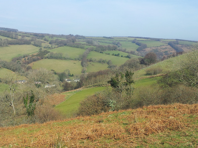
Having left the coast some time before, I had been climbing for a while – albeit gradually. As I was expecting from a previous visit: as soon as I hit Queen Elizabeth Country Park (QEP) there was the biggest climb of the entire route, not the most fun with a loaded bike but easily manageable. This coincided with the sun getting higher & me getting noticeable hotter. I finally saw my first of the twenty new sculptures along the route – each relevant to history or wildlife of the particular area they are set. Of the twenty, I only saw about five – eight are yet to be installed yet, but I still missed quite a few. Immediately behind the sheep sculpture, the trees had been cleared to give a nice look over the downs.

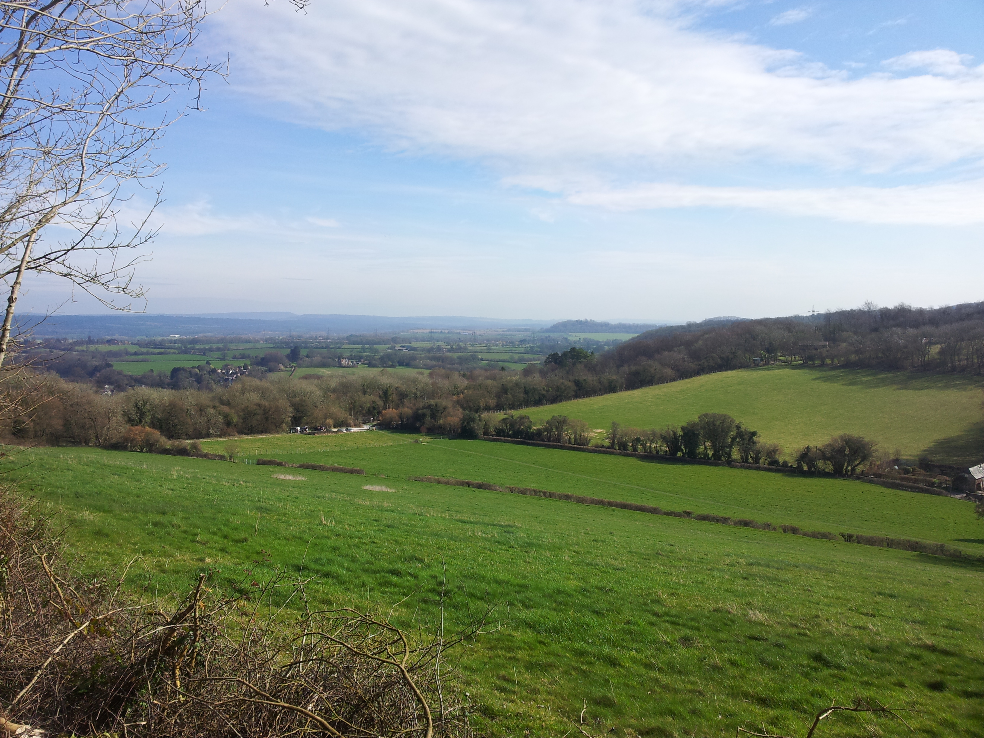
Looking out over the South Downs National Park from Queen Elizabeth Park

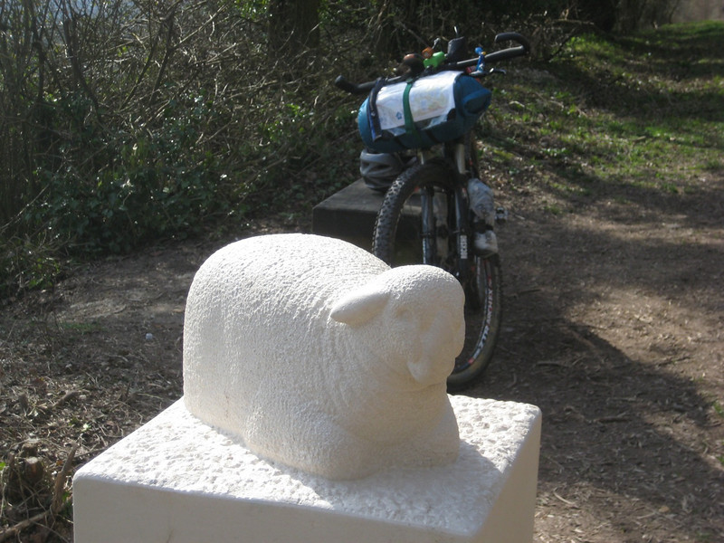
The first I saw of the many new statues on the route – a Hampshire Downs sheep

It was a steep downhill section past chalk pits hundreds of years old (of which I enjoyed reading the industrial history) to the village of Buriton before a mostly sealed section into Petersfield – which handily had a market to provide me with lunch.
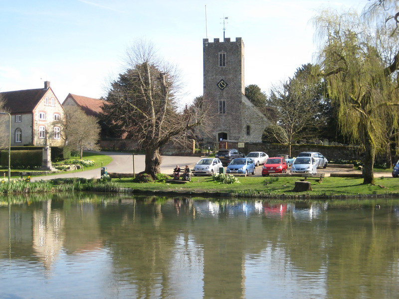
Buriton

Crossing under & over the busy A3 and then the railway again, into Liss I joined another rail-trail. This time, it was through a nature reserve & used to be the Longmoor Military Railway – that used to go from the mainline at Liss to the large military camp at Longmoor. At one stage it was a seventy mile length of track & saw a huge assembling of rolling stock to go to the continent after D-Day. I was still finding evidence of large sidings in woods many miles north. Annoyingly, the route is not yet established for Section 4: Lindford to Liss – so I tried to find a more direct way than the main roads. This involved some slightly damp off-road cycling trails & then I found myself on footpaths – footpaths aren’t a good idea with a loaded bike as the gates are extremely difficult to get a loaded bike through or over.

Most of the rest was through Alice Holt Forest, which was well frequented by families enjoying the sunshine – there’s also a very large adventure type playground that seemed very popular. I didn’t stop as I feared I’d not be able to weave out of the melee of kids if I did. Shortly after I reached the end (start) of the route at Bentley – stopping briefly for croissant, cake & ginger beer I turned to see how far back I could get. With eight hours of travelling time for eighty kilometres, I figured I could do the easier overall-downhill direction in six hours.

But as I’d dragged my camping gear all the way it seemed a waste of effort to just return to the car & drive home that night. So I had steak dinner in Petersfield and continued in the dark to QEP. Well dark by now, my dynamo (in the hub of my front wheel) powered k-lite front light was super bright & more than enough to light up the trail & blind oncomers; the charging system worked well in the day either charging AA batteries for my GPS or charging my phone (via USB). The steep climb up past the chalk pits was tough for legs that aren’t used to twelve-hour rides carrying a heavy load. At the top of QEP, after startling a large herd of deer, I found the picnic shelter that I’d noticed early in the day. With no one about, three walls, a roof and relatively flat woodchip floor was good enough for me – no need to put up the tent. In bed by nine, I was later woken a noisy pack of cubs (of the marauding boy scout variety) out hiking to an unknown (to me) campsite. Much to my relief they continued on after noticing the bike & strange man sleeping in the shelter – they were rather noisy.

An even more stunning day dawned Sunday – I was fed, packed up & riding by quarter past seven. I was right – it didn’t even take me two hours to get back to the car, although I opted out of trying to get the ferry as I couldn’t be sure I’d make it in time & then not have to wait an hour for the next one. I’m glad I wasn’t out long as I was much-overdressed for the sun & heat. Even so, I dumped my heavy load of camping equipment in the car & enjoyed a pleasant ride along the waterfront to the end of the route in Portsmouth at the Historic Dockyard. I always like the naval history in Portsmouth & I saw some different things compared to my previous visits.

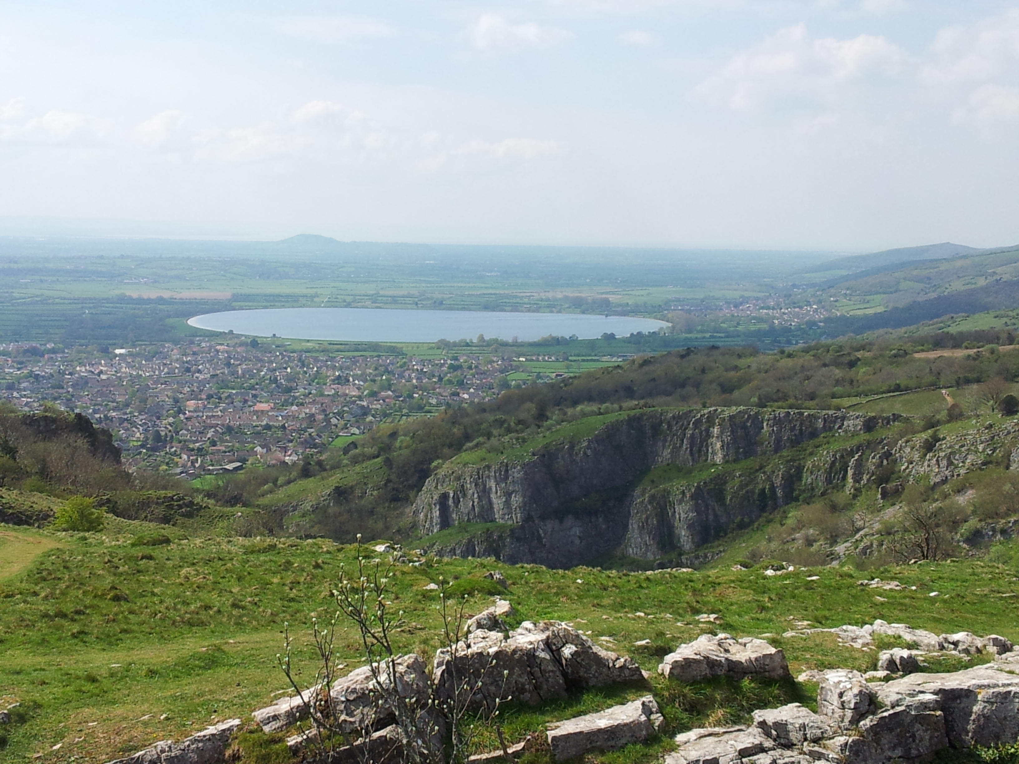
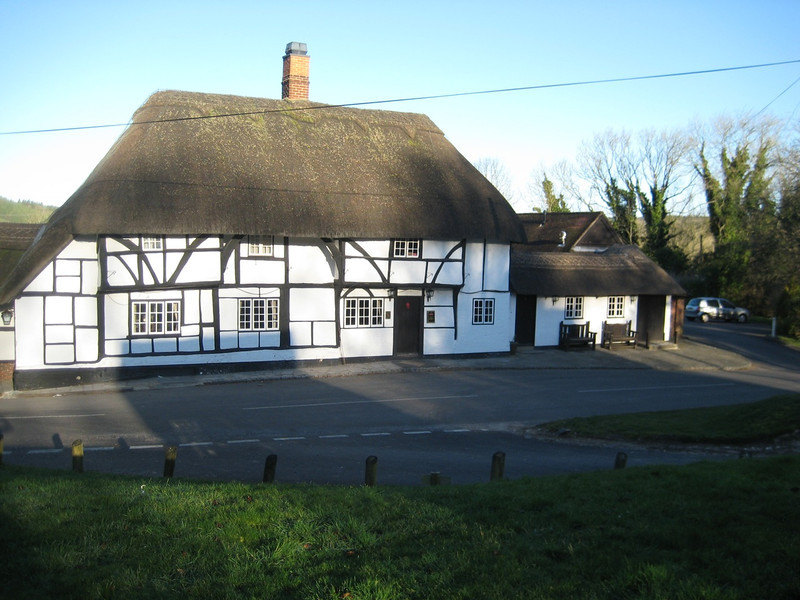
A little off the route at Chalton

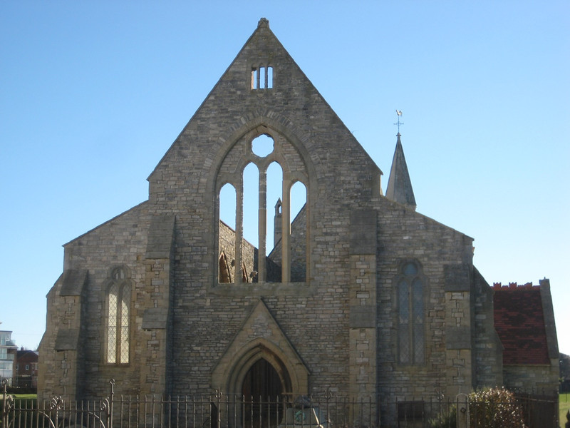
Royal Garrison Church, Portsmouth – fire-bombed in WWII, part of it is still roofed

So a great ride all-up, although I wouldn’t recommend it for the mountain-bike trails – I would recommend it for a mostly easy ride to link together a lot of interesting history, nice villages & scenic countryside. There’s so much I missed by not stopping more, I think it would be quite a pleasant walk if one was so inclined. Now to find the next overnight trip around Hampshire/Wiltshire/Dorset or somewhere suitably close by.

Combe Raiders in Exmoor Mud

After I managed plenty of long solo rides in January, it pretty much rained all of February – a lot. While the flooding in southern England didn’t quite touch home, it was wet enough that I hardly rode & instead completely rebuilt my bike. It was even worse over in the Somerset – the home of the Combe Raiders; so come March, most were itching for a decent ride. Not deterred by words such as “big”, “epic” and so on, eight of us assembled in Wheddon Cross on Saturday.

Moving towards a bikepacking set-up, I’ve been riding this year without a backpack – after ten years of using a Camelbak, it’s refreshing to not have a few kilograms of water, tools, food & clothes pushing me down into the saddle. But with all those thing now on my bike somewhere, it does look as I’ve got some big expedition planned – even if I’m carrying no more than I would usually on a ride. Consequently, there was much associated ribbing. Strangely, being the out-of-towner I ended up leading the ride – never something I really enjoy in a large group as I find it hard to set a pace suitable for everyone.

The day was supposed to be brighter & warmer than those past, but it didn’t start that way. There was the biggest climb of the day first up – partly on road then up the rest of the sodden hill to Dunkery Beacon. Reaching the beacon (which is not a beacon in the shining bright sense of the word) we found it was blowing a fair gale & I discovered that a frame bag in a huge crosswind just serves to turn one’s bike into a sail. I struggled to reach the top. I’ve yet to find a suitable handy place on my new set-up to stash my camera, so most of these photos are from John. He seems to like black & white, on the plus side there are a few of me on a bike.

IMG_0417
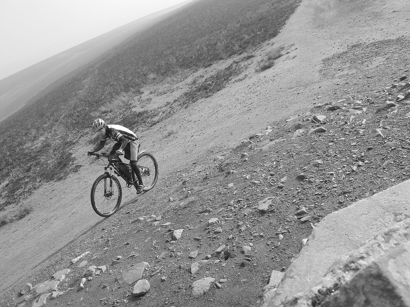
No backpack – trying to stay upright in the wind

IMG_0420

After that seven kilometres was over, it was pretty much downhill for a long time. The first part was great fun, even if the intense wind meant we had to pedal for most of it. Eventually we dropped down enough to get into the shelter of the hills & no longer work for the loss of altitude. The first & largest part of the ride finished in the village of Winsford, after we’d crossed the River Exe & followed it down for a while. At twenty-five kilometres we’d made reasonable progress in just over two hours and it was brightening up. Even though the village store had closed but eight minutes before, the proprietors were more than happy to reopen for eight hungry mountain-bikers – we promptly ate them out of pasties.

IMG_0426

Of course, after all the descent – we had to climb out of the valley. There was a lot of grass & some nice steep climbs that spread the group out well (not to mention tired a few out). We saw a large hunt in the distance – many in red coats on horses with a pack of hounds (“release the hounds”), but no foxes in sight any more. What was more amusing was the masses of spectators driving around the country lanes with walkie talkies – what exactly was going on & what the attraction was I’m still not sure (but then traipsing slowly up hills on bikes getting covered in mud probably holds even less attraction for most).

IMG_0433

IMG_0442

The climbing stopped a while as we followed the contour along the edge of a very wet & muddy ridge. With a good fun descent we were back in Wheddon Cross. We should have carried on & done the third leg – but as some of the group were noticeably flagging & getting just a little grumpy, I cut this out & took a more direct route home (much to my chagrin). Unfortunately it had a big steep climb & then an awful lot of mud for the final push up to the car park. A great day out (even more so when we lost the early gale) in the sun, beautiful countryside & good mates – nice to have some company on a longer ride.

Back to John & Anna’s for bike cleaning, a spot of dinner, a few games of cards (haven’t played Monopoly Deal for a very long time) before I faced the late two-hour drive home for the next day’s event. Some time ago I volunteered to be a lead mountain-bike to show the route for the frontrunner in a off-road half-marathon for charity in the New Forest. I scoped out the course last weekend, found it rather water-logged & boggy and then was told the route had been changed to something less wet. As it happens, another rider & I led a rather quick guy through a seventy-three minute half-marathon – it looked like hard work running, but it was pretty easy riding. The other six hundred-odd runners were four or minutes behind. Also, it was the nicest day we’ve had in months so I was pleased to have had a reason to get out early & enjoy it – especially for a good cause.

Whitchurch, Watership Down & Basingstoke loops: Hampshire Off Road Cycle Trails

Looking for somewhere else close to home to string a big off-road loop together, I happened across the Hampshire County Council’s page dedicated to off-cycle trails.  Almost two years ago (my last ride before shoulder surgery) I did the Whitchurch loop & so had some idea of the terrain involved & what I would be getting myself in for – nothing horrific.  I also remembered that some of the loops connected to each other.  So with a bit of printing, I was ready to hit the Whitchurch, Watership Down & Basingstoke loops – I hoped that this would give me about eighty to ninety kilometres of mostly off-road riding through some nice villages & with a few more hills than last week’s New Forest ride.

Being the least distance to drive to the loop (a shade under forty miles), I parked in the free car park in Whitchurch (Bell St, just west of the main junction in the village). The day was the pick of the weekend’s forecast weather, so I was hoping to get around before the late-afternoon rain turned up. After all the recent rain, everything was sodden but it wasn’t too hard going to start with. It was odd riding through villages & farms that I bothered to stop to take photos of two years ago. There wasn’t the need this time.

The long downhill to cross the A34 was very tricky as it was extremely muddy, rutted & slippery. The trail actually crosses the busy dual-carriageway here – but there is a permissive bridleway along the edge of a field to an underpass. I thought this was a good idea until halfway through the puddle in the underpass. By the time I got off my bike, I realised it wasn’t so much a puddle as a pond & I was standing in rather cold water up to my waist. Quickly hoisting my bike (large tyres sure help with buoyancy) out of the water I reassessed & ducked around to the right of the end of the tunnel & clambered up to the edge of the road through too much blackberry. End result was I had to ride the wrong way along the edge of the road, & my shorts were soaked. None of this was a problem – the largest inconvenience being that the maps in my pocket were now soaked; they were still readable, but required a little more care in folding & unfolding. My advice whatever the weather – see if you can cross A34 through the traffic – there is a gap in the median barrier; it’ll save a tedious detour & perhaps getting very wet.

Soon I was climbing up to Watership Down & new trails. At marked point 11, I continued straight on Wayfarers Walk (instead of turning left on Meadham Lane) as this provided more bridleway & less road. It was muddy & slow. I was about halfway through the ride a little way into the Basingstoke loop, this is graded as moderate (not strenuous) so there’s a bit more road & it was nice to get away from the mud for a while & the path crossed the Test and railway numerous times. Rejoining the Watership Down trail at Ibworth, the next section after Bailey Hall Farm was truly horrendous energy-sapping claggy mud for a mile and a half. Not much fun, but all ridable.

Stopping in the village of Kingsclere I had a few energy sweets (I ate very little on this whole ride, which is rather unusual) before heading off on the road towards Sydmonton & to finish the Watership Down loop & rejoining the Whitchurch one. I turned left before Sydmonton to miss out points three to seven on the map – because I don’t like repeating bits if I don’t have to & the wind was really picking up & a big black cloud was making its way ominously from the south east. Up on the ridge, the wind was rather extreme – I’m never a big fan of having to pedal downhill. Turning on to the Caesar’s Belt of the Portway (part of the old Roman road that used to run from London to Weymouth – so it’s dead straight), I turned in to the wind & it was a hard slog. Thankfully the rain that fell was only a light drizzle for a few minutes – not enough to put a jacket on.

There was a few miles of road back in to Whitchurch where I could load up the car & get out of the rather muddy clothes. A good day ride with plenty of mud to burn a bit of extra energy – and at eighty-five kilometres, my estimation proved correct.