Category Archives: GPS

Lusk Pass – Jumpingpound – Cox Hill – Lusk Pass epic

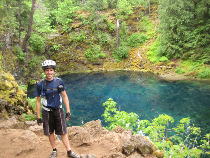
I was surprised to learn earlier in the week that Emma & Brent were going to be up around Canmore so soon in their big American roadtrip (we saw them mid-June in San Luis Obispo, CA) as this weekend just gone. But they managed to get up here just in time before I go back to London next week (which I’m not looking forward to so much after the last few days’ news) & I was very pleased to have my first Kiwi visitors to Canmore. A lot of Saturday evening was spent sharing roadtrip & mountain-biking stories – I hope we didn’t bore Megan & Alex too much. A small period of time was given over to discussing the ride we were to take them on the next day. My favourite ride from last summer was Jumpingpound Ridge & Cox Hill, so I was keen to show off some good backcountry riding in Kananaskis Country. I think Alex has been missing big rides this summer – he wanted to go over Lusk Pass to start & finish the loop (making more of a lasso). We, perhaps naively, were up for this.

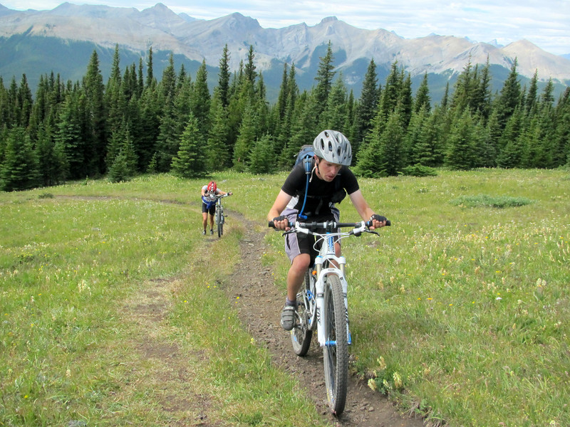
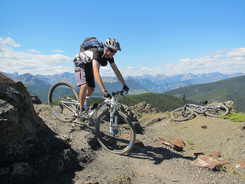
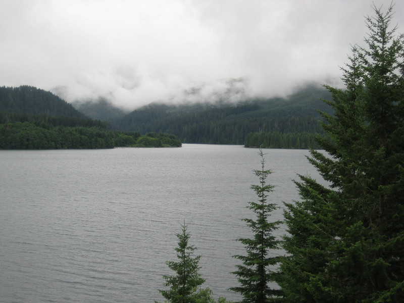
Parking at the University of Calgary Barrier Lake Field Station, we were soon climbing up towards the top of Lusk Pass. It was mostly double-track (we followed the Trans-Canada Trail for a while towards Baldy Pass) & steady climbing. However, near the top of the pass it got really quite steep & so loose in parts that we were all walking. I was beginning to think that we were spending a lot of energy that we would want later in the day. Nonetheless, we had a little descent from the pass to the road, Powderface Trail, where we turned south & headed ten kilometres or so to the trailhead. We were fortunate to have a thin layer of cloud keeping the sun off us & not much wind to contend with.

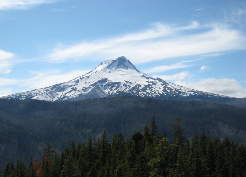
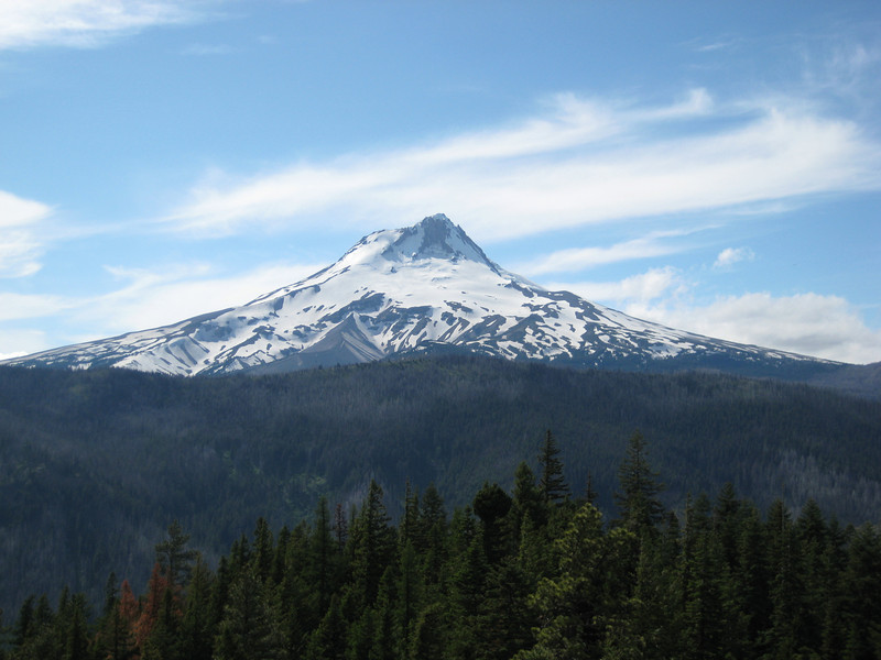
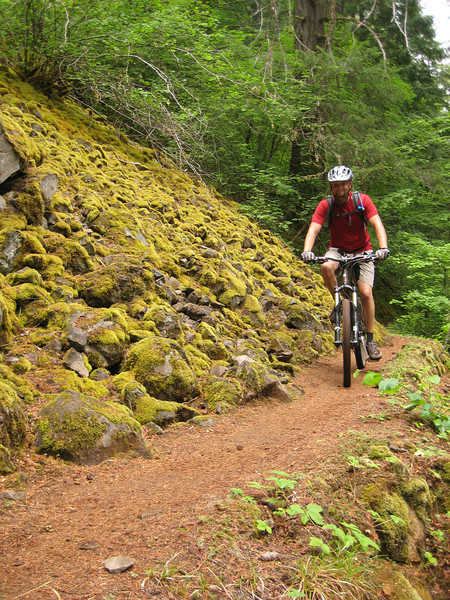
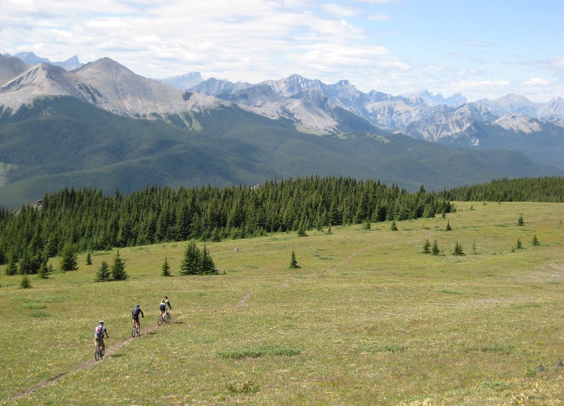
I covered most of the trail last year, but that climb up to Jumpingpound Ridge is still brutal. Looking back on my last trip report, I think I was able to ride the same as last year – but the big wheels made it a bit easier & less energy sapping. We all kept a good pace up – well three of us kept a good pace & Brent was noticeably ahead of us as he cleared everything. That hardtail with a single (30T) chainring obviously works for him. The rocky part along the ridge was definitely easier for me on a 29er; soon we were out of the trees & at the summit as the clouds cleared & we got the views we deserved.

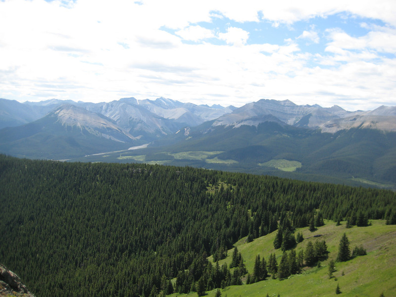
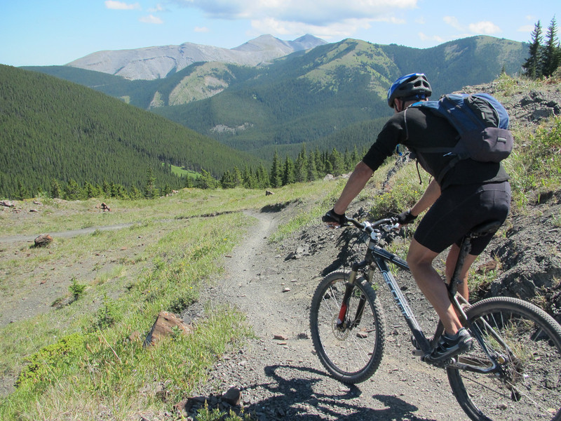
Before long we were snaking along the ridge – the lack of wind compared to last year was great.

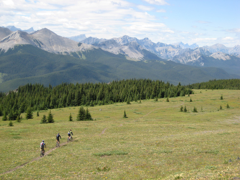
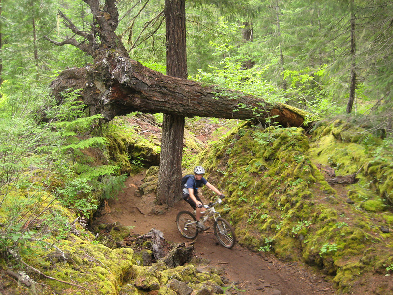
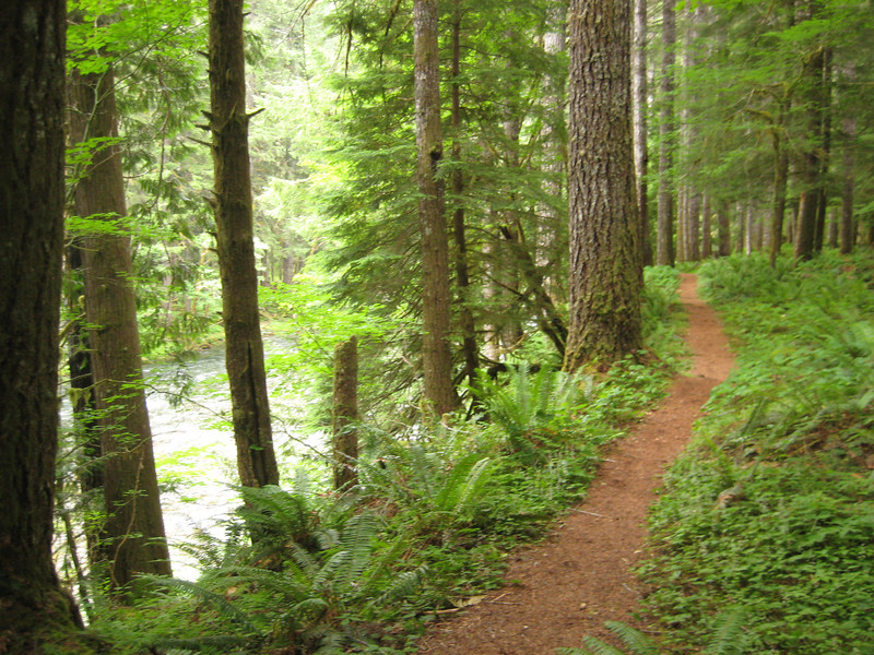
After the ridge-riding, the trail drops nicely through a couple of hundred vertical metres & is great fun. There’s a few rocky bits & small periods of unobstructed panoramas.

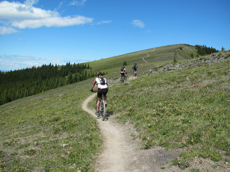
Can you tell I was enjoying myself?

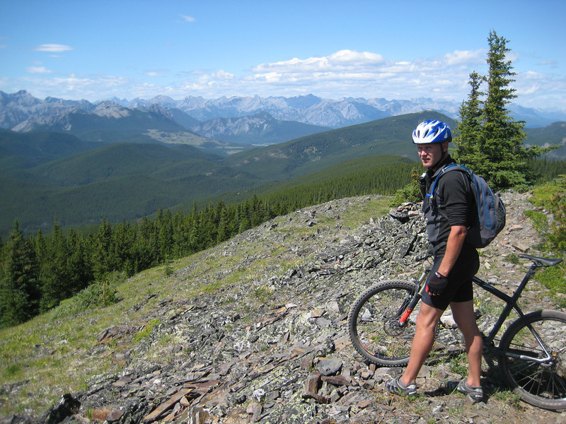
It’s more steep climbing to regain most of the altitude just lost to summit Cox Hill. That first Lusk Pass bit must have had me tired, because I feel that I didn’t ride quite as much as I did last year & this time there were no insane gusts to contend with. We all rejoiced (well, three of us) when Brent’s climbing ability was finally defeated by a lack of traction less than fifty metres from the end – he is human after all.

Once again, the huge downhill off Cox Hill made the 1800m of climbing we did in the day worthwhile. Starting with those big open traversing switchbacks on loose rock before diving in to the trees & the trail changing to roots, to rocks & frequently back again it was a blast all the way down. I was pleased to mostly be keeping pace with Brent – I’m still not completely used to having the brake levers on the opposite side, so I’ll stick to that as some sort of lame excuse.

We had a steady climb along the road for seven or eight kilometres & after being out for six hours & climbing so much, we were all starting to feel rather exhausted. But we kept a good pace along the road & were eventually back at the Lusk Pass trail – which, naturally, had more of a climb to the top than we remembered going down earlier in the day. But those steep bits we had to walk up were a complete blast on the way down as we blew through many loose rocks. Brent & I got a nice little surprise to come around a corner at speed & see a bear cub running off down the trail – we started making a lot more noise after that. The last part of the old fireroad had a lot of logged trees across it, which was a bit of drag.

We persevered & were back at the car 56 km & almost seven and a half hours after leaving it. Truly the longest, most epic & best ride that I’ve done all summer – which is great, as I’ve been looking forward to it for many months. We all hurt, but were pretty happy with the riding & that we’d achieved it. Joel & Kristy had us all (Megan & Finn included) around for barbecued beer-can chicken dinner, all that meat was much needed & deserved!

– Some photos taken shamelessly from Alex & Emma.

Lewis River Trail

Crossing in to the final state of our trip, Washington, it proceeded to get more & more grey as misty clouds descended down the hills as we drove northeast towards Mt St Helens.  Washington, well this part anyway, was a bit more down in the tooth than any parts of the country we’d been through in a while – just older, less maintained houses with plenty of rusting pickups lying around.  My great idea of a ride was looking more & more damp as we pulled in to the Forestry Service HQ – their webcam of the volcano was just a screen of grey.

The road continued east along the top edge of Swift Reservoir before crossing the Lewis River just as it entered the lake.

Closer inspection of the GPS trail showed that I could cut the 33 km loop in half by getting Valerie to shuttle me up the road to the Lower Falls.  We lunched in the very dark & tree-lined parking lot before heading out to check out the falls.  Once again, the river was high & the falls were interesting as the drop curved around to be mostly parallel with the overall flow of the water.

Still rather chilly, I had to put on all my long-sleeved riding clothes before heading down the trail.  The river only had a gentle drop along the length I was riding & it didn’t really feel like I did an overly large amount of downhill.  In fact, there was quite a bit of climbing amongst all the moss, trees & ferns.  It was nice to have decent bridges that didn’t require dismounting, although some were a little slippery in the damp.  Annoyingly, the dogbone on my bike snapped early on so I had to do most of the ride with my bottom bracket (& therefore, pedals) floating around.  [This part has been quite difficult to find a replacement for, I may have a bodge job that will do the trick for Canada.]  There were occasional pretty glimpses of the river & creeks flowing in to it.  The short pinch climbs kept coming, but I was soon meeting Valerie at the pick-up point.

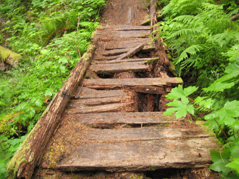
This bridge wasn’t so great, showing the signs of such a damp climate.

It was very well-timed on our part that the road along the east side of the mountain was opened the day before our visit.  We got a few glimpses of Mt St Helens & the reemerging forest along the drive in to Seattle.

Out of Bend & Gunsight Trail

We got the call just before ten o’clock that Subaru Guru in Bend had finished the head gasket replacement. Excited by the prospect of getting back on the road again, we made the big trek to the south of town & back, packed up & were pulling out of the driveway by eleven o’clock. We had ended up staying a week in Bend – not the ideal circumstances, but a great place to be stuck (even if the weather was a little unseasonal) & we were so fortunate to have Allen & Lisa’s kind hospitality.  I was toying with the idea of a big drive & then the classic Lewis River ride near Mt St Helens, but in the end decided that was too optimistic.

But I had a back up plan – the Gunsight Trail near Government Camp that I had intended to ride the day the car problems started. Mt Hood was once again shrouded in cloud, but it was a lot warmer than last time we drove through the area. The GPS trail I had showed riding from the highway, but as I had Valerie to shuttle me I managed to skip a few kilometres of paved road in the forest. When it turned to gravel I got on the bike, but the doubletrack is so good I would have been confident taking the Outback up there quite a way. I could see the ridge that I had to get up to & it was a long way up. Mostly the doubletrack was steady climbing, but it got pretty steep at one stage – climbing 150m in 1km. I was sick of pushing that middle ring around halfway through that section.

Diving off through the trees to the left, I soon popped out on an old dirt road that went up more gradually to the start of the singletrack. As this road met another, the trail dived off into the trees. I was immediately concerned by the amount of blowdown that I had to climb over – it was going to be a long ride if there were many trees down. But trees weren’t much of a problem after a few hundred metres as I continued climbing on the singletrack. I quickly became reacquainted with my old friend Mr Snow at about 1700m. So for most of the ridge I pushed over quite a bit of snow, rode on a little of it & climbed over the odd tree (breaking a spoke in the process). Pleasantly the cloud was retreating from Mt Hood & by the time I was on the top of the ridge at a burn-site I could get a decent view. There were also good views out to the east of the High Desert.

After slowly making my way along that ridge between 1700 & 1800m for quite some time the trail finally turned down & the snow became scarcer & scarcer. Unfortunately, the screaming good downhill was often interrupted by fallen trees. Nonetheless, it was a great run down – a nice wide trail with just enough rocks to keep one from getting too complacent. Unlike the descent from Surveyor’s Ridge last week, the switchbacks were so far apart I wasn’t annoyed by them. It ended up a pretty short ride at about 17km/10 miles, but after all that climbing, snow & trees I didn’t really mind as I dozed on the drive into Portland.

McKenzie River Trail & the Xen crew

On my fourth attempt to ride the McKenzie River trail, I was finally successful. With the car in the shop having its engine pulled out & apart, we had a loaner that actually got us more than eight miles out of Bend on Highway 20 north. For most of the hour drive to the trailhead I wasn’t overly keen on all the rain that was falling, but as we started to go down the other side of the range it eased off a bit.

Starting at a recently sealed parking lot, the new trail signs aren’t quite up yet, immediately I was over the first of many log bridges crossing various streams & the river on the ride. There was a mile or so of nice wide packed dirt singletrack under big trees before I crossed another bridge at the head of Clear Lake. The east side of the lake has a lot of lava flow to ride over & it’s easily the most technical & tricky part of the ride – quite slow as well. The sun wasn’t out, so the lake wasn’t as clear as it may usually be but beautiful all the same.

The tricky rock continued for a while & I passed many hikers before the trail suddenly became sealed in the middle of a big lava flow – some quite tight corners here. After the lake the trail alternated quickly between smooth trail & rocks. After crossing a forestry road & then the highway in quick succession it wasn’t long before I happened across the river plunging over Sahalie Falls. There were a few vantage points to get a look (& feel – a little spray, but nothing like Yosemite) at the water thundering over.

The river disappeared for a while underground & while I was cruising down through the damp, mossy trees I caught up to a group – actually a pair from Salt Lake & another from Portland. After a bit of chatting (it turns out we all had Giro Xen helmets of different colours) we were riding up to Blue Pool where the river comes back out of the ground. Strangely still, it was even clearer than Clear Lake. Looking down from above it was very difficult to gauge its depth, but it was plenty stunning. We all traded cameras a little, so I ended up with a few photos of myself for a change.

Switching the order around a bit as we continued down the fun trail through more trees, rocks & moss I somehow found myself at the front. I’m not sure that that is always a good idea as I kept stopping for pictures like the tourist I am.

Just before the halfway point Rob & Kevin had to leave & head back to Portland. Jeremy, Pam & I continued on our merry way. There were a few small climbs, but these weren’t much of a bother – helped to break up the monotony of sweet downhill riding. The descents weren’t particularly steep, just good fun weaving in & out of trees & dealing with the occasional rocky section.

At times the forest became quite enchanted as the moss was even more mossy, the light darkened & it all became a little etheral. I was wondering where the Faraway Tree was & Jeremy was concerned that some gnome was going to jump out from behind a rock, put a big stick through his wheels & steal all his stuff.

We continued our way down throughly enjoying the ride – Jeremy & I had a good pace going & I was happy with a few little rest stops. Especially as I’d hit climbs thinking they’d be short & they were always twice as long as I expected. For quite a bit of the ride beside the river we’d noticed a mist hanging around the yard or two above the river – it was a little spooky seeing it so much.

There was a bit of riding near the highway, but the traffic noise was generally blocked by all the trees. The trail-goodness just goes & on & on and after five hours we were within a mile of the cars when both Pam & I managed to stack it. I was having too much fun & rode around a corner to find a white-bearded, bare-footed hippy in the middle of the trail – he was surprised as I grabbed a handful of brake, washed out the front a bit & stopped & fell to the left very quickly. From all accounts, Pam did a commendable impression of someone wanting to introduce her helmet to a tree – not sure how that happened. A most excellent ride all up & great to have met good riding buddies along the way.

Valerie & I took the scenic route 242 back to Sisters. It climbed its tortuous path up to over 5000 feet through a lot more rain & big trees. Valerie was particularly pleased to see a black bear cub run across the road in front of us, I was pleased that this time I wasn’t on my bike a few metres down the trail. At the top of the pass it was all volcanic rock again & just dry enough to get out of the car. There is a cool old viewing platform at the top with small holes in walls to look out at the various peaks. Alas, it was too cloudy to see any.