Category Archives: GPS

The start of a Grand Junction week

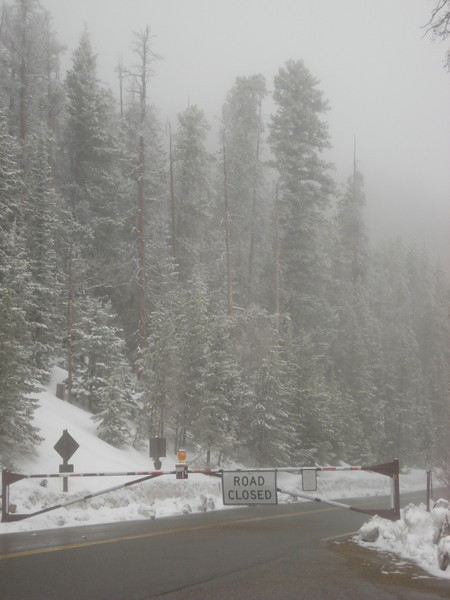
Boring, but necessary, things were done yesterday morning – I changed the oil & filter (it’s amazing how fast 5000 km comes around on a roadtrip in this big country), grocery shopping, first visit to REI for the trip & so on.

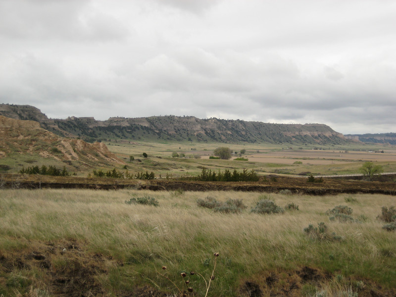
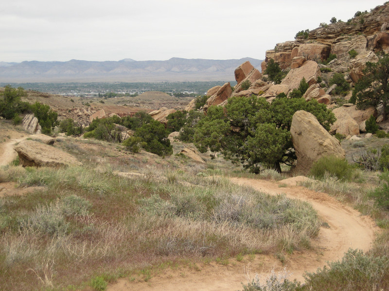
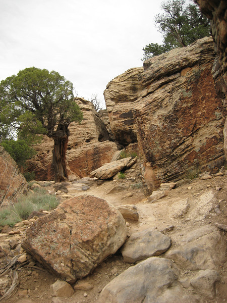
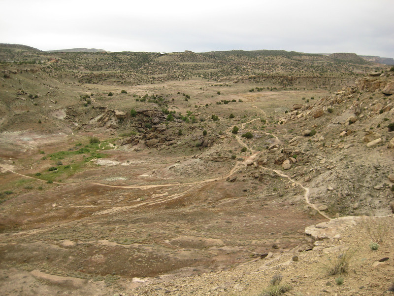
So I was ultra-pleased with the opportunity for a good ride in the afternoon.  Perfect riding conditions showed up too – overcast. warm but with a nice breeze to prevent overheating.  Just north of town across the Colorado are the Lunch Loop trails set in some nice little canyons.  For an early Monday afternoon, there were an awful lot of cars in the parking lot – they must be good trails.  I’m nowhere near bike-fit yet (damn long winter) so the steep climbing up the canyon (at one point I think I was going up a gnarly down trail) was punctuated by a few photo stops.  I love these canyons in this part of the world, they’re gorgeous.  Good overcast riding weather is not great photography weather, but my photos are never world-class so it hardly matters!

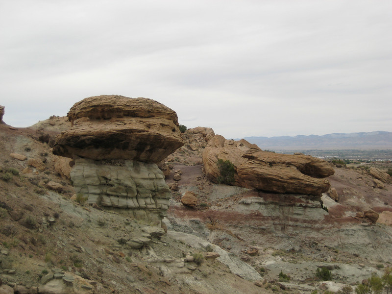
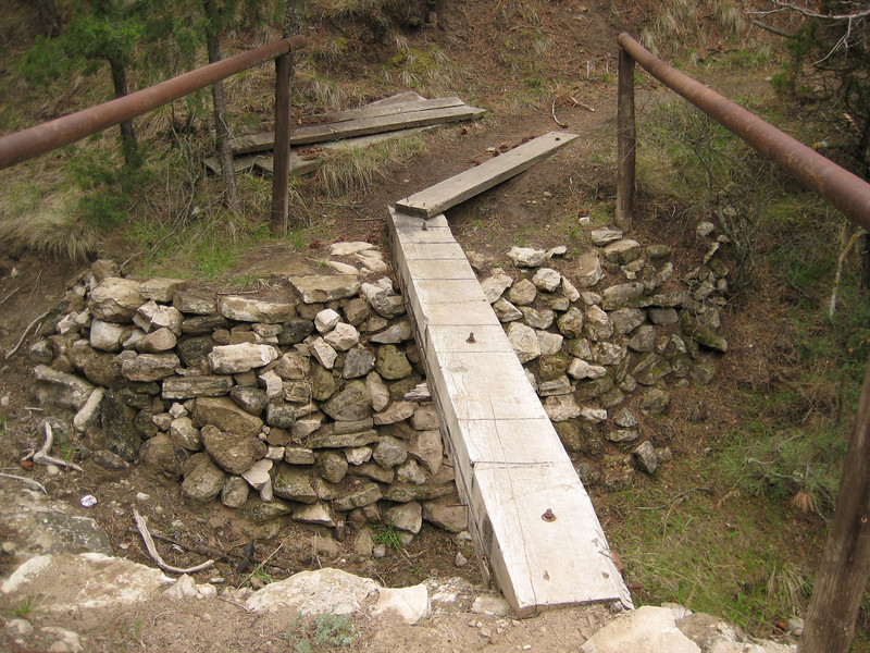
My legs survived OK, but I’ll be pleased to get a bit of cardio back. But it was soon time to turn & go down. The trails were flowy for a while & then headed in to some really big rocks that meant I found it difficult to negotiate some of the step-ups – maybe the biggest part of being off the bike for so long isn’t the fitness, it’s the loss of technique & confidence to attempt some of more tricky technical bits. Despite that, I had an absolute blast as I wound my was down & in & out of sub-canyons.

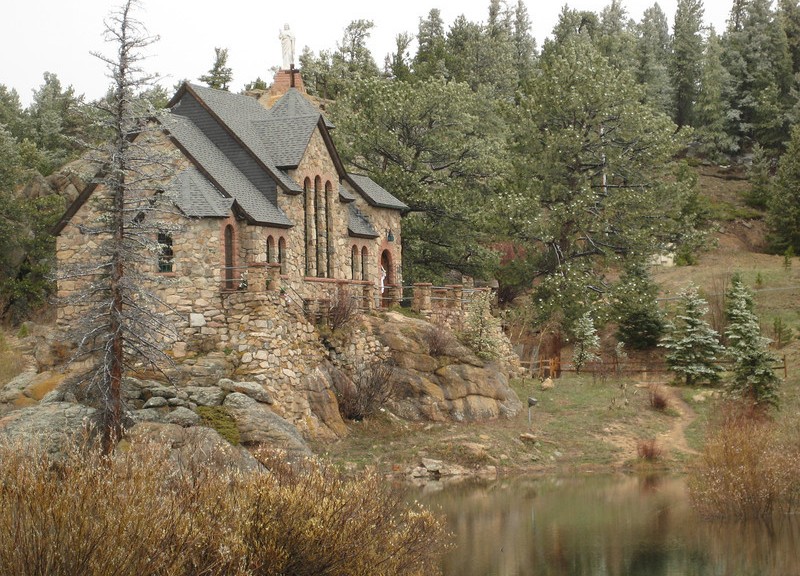
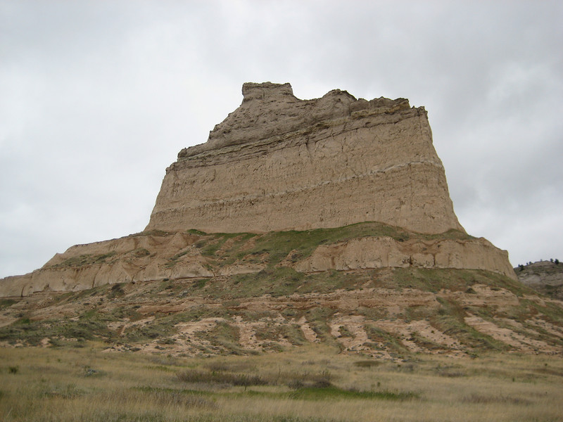
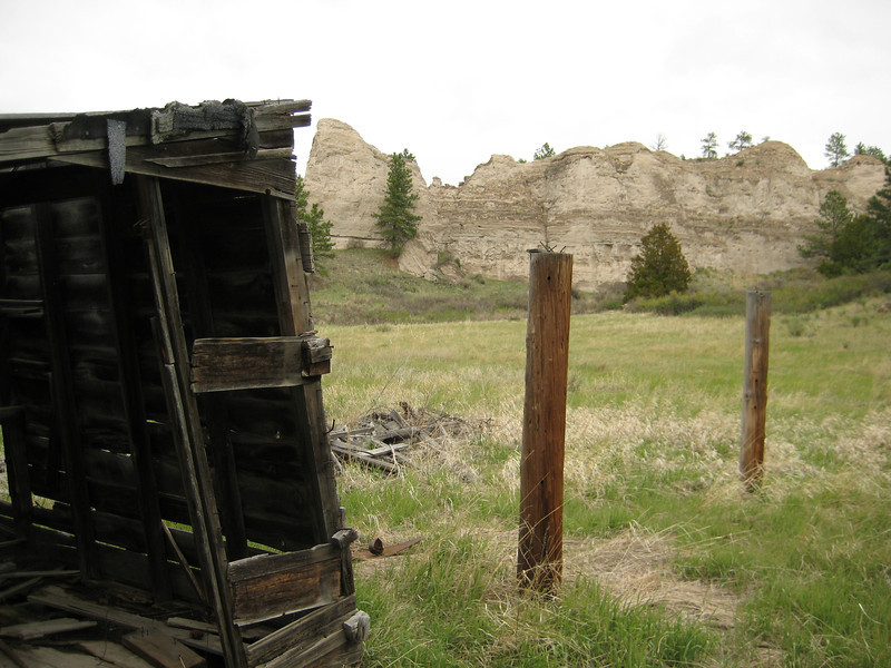
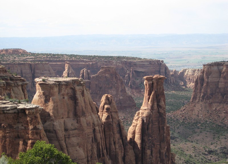
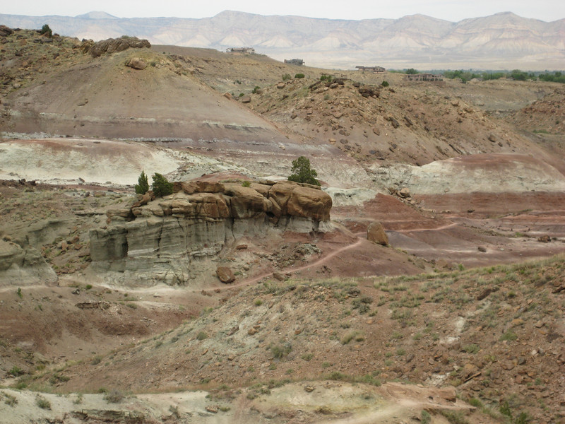
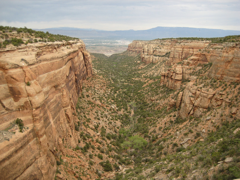
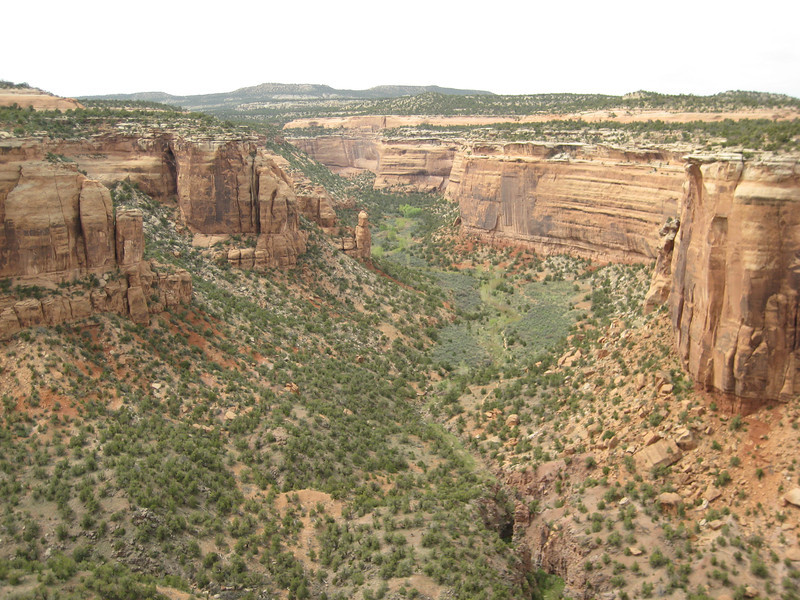
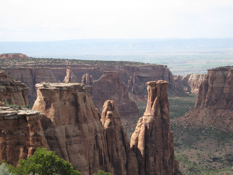
I met Valerie back at the car, she having returned from walking some of the trails closer to the parking lot, & we continued up the road to Colorado National Monument. This was another one of those places we’d never heard of the day prior, but all the literature for GJ accommodation & the first waitress we had in town gushed about it. A big rock above towering above Grand Junction it is over 20,000 acres worth of monument with many spectacular canyons carved into it. It was a great scenic drive of about twenty miles punctuated by many stops as we looked over the precipices (of great peril) as the sun came out.

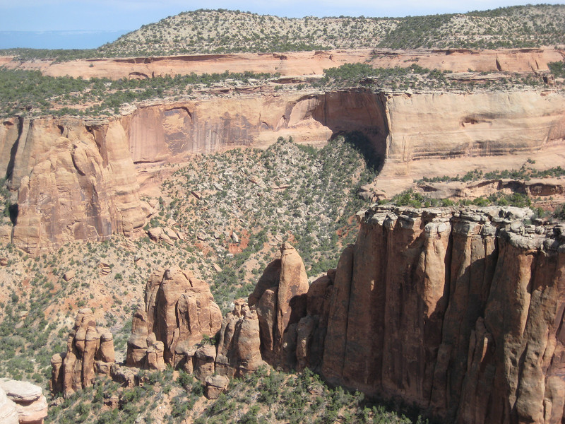
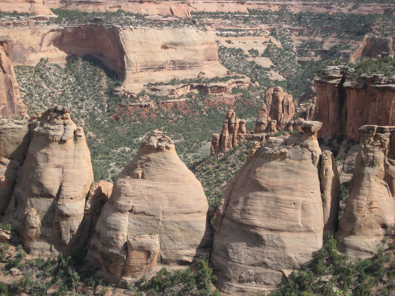
These are appropriately called the Coke Ovens

We’ve decided to extend our time here in Grand Junction up to a week as it’s a nice place, but the weather forecast means I’ll struggle to fit all the rides in I want to if we left on Thursday. So Moab has been pushed out until Sunday, I’m sure I’ll survive. Today we checked out the local museum while it drizzled – the history of the local nomadic tribes & the roaming Spanish in the 1700s was fascinating. With just a few scattered showeres this afternoon & a bit of sun we enjoyed a leisurely ride along the Colorado River Trail – with lots of birdlife (& a couple of deer & many burrowing rodents of some description) to keep us amused.

Scottsbluff, first ride & Rocky Mtn NP (more snow)

We got away from Alliance nice & early & headed for Scottsbluff, as I’d heard there was some biking nearby.  Previously, I couldn’t work out the references to Alliance being the heart of the Sand Hills as everything was flat.  Quickly we found the big sand dunes, they were covered in beach grasses & I was sure we should have been on the coast, not thousands of miles inland.  I saw something I haven’t seen for many months – a dairy farm with real dairy cows!  They still looked to be wintering & feeding close to the shed, nonetheless I’m claiming it.  With time to spare, we could afford to stop & look at random abandoned things.  The old motel is a steal – it’s got new-fangled electric heating after all.

Bypassing the town unintentionally, we headed for Scottsbluff National Monument – having no idea what it was, apart from some impressive looking bluffs.  As it turned out, this area was an important part of the Oregon Trail (not the computer game, the real deal).  Scottsbluff & the Mitchell Pass through it were about a third of the way into the trail from Missouri & marked the end of the so-called Great American Desert.  It must have been quite something to make it there after two or three months & realise there was still so much further to go.  We spent a little time in the Visitor Center learning a bit, then walked on the trail a while (it was muddy enough in places to walk over, must’ve been awful out of summer with a wagon) & then drove to the top for some good views.

The trailhead was not much of a drive from the Oregon Trail (although I’m not sure that those are related, I can’t imagine pioneers heading up into the Wildcat Hills to hit some singletrack). I’d only read brief details of this ride on a forum & knew it wasn’t that long & was on our path – perfect for my first ride of the summer (without a trace of snow, that is). It was still quite cool, but dry – my lungs didn’t appreciate the chill, but we got up the hill eventually. There wasn’t a lot of signage so I just went all over the place exploring – it was so good to be back on the bike. Most of the climbing wasn’t too steep & the trail was mostly wide, although there was this nasty bridge.

I did find this substantial picnic shelter that seemed over-designed for the number of people that visit it (I didn’t see a soul on my whole ride – on a Saturday afternoon).

Occasionally, I popped out of the trees & could see where I’d come from & get my bearings again.

It was another couple of hours to drive to Fort Collins – in our fifth state, Colorado. Although grey night last night, it’s a very nice town – lots of lovely old houses & big old trees. I would have been tempted to stay more than one night if we were not getting so sick of rain & cold after ten days. So this morning, we headed up to Rocky Mountain National Park (a little west) to see some wildlife & drive through to Grand Junction (west CO). The drive out took us through a great skinny canyon & by the time we got to the park it was very foggy. It turned out that the road through was still closed for the season, but we went as far as we could (about 2800m) & looked at the snow, thought it was cold & turned around.

Bits of the park were nice, it was a pity we couldn’t see the great views; we didn’t see any moose or anything else interesting, just more lupins (actually didn’t see any bloody lupins), elk & bighorn sheep. Thankfully we didn’t have to backtrack much due to the road closure, just head south to I-70. The road was tortuous & still pretty high up, it was evident that they (there were lots of scattered houses forming a nice mountain community) had had quite a few inches of snow in the last day or two.

Just before the interstate we went through some very western & old looking mining towns – Black Hawk (founded during the Pikes Peak gold rush) was the most impressive (I’d be more impressed if they hadn’t banned bikes from the streets).

We were soon on I-70 & climbed steadily to cross the Continental Divide. The tunnels through the divide sit at 3400m above sea level & are 2.7km long – it was quite a tunnel that we went through. From there it was mostly downhill (& quite steeply at times too) to Grand Junction at 1400m. The scenery changed dramatically from snow covered trees, to trees & the large ski-resort town of Vail (reminded me a bit of Canmore – lots of new housing that looks like it sits empty most of the year) & then we crossed the Colorado River for the first time. For a while, we were through open valley-bottom plains & then plunged in to tight twisty canyons with very impressive rock – even saw a few climbers on crags right next to the road. By now it was getting hot & the clothes we had on for the morning’s snow & fog were too much. When we rolled in to Grand Junction almost 600km later, we realised we’d gone from close to zero to thirty degrees Celsius in five hours. It sure is nice to be in shorts, T-shirt & flip-flops/jandals.