Category Archives: NZ

Great Southern Brevet – Day Three – Wanaka to Nevis Valley

Nigh on six hours of quality sleep was more than enough to get me riding again at four-thirty on Monday morning. Twenty-odd kilometres of gentle climbing up Cardrona Valley Rd was much warmer than the so-cold-my-fingers-can’t-operate-zippers morning near the end of my Tour Aotearoa. As the day dawned, I reached the Snow Farm access road and began the climb up onto the Pisa Range. Unsurprisingly for a NZ ski-field access road, it was steep and heavily switch-backed – this one climbing almost a thousand metres in little over ten kilometres.

Quickly I was overlooking the valley below as the sun hit the hills opposite.

Soon after, Steve and Jake caught up to me. We chatted a while, but they were stronger climbers so rode off. The wind, still tending west to northwest, was starting to pick up again and push us up to Snow Farm.

I was pleased to be doing this climb in the cool and shade of the early morning.

Past the lodge, the route was off to Meadow Hut. Luckily for me, I’d been up here six months prior for a little bit of ski touring – otherwise this would have been another spot in the route where the low-resolution GPS route would have been frustrating. It was vaguely downhill to the hut, but the grass surface was annoyingly slow.

The hut appeared soon enough and seemed a good spot for a snack and brief pause.

There was still about five hundred metres to climb up to the high point of the route, just off the summit of Mt Pisa. This was more a hiking trail, nicely technical compared to all of the riding so far. Following Kirtle Burn up, the grass was often spongy, the creek crossings rocky and unrideable – a good challenge and plain honest fun.

Kirtle Burn Hut was out of the slight valley the creek was in. I didn’t stop long, as the wind had really picked up.

I was surprised that Jake and Steve caught up to me again – apparently they’d stopped in the ski lodge for water. We continued together.

A zig left and then a zag right and we were definitely on the shoulder riding up through barren rocks.

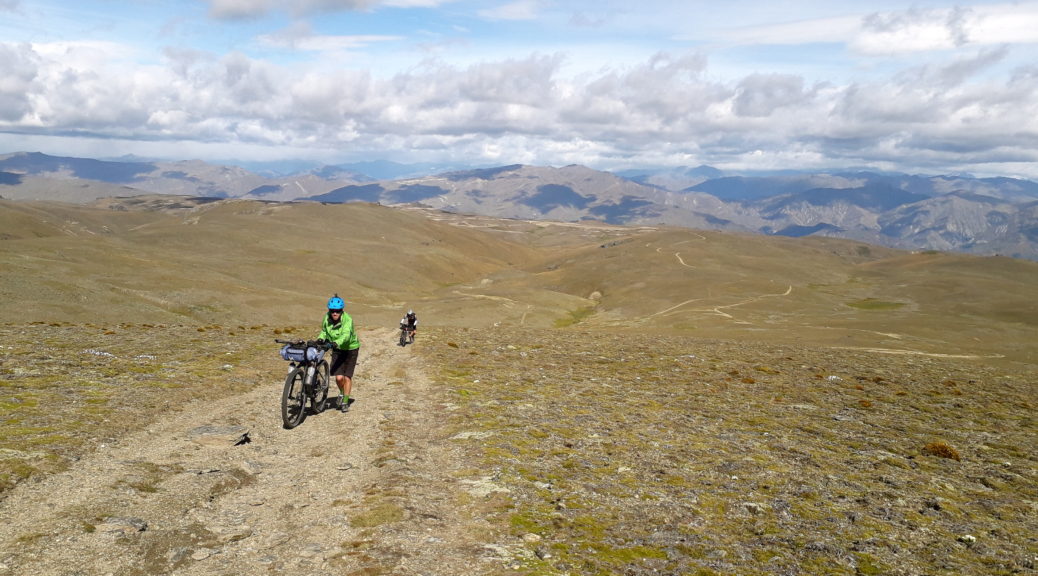
Before long, it was too steep and windy to ride.

Joining the Pisa Range Ridge Track, things began to get really interesting (read, scarily challenging). Turning towards the north, the gale went from being an occasionally helpful tailwind to a treacherous crosswind. The first challenge was Sally’s Pinch, a narrowing in the ridge with a cliff off downwind and the wind funneling aggressively through. Approaching it, for the second consecutive day I was blown off course and off my bike. I decided to walk. Steve and Jake, having a bit more ballast to weigh them down struggled through.

It was all I could do to inch forward while trying to hold on to my bike as the wind did its best to turn it, first, into a kite and then a two-wheeled missile. Far too many times I contemplated being whisked away to certain peril somewhere down near the Wanaka-Cromwell highway. Nothing for it but one foot in front of the other.

The last time I bothered to take a photo – it was a long push up that slope from Sally’s Pinch into the wind.

Fifteen minutes of tediously slow progress did get me to the highest point. Where I was delighted to find I couldn’t even ride on the flat or downhill. With the rocky track and the wind, I just couldn’t keep any sort of control of my path. It’s always frustrating not being able to ride downhill! While the others could ride, the safest option and best chance of getting off the range under my own steam was to walk much of the descent to start with. Also, if something untoward did occur – I didn’t fancy a helicopter was going to make it up to rescue me.

Back to Wanaka – six hours of effort didn’t seem to have got me as far as usual!

Eventually I could ride again. There was much rejoicing.

A brief turn west to climb steeply then led to where I could then ride all the way down.

These flowers looked an invasive species, but they sure were pretty.

More poor-GPS-trail induced confusion at a series of gates slowed my descent slightly, but before long I was back on the valley floor. Very pleased to have survived, I now have a new standard for windiness when on a bike. I also still had my bike, so that was a plus. Having driven through a few times, I didn’t even know Queensbury was an actual place – but it did have a welcome and very good cafe. I collected my frazzled nerves as I refuelled.

The wind direction on the Pisas and the direction of the road told me I would have a rollicking tailwind to whisk me to Cromwell. That I did, for the first third of thirty kilometres to town. The rest, on the side of a highway, was plain wind-induced toil. Tiring by now, I got out of the sun again and ate at Subway – taking half of it for dinner, as the route next went through the remote Nevis Valley. This was another bit of the course unknown to me and I was well looking forward to it.

I did however remember the climb up to and just beyond Bannockburn. I knew I could stay in the small settlement in relative comfort, but four-thirty and just over a hundred kilometres seemed much too early to call it a day. Even if it had been a tough day, my legs were still going round (however slowly) and the sun was shining. Somewhere in here, I chose to ignore the ever-present wind in my thinking. Leaving Cromwell, I was once again surprised to have Jake and Steve catch up again. They’d taken one long break instead of my two shorter ones. The path around the edge of Lake Dunstan was nice, but energy sapping. Soon I was left by myself for the steep pinch up to Bannockburn. I just sort of kept pedaling, the decision seemingly making itself.

Turning onto Nevis Road, this part of the route was new to me and I was excited to finally be heading into the Nevis. For some reason, this gravel climb built to legendary status in my mind. It didn’t disappoint; averaging near ten percent gradient, it was an efficient way to climb almost a thousand metres. Parts of it were much steeper and I took my time, happy to spin my way up the hill and not push my tired body too much. Also, it was worth stopping to take in the scenery every so often:

Even at my pace, I ended up chasing much of this herd up the road as one by one they peeled off.

Eventually, I was no longer herding cattle up the road.

Back towards Cromwell and Lake Dunstan.

Most of the climb had been sheltered enough, but rounding one corner as I neared the top the wind hit me full in the face again. Having practiced so well walking my bike uphill earlier in the day, I accepted my fate, dismounted and pushed on. In some respects, the gale was horrendous and progress was slow. But compared to the morning’s ordeal and the prospect of real injury, this was a lovely evening stroll!

Eventually I reached the sign Duffers Saddle; I rather wanted a photo of my bike next to the sign. Alas, it was too windy for my bike to stay propped against a signpost. I was struggling to stand up and began to wonder if this would be another time where I’d have to push my bike downhill. But the surface, being an actual road, was much better and I could enjoy (as far as the wind allowed) the seven and a half kilometre downhill to the Nevis River.

It was quite a fun drop down into the valley – I’m sure nothing to do with my legs not having to do anything.

By this time it was approaching a sixteen hour day for a mere hundred and thirty kilometres; I was starting to look for somewhere to shelter from the persistent gale for the night. Getting close to the river I spied a caravan in the middle of nowhere. It looked pretty shut up and left, with nice big awnings. Hmmm, inviting. On closer inspection, it was definitely parked up for the summer and no-one was around. Internal debate ensued for a few minutes before I decided I couldn’t just doss down in someone’s caravan awning.

I went to find shelter behind the riverside willows. Turning, I saw approaching a truck, which carried the owners of the caravan. We got chatting about the crazy bikepackers they’d seen; before long I was invited to sleep in the awning for the night, invited in for a cup of tea and water bottle-filling. Fantastic and much appreciated. The remainder of my Subway was devoured as I calmed after the exertions of the day. I slept well that night rather satisfied at having got through a challenging day and over three thousand metres of climbing.

Home for the night, wonderfully sheltered from the wind by the caravan.
Great Southern Brevet – Day Two – Omarama to Wanaka

As a plan, bothering to find a room for the night after a tiring day works much better when one actually sleeps. Alas, I did not for whatever reason – probably having too many anticipatory thoughts about riding bikes over the coming week. So many unknowns and adventures to be had! Pete and Nathan left just after four, I managed to carry my bike down the stairs and ride off into the dark just after half-past. Southwest out of Omarama for an hour, past the sentient centre-pivot irrigators blinking in the darkness, it was a gradual climb to the end of the flat pasture and the foot of the hills. An early start did at least claw back most of the distance I had hoped to ride the previous night.

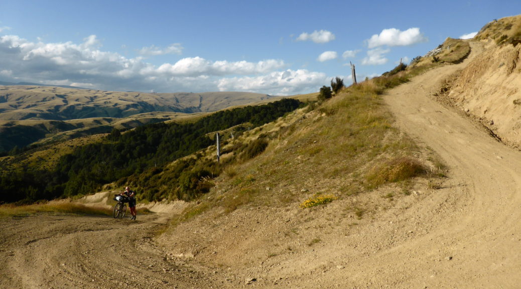
Well made four-wheel drive track led the way up to Little Omarama Saddle (which paradoxically is higher than Omarama Saddle), but it was steep. Uncharacteristically, I quickly relented to pushing my bike – perhaps knowing that a fourteen percent climb rising almost seven hundred metres would not be the only steep ascent of the day, let alone the week.

The sun started to hit the basin from which I’d steeply left – the track across the bottom of the frame.

Short sections, I managed to ride – but otherwise it was a pleasant morning walk with my bike up a hill looking out over the surrounding farms, tussock-clad hills and mountains.

Finally, the high point came into view and I crossed from Canterbury to Otago.

Just after seven o’clock at the summit, it was fresh – I was pleased I didn’t sleep up there as one of the riders did. It was a rollicking, and chilly, descent with a couple of dozen stream crossings to soak one’s feet with cool water. It wasn’t the only time that week that I thought having front suspension might have been a good idea. Shortly after the only crossing that was too deep and swift for me to ride, Jake and Steve caught up with me. They had left town later, but were clearly faster than me. Chatting a bit, I then let them go – often catching up to them at the many closed gates.

Things flattened out and opened up a bit and we joined the eastern branch of the Manuherikia River.

The bridge over the river had long since been washed out, but picking the right spot it was easy enough to ride through.

Briefly we were on the gravel road that I rode with family only three weeks before. We passed our picnic spot and turned off to Falls Dam; the dilapidated fishing huts beside the reservoir were the gateway to the short, but steeply up and down, trail to the dam.

Looking over the overflow intake to the Hawkdun Range, our route enters the frame from the left.

A short section of nice gravel took us down to the St Bathans road and then up to briefly join the deserted highway. With Jake & Steve playing leapfrog with me, we raced down to Oteruha and the Otago Central Rail Trail. Being nine o’clock on a Sunday morning, I was not surprised to find no stores open; I was somewhat surprised to have caught up to Pete though. We set off on the rail trail together. That hour of the day is well before the hoards of tourists on rented bikes are up riding – so we could ride side by side, chat and make good time to Omakau to ensure we got one of the famous pies before they sold out.

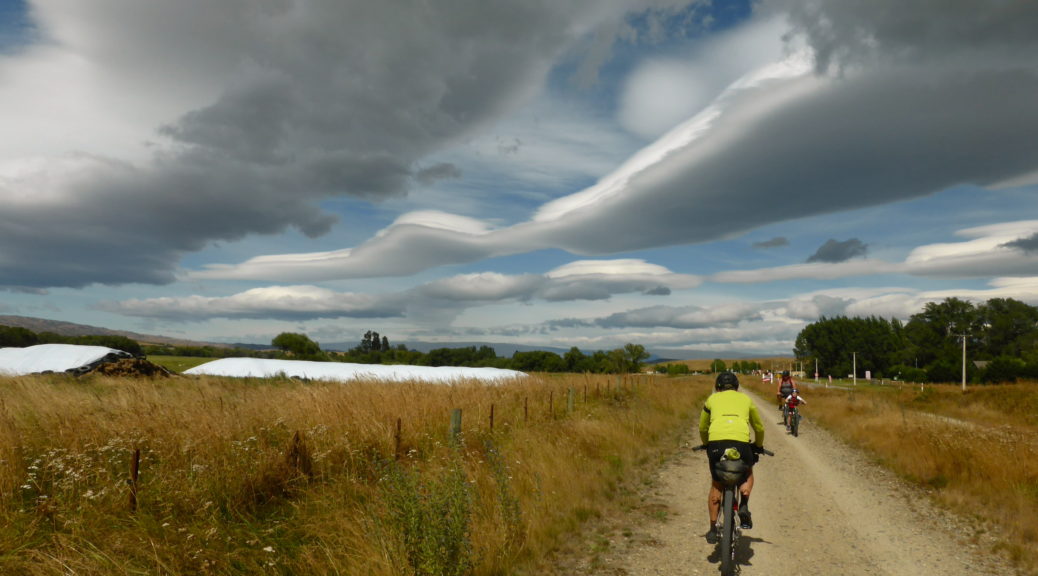
Admiring the clouds as we headed into Lauder.

After the early start, an early lunch was in order – and one really can’t go past the venison pies in Omakau. We caught up with a few other riders, including Muurtle Turtle who had ridden out to meet riders from Alexandra. Stocking up at the store fortified us for the steep climb Pete and I knew was coming. Unfortunately we were about to turn towards the wind that had been rather kind to us all morning. Racecourse Road north out of town gave us ten kilometres to get our legs going again. Then the steepness hit – but at least more of it was rideable than the previous climb that day.

I’d ridden this part of the route just after Christmas a year prior, and was quite looking forward to seeing it again. It didn’t disappoint, although I took far fewer photos – knowing I already had them. Once again, there were far too many closed gates – this time annoyingly on a public road. At least with Pete, and then Steve & Jake catching up, one did not have to do all the gate-duty.

The wind started to get up as we climbed out of the valley that’s in the middle of Thomson Gorge Road. It became a bit concerning that it was easier to walk into the wind, rather than ride up the climb. Then, being such a lightweight, I was blown off my bike. That was unusual. I became more circumspect after that. Finally we reached the summit and began the long downhill to the Lindis River. With the wind howling up towards us, I was still more cautious than normal.

Unfortunately Pete got stuck in a rut and came a cropper, crashing and splitting his lip rather well. It looked like it needed stitches, but there wasn’t much chance of that out there. With the bleeding halted, Pete was good to keep riding, although we did take a half hour rest once we were close to the river.

I well remembered the gravel road and then highway towards Wanaka being interminable. In the headwind, it was horrendous; the holiday traffic wasn’t much better either. Eventually we joined the singletrack beside the Clutha for the final thirty kilometres to Wanaka. We feared that this would be just as testing, but as the trail twisted and turned, rose and fell, besides the river the wind was far more manageable.

First trail angel! Delicious cookies left out for GSB riders just before Albertown.

We’d decided earlier to call it a day in Wanaka so Pete could get medical attention. I also figured the wind may abate for a while in the early hours of the next day. Topping up on food for the next day, we set off for some excellent southern hospitality. A longer day than I’d had for a while, I was well pleased with how it went – two decent climbs, but apart from that it was pretty flat and gave a taster of the wind to come.

Great Southern Brevet – Day One – Tekapo to Omarama

With my arm in a sling after the magpie fiasco and dealing with the disappointment of not being able to attempt to ride over the Snowies from Canberra to Melbourne, I suddenly realised that the Great Southern Brevet would be a good replacement ride and something to look forward to. A 1100 kilometre bikepacking event near and around Central Otago, I could do that with a month off the bike, and then Christmas, for preparation. Surely?!

When I did my first bikepacking event four years earlier, the GSB was the other option. But in comparison to other events, it flies further under the radar and information is harder to come by – so I chose to start with the Kiwi Brevet. The GSB had stayed in buried in the back of my mind ever since, waiting for the timing to be right – finally it was, so I was excited to turn up in Tekapo and discover the half of the course I’d not ridden previously. After having now completed both of those brevets, I’m glad I did it that way around.

Ten o’clock was the very gentlemanly start time – it seems such a waste of daylight when one is eager to get going. But it does give ample time for meeting fellow riders over a leisurely cafe breakfast. More so than other events I’ve done, everyone seemed to know plenty of other riders and there were many returning riders. I was surprised to meet people from other events and have people remark on this little blog, and commiserate about the magpie incident. After a large breakfast, it was down to the start to crowd out the throng of tourists, listen to the briefing, make last minute adjustments to bikes and kit before rolling out.

At the start earlier.

With no real lead-up of biking, I was happy to drift further and further back in the field as we headed out of town. By the time we were on the gravel I was tailend charlie and finally getting to meet Keith who had recently kitted me out with his Robo-Kiwi creations. We caught up to Pierre alongside the canal. Pierre’s bike had caught my eye earlier – over twenty years old, twenty-six inch wheels, rim brakes, original unserviced forks (!); it certainly was a leap back in time. Kudos.

Dropping down to the wide river basin, we had over forty kilometres of gravel track to ease us into the route. Well, one thought so – however, despite the gradual downhill, the surface was more bumpy river stones packed into something resembling a hard surface. Constantly battling the round rocks to keep momentum was not the most fun. But on the other hand, the wind was behind us, the clouds hadn’t burst yet and the company was good. It turns out the GSB every two years is about Pierre’s only bikepacking that he gets to do (more kudos) and he had plenty of entertaining stories and handy pointers from past rides. Already at this point of the ride, I was becoming keen to return – the route changes each time, although this one was a repeat of the 2017 route as that year severe weather (snowstorms on the Pisa Range, flooding and washed out bridges in the Nevis Valley) meant it was curtailed.

Looking back north.

Heading south to the northern reaches of Lake Benmore.

Having followed the Tekapo River most of the day, finally we crossed it as it emptied into the Pukaki – which soon ended in the lake.

We caught up to other riders hiding from the sun, these guys were far more disgruntled with the surface – so I wasn’t displeased as they departed with their negativity while I snacked. I was surprised to learn later in the day that it was well over 30ÂșC that afternoon – with the breeze, it didn’t feel that way. For a change, I managed to break my habit of dehydrating myself on the first day of such events. Maybe I’m slowly learning something about this bikepacking lark?

Joining gravel roads for a bit, we skirted around the head of the lake.

Organiser extraordinaire Dave had gained permission for us to ride through private land, this took us away from the lake and up into the hills to eventually drop into the Waitaki Valley.

I caught up to some others – more people to chat to; first days are fun like that.

As the climbing intensified I found myself alone enjoying the ascent, new scenery and the warmth. The surface was far more rideable too since leaving the rivers behind. Having spent a bit of time around Benmore in years gone, I’d never been up the northern arm.

The pylons rise from NZ’s largest hydro station, starting the HVDC link to the North Island. The rain finally started about here too.

There was some fairly decent climbing around the lake; nothing huge – but it seemed to keep coming more than one expected. Finally I descended to the dam for the last little run to Otematata and resupply. Once upon a time, my parents had a small house here – it was strange to revisit.

Thankfully the store was still open, unfortunately it was a rather average store (no pies, inconceivable!). As I was leaving, four others rolled in just before closing time. I took off in the rain up the hill towards Omarama. Expectedly, that stretch of highway is tedious in the reverse direction – Adele and I rode it a couple of years earlier on our A2O ride.

Returning to the lake, the trail goes off the road and it was a pleasant ride up the hill in the drizzle. I saw someone fly past on the road, they must have missed the trail. Going through Sailor’s Cutting for the final run down to Omarama (huzzah, this section is now off the road) was a little less pleasant as the heavens opened and it tipped down. There was quite a congregation of bedraggled riders at the Four-Square buying supplies for the next wilderness section and sharing stories of the day. As the rain pelted down in the early evening, finding a room rather than risk exposure at higher altitude seemed sensible – it was supposed to clear overnight.

No sooner had said room been found, things brightened and going over the Little Omarama Saddle seemed a better use of time. But I was in no rush and a decent rest after my biggest riding day in months seemed prudent. Dinner was pretty good too, and cafe’s accommodation (and shower) were most welcome. That was a good day of riding, and my shoulder stayed where it should – bravo.

Whirinaki Hiking

Before heading south to ride the Great Southern Brevet, Steve and I had set aside the following weekend to go hiking in the Whirinaki Forest. Still fatigued all week from the brevet, it didn’t seem like a good idea. But as it happened, a weekend walking with a light pack through beautiful native forest was just the tonic.

Perusing maps and brochures, I came up with this vague plan; it happened to be what Steve had in mind too.

I had Friday off work for my shoulder MRI in Hastings (the dye injection was horrible, the MRI went well – completely different in details to the one I had in the UK seven years ago), so was left in charge of food. Planning only a two night summer trip, there was plenty of room for fresh items – I made sure we would not starve.

The ache in my shoulder lessened enough to drive out and meet Steve at work; an hour of Napier-Taupo Road before turning north for forty minutes of gravel brought us to the trailhead right on the Hawke’s Bay – Bay of Plenty boundary, having climbed to the watershed at about 900 m. The walk into Central Whirinaki Hut that evening was a glorious and easy ten kilometres. From the start, we lost altitude over half the distance on a wide well-maintained trail to reach the Whirinaki River, which we followed to the hut.

It was a balmy evening for walking, and we were soon impressed by the number and variety of both large native trees and ferns. I don’t know that I’ve seen so many different ferns in such number in one place that I saw over the next two days and fifty kilometres. My left thigh gave me a bit of gip that evening going downhill, most unusual – thankfully I’d put in my ski/hiking poles and they helped no end, that niggle didn’t bother me the following days.

Friday evening and we didn’t see another soul that night – so we had the entire large hut to ourselves, a bunk room each. Luxury. It also meant we didn’t have to worry about disturbing anyone’s slumber as we turned up, cooked and ate a small pile of nachos well after dark.

I got outside in the morning for a hut photo before the rain came in.

A stone’s throw away from the hut was the river and wonderfully there were two pairs of whio (blue ducks) slowly making their way upstream finding breakfast as they went.

Endangered, these ducks are also rare among water birds in that they live year-round on fast flowing rivers.

Thanks to Steve for the video.

The rain persisted as we set off, but it was inconsequential under the vast canopy. The trail tended down as we loosely followed the river. It seemed that a lot of the cuttings made to smooth the gradient weren’t really necessary – the walking was easy. There was even a tunnel!

Outrageous.

Did I mention there were ferns?

A short diversion had us standing on a bridge above the thundering Whirinaki Falls, alas there was no lookout spot. We left the Whirinaki River to turn to walk up a tributary – Mangamate Stream. With that we left the crowds behind; that morning we’d seen two men (and a dog) heading up to do some pest control and a group of five walking up to Central Hut, we were to see no one else for another twenty-four hours. Knowing we were about to get our feet wet, it seemed a good time break for lunch.

Quite a spread it was too; hooray for short hiking trips when much fresh food can be carried.

The trail notes told us we’d be following the stream most of the way up to the hut and to expect more than sixty crossings.

Finding the orange marker, I contemplated all the crossings to come before wading in. It was luxuriously warm, and like most of the crossings to come – around my knee-height.

I took to counting stream crossings, but that became difficult when much of the time the trail was simply walking up the watercourse. I was well pleased that we were doing this in the height of summer and it was a clear, warm day. For about six kilometres we did our best to follow the elusive orange markers upstream. Along the way the trail often disappeared and we were left immersed in toe-toe (cutty grass, pronounced “toy-toy”), failing to avoid nettles and, most of all, brushing increasingly-sensitive leg hairs across hook grass.

Oh, there’s the marker. I guess we’re walking up the stream again. A welcome respite from the hook grass.

We escaped from the sea of toe-toe!

Finding the site of the previous hut, we left the now-much-smaller stream and climbed to the hut. A couple of hundred metres to climb was a nice change from picking our way through water, rocks and grass and a suitable way to work up an appetite before suddenly emerging from the bush at a saddle to find the hut. For the record, I stopped counting at eighty stream crossings when the stream became small enough to barely get my boots wet.

Once again, our digs for the night were otherwise deserted. (Mangamate Hut)

Looking north as the day ends, in much more friendly grass.

Not a bad spot to devour more of the food we’d hauled in, all in the name of lightening the load for the following day of course.

Reading in fading light back-issues of the Auckland University Tramping Club magazine left in the hut showed a few things. Firstly, this area had been well visited by the club. Secondly, hunting orange markers, masses of hook grass and having wet feet were all part of getting here. Thirdly, I really should have done/do more hiking – while it’s not biking, it can be surprisingly good fun (I can imagine the eye-rolls that comment is getting from certain people).

With an earlier night’s sleep, we got away a bit earlier the next morning to walk down from the other side of the saddle. The morning would mostly be spent following a stream down a valley, before picking up another to walk up the next valley. At times the trail was wide and well-defined, but mostly it was not and occasionally downright difficult to find. Two more hours of hook grass exclamations and I decided it wasn’t too hot to wear trousers and save my hair – why did I not do that earlier? I could just walk straight through everything non-plussed and use far less energy not carefully maneuvering legs to avoid the dreaded hooks.

Steve carrying a relatively low inventory.

Upper Whirinaki Hut – only subtlety different to the previous night’s hut.

Stopping to lunch at the hut, we met the group of five that we’d seen the previous morning. We were lucky to escape with our lives, as our ample lunch consisting of such delicacies as fresh produce and cheese had our new acquaintances turning green. We didn’t hang around to see if we’d be skinned alive for daring to pull such items out of our packs.

Another kilometre of river walking, we crossed the Whirinaki River one last time and contemplated the climb back to the car. It was steep, but the most challenging and enjoyable hiking of the weekend. Climbing over three hundred metres in less than a mile probably should have been harder and less fun than it was. Thankfully we’d eaten most of the food by then and our packs were light, also the trail, while steep, was easy enough to follow.

The birdlife changed too, wood pigeon (kereru) up here.

Disappearing in seas of ferns is preferable to cutty grass.

Up on the ridge, we began to get a better impression of the vastness and density of the bush we’d walked through. As well as finding it was a pretty warm day.

One final pose, near another big tree – there were plenty of those.

Slight undulations took us back to the main track just short of the car with plenty of time to get home before dark. A fantastic weekend of walking in sublime native New Zealand forest; great food, company, birdlife and weather really helped more. I may have to do a bit more hiking – if only to recover after a week of intense bikepacking! Now to get back there again and do a longer loop, or take the bike.