The possibility of riding between home (Napier) and Rotorua had been mentioned a couple of times at work by Steve and me. While not initially put off by the idea, the thought of doing over two-hundred kilometres of highway (the start hilly and quite narrow) in one day rather discouraged me. Then a cycle-tourist who stayed the night carried on north to Wairoa and then rode the Waikaremoana highway. This is a highway in the loosest sense of the word – winding its way through the rugged and remote Te Urewera National Park, it is mostly gravel, sees little traffic and there are few settlements along the way. It is, however, yet another beautiful part of the country.
Convinced of the brilliance of a two-day bikepacking trip through the area, I just had to bring Steve around to the idea of a lot of unsealed-road riding. Although he’d never been bikepacking or cycle-touring, it wasn’t hard to get Steve onboard with the promise of a big, new type of adventure. A representative triathlete, I was a bit worried I wouldn’t be able to keep up with Steve as he’s one of those people who is so unbelievably active, it’s tiring just thinking about it; also, with Steve’s sizeable dose of Fear-of-Missing-Out I shouldn’t have been surprised he was a surefire starter-for-ten for my mad (the general consensus around the office as our plans leaked out) idea.
Unfortunately, we didn’t even got to Wairoa on our first attempt as I, unusually, got ill just in time for New Year’s weekend. This worked out well, as the weather turned horrid over much of the North Island that long-weekend – I was glad not to be out riding in such weather and sleeping in a tent. All the details worked out well for a repeat attempt the following weekend, so off we set for Wairoa early that Saturday morning. Delightfully, the fabled Osler’s Bakery was just opening as we drove into town – steak and mushroom pies are OK at eight o’clock in the morning for second breakfast, aren’t they? It was already 24ºC as we emptied the car and got our bikes and luggage sorted. It was clearly going to be a hot day, but we had all day to do 120-odd kilometres and the breeze blowing into us wasn’t too strong as we headed north over the Wairoa River and turned inland.
It was all rather flat for quite a while as we went up the broad river valley.
 I was pleased to find classic Tip Top ice cream and Fanta advertisements on the side of a long-since-closed corner store in Frasertown.
 I’m sure this sign is to warn off inexperienced gravel-road drivers and people who expect state highways in NZ to be up to a much higher standard than some (read: most) of them are. For the bikepacker, this serves to add to the anticipation for lightweight travel through remote places; I was well pleased to see this sign.
 It was still all smiles as we had plenty of practice taking photos while riding along. This a particularly good one of Steven’s thumb, and for a change I make a photographic appearance in my own blog.
The sealed road ended after about thirty kilometres, but the climbing up to Lake Waikaremoana didn’t start in earnest for another fifteen or so. Another advantage of not doing this trip the previous weekend, was a lack of public-holiday traffic. That being said, there was a fair few people returning from the lake with boats and caravans at the end of their holidays. But the surface was good and we never had a problem with the traffic. Even the persistent norwester wasn’t too much of a hindrance on such a fine day – it had more of a cooling effect than a slowing one.
 Taking a slight detour off the highway, we began a little side-tour; that of the Waikaremoana Hydro Power Scheme. This the lowest of three small power stations linked together, all using water flowing from the Lake Waikaremoana.
 Riding across the dam of the hydro lake at Tuai – the power station in the distance. Most of our riding was now surrounded by either water or vast expanses of native bush.

 First swim stop of the day for Steve.
 As is quite common, a small town (large village, really) was to be found near this hydro power scheme. This one, Tuai, obviously built for the construction of the dams & powerhouses and still looking in really good condition. Just a representative house that I happened to snap while riding past.
 We rejoined the highway and the climbing continued, but never steeply. Here we look back down to Tuai.
 We lost a bit of altitude taking another detour to the third power station, Kaitawa. These penstocks bring water down from Lake Waikaremoana after it’s travelled through a tunnel. It was at this point Steve suggested we should ride up there as a shortcut; I suggested he go jump in the lake while I had first-lunch.
 A rather reflective sign about the power scheme: in case anyone still cares and so I can stop banging on about it so much.

 Quite picturesque really, despite the infrastructure. We set off on a short walk around the lake, but it never opened up and gave us good access to or views of the lake. So we turned back.
 Steve did take that second swim, while I enjoyed my bacon & egg pie from Osler’s. Only when he tried to get out of the tailrace, did Steve realise the walls were really quite high.
 We did make it up the access road beside the penstocks – it did save a bit of backtracking distance and in our granny gears the 20+% gradient was OK.
After that steep climb, we were pretty much at lake (Waikaremoana) level after about five hours and sixty kilometres. From there it was undulating for seven kilometres around the lake edge to Home Bay and second-lunch. You may have noticed a bit of a theme here: not travelling solo meant taking a large tent, which somehow Steve ended up with (still didn’t really help me to tire him out). Which in turn meant I had a lot more room on my bike to carry delicious, and necessary, food.
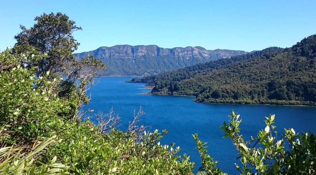
 Finally, more of Panekire Bluffs came into view – much as I remember them from my last visit to the area to do the three-day hike around the lake with Adele.
 Once again it proved impossible to keep Steve out of the water – just a swim across Home Bay & back this time, about a mile. I sat under a tree and enjoyed the $80/kg pastrami from the store at the campground.
Following the north edge of the lake on pretty flat road (now with even less traffic than not-much), I was confident that we would easily make the saddle and highest point on the route well before we’d had enough for the day or run out of daylight.
 When we rode over the bridge atop Mokau Falls, we didn’t even realise they were there – let alone, that they looked like this.
 This was our final view of Panekire Bluffs, perhaps the best yet.
Heading away from the lake towards the saddle, it was a gradual climb up a gentle valley shaded by the dense bush on our left. Crossing from Hawkes Bay to Bay of Plenty it wasn’t long until the summit. While the route was an awful long gravel road, it was interspersed with short stretches of seal – mostly around settlements and on any steep hills. Over the saddle I was pleased that the steep descent was sealed – my cross tyres proving a bit sketchy on anything too loose and fast.
 We’d heard much of wild horses all over the road once over the saddle. Here, our first sighting; also memorable as just past all those cars was our first being-chased-by-a-fierce-dog experience of the trip (something else we’d also be warned about).
We took the opportunity to fill water bottles at a derelict motel in Ruatahuna – I haven’t got sick yet – before a few kilometres up to where there was supposed to be a campground. At least I was hoping so, details were elusive online – I think it was once a DOC campsite, but no longer. Anyway, it was there with a picnic table, plenty of space, a toilet, the Whakatane River in its infancy and masses of persistent sandflies (a bit like Scottish midges, small bitey insects that attack by stealth [unlike mosquitoes]). Steve made camp and just for a change from lakes, got in the river for his fourth swim of the day while I whistled up the culinary delights that are freeze-dried meals.
What a fantastic day’s riding – great route, excellent scenery, lovely summer weather, plenty of food, good adventuring company and even a bit of engineering history. Well pleased and well worth the effort.
 Our set-up for the evening, I probably should have been not still sitting down.

 We even had blue ducks visit our campsite! An endangered species native to NZ, they feature on our ten dollar note/bill and I don’t think I’ve ever seen one before. Fortuitously, we didn’t even have to go searching for them, as they can be hard to find (obviously, they’re endangered & therefore rare) – they came to us.
 A few of the locals dropped in for an evening graze.
After a warm, surprisingly restless night considering the previous day’s efforts it was a leisurely start to the day. Fueled up on porridge and many other snacks (jerky for breakfast? – if you’re going to carry excess food, you may as well eat it) we were on our way. The morning had cooled a fair bit and it was slightly cloudy too – just as well we started with an easy climb to warm us up again. Seemingly in the middle of nowhere, we came across a fair few people just walking along the otherwise deserted road. Rather odd, until we got to a rather small settlement with a marae.

Our gentle climb to start the day, just kept on going and turned out to take us to the highest point of the day – we were done with it within an hour and the road turned back to seal (mostly) for the screaming descent to the Minginui turn-off. And that was the gravel road riding done for the day – things weren’t quite so interesting as we got out of the remoter areas. Actually, things started to look vaguely familiar. When Dad was a dairy management consultant in the Bay in the ’90s, this area was on the outer edges of one of his patches. So when we stopped to talk to local roadies on their Sunday morning rides (not a cafe stop in sight out here), I recognised a fair few place names.
 The steelwork of destroyed picnic tables makes for great bike-stands; here at the highest point of the second day – looking back over the Ureweras.
 We stopped at this old service station shortly before Murupara to fill water bottles – we’d been warned about the dogs in town, so avoided that.
From Murupara it was a twelve or so kilometre climb up through boring plantation forest with fast-moving traffic into the wind. Definitely not with the pleasure of the previous day’s riding. Still, the closer we got to Rotorua the more familiar things seemed. We started passing places I remember from my first bike tour twenty years ago (crikey) – a school holiday camp.
 It was strange seeing Mt Tarawera looming up from a different angle – but all the same, there it was.
We turned off the highway just before Rainbow Mountain and joined the Te Ara Ahi for our final stretch to Rotorua and Steve’s car. Stopping at Lake Okaro (a rather nice little lake I didn’t even know was there – there are many lakes in the area) to finish off the food for lunch, I was surprised that Steve didn’t have a swim. There’s a slim chance he was getting a little tired, but I think it unlikely. Heading west from Waimangu, we bore the brunt of a vigourous westerly – it was awful. But then the cycle trial turned for twenty kilometres of downhill to town – the wind didn’t matter so much then. I don’t recommend that cycle trail – it’s basically a concrete path right next to the highway: dead boring and quite horrible.
At least it was an easy finish to a most excellent adventure – with a bit of luck I’ve opened Steve’s eyes to the possibilities of exploring all sorts of places by bike. We got to Steve’s parents’ place, cleaned up, ate a bit more and filled the car. Somehow we fitted in three bikes, all our touring luggage, some Christmas presents, two collapsible workshop benches and countless tools.

 The first photo control point – I really could not bothered wandering all the way down & back up the hill to somewhere I’ve been enough times before.
 My support crew (Dad) snapped a picture of me happy and clean before the off; happy didn’t really change, clean definitely did.
 Rather large sand dunes looming.
 They got bigger/I got closer.
 There was quite a bit of stream crossing and riding. Very soon I was glad to be riding without external gears; this feeling amplified on the beach with all its sand and salt.
 The standing joke of the first day seemed to be: when you get to the beach, make sure you turn left. And that was the end of the navigation for four and a half hours!
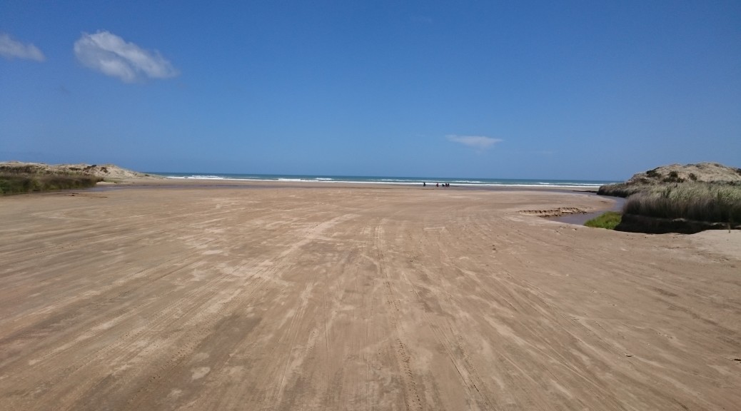
 This seems to be the only photo I have from riding along the beach – I guess because it is fairly representative of what I saw for four and a half hours.
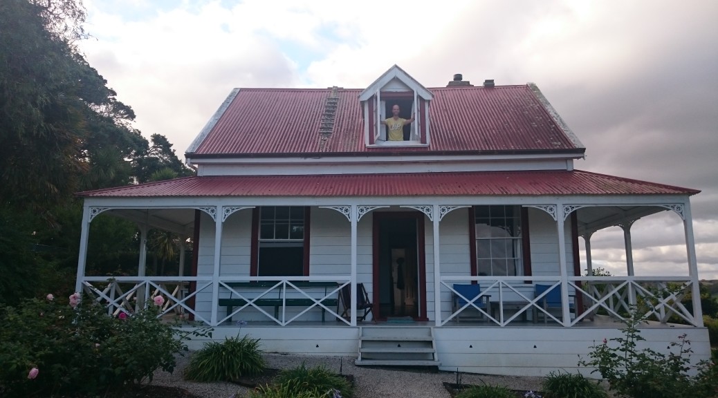

 All smiles at the prospect of exploring somewhere new – Steve has now perfected the riding selfie, no thumbs in this one.

 While we waited we could look back over the valley we’d just ridden down to Darkys Spur – you can just see the cutting for the road heading down and right from the centre of the ridge.
 To my surprise, I got closer to the lake than Steve – he didn’t have a swim at all during our ride. (c.f. the three of the last trip)
 Just a NZ backcountry traffic jam.
 I didn’t know these signs actually existed – I have a small plastic version that someone (Adele) sent me while I was overseas, I suspect to make me homesick.
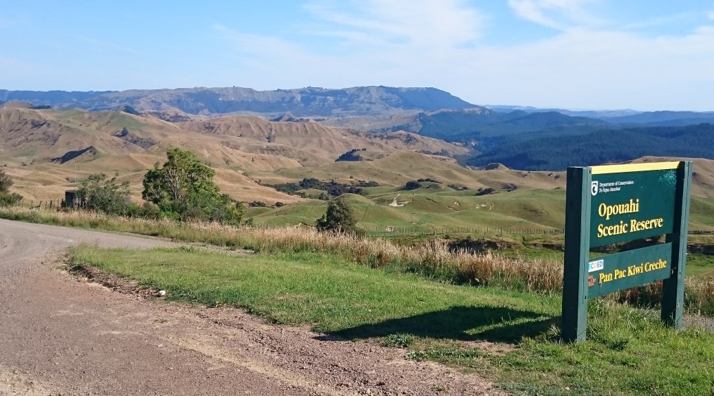
 I’d enjoyed seeing many different uses of the land on this ride so close to the city. Now we were definitely heading into plantation forest.
 Glenfalls looks a popular place to camp.