Category Archives: travel

Back into mountains

I’d promised my legs an easier day today – in light of the punishment that the Juras had handed out and what was sure to come in the Alps. And for once, the easier day plan actually eventuated. I set off at nine to follow the southern shore, approximately, of Lake Geneva until there was no more lake and then I’d follow its source – the Rhone.


I stopped every so often to take in the view and eat croissants.

I rode past the Evian bottling plant (which I’d always assumed was in Switzerland, but was actually in France) – the source of such an aspirational waste of plastic.

Evian itself started off rather poorly, at least on the road that I came in on, but seemed to be quite the destination for the well off.

After lunch overlooking the lake, I crossed the border (there were actually Swiss border guards, not that they wanted to do anything so mundane as check my passport) and thought I’d better snap a few last pictures of such a large lake and the looming mountains as I then headed south following the Rhone up-river.

From this point until the end of the day it was mostly cycle trails away from the road – but being in an ever narrowing valley not ever far from the railway or motorway. There was a surprising amount of big industry for such a spectacular setting – it has been said that the Bow Valley is a bit over done with its cement and aggregate plants as you drive in from Calgary to the Rockies, that’s got nothing on this part of the Rhone valley. As the valley narrowed, the clouds also closed in until there was need to put all the wet-weather gear on for only about fifteen minutes.

Of course, I knew there was no way out of this valley to my intended destination without a big climb – even so the mountains were getting alarmingly large and surrounding.

The sun came out, so there was at least a chance for to get a picture of the strangely coloured Rhone.

With a nice round hundred kilometres for the day (but very little climbing, only about 600 metres, and little off-road effort), I arrived in Martigny – where I’d promised myself my weekly hotel stay as I really want a good night sleep before I cross into Italy (hopefully) tomorrow. Mind you, this is the end of the third week and only the second hotel stay – maybe that’s what I did wrong the first week in wet Belgium.

The castle overlooking Martigny.

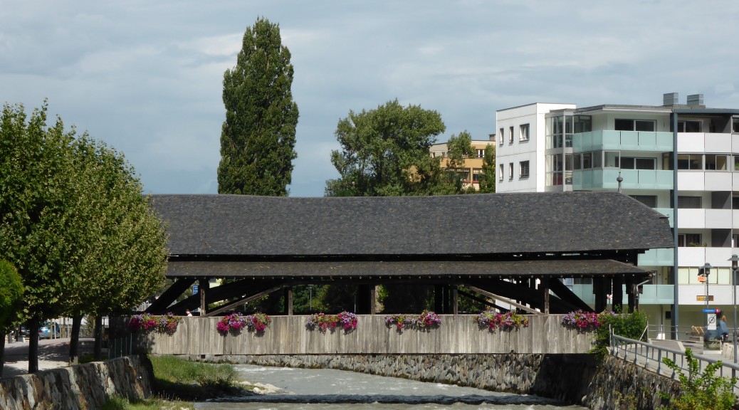
They have covered bridges here too – such sights always remind me of my stay in Pennsylvania.

I like that I’m getting close to Italy – it’s not uncommon to see Italian included in the languages on signs and so forth and a bit is spoken. The hotel receptionist began speaking to me by saying “tell me” which I’ve not heard for a while. After a short stroll around town in which I manage to miss a rain shower and I’m disappointed by European portion sizes – can they not see I’m a hungry cyclist in danger of fading away – I returned for an early night before my attempt to cross the Alps the next day.
Many metres lost

For the first time in three weeks I rose to brilliant blue skies and they stayed that way all day. I did find the disadvantage of not wild-camping and hiding in forests – clear skies mean a lot of dew, so the tent went away just as wet as if it had been raining! I’m sure I didn’t notice the extra mass.

As a region, the Jura, that prides itself on its clock and watch making pedigree, I’ve noticed an odd tendency for the church clocks to double chime. That is, they chime the number of hours that has just been reached and then about a minute later the chime is repeated – so at noon, you get twenty-four strikes of the bell to tell it is so. This does have the advantage of if you forget to count the chimes or lose interest, you get another chance. While I was sitting eating breakfast in the dining room, very civilised compared to my usual method of eating baked goods in my tent, the grandfather clock also did this. The village church was only across the street, so four lots of chimes at nine in the morning became a little repetitive!

Knowing the Geneva was about 800 metres of altitude below me, I had hoped that I would ride to the end of the Jura plateau and then coast /speed down to the lake. Alas, this was not the case – as I passed Belfontaine I plunged down to the valley only to have to recover all those lost metres and more besides to reach the top of the pass. I’ve hardly a speedy rig for long road climbs, so there was plenty of time to enjoy the sunshine, the cool of the trees and the views across the valleys. The ski-fields were getting bigger – for the last few days I’d been in cross-country skiing territory, and saw some more people out training on the road on roller-skis.

Around the corner, there was the summit of the pass and Mont Blanc.

At last I made the top of the six hundred metre climb and could speed down to the lake below. Even more reason to ride with one’s mouth closed, I found small swarms of gnats to contend with. They were OK, I hit something bigger – I think a bee – while I was doing about fifty km/hr; how it managed the time to sting me, I don’t know, but I’ve a slightly itchy neck. The terrain flattened out to farmland and then I was standing above the Large Hadron Collider. Being that most of the interesting parts are ninety-five metres below the ground there’s not a lot to see – the big shed was fairly unremarkable. On the plus side, the world didn’t end.

From where I came.

I tried the panorama function on my camera for the first time…

As well as being a logical point on my route (the big lake rather dictated that I pass through the city), I wanted to return to Geneva so that my only memories of it aren’t as a four year old getting my hand stuck in an elevator door and standing in a roof-top garden listening to that distinctive sound of European ambulance sirens. Unfortunately, my memories are no better now – I found Geneva to be wholly uninteresting. And that was on a glorious late-summer’s day where plenty of people were out and about enjoying the sun and being by the lakeside. Perhaps it was because I’d just spent a few days in the Juras and found them to very nice.

One of the two photos I took in Geneva – I could see this fountain from the top of the pass before I descended, but didn’t know what it was at the time.

My legs, particularly my left calf, were beginning to tell me that I hadn’t bothered to stretch them the last two evenings and they’d done quite a bit of hill work. I resolved to follow the road around the south-east side of the lake and hopefully not put them through too much over the next day and a half. The highlight of Geneva was the bakery stop on the way out of town – when I explained my trip so far, the guy gave me a free donut and croissant. There wasn’t a lot of competition in Geneva for best moment.

The real estate was rather swanky on the way out of the city beside the lake. It toned down a bit when I crossed back into France, but the chances of finding a good wild-camping spot were less than the previous few days. When the second sign for a campsite came up, my legs had had enough for the day and the prospect of a shower, being clean and putting my tent up while there was still sunlight to dry it were too tempting.

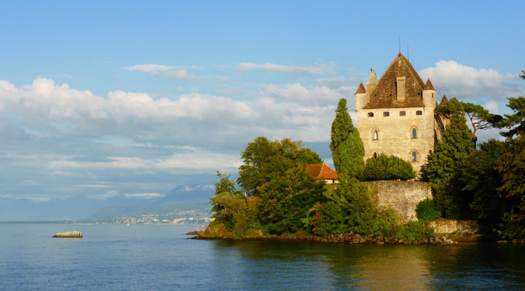
Yvoire is the village just across the road and it is a delight. Right on the edge of Lake Leman (Geneva), it’s got an old castle, ramparts and fortified gateways. Not to mention plenty of little twisty streets, no cars in the centre and plenty of bright summer flowers. A nice spot for a strange bit of time on the bike with no luggage and a tasty dinner.

The slimmed down Ogre out for an evening ride.
Continuing through the Juras

It fair rained all night, but somewhere between being semi-conscious it was raining I managed a fair bit of sleep. Pleasingly, the rain abated just at the time I emerged to another day and decamped. But when the rain set in just as I departed for the day it looked like it would stick around for most of the day. After Tuesday’s climbing and distance I decided an easier day on the road was in order – plus, if the state of the forest was anything like where I camped, I had best stay out of the mud.

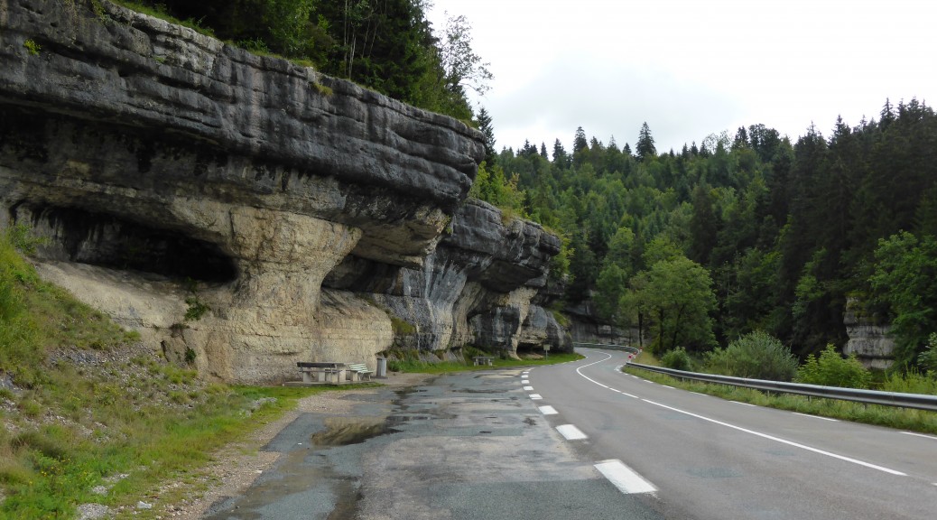
Having just missed out the day before, I almost immediately passed through 1000 m. A nice little milestone to finally get. All too quickly I was on a fairly busy road to Morteau plunging down the valley to the Doubs again. Deciding that I’d certainly under-eaten for the previous day’s efforts it was an early stop at a Tabac for a Snickers. Taking the road following the river up was easy – but a bit busy (although drivers here are all courteous and give plenty of room when passing cyclists – & the occasional toot of the horn). The river has slowly worn away the limestone plateau either side, so the cliffs and overhangs gradually became bigger.

Looking for somewhere to buy food I found a rail-trail that had joined the river’s general direction so I got on that for the final ten kilometres to Pontarlier – a nice old town that still had some fortified walls and gate to pass through, one of its claims to fame seems to be as a centre of absinthe distilleries. The sun finally made an appearance, so after having full wet-weather gear on all morning it was a relief to take them off and get a bit more air flowing over the limbs. A large lunch consumed, and second-lunch bought for later there was time for a couple of photos.

Somewhat sick of the busy road, I thought I could see a path through the forest on my GPS to the lake and some quieter roads. This proved to be a fairly decent climb, but it was quiet and it did actually take me where I wanted to go! Also, the downhill was on less well-made trail so that was more fun.

Also, there was this to spy through the trees.

When I reached Lac Saint Point, the walking trail I’d been following diverged from my intended direction so it was nice quiet roads to take me south-west. Here’s some general photos from the valley riding.

Cow picture for Dad – this seems to be the dominant breed here.

A more unusual church from afar.

Cows have had bells around there necks for some days now – these bells are getting a bit big I think. Also, goats, sheep and horses are prone to having bells attached

While on the subject of animals: all through this tour I’ve noticed many lone cats just roaming the countryside. They must be pets – but they pop up in the strangest places. And slugs – for a couple of weeks now I’ve seen large brown slugs just hanging out on the road, always about a foot from the edge; perhaps none of them make it further than a foot. I always try and avoid them as I’m not keen on a squashed slug being flicked up by my front tyre into my face (always ride with your mouth closed); I’ve not seen any flattened slugs, perhaps they reform.

Just another WWII bunker in a field – for once I bothered to take a closer look. Not sure why this one was here – it’s only the Swiss border a few kilometres east.

It commanded a good view of the valley.
If it’s fun to pass roadies on a single-speed mountain-bike, it’s even more fun to pass them on a loaded touring mountain-bike with big knobbly tyres. It doesn’t happen very often obviously – but the couple I passed today were quite chatty and I got some tips on the best route to get me wherever it is I’m going. It did involve a bit of a hill – but at least it was more peaceful. Around the small villages I’d passed through then I’d noticed MTB trail maps – so once I’d climbed my final steep road climb of the day I took off to the right and went for some more climbing. It began with a big rocky double-track, nice technical climbing before degenerating into slippery muddiness and then onto a long-ago sealed forestry road. The signs said there was a look-out off a spur to the right, this was properly steep and took me through 1250 m. Unfortunately, the trees were too tall so I couldn’t really see much of the lay of the land.

But the downhill more than made up for that disappointment. It started out steep and rocky and just got better – it became a case of it shouldn’t be possible to have this much fun on such a loaded mountain-bike. By the time I rolled into a slightly larger village (cross-country skiing is popular around here in the winter), my easy day had ended up being 109 km with about 1500 m of climbing and some significant off-road bits; oops, again. I was hungry, but the promised restaurants were hard to find. The one I settled on, part of a small hotel, didn’t serve dinner until 7.30 so I had to wait. The owners didn’t speak much English and I speak just as little French, but despite him continually speaking to me & me answering with blank stares, I managed a nice dinner. And they let me camp in the back garden – score, especially after that carafe of red wine.

The hills may be getting bigger

Well, my commandeered verandah may have kept me dry, but it was a rather broken night’s sleep. I still couldn’t manage to get away before nine – but when I did, I changed course south to cut across the bulge in Switzerland encroaching into France. I was off-road and with the overnight rain things were decidedly muddy. Quite by accident, as I approached the Swiss border I happened across Kilometre Zero – the start of the Western Front in WWI. At that time, before Germany had lost Alsace at Versailles, the German-French frontier was here with the Swiss to the south. The ruins of the German defences were still visible. The Swiss Army had recently reconstructed the wooden fort that they used to keep an eye on the belligerents.

I turned to the road for a while before laying my eyes on a ridge above the valley to the south. This whole time it had been overcast with just enough drizzle to mean that the jacket had to stay on – but with the warmth, the rain trousers didn’t last long. I followed a double-track gravel road to the top of the ridge – it was pretty steep and took me through seven and then eight hundred metres. There was a tiny ski field at the top, but a missing sign sent me on a big loop downhill and then I had to recover quite a bit of altitude – a little frustrating to lose an hour, but hey ho.

There was a big plunge down to the River Doubs, it was rocky, slippery and all kinds of good fun to ride down. It’s times like these that make it nice to have a mountain-bike with big knobbly tyres on such a tour – I do spend quite a bit of time off-road now that it’s drier than the Ardennes. Trying to get a few miles in for the day, I followed the river down the valley to St Hippolyte – a rather nice little town that had a potable water supply outside the information centre (many fountains seen so far today were non-potable) and provided the day’s bakery stop.

Every village has a church and it’s usually the most obvious thing to take a photo of – this one before the first big climb of the day.

The valley from which I climbed.

And into the Doubs valley.

St Hippolyte

The only way out of St Hippolyte, in the southerly direction I was headed, is a really big road climb – my biggest yet that took me up 400 metres on a rather busy road. After giving him a head start in town, I hauled in another cycle tourist – he for some reason had two rear panniers, a bag on the handlebars and a trailer usually used for towing children with who-knows-what in it. That some people manage to find so many things to take on tour continues to baffle me – he really was breathing heavily.

I read somewhere, it doesn’t seem believable, that this area was where the first pack horses were bred. This one certainly had a great deal of stockiness about it.

At the top of the hill it did seem that I was up on a plateau – maybe this is what Adrien was talking about. Through a mixture of roads, forestry roads and mountain-bike trails I continued south. Stopping in Le Russey for dinner I got chatting to a couple of mountain-bikers that were just heading out on their weekly club ride. I was tempted to join them, if I could find somewhere to store my rear bag, but truth be told I was too tired from the day’s climbing. For only the second time this trip I had hauled myself and my load (small compared to some, admittedly) through over two thousand metres of climbing. I didn’t last long after dinner before finding a camping spot – I hope my tent stays up as there’s been a strong southerly all afternoon (which was delightful), it’s just started to rain and the stony ground here was not at all receptive to tent pegs.

Oh, if anyone can tell me what these little towers are for I’d be most interested. I first noticed them back in the Ardennes, they were larger there. I thought first perhaps they were fire lookouts (always in forested areas), but they are much too short. The one on the left is tiny, the platform is barely a metre off the ground; the one on the right is more of a normal size for around here.