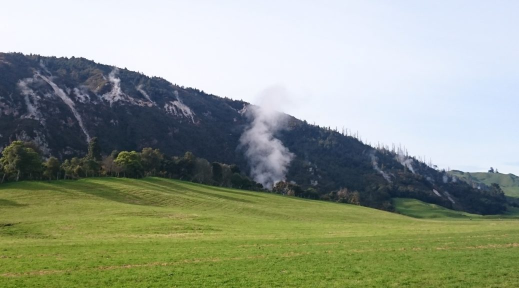
The previous day must have been somewhat tiring as I slept unusually well in a small tent. Packed-up we cycled off – that was the last we saw of most of group, as they were doing the three-day option and taking an entirely different route to us four-dayers. In a contrast to Day Two, the day started gently with the easiest section of the day. It was reasonably flat along Te Kopia Rd for a while as we watched the geothermal steam languidly rise.


The climbing started in earnest, and so began a day which felt like we were constantly going up or down. It probably wasn’t quite like that, but that is how I remember it. As we neared the Waikato River (the longest in the country) the land use turned to forestry again, the road became shingle and turned sharply south-east. With a few more rises and falls, going past some beautifully remote-feeling spots we reached an intersection and were shortly stopping to snack and look as we crossed the river. I thought it remarkably still.


Turning onto State Highway One I was surprised to see we were only twenty-two kilometres from Taupo! And we were about to get closer as we were dumped beside a passing lane with little shoulder and holiday weekend traffic. Thankfully that was over soon enough as we passed our highest point of the day. On the back road to Kinloch we passed plenty of lifestyle blocks before heading through more forestry and dairy farms; of note was a sprawling complex of tomato glasshouses heated geothermally, a new diary factory and geothermal power generation.
There was some respite from the climbing before a prolonged descent towards the river again and catching up to Colin as he was standing perplexed by an irregularity in the GPS route, much as I had been. We didn’t quite get to the river, but did pass this conspicuous formation that one usually sees from the other side driving past on the highway.

Once again we rode beside a horrid passing lane on the highway – thankfully only three kilometres of rushing traffic before turning off, climbing once more before stopping on the grass of Ohakuri Dam for a very long lunch watching the activity on the lake.

 Admittedly, there is not much activity to be seen in this picture.
Maleme Road provided the only other stretch of gravel for the day, unfortunately. Or perhaps fortunately, as although it was a beauty it climbed a couple of hundred metres. Coming off the hill, we ended back down at the level of Lake Ohakuri, and about six kilometres from where we had been at the start of the day. Psychologically this was difficult – to have ridden 110 km just to end up basically where we’d started, with an awful lot of climbing in between time and not really any particularly unique scenery. I tried to keep this frustration quiet as I think Steve was struggling with so many hours in the saddle over consecutive days – at least he couldn’t see the GPS track and its seeming futility.
Things flattened out, relatively speaking, as we headed back to Rotorua to skirt its edges. We reached the first shop of the day in Springfield, resupplied and chatted to Colin again. With a decent cup of tea downed, we set off to finish the last twenty kilometres of the day around the back of Mt Ngongataha. The climb up to the saddle wasn’t as long or high as it looked and the change in scenery, from the farms and forests, around the back of the mountain made everything wonderful again and I was happy to be out riding bikes in the gathering gloom.
We found the campground easily enough, got a different view of Lake Rotorua and made camp. With recommendations for the best takeaway shop on the main street, we set off to collect rather large bowls of Chinese food. Eventually Erik rolled into camp having taken a twenty-four kilometre detour in the middle of the day for a cafe. I was a bit tired, so settled into my sleeping bag for what was to be a rather rainy night.
 Lake Rotorua looking a little gloomy as a strong wind whips off the lake towards our tents.
