A little West Coast weather keeping my enthusiasm for outdoor activities to short walks, short rides and some gardening for four days, a break in the conditions coincided nicely with my desire for a longer hike in the area. Well aware of the Coast’s reputation for gnarly, steep tracks I was offered three choices – I forget why we settled on Mt Brown Hut, perhaps because it offered the chance of a loop. A bit of a drive, particularly scenic around the back of Lake Kaniere, and we were at the trailhead – a couple of vehicles of the van-tourist variety reminding Katie that this hut has become far more popular with its Insta-fame.
 Heading up there somewhere; I know now the hut is on the ridge on the right, the summit the left.
Beginning mildly, straight into the bush, we were soon climbing in earnest. Hudson (a young German Shorthaired Pointer) covering twice, if not thrice, the distance we were as he repeatedly zoomed off smelling all the smells. Progressively steeper, it never got quite as steep as I thought it would – although there were plenty of times where hands were required, both for my balance and propulsion but also occasionally for Hudson to get up the steepest sections. I was convinced this steepness was going to be very tough on the legs descending.
Amongst the effort, plenty of changing bush to admire as altitude quickly increased. Dense enough, there were seldom any glimpses of a view beyond the trees. Gaining the ridge, the sub-alpine gave us some views and plenty of mud.
 Browning Range to the south.
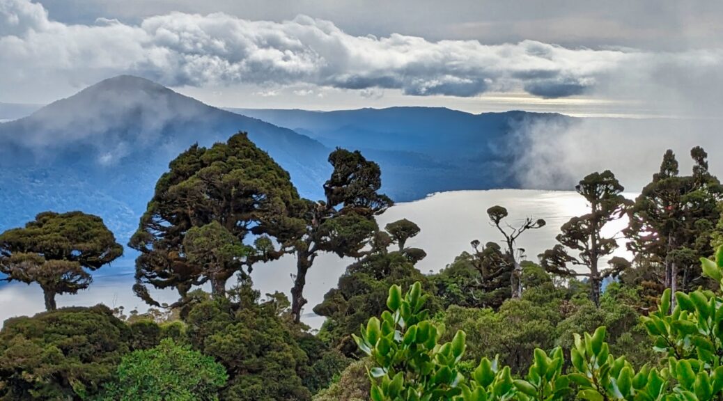
 Lake Kaniere to the northwest.
 Opening up now, damp underfoot, clouds starting to blow through. Summit is centre of the three peaks on right side.
I’d slowed the normal quick ascent markedly, but it was still only a hundred minutes to the hut. Pleasingly for the ease of quick sums, we’d climbed about a thousand metres in five kilometres – so an average gradient of twenty percent, it was a fair climb. Time for lunch in front of the hut and trying to glimpses different aspects as the cloud continued to build but kept moving.
 Yip, it’s a picturesque hut and setting.
 A peek, and indeed peak, of the Southern Alps to the southwest.
Completing the loop, dropping steeply to the Styx River and then walking along flats didn’t appeal as much as carrying onto Mt Brown summit for a look-see (I assume it’s named so, with the hut and all – strangely it’s not identified on the topo map).

 Not a marked track, it was easy enough to navigate along the ridge as it dropped off steeper on each side.
 Spot the hut, certainly can’t see Lake Kaniere any longer. Also spot me, lagging behind.
 This isn’t so good for the summit views.
 Thankfully things cleared a bit as we reached the top, enough anyway to look up the Styx valley.
 Someone stayed still long enough for a photo!
The descent wasn’t nearly as horrible on my legs, or as steep, as I feared – it did take just as long as the climb however. As things flattened out over the last few hundred metres, descending muscles definitely making themselves known!
 About the biggest look at the lake from the bush that I got.
A great little foray into the West Coast hills – hopefully not too slow for the Katie and Hudson, and thanks for the couple of photos that are obviously not mine.