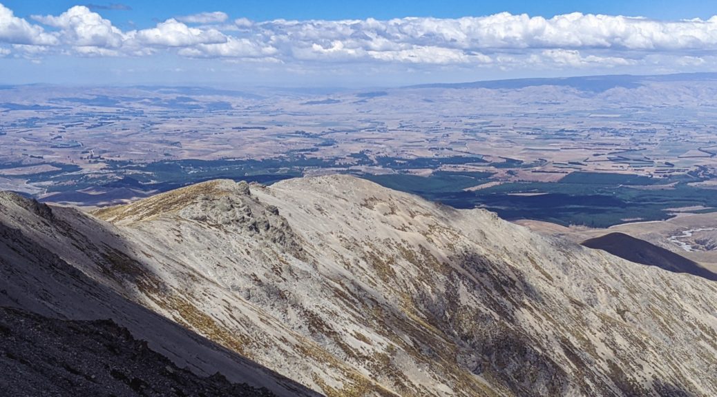
Having been distracted by the summit of the Hawkdun Range a few days before, I had to wait for clear skies and some energy to return before attempting to get up Mt Ida. This did mean another two-hour bike push up onto the Hawkduns; being the third time in a month, it’s getting to be old hat now and just part of getting to enjoy this area. Of course, I could have just hiked up without a bike – but I would have then resented every moment of the unnecessarily slow descent!
 Do quite like it up here.
 Over the Maniototo with the Rock & Pillars in the distance. I’d soon zig and zag along that ridge at left to get onto the Ida Range.
I was surprised to see a truck parked at the top, and more so to see someone around. Turned out there were lizard researchers camping up here for a few days counting such things. Nice spot for it. Stashing the bike, I lunched before setting off on foot to connect the ridges to Mt Ida. Thankfully the contour lines on the map along the path I would follow were relatively benign.
Of course, that was just the map and, as expected there was plenty of tussock and loose rock to deal with. There were still hills to deal with so, but the summit wasn’t much higher than where I left the bike – so I just had to regain the mellow altitude loss.
 Doesn’t look too far away, or that lumpy.
 Hills Creek heading to the left of Raggedy Range to join with Ida Burn near Oturehua.
 Maybe sidling around here wasn’t such a fantastic idea, time to veer for the ridge.

 It’s not far away, just have to get around there, by heading right. (Summit back left.)
A breeze kept me from overheating as I picked my way through the tussocks and over the rocks, giving my ankles a good workout on many hidden lumps and slip-sliding rocks.
 Northeast over the Oteake lumps and gullies to St Marys Range.
Out on the Ida Range now, there was one last dip and then the steepest climb of the walk to go. Views opened up south.
 Little Mt Ida, and its transmitter, looking, well, little. Ida Burn forming and then tracking away from the Maniototo plain.
 Intrigues me when water doesn’t take the obvious, short path – here Ida Burn avoids filling the Taieri and heads right of Rough Ridge to Oturehua and ends up in the Clutha at Alexandra.
 Naseby is easy to quickly zoom in on a map as the forest is clearly an anomaly around here.
Summit time, marked only by a small cairn and slightly better views. Not quite two hours on foot with a few snack and view pauses, a good little walk to add to my understanding of the area’s topography. With more time to organise logistics, a traverse of the Ida Range appeals; maybe by foot first to see if it’s worth dragging a bike along!
 Boundary Creek forms here, we crossed the lower end of it a few weeks before as it becomes the Otematata River.
Time to turn and head for the bike, pretty easy to see much of the route back to the spot at the left of this picture:


A more considered route back was a good twenty minutes quicker, but there were also fewer photo stops on ground I’d already covered. Grabbing the bike and pushing back to the double-track, I was surprised to see two bikepackers at the top of the descent. I was sure all the Tour Te Waipounamu riders had gone through. I was correct, these two had come from Tailings Hut and were on a bit of Central Otago and Southern Lake tour – much of it sounded familiar.
Nice to chat before ripping down the loose track to the car. Thankfully I’d learnt my lesson of Friday and borrowed sister’s full-suspension bike, far faster and more comfortable on such a rugged track. Am looking forward to bigger wheels, fatter tyres, more travel and slacker geometry…soon (c’mon postal service!).
