Day Two: American Flathead to Red Meadow Lake

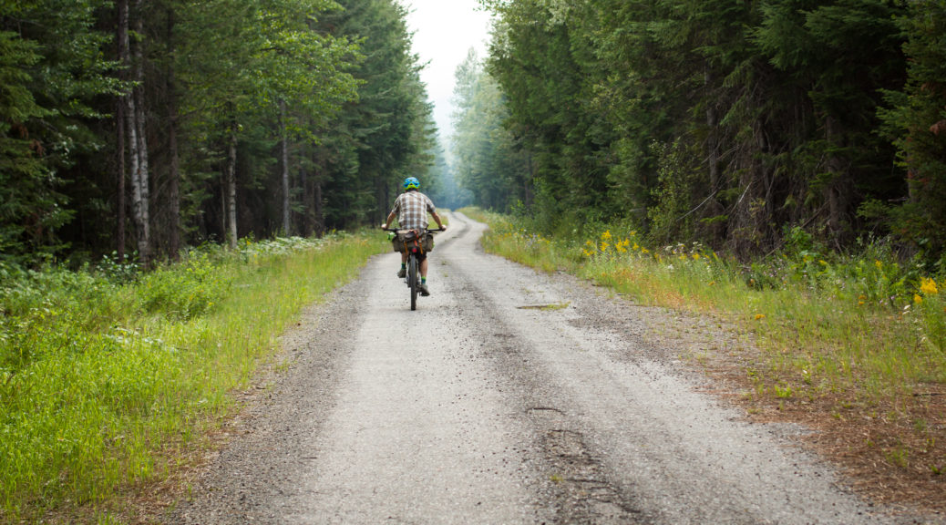
Excited to be heading into the wilderness, after a large breakfast we stocked up on food for the next two days and hit gravel soon out of Eureka. Steadily heading up the Tobacco River valley, shortly after crossing the river we were on highway briefly and then off it again heading for the hills. As the climbing began in earnest and farms were left behind for national forest, it was expected that we’d be rolling on gravel. Strangely, the sealed road just got smoother as our elevation climbed.

Traveling far lighter than other cycle tourists (they generally had far larger routes planned), they were hauled in at our steady pace. It turned out that there were so many other cyclists, we couldn’t possible remember all their names – over about two days we met about twenty-five others. Some we chatted with for quite some time, some briefly and others just exchanged greetings. Plenty of interesting folk out riding bikes.

Shortly after meeting some Alaskans, the seal ended and the gravel began – that, I think, was entirely coincidental. A pleasantly warm day, it was nice to be in clearer air than the smoke-stained skies of British Columbia. At least, it meant we could actually see the view in the distance.

There may have been a lot of trees.

The surface was fantastic and the gradient mild. Things opened up a bit where avalanches had long since cleared the slopes.

A feature of the trip was the many different varieties of wild flowers roadside.

You know, a few more trees. Who me? No, I don’t work for a forest products company, not at all.

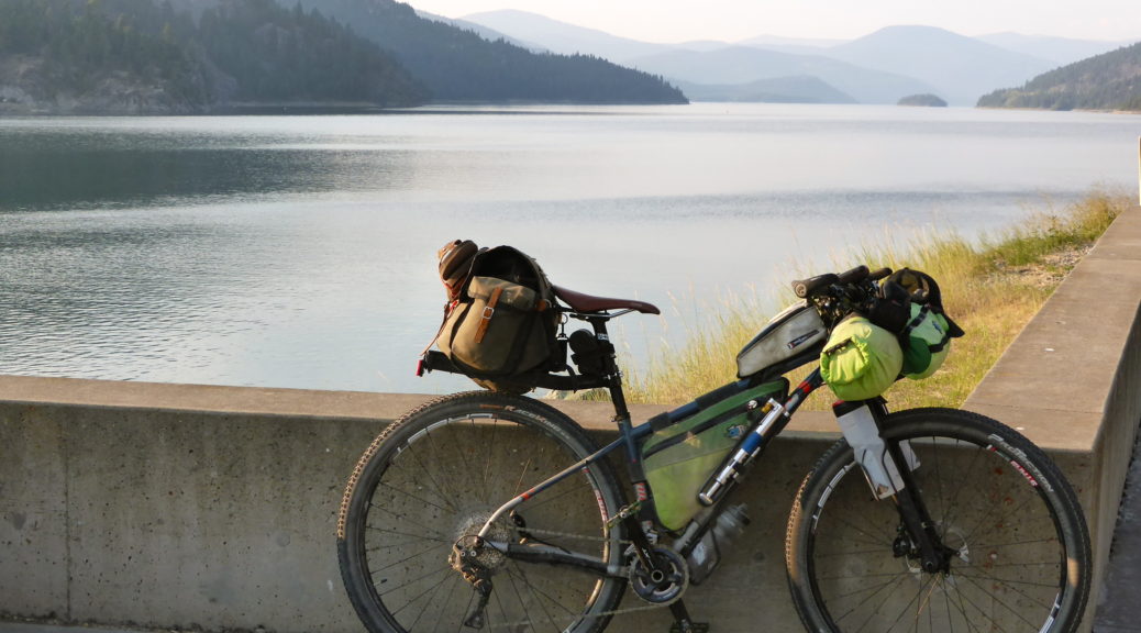
Eight hundred metres of climbing done, it only seemed fair to stop at the top of the pass and eat. Also, it would be rude not to chat to more passing cyclists. The downhill was long and also mellow – all the better for looking at the views.

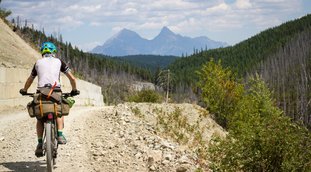
The west side of the spectacular Glacier National Park came in to view. It was easy to pick the patches of forest that had long since, or recently in some case, been ravaged by wildfires.

Being in the mountains so much, we were never short of water sources – water treatment drops were used, probably mostly unnecessary but how can one know?

One of the woman from the top of the pass, Sarah, passed us as we stopped to fill bottles. A novice, she was hauling an extraordinary load – worryingly all carried on the rear of the bike. Shortly after, we were confused to come around the corner, see another cyclist standing on the side of the road and some other guy (no vehicle in sight) who must have apparated there . Eventually we recognised Sarah – that was difficult initially as she was covered in an unhealthy amount of blood. She convinced us she wasn’t concussed and the other guy’s family had driven off to fetch her friend – turned out he wasn’t a wizard, disappointing. We couldn’t do any more than had already been done, so carried on – bike helmets really are quite useful.

The road flattened out as we headed for the Flathead Valley.

It became apparent we were out of the national forest as Private Property and Posted – No Trespassing signs started and we noticed increasing numbers of cabins in woods. Riding south along the Flathead, I’m told it was a lot less remote than the Canadian Flathead.

We never quite sure how many of the cabins and houses were holiday homes, permanent homes or properties of survivalists/preppers. Thankfully the road was still quiet and most traffic, except the FedEx pick-up, courteously slowed for us.

Mid-afternoon we turned away from the Flathead River and started towards Red Meadow Lake – the highest and end point for the day. Stopping again for snacks near a small pond, it may have been the first time we partook of one of the most common delicacies of the trip – frozen burritos. Bought frozen at the start of the day, usually from a gas station, these are much mentioned by GDMBR riders – they gradually thaw and then warm over a hot day, ready to eat heated mid-afternoon (depending on how hot the day is). Another one of those things that taste OK, but it pays not to read the list of ingredients.

A mostly gentle climb up more pristine gravel with even less traffic, it kicked a little for the final section before we rolled ever so slightly down to the lake.

What a pristine spot for a campground nestled between lakes and mountains.

We shared a campsite with Johnny, a young Swiss guy riding the GDMBR – well, a large part of it in the time he had. Understandably, he was tiring of all the beautiful mountains – not really traveling to see places just like home, he longed for flat, open lands. He was quite taken with how little we were carrying and determined to shed some of the many kilograms he was carrying.
The dust of the day washed off in the lake, local fisherman met, exuberant young dog pouncing avoided and sick of mosquitoes – it was time to call an end to a fantastic day on bikes in beautiful big country. It was much quieter and cooler than the previous night, far better for sleeping.

Thanks to Megan for the photos of me riding.

Day One – Out of Canada (so soon?)

A bit shocked having just come from winter and skiing, sleep was hard to come by in the August heat of the Rockies. Not in any particular rush, breakfast was leisurely and bikes were eventually packed and ready to go. Saying our thanks and goodbyes, we rolled into the centre of town. We promptly stayed for quite some time buying food, unexpectedly meeting friends (whom I knew from previous North American stays) and eating bagels.

This was the first adventure on my new bike. Only having ridden a hundred and thirty kilometres on it, I was keen to see how it would go. My hastily cobbled together luggage arrangement didn’t last long. We hadn’t even got out of town before a malfunction of my saddle bag stopped me in my tracks, a roadside repair was effected. It wasn’t to be the last time in the trip it was overloaded with food, but thankfully it was the last such mishap.

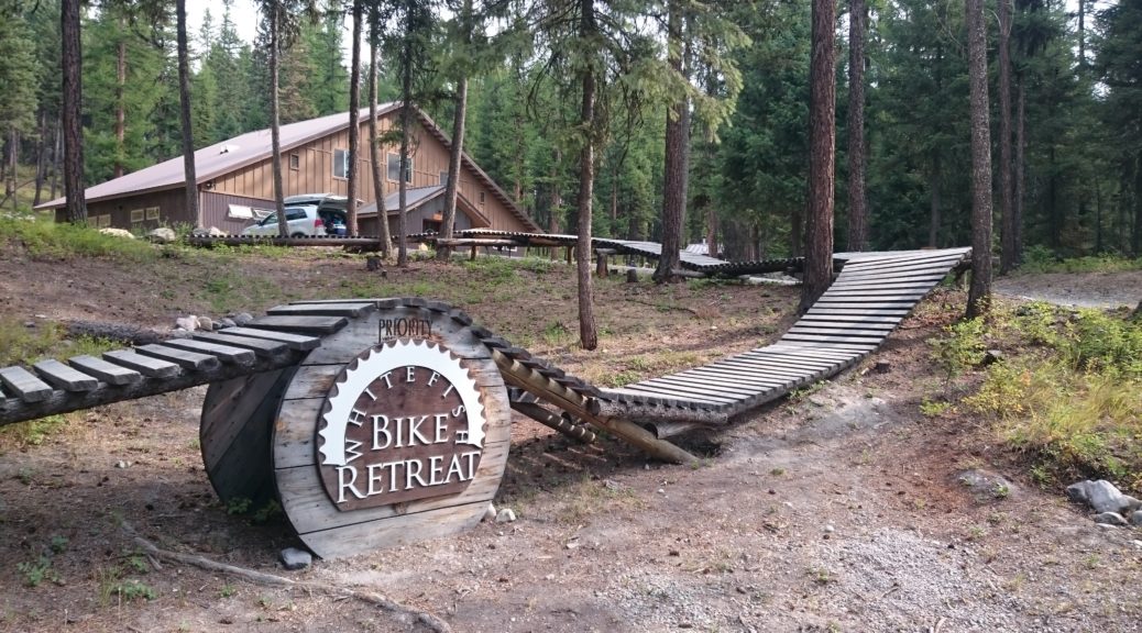
After waiting at a level crossing for a massive-by-NZ-standards, normal-by-North-American-standards train, we were on our way almost two hours after leaving the house. Definitely not in any rush – but we did want to cross the border and make Eureka that night, so that we did make the Whitefish Bike Retreat booking sometime over the approaching weekend.

This below is the route that we were to trace, clockwise, over the following twelve days. A combination of various defined routes, points to meet and spend time with friends, towns, remote backcountry gravel roads and some seal to link it altogether – it was excellent, as will become clear.

Taking a Great Divide Mountain Bike Route (GDMBR) alternate south out of town, we were soon past houses and riding gravel roads through forest. The highway was off on the other side of the Elk River, so our road was quiet – apart from the occasional train nearby. Trending downhill, there were still plenty of climbs to test our legs – neither of us having ridden loaded bikes any great distance for a while. We met our first other bikepackers of the trip – chat with all the interesting riders of their planned trips was good fun.

Crossing the Elk River (my head not in the space of cooling off in rivers, we missed a good stop) the lovely gravel ended and we were spat out at a gas station on a busy highway. It seemed time for ice cream and other rejuvenation. Further down the highway were meant to connect to back roads for the run to the border – but the main highway was too busy, so we turned off quickly for a quieter highway straight to the border. Mid-afternoon by this time, it had really heated up and a nagging hot wind slowed us on the mostly-but-for-two-notable-exceptions downhill to checkpoint.

We joined the actual GDMBR and soon hit the queues at the border crossing. Having cleared US immigration during transit in Los Angeles, the questions of our intentions were very mild. In fact, outlining our planned route the line of interrogation turned into jokes about hearing banjoes playing. Half-five and into Montana we were; first objective of the day complete, it was “only” about twenty kilometres to Eureka, food and a community campsite.

Gravel backroads took us off the highway, and provided plenty of rollers. Pace slowed, but eventually we got a tailwind and a significant downhill into town. Exhausted there was resting in a very small park, with its own menagerie of aggressive turkeys, before trying to find food. Pizza took an age, but then I would join a queue behind what seemed like a whole battalion of Californian wildfire-fighters (wild-firefighters seems a bit unruly; there’s probably a more correct name).

Down the road, right next to the Tobacco River, was the campground. With a few picnic tables and grass, it’s available by payment donation only and is near to the sorts of services those on the GDMBR need. Cycle tourists #4 through to #12 (?) were there for the night and more bikepacking chat ensued – sure was interesting hearing more and varied plans, and backgrounds. Poking around an adjacent compound of historic buildings scratched the itch to know slightly more of where we were. Strange American experience for the day was buying a sealed cup filled with frozen diary, putting it in some futuristic automated machine and out popped a thickshake – curious, so long as one wasn’t so inquisitive as to read the list of ingredients/chemicals.

The evening drew in and after a hot, long day – well, it was a hot night in a bivy bag punctuated by noisy traffic. Fantastic to be out biking in new places, tomorrow – wilderness!

Dan Loops of New Plymouth

Saturday dawned a cracker and we were out on bikes for the day as Dan gave us a tiki tour of New Plymouth comprising loops of various sizes. First up was some nice rooty track through suburban native forest before joining one of the many pathways that follow the lower reaches of various waterways flowing to the Tasman. Beside one of these were two large rope swings strung up in trees on the back of someone’s property.

Proper decent rope swings; it was not easy jumping off makeshift platforms onto the ropes – great fun but.

We wound our way downtown, pausing briefly to check out some murals and numerous eels slithering around another stream.

Down to the coastal pathway, near the infamous Wind Wand – this is about the only thing I remember about New Plymouth from my university holiday job in South Taranaki – it was the topic of much conversation in the smoko room.

Jacqui, Dan, Adele and James just before heading west on the pathway.

A lovely day, the pathway was chocka with people out walking, riding and running. Fantastic to see, it reminded me of home.

Passing the port, we rode up towards the base of Paritutu Rock.

A super steep climb up above the coast, bikes were left behind as we scrambled up. Staircases took us about halfway and then chains were strung down the face to aid climbing. Once again, plenty of people were out enjoying the sun.

Atop, we looked out over Sugar Loaf Islands and could just spot some offshore platforms.

East we looked along the coast, past the port and a disused power station.

Floating roof tanks! Oh, and the city. I rankled a little bit at the industry-is-ugly comments.

Hidden in the cloud was Mt Taranaki.

The walk down was tough in MTB shoes and torture on my legs – which were starting to ache after the previous day’s descent off the mountain.

A little further west we enjoyed a bit of beachside riding – my legs were at least still good for cycling and some nasty little grassy pinch climbs.

Looping back up beside another stream we came across a smattering of shops – definitely time for lunch. Dumplings were procured and we found a picnic table on the shore to eat, literally, scores of the tasty morsels.

Back towards Paritutu, note the sax player adding a touch of class to our seaside meal.

The slight detour back into town was unsuccessful in obtaining cronuts, alas; but this building is striking.

We continued west with ample distractions to look at – and still numerous people to avoid banging into.

This striking bridge is even more so when the mountain behind us is not shrouded in cloud.

Heading home we found a bakery for more treats and yet another pathway beside a river to get us most of the way back. An altogether lovely day out in a very pleasant little city; good weather, food and company sure helps too. It’s a pity New Plymouth is five and a half hours’ drive away.

Mt Taranaki

I had planned to break the five and half hour drive after work to New Plymouth with a stay overnight halfway. But the weather window was good and someone decided that Friday was the day to summit Mt Taranaki – I could hardly miss out on such an adventure and new experiences with dear family and friends. I’ve climbed higher peaks, even in the North Island, but never in winter through such snow and ice cover. So I was pleased to arrive safely in New Plymouth not too tired.

Leaving the parking lot at the North Egmont Visitor Centre, it was just on sunrise and we were treated to the mountain being bathed in a wonderful glow.

The clear skies were also pleasing to see.

A relatively steep double-track road (used to service the transmission tower we reached just before donning our crampons) took us through dense native forest. Gnarled old trees, branches and foliage lost as the mountain stood above.

I was taken with the difference and large crown of the cabbage trees – most unusual compared to the ones I usually see.

As the snow layer thickened, we reach an alpine club hut. A little salubrious – electricity, flush toilets and swipe card access. Crampons were fitted to my boots (and everyone else’s, but it wasn’t unusual for Adele, James & Dan), snacks taken on, sunscreen applied and we were off into the snow and ice.

It took a little to get used to walking around with big spikes attached to one’s feet. Using the handle of an ice axe as a walking pole, on the uphill side of the traverses, was more difficult to get a rhythm going with. Switching hands through the leash (it doesn’t pay to lose an ice axe down the slope) every time we switched directions also required more concentration than simply walking.

After a short section of quite narrow snow between rocks and a drop (great introduction), our route opened into a nice wide gully.

Apparently it was time for me to learn to “self-arrest”. Which basically involved throwing oneself down the hill, getting a bit of a slide going on (keep your feet up to prevent snagging them) and leveraging the ice axe into the snow to stop the descent to certain peril. Brilliant. Two such attempts were enough.

Steep enough for this novice.

We watched a large layer of cloud slowly approach us from the east and smaller clouds blew on top of us and soon fled. It was a surprisingly calm day for the most part. Occasionally we were exposed to a bit of a southerly, but conditions were generally benign. Small patches of white-out conditions had us following the poled route.

Due to my inexperience it had been decided we’d take the easiest, least interesting route up. It was plenty interesting for me but – constant thought of where one was stepping, trying to get as much contact between crampons and snow, driving ice axe in. So much so, that I had to stop to admire the view, rather than looking aimlessly while walking. There were four others that we shared the walk up with – everyone taking slightly different routes up.

Approaching the crater, the ice formations became larger, more unusual and at times surreal.

In the crater, the surface turned from snow to lumpy, knobby ice.

It looked rather windswept. While we were still bathed in sun, a layer of cloud encircled the lower reaches of the mountain.

Out of the crater, one last pitch up to the summit. Here the ice was in much larger lumps, some of them shattered when bearing weight, others didn’t – they all looked potential ankle breakers though.

Five hours after setting off, we had ascended 1500 metres and enjoyed a bit of time on the rather flat and, in this case, calm summit.

Dropping back down to the crater, we lunched in the sun before starting the descent. Back on the snow, it took a little while to get any sort of technique to go at a decent pace – this involved moving from walking across the face using the whole sole of the foot to turning to walk down the steep slope and relying on one’s heels to dig in. It worked, until it was too steep and I became more faint of heart.

The weather closed in again, and after two hours of slow descent (oh for skis) I think I was starting to get a bit fatigued. So repetitive…

One of the other parties inadvertently followed us down – which would have been OK, except we were not going back to the hut where they were heading. As the visibility vanished, we cut back to the poled route so that they did not get lost. Parting ways just before the hut, we missed a bit of the track out by taking a narrow gully – we tried sliding down, sans sleds, but it was rather bumpy.

Back on the access track – golly it got steep, no wonder it was paved in part.

Things cleared a enough to admire a bit more of the scenery.

My legs held out enough to make it back to the car. But how I would pay for it the following days – barely able to get up and simply walk, my quadriceps have never felt so tight. All worth it though – a fantastic day out learning new things, going new places with great people.

Biking to go places, going places to bike.