The Otago Central Rail Trail is the original long distance cycle trail in New Zealand – it’s been around since about the turn of the century, the railway having closed about ten years before that. It’s hardly thrilling mountain-biking, but at a shade over 150 km and passing through spectacular Central Otago landscapes, I was determined to ride it this summer as a training ride.
Initially I thought I’d drive to Ranfurly (a little east of the halfway point) and do two days of out & back rides to cover the whole trail in both directions – not really the pace the trail is intended to be ridden, but good long days on the bike that are necessary two weeks before the Kiwi Brevet. But on my little bikepacking trip just after Christmas I realised I could easily ride to the trailhead from home in just over four hours.
With Linda, of the Grandview ride a few weeks ago, house-sitting near the other end of the trail I planned a six-day bike trip – two days on the rail trail there, the weekend biking around Alexandra & two days riding back the way I came. So Thursday afternoon I set off & rode to the end of Ramrock Road again. It was even more overcast this time & there was a strong wind blowing out of the north. Thankfully, I was generally going west so the wind was manageable the few times I had to go directly into it. A bit fitter and stronger than three weeks prior, I made reasonable time with few stops – & there was much less stock to frighten off the road this time.
 Down in the Nenthorn Valley, I remembered to snap a few pictures.
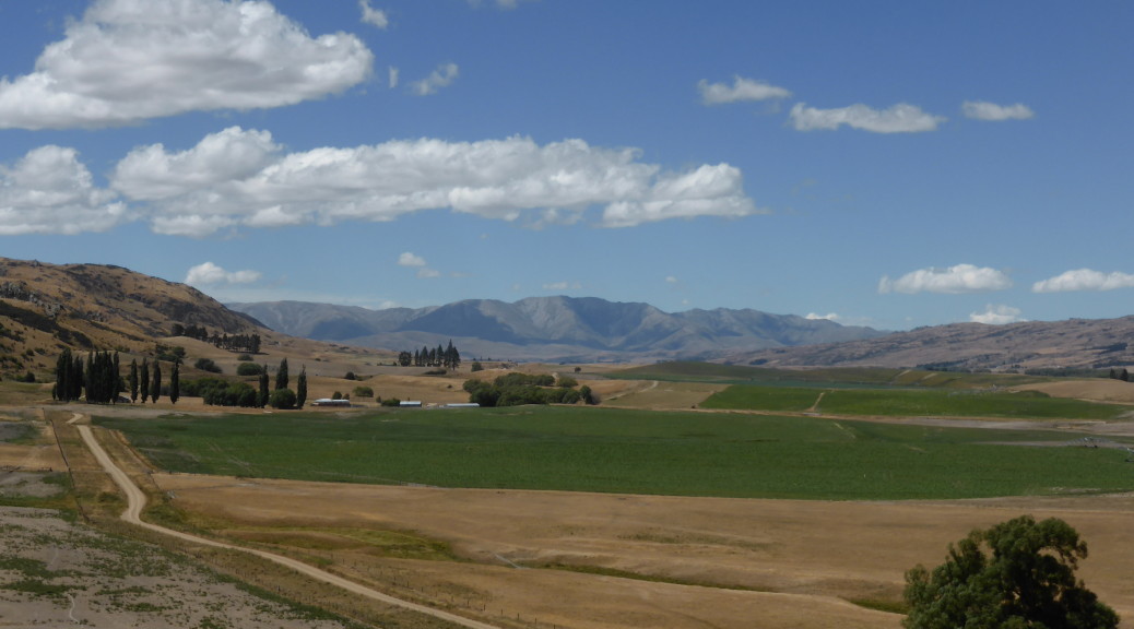
 Back up on the ridge again before the gravel road ends for the big descent down into Middlemarch.

I decided it was too early for dinner in Middlemarch, so started on the trail to get dinner at Hyde. The trail didn’t get off to a very interesting start – with its longest straight, 6.5 km, dragging on & on as I started to do battle with the wind that would plague me for days. The straight finished & things got more interesting as the trail curved gently around the foot of the Rock & Pillars; all along the trail there are numerous gangers’ (railway workers of yesteryear) huts that have been spruced up and adorned with information boards. I took to stopping at most of these as the history was interesting and they provided a respite from the wind.
To my dismay, I found in Hyde that the only eating establishment had changed its hours and the kitchen was only open in the evening to pre-booked guests at the adjoining accommodation. A sure trap for novices like me. As I filled my water bottles and tried to decide whether to go much past my intended campsite to Ranfurly for dinner or just to camp where I had planned & have porridge for dinner (neither were appealing options), I spotted the kitchen-hand eating his dinner out front. He & the manager were most gracious and opened up the cafe for me (I assume it is open standard day-time hours) – I felt obliged to order a lot of food, but I hardly need much encouragement.
I hadn’t seen anyone else on the trail at all, being early evening, but as it happened a group of three rode up from the direction I was heading looking for some food too. So I wasn’t the only one whose lack of planning had let them down. They were very chatty and asked all sorts of intelligent questions of my bikepacking set-up and we worked out that they had shortly before swum in the river next to where I meant to camp – apparently it was beautiful. They were heading back the way they came & I soon caught them up.
There are a couple of tunnels just north of Hyde – I’m told that you can just ride through them with a degree of confidence as the light fades around the bends in the tunnels; I wasn’t so keen on that, so flicked on my bike-light. After more chatting about bikes & adventuring at the rudimentary campsite (there is a toilet and a picnic table – and a river), I let them get on their way as I explored & set up my home for the night.
 And very peaceful it was too with the Taieri River slowly flowing past.
 The clouds later tried valiantly to break the drought, but not much came of that. But the wind did change in the night to a NWer – with my tent buffeted strongly by that, I didn’t sleep much.
 Things seemed a little calmer as I packed up and got back up to the trail – as you can see it’s very well graded and easy riding, or so I thought.
Soon I was out of the shelter of the gorge and very quickly finding out just how strong the NW gale was. The NWer in this part of the world is a very dry &, in summer, hot wind – but this was so strong it had some cooling effect on a clear, sunny day. Away from the hills, there was little shelter out on the plains and for about forty kilometres I battled into the NWer. It was ridiculous – my speed was cut by up to half for the best part of four hours. It was mad that perhaps the easiest, flattest and best-graded trail I’d ever ridden for such distance was one of the hardest rides I’ve done – the hills of the previous day, & even crossing the Alps, were easier! Ranfurly was a good excuse for an early lunch #1 (although at ten-thirty, it may well have been brunch) and a bit of respite.
Understandably, the most popular direction of travel was the opposite one – there were plenty of tourists out on what seems to be the standard hire bike for the Rail Trail, one with two small rear panniers. Finally, I started to catch up to and pass the odd small group heading the same direction I was – always with a brief pause to discuss/slate the headwind. The scenery was beautiful looking out across the plains towards the various ranges that I’m becoming more familiar with – but I wasn’t much in the mood for taking photos, so I have few.
Even after reaching the highest point on the trail & then the most northerly & turning SWW things didn’t get much easier due to battling just to stay on the bike in what was now a fierce crosswind. On more than a few occasions I was suddenly blown almost off the edge of the trail; it was with some relief I could stop and have second-lunch. Struggling through the next section, I finally thought I should stop and take some pictures of the surrounds – it was very nice after all, I was just a bit preoccupied.

 The Poolburn Viaduct is the highest on the trail and the following Poolburn Gorge with its two tunnels make it one of the most interesting parts of the trail.
Finally after eight hours of slog, the trail turned sufficiently south that I had a tailwind for the best part of hour. And there was much rejoicing. Nearing Alexandra, I could glimpse part of the quite-recently expanded network of trails that is making the small town a MTB destination. These will have to wait until I have more time, energy & a more suitable bike.
From there it was only a easy ten kilometres north-west (the wind seemed to have changed) to the end of the trail in Clyde – perfectly timed, I found Linda just starting to ride down the trail to meet me. A beer was in order to celebrate surviving such a hard day. Even at my slow pace on a loaded bike, the whole trail is doable in a day (although, that’s not really the point – there is much to see & explore) – but I do recommend choosing a day with more suitable conditions. That NWer sure sucks the moisture out of you – I drunk so much that day, & only when I stopped did I realise how much I was sweating, such was the rate of evaporation.
The wind had one last cruel trick for me – as we rode home, I found it had changed in that particular area to a southerly. It was a long eight kilometres back to the house – I was exhausted. Strangely, although I was hungry, I didn’t have much of an appetite – can’t really explain that. Despite that, I slept very well that night.


 The remains of a dredge that sunk in 1912 – it got over 3300 ounces of gold out of the riverbed between 1902 and 1906.
 Looking west over Lake Wanaka to Mt Aspiring National Park.
 South up the Coronet Valley.
 East over the lower reaches of the Coronet River – it then flows into the Clutha just after that flows out of Lake Wanaka & is then joined by the Hawea River.


 The rain started shortly before Beaumont, so the camera stayed squirreled away for the rest of the day.
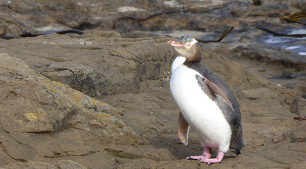
 We started with a short boat trip out of the Otago Harbour into the Pacific to see the wildlife around Taiaroa Head.
 Strangely, this little blue penguin was not that shy – we watched it swim around in front of the boat for quite some time.
 There were plenty of fur seals lounging on the rocks in the sun – once hunted almost to extinction for their skins, they’re doing much better now having been a protected species for over a hundred years.
 Taiaroa Head is famous for having the only mainland breeding colony of royal albatross. At this time of the year, the breeding pairs are taking it in three to four day turns to incubate the large egg while the other is out at sea fishing. We saw many birds sitting on nests and this one spread its huge wings (on average they have a three metre wingspan) and soar off into the wind. Majestic.
 After starting off on the Southern Scenic Route following the coast for a while, we stopped overnight in Balclutha.
 The south of the South Island has been rather treacherous for shipping over the years – so we did see quite a few lighthouses. This one at Nugget Point.
 More fur seals here; you can see how the coast could be problematic for any wayward ships.
 At Surat Bay we could get pretty close to the world’s rarest sea lion – but not too close as weighing up to five hundred kilograms, they can get aggressive.
 At Jack’s Bay, down another long gravelled road, we stopped to look at a large blowhole two hundred metres inland from the sea.
 While it was an awful big hole in ground with the sea rushing in – I don’t think the tide was quite right to create the proper blowhole effect. Still, it was a nice coastal walk.
 More gravel back-roads, and a short walk later we were at Purakaunui Falls – apparently some of the most photographed waterfalls in the world. Not particularly large, they are multi-tiered and quite pretty.
 The McLean Falls were more impressive, at twenty-two metres high.

 At Curio Bay we unsuccessfully tried to spot Hector’s dolphins playing in the surf. I stayed here with my family
  But around the corner at the petrified forest, we did see a few yellow-eyed penguins – including this one coming out of the sea and heading to its nest at the end of the day.

 Late in the day, we popped down to the southern most point of the South Island and tried our best not to fall off the cliff into a certain abyss.
 Somehow, we found somewhere to stay in the tiny settlement of Tokanui.
 After eventually finding some fuel in Invercargill (while I expected difficulty in finding a gas station in rural Southland, the dearth of gas stations in southern Invercargill was ridiculous) we headed out to Bluff and the end of State Highway 1 (it runs the length of the country).
 Beautiful pohutakawa blossom.
 West of Invercargill we headed out to Oreti Beach to have a very pleasant picnic lunch in the sun. You’re still able to drive down the beach – the scene of some of Burt Monro’s motorcycle exploits that gained more recognition in the film The World’s Fastest Indian.
 On a wonderful summer’s day I was quite impressed with Invercargill – people that have lived there tell me it doesn’t deserve its reputation. But it is awfully flat there and a long way from anywhere & I’m not sure I could handle that.
 At Gemstone Bay, the stunning beaches just kept coming – but the sea had taken any gemstones away.
 Further around the coast, it started to get a bit more wild.
 Another, once-typical, South Island crib (a holiday house, not particularly salubrious).
 Tuatapere was a lot bigger than I remember from twenty years ago – we struck it in the middle of haymaking season with countless tractors and hay-wagons trundling past.
 This is a what a thousand-year tree looks like apparently – always difficult to capture the grandeur of such in a closely packed forest.
 After even more gravel road driving, we were in NZ’s largest National Park (Fiordland) looking across NZ’s deepest lake – Lake Hauroko, 462 metres deep. Suddenly, after the plains and small hills of Southland, there were mountains and the wilderness was starting to look inviting. While home to some of NZ’s Great Walks, unfortunately I don’t think there is much biking in the that particular wilderness.
 We stopped to look at the Clifden Suspension Bridge – once it was NZ’s longest bridge; now that many years have passed and the Manapouri hydro power station has taken a lot of the Waiau River’s flow – it really does seem a big bridge in the middle of nowhere.

 Now, there’s a house I could probably afford.
 Last stop on our little tourist trail was some exploring in the Clifden limestone caves; we then hightailed it for home, scooting across Southland and Otago.
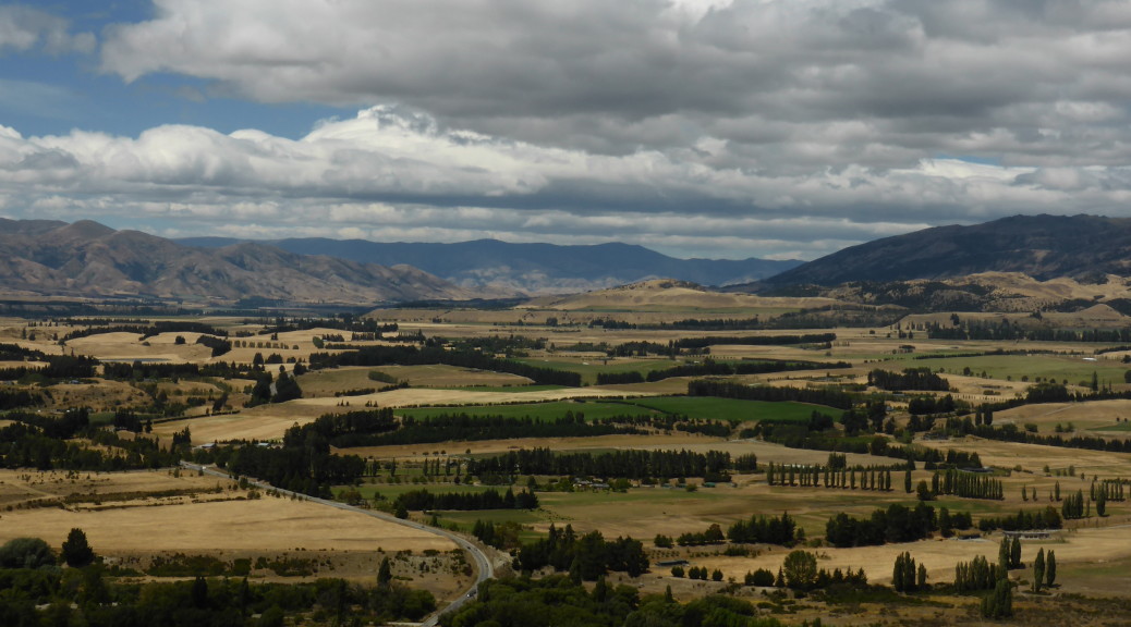
 Looking back towards home.
 Hills and clouds.

 The views opened up, naturally, as we climbed – the reservoir in the centre.


