To pretty Wissembourg

Another leisurely start to the day, I was riding by nine. Descending out of the forest that sheltered me for the night, I headed south towards the French border – most of the day’s riding followed the rough outline of the border, just a few kilometres to the north. To start with it was quite chilly, but by about ten o’clock I had my fleece off (never to be seen again – I can’t for the life of me figure out where it has gone, it always goes in the same place in my bag) as there was a little bit of climbing to be done. The first part of the day was through reasonably open farm & cropping land – sometimes it was worth stopping to admire and take a picture.

Shortly after, I stopped to do the big battery changeover for the GPS – replacing the six now charged batteries, with the six empty ones that have powered my navigation for the previous day and a half. Except this time, the ones in the unit were not charged. This had happened before at the start, but as I got it all sorted eventually I assumed it was user error – this time definitely not. This led to quite a bit of time pondering how to sort all this out and get where I wanted to go. Thankfully, I keep some spares so I’m good for a day or two – but either I source a wall-charger & become more dependent on the grid, hope mine becomes a bit more reliable (not much chance), buy copious amounts of single-use AAs – or go without a GPS, but I do rather like knowing where I’m going and where I’ve been for future reference. It’s little problems like this, & losing one’s sweater, that become much bigger than they should when you are travelling solo and don’t have anyone to discuss them with… There was a big long downhill on off-road tracks that took me down to the bottom of the valley.

About a third of the way through the day’s riding, the terrain turned much more forested. I was still mostly on dedicated cycle paths and they seemed to following rivers, so any climbs weren’t strenuous and everything was pleasant. It is, however, difficult for me to take photos of riding through forests that capture just how nice it was – all you ever end up seeing is some trees and the mood is not conveyed at all. With one little climb after lunch at a beer garden – which while the beer was cheap, didn’t really serve food, oops – the rest of the day was also pretty easy.

Mention must be made of firewood stacks – they’re everywhere out here and some of them really are quite large.

I’d previously decided that I’d find a hotel in Wissembourg so that I could get organised for the TransVosges route – which would probably be four or five days of riding (from what I could tell by looking at the elevation profile & distance). As a wiser person than I mused, bikepacking might not be all that fun for him as the performance of the bike would suffer and take away from the enjoyment of the riding. With my experiences so far, while the exploring facet of my trip has been great, the mountain-biking in the purest sense has not got me excited. Plus, once again, being solo, the prospect of four or five days without anyone to share the highs or lows of such a big route with is just too much. Add in that doing the TransVosges would greatly increase the chance of me spending my birthday alone – any desire to head to the hills just now has gone. I must have got this all wrong – I’m not quite cycle touring and I can’t quite get this solo-bikepacking thing to work.

The fool in me thinks everything will be OK once I get to Italy and I can at least hold a halting conversation in the local language. But, not being the most outgoing of people, I’d really have to force myself to engage a bit more – which may be a bit drastic or require drastic steps! But as it is, I’m tired of just passing through seeing really nice places and not having any real sense of what is happening in said places. Anyway, I’ll head to Strasbourg, which I’ve wanted to see for a while and then work out the best way to get to Italy – proabably train to Turin.

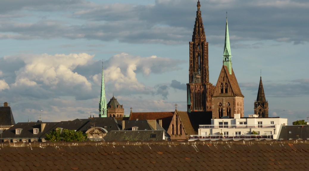
Wissembourg surprised me, which wasn’t hard as I knew nothing of it, by being very pretty – perhaps the prettiest town I’ve seen yet on this trip. In the Alsace region (here comes WWII history classes again) there is a fair bit of Maginot Line history around, so that interests me. I wandered around the delightful streets in the late afternoon sun, had my first gelato of the trip & yet couldn’t really shake the malaise. After catching up on the mammoth photo dump for the previous post I tried to order my dinner in Italian at Pizzeria Chianti – but the French proprietor wasn’t having any of that!


Volklingen Iron Works

[Content Advisory: Here follows a gratuitous amount of industrial history, associated photos and general talk of ironmaking. If that doesn’t interest you, too bad – it was the highlight of the trip so far. Yes, I know that that is quite sad.]

When I chose my camping spot for the night, I did not realise there was a chiming church clock just the other side of the river. Or a building site. Still, I slept well enough and had a pretty good gauge of the time each time I awoke. Eager to see it, or with nothing better to do, I was first through the gates at Volklingen Iron Works. I was quite nervous about leaving my bike unattended for so long with only a lock that serves only to thwart the opportunist thief. But the attendant assured me that it was quite safe, I suppose you don’t get a lot of thieves frequenting industrial museums early in the day. By the time I returned three hours later, there were many more bikes around – so mine was less conspicuous.

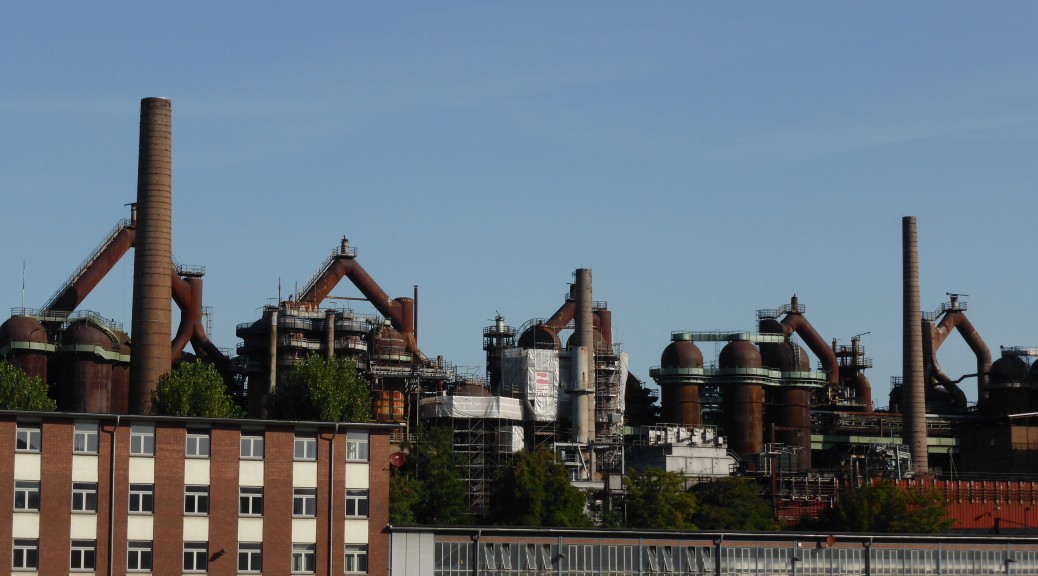
When they shut the plant (six blast furnaces and much more ancillary equipment) down in 1986, they really did just leave it. I couldn’t believe how much there is to see – I was fascinated and even though the multimedia presentation wasn’t in English, all the signs were, so it was easy enough to understand. You could wander around an awful lot without barriers getting in the way – obviously some areas are off limits as the platforms and walkways have decayed over time, but work continues. Donning a hardhat, you could even climb through forty-five metres of height up stairs (brought back a lot of memories of getting around the NZS Iron Plant) to the charging floor and then go even higher and get amongst the off-gas system.

The explanation of the process was very well done, and only later on in a hall under the burden room did you get to read/hear a few stories of what it was like to work there. I would have liked to have seen more of that – at one stage in the sixties, some 16000 people were employed making iron. Incredible to think; although each blast furnace only had the daily capacity of one NZS Melter (of which there are two). Well, obviously I loved my visit there – as shown by the fact I took so many photos. I will let some of them tell the rest of the story.

Photo & Video Sharing by SmugMug


Hoist controls in the inclined ore conveyor machine room.


I’d noticed these two hills the night before – completely different to any others in the region. I should have known that they are slag heaps from almost one hundred years of operation.

Photo & Video Sharing by SmugMug
Charging floor – the cars on the monorail used for feeding the furnaces.


Top of the inclined conveyor.


Off-gas system, part of.


Still an industrial town


More off-gas system.


The hood that is raised to charge five cars at a time into the furnace – there is another such bell cover further down to prevent the furnace gases escaping.

Photo & Video Sharing by SmugMug
Nature taking hold at height.


Work continues all around the site still – I was surprised by how much exactly. All to broaden the areas accessible to visitors.


Metal tap hole


Mud gun – used for closing taphole


Slag taphole

Photo & Video Sharing by SmugMug
Coke ovens – coke side


Coke ovens – machine side


Inclined ore conveyor, built in the 1910s – took the sintered iron ore up to the charging level. The main reason the plant could not be expanded to compete in the 1980s by making the furnaces larger (taller) is that this conveyor could not be heightened.


The charge cars used on the monorail system.

After all that excitement, the time available for riding was cut back substantially. It was a very easy eighty-odd kilometres. Mostly following the Saar upriver, stopping at a bakery in France somewhere before following the Blies upstream back into Germany. This turned into an old rail trail, sealed as they mostly are, so was rather quick – well, for my bike. There were many people out riding beside the river all afternoon. Which would be why there were multitudes of beer gardens backing on to the cycle routes. I stopped in at one for a drink and what turned out to be a strange rectangular pizza-like dish – very white & runny cheese, much onion and pancetta.

Photo & Video Sharing by SmugMug
The signs I’ve been following for three days.


A glorious evening to be out riding – sun setting on fields just cut for haymaking

Tomorrow, I should make the town where the TransVosges MTB route starts – it’s only fifty kilometres as the crow flies, but after my northern Luxembourg experience that could be quite hard work, although it’s not as hilly around here. I’ve enjoyed the last two days’ riding with no rain and occasional warmth; a bit of rain has fallen at night, so my tent is wet again – but, hey-ho. Hopefully the TransVosges has had a chance to dry out – I’ll shall have to see if it’s suitable for me.

Deeper into the Saarland

After a particularly poor night’s sleep, I was taken aback to find it almost nine o’clock before I got up. It was a still and clear, but very chilly, start to the day’s riding. I had better luck finding villages with open shops – so much so that first lunch was at 10.30. I think that I didn’t eat enough for yesterday’s 115 km – more bakery stops required. It was more of the same sealed trail through farmland – much easier to appreciate in the sun. Every so often I do remember to take a photo just so that I don’t forget it all in many, or a few, years’ time.

Photo & Video Sharing by SmugMug

While the scenery is nice, it doesn’t thrill me the same way as riding the North American West does. Thoughts throughout the day return to the still vague possibility of riding Tour Divide 2015. While I’m beginning to realise that open-ended solo bikepacking might not be best suited to me – I’ve always loved riding singletrack unencumbered and with good mates, not much of that is happening here – a crazy undertaking such as the Divide would be quite an achievement to work towards and be lighter-weight bikepacking with more of a purpose…

As I dwell on this the route enters forested areas much more and as, I assume, there are less tractors to churn up the paths they are now gravel and that is much better. I see a lookout ahead as I approach the top of a climb, the GPS shows two small lakes below it. I was rather underwhelmed. A big disused mine, a large power plant in the distance and some other factory off to the left.

Photo & Video Sharing by SmugMug

All through this trip so far I’ve been trying to remember much that I learnt about where I am from various high school and university history classes. I think, I’m sure someone will correct me below if I’m wrong, that the Saar was lost by Germany at Versailles and that was a blow as it was an industrial powerhouse – with coal and iron, & therefore steel predominating. I’ve noticed that I’m missing researching a bit about the areas I’m visiting beforehand – the reasons for this are twofold: 1) I don’t really know where I’m going until I get there and 2) I’ve such irregular internet access, such research is not possible to do on the fly.

In one small town I spied a collection of new MTBs on display down a driveway. It was actually a very small bike shop. I stopped ostensibly to look at what bikes might be popular in Germany. While the trend for e-bikes (bikes that electrically assisted, mostly uphill I think) has been around for a while, it is a little concerning and bewildering to see the popularity of full suspension e-MTBs. While I was there, I mentioned the little bit of play that had started to develop the day before. I was in luck – the guy had the correct one in stock, so I had it changed then & there.

Past Saarbrucken was my goal for the day, but only ten or fifteen kilometres short I was on the outskirts of Volklingen. The trail board mentioned an old steel works that had been preserved after the blast furnaces closed in 1986, I could see it not far away – I couldn’t resist taking a peak as I’m a sucker for industrial history, steel in particular. It turns out that it’s so well preserved that it was the first industrial site to be given UNESCO listing as a world cultural heritage site. Well, I just have to see this properly – but as it was closing for the day, it will be tomorrow – which puts everything back a couple of days. Oh well, it’s not like I’ve got a schedule.

Photo & Video Sharing by SmugMug

Being a steel town, I can’t say I was surprised that the centre was pretty dead and difficult to find somewhere suitable to eat. It was a little unnerving to ride under a rail-bridge that I’d seen torpedo ladles of molten hot metal roll over a few minutes before. The bridge held.

Rear-rack back-track

I’d decided that I’d ride towards the north-east of France and the Vosges Mountains as there is a four-hundred kilometre MTB route that goes south towards Mulhouse. To get to the start should take three or four days, all going well as I head south-east from Luxembourg City by whichever route takes my fancy, mostly sticking to cycle routes that show on my GPS.

I’d only wound my way out of the city following a river for an hour when I stopped to investigate the new rubbing sound that had appeared – in doing so the rack holding my bag to my saddle and off the rear tyre completely failed. In the circumstances, I thought the safest option was to return to the relatively close city and try to find a bike shop that would sell me a suitable rack. If necessary, I could always wait and get one shipped to me. As it happens, only a few hours and some repeat-riding were lost – I now have a more traditional, but only slightly heavier, rack holding my rear bag above the wheel.

Riding the stretch of river for the third time, I finally made it on to the new bridge in the town of Hesperange to read the poignant and tragic tale of the American tank that plunged into the frigid river Boxing Day 1944 while returning in convoy from the Battle of the Bulge. Needless to say, I’ve seen many monuments and read many tales of lives lost in each world war in this part of the world. Mostly about young men far from home in foreign lands – well, those are the ones that tend to be translated into English.

Photo & Video Sharing by SmugMug

A lot of the riding for the day was through open farmland – where the cycle routes all tend to be paved. There was still a fair amount of climbing to be done, and occasionally a panorama opened up. I flirted with the French border a couple of times, but generally I was heading towards Germany. That which had held such promise previously, but then (I felt) didn’t treat me well at all with all that mud and rain, the GR5, abruptly came back into my path. I ran with it for a little while, it seemed OK, but it didn’t work out again so I continued on my way. Apologies for the laboured metaphor.

The daily heavy rain came during the daily (sometimes twice-daily) bakery stop – so I missed most of it. It turned into wine country very briefly as I approached the Moselle River (the German border in this area) – there was a steep roll downhill to the river & it turned out Schengen was just down the river a bit. I could hardly not visit such a place that is associated with me being to do all this border-crossing (six countries so far, dozens of border-crossings) without once showing my passport. There’s nothing there – I suppose the only thing of note is that it’s at the meeting point of three countries.

In Germany there was a big climb out of the Moselle Valley and I quickly realised that the German cycle networks is wonderfully signed. From a big map-board I worked out that the Saarland-Radweg route would take me roughly the way I wanted to go – & the signs have English translation, so I get to pick up some of the local history/attractions. For the rest of the day it was mostly across farmland and paved – I tried a MTB trail for a while, but it wasn’t really helping me get where I wanted to go and had an annoying number of steps in it. I found too that the villages were pretty much dead in the prevening, so it was some time and with quite a detour that I got to a town big enough to have open restaurants.

With it still not being warm and summery, which might be expected in summer, my thoughts turned to getting to Italy sooner. I’m a little sick of being wet and cold for no particularly good reason – I’ve survived enough English winters MTBing to choose to go somewhere drier! This would mean not heading east towards Munich and doing the TransAlp route I had intended through Austria and finishing at Lake Garda. But it would mean I’d be in a place where I could at least understand a little of what is going on around me and at least be able to converse with those that serve me food (those being the people I have the opportunity to talk to the most, of course). I think I would much prefer that & maybe my Italian would improve.

Biking to go places, going places to bike.